$1,425 / Month
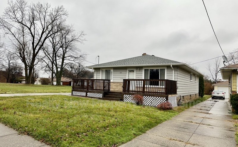
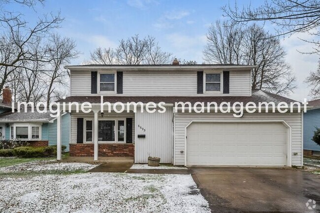
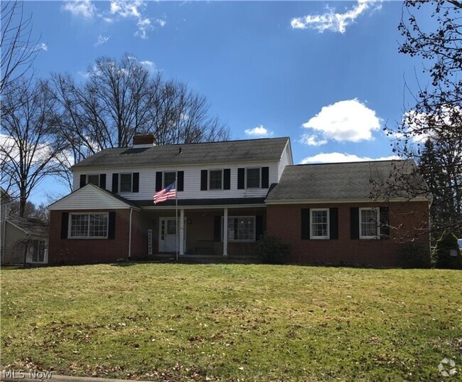
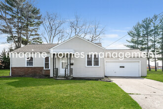
5283 E 133rd St
Garfield Heights, OH 44125
2 Weeks Ago
Favorites
5283 E 133rd St

Favorites
Check Back Soon for Upcoming Availability
| Beds | Baths | Average SF |
|---|---|---|
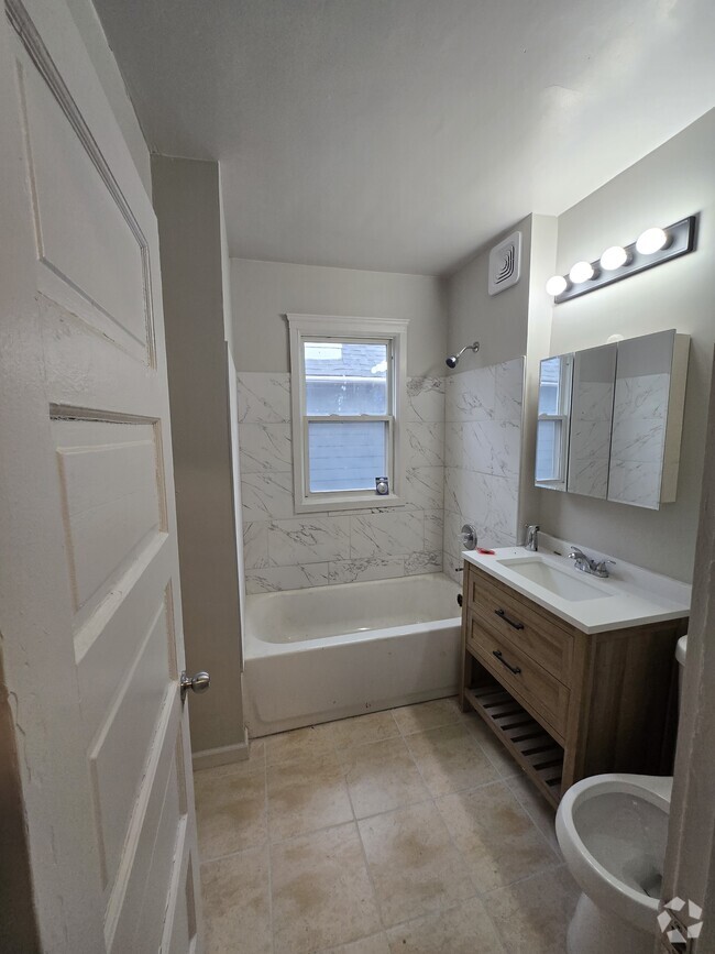
| 3 Bedrooms 3 Bedrooms 3 Br | 2 Baths 2 Baths 2 Ba | 1,176 SF |
About This Property
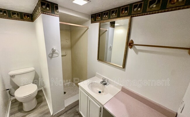
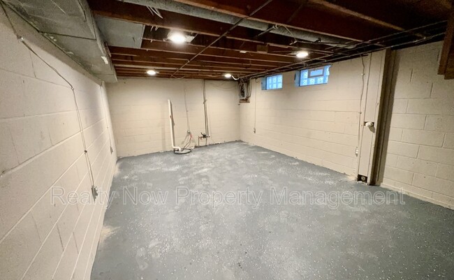
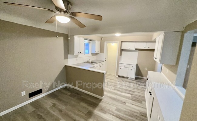
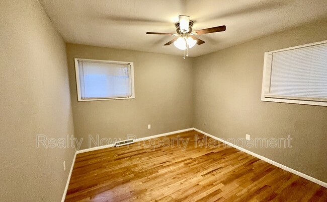
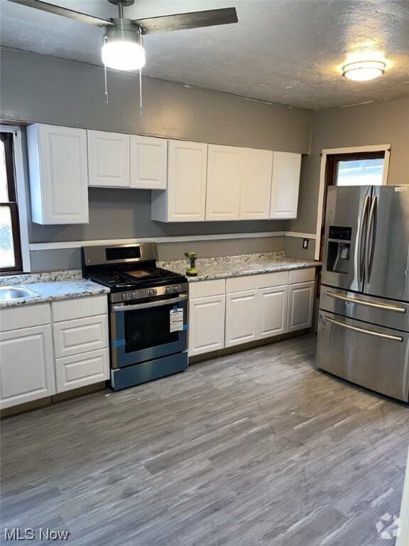
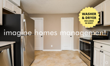
Beautiful 3 bed 2 bath single family ranch home located at the end of a cul-de-sac. Large eat in kitchen. Semi finished basement. Refinished hardwood floors throughout. Oversized 2 car garage.
5283 E 133rd St is a house located in Cuyahoga County and the 44125 ZIP Code. This area is served by the Garfield Heights City Schools attendance zone.
Location
Get Directions
Located just ten miles south of Cleveland, Garfield Heights offers residents the best of suburban living on the outskirts of a big city. Convenience to multiple freeways makes commuting from Garfield Heights a breeze. Access to Garfield Park Reservation, Bacci Park, and the Cuyahoga River offers a host of opportunities for outdoor recreation near Garfield Heights at any moment.
Garfield Heights is also close to numerous golf courses in addition to major attractions like the Cleveland Metroparks Zoo and Cuyahoga Valley National Park. The commercial corridor in Garfield Heights stretches along Turney Road, with a variety of retailers, shops, and restaurants. Garfield Heights residents can also venture into Downtown Cleveland to catch a sporting event at Quicken Loans Arena or Progressive Field, peruse Tower City Center, and purchase fresh meat and produce at the West Side Market.
Learn more about living in Garfield Heights
Education
| Colleges & Universities | Distance | ||
|---|---|---|---|
| Colleges & Universities | Distance | ||
| Drive: | 13 min | 6.8 mi | |
| Drive: | 12 min | 6.9 mi | |
| Drive: | 19 min | 8.7 mi | |
| Drive: | 17 min | 8.7 mi |
5283 E 133rd St is within 13 minutes or 6.8 miles from Cuyahoga C.C., East. It is also near Cuyahoga C.C., Eastern Campus and John Carroll University.
Schools


Public Elementary School
Grades PK-5
511 Students
Attendance Zone
Public Middle School
Grades 6-8
746 Students
Attendance Zone
Public High School
Grades 9-12
1,109 Students
Attendance Zone
Private Elementary & Middle School
Grades PK-8
245 Students
Nearby
Private Elementary & Middle School
Grades K-8
348 Students
Nearby
Private High School
Grades 9-12
355 Students
Nearby
School data provided by
 The GreatSchools Rating helps parents compare schools within a state based on a variety of school quality indicators and provides a helpful picture of how effectively each school serves all of its students. Ratings are on a scale of 1 (below average) to 10 (above average) and can include test scores, college readiness, academic progress, advanced courses, equity, discipline and attendance data. We also advise parents to visit schools, consider other information on school performance and programs, and consider family needs as part of the school selection process.
View GreatSchools Rating Methodology
View GreatSchools Rating Methodology
Transportation options available in Garfield Heights include Lee (Blue Line), located 4.8 miles from 5283 E 133rd St. 5283 E 133rd St is near Cleveland-Hopkins International, located 15.1 miles or 24 minutes away.
| Transit / Subway | Distance | ||
|---|---|---|---|
| Transit / Subway | Distance | ||
|
|
Drive: | 11 min | 4.8 mi |
|
|
Drive: | 11 min | 5.1 mi |
|
|
Drive: | 12 min | 5.2 mi |
|
|
Drive: | 12 min | 5.3 mi |
|
|
Drive: | 12 min | 5.5 mi |
| Commuter Rail | Distance | ||
|---|---|---|---|
| Commuter Rail | Distance | ||
| Drive: | 8 min | 4.0 mi | |
| Drive: | 10 min | 4.2 mi | |
|
|
Drive: | 21 min | 11.5 mi |
| Drive: | 22 min | 12.9 mi | |
| Drive: | 29 min | 17.9 mi |
| Airports | Distance | ||
|---|---|---|---|
| Airports | Distance | ||
|
Cleveland-Hopkins International
|
Drive: | 24 min | 15.1 mi |
Time and distance from 5283 E 133rd St.
| Shopping Centers | Distance | ||
|---|---|---|---|
| Shopping Centers | Distance | ||
| Drive: | 2 min | 1.1 mi | |
| Drive: | 4 min | 1.7 mi | |
| Drive: | 6 min | 1.9 mi |
5283 E 133rd St has 3 shopping centers within 1.9 miles, which is about a 6-minute drive. The miles and minutes will be for the farthest away property.
| Parks and Recreation | Distance | ||
|---|---|---|---|
| Parks and Recreation | Distance | ||
|
Garfield Park Nature Center
|
Drive: | 4 min | 1.9 mi |
|
Bedford Reservation
|
Drive: | 12 min | 5.0 mi |
|
CanalWay Center
|
Drive: | 11 min | 5.2 mi |
|
Ohio & Erie Canal Reservation
|
Drive: | 9 min | 5.4 mi |
|
Nature Center at Shaker Lakes
|
Drive: | 14 min | 6.3 mi |
5283 E 133rd St has 5 parks within 6.3 miles, including Garfield Park Nature Center, Bedford Reservation, and CanalWay Center.
| Hospitals | Distance | ||
|---|---|---|---|
| Hospitals | Distance | ||
| Walk: | 16 min | 0.8 mi | |
| Drive: | 9 min | 5.0 mi | |
| Drive: | 11 min | 5.8 mi |
5283 E 133rd St has 3 hospitals within 5.8 miles, the nearest is Marymount Hospital which is 0.8 mile away and a 16 minute walk.
| Military Bases | Distance | ||
|---|---|---|---|
| Military Bases | Distance | ||
| Drive: | 95 min | 79.2 mi | |
| Drive: | 105 min | 87.1 mi |
5283 E 133rd St is 79.2 miles from Mansfield Lahm Airport Air Guard Station, and is convenient to other military bases, including Camp Perry Air Guard Station.
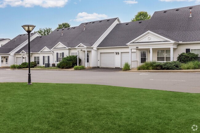
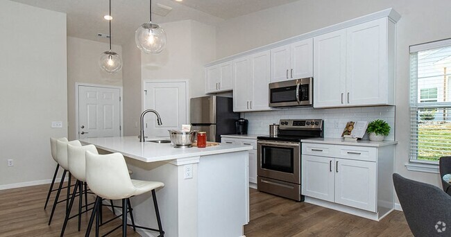
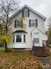
You May Also Like
Similar Rentals Nearby

What Are Walk Score®, Transit Score®, and Bike Score® Ratings?
Walk Score® measures the walkability of any address. Transit Score® measures access to public transit. Bike Score® measures the bikeability of any address.
What is a Sound Score Rating?
A Sound Score Rating aggregates noise caused by vehicle traffic, airplane traffic and local sources

5283 E 133rd St
Garfield Heights, OH 44125