
$2,500 / Month
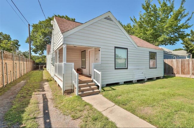
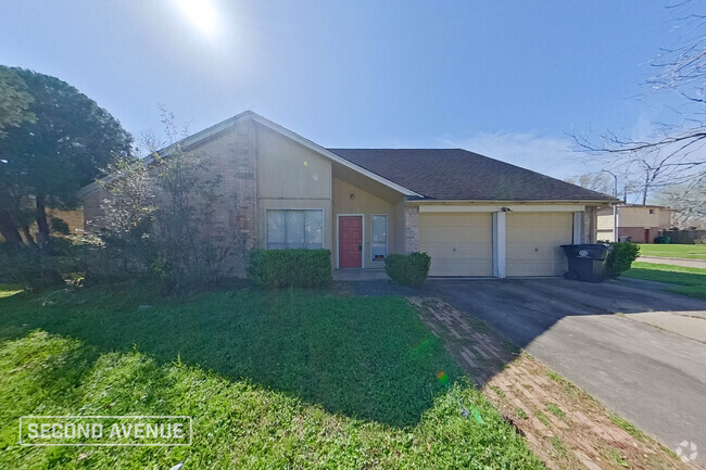
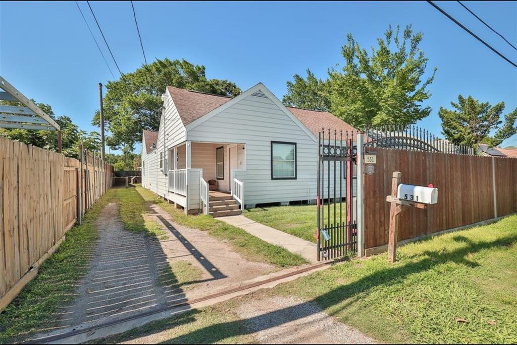
531 Dogwood St
Houston, TX 77022
Today
Favorites
713-614-6498
-
Bedrooms
5
-
Bathrooms
2
-
Square Feet
--
-
Available
Available May 1
Highlights
- Smoke Free
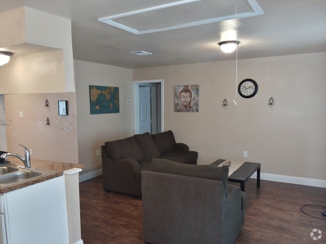
- Loft Layout
531 Dogwood St

Favorites
About This Home
12 Month Lease
,
Available May 1
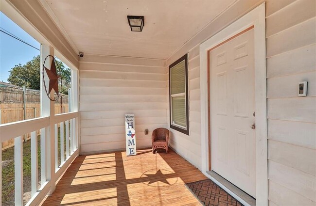
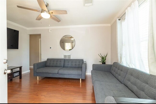
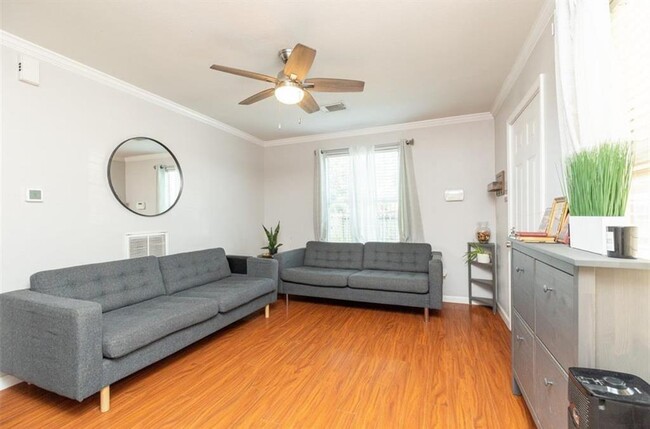
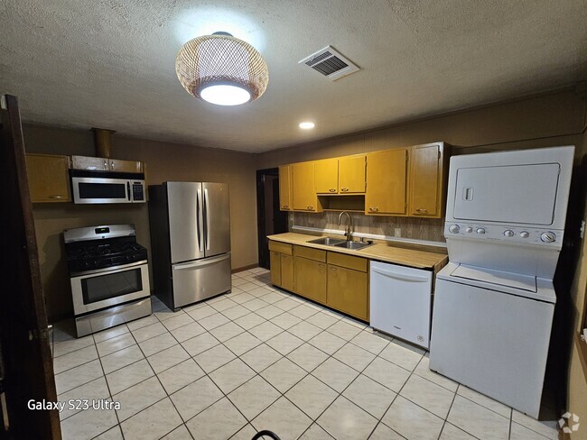
For Lease! This spacious 5-bed, 2-bath home (with potential 6th bedroom) offers comfort, space, and style in a quiet, well-established neighborhood. Enjoy upgraded fans in every room, fresh paint, and stainless steel appliances. The oversized patio is perfect for entertaining, with large front and back yards—fully fenced with a gated entry for added security. A brand new 30-year roof adds peace of mind, and the home has never flooded. Conveniently located near shopping, dining, and major roads while tucked away in a peaceful setting. Move-in ready—schedule your showing today!
531 Dogwood St is a house located in Harris County and the 77022 ZIP Code. This area is served by the Houston Independent attendance zone.
* Price shown is base rent and may not include non-optional fees and utilities.
Price, availability, fees, and any applicable rent special are subject to change without notice.
* Square footage definitions vary. Displayed square footage is approximate.
House Features
Dishwasher
Loft Layout
Microwave
Disposal
- Smoke Free
- Dishwasher
- Disposal
- Microwave
- Loft Layout
Fees and Policies
Details
Lease Options
-
12 Months
Contact
- Listed by Kassandra Toledo Garza | Nan & Company Properties
- Phone Number
- Contact
-
Source
 Houston Association of REALTORS®
Copyright © 2025 Houston Association of Realtors. All rights reserved. All information provided by the listing agent/broker is deemed reliable but is not guaranteed and should be independently verified.
Location
Get Directions
Amenities
- Smoke Free
- Dishwasher
- Disposal
- Microwave
- Loft Layout
Northside-Northline is a large neighborhood about 10 miles north of Downtown Houston. The neighborhood is filled with shopping plazas so residents have easy access to plenty of stores and restaurants. There are also several schools and parks in the area. Northside-Northline is known for its affordability and has apartments, townhomes, condos, and houses available for rent at various price points. Interstate 45 and Hardy Toll Road run through the neighborhood and Interstate 610 is nearby as well, so the neighborhood is a great option for commuters and anyone who wants easy access to the heart of the city.
Learn more about living in Northside-Northline
Education
| Colleges & Universities | Distance | ||
|---|---|---|---|
| Colleges & Universities | Distance | ||
| Drive: | 9 min | 4.2 mi | |
| Drive: | 14 min | 7.3 mi | |
| Drive: | 14 min | 7.5 mi | |
| Drive: | 16 min | 9.2 mi |
531 Dogwood St is within 9 minutes or 4.2 miles from Univ. of Houston, Downtown. It is also near Houston Community College and University of St Thomas.
Schools


Public Elementary School
Grades PK-5
828 Students
Attendance Zone
Public Middle School
Grades 6-8
1,417 Students
Attendance Zone
Public High School
Grades 9-12
2,779 Students
Attendance Zone
Private Elementary School
Grades PK-5
Nearby
Private Elementary & Middle School
Grades PK-8
Nearby
Private High School
Grades 9-11
15 Students
Nearby
School data provided by
 The GreatSchools Rating helps parents compare schools within a state based on a variety of school quality indicators and provides a helpful picture of how effectively each school serves all of its students. Ratings are on a scale of 1 (below average) to 10 (above average) and can include test scores, college readiness, academic progress, advanced courses, equity, discipline and attendance data. We also advise parents to visit schools, consider other information on school performance and programs, and consider family needs as part of the school selection process.
View GreatSchools Rating Methodology
View GreatSchools Rating Methodology
Transportation options available in Houston include Melbourne / North Lindale, located 0.7 mile from 531 Dogwood St. 531 Dogwood St is near George Bush Intcntl/Houston, located 15.6 miles or 20 minutes away, and William P Hobby, located 17.5 miles or 31 minutes away.
| Transit / Subway | Distance | ||
|---|---|---|---|
| Transit / Subway | Distance | ||
|
|
Walk: | 13 min | 0.7 mi |
|
|
Drive: | 3 min | 1.3 mi |
|
|
Drive: | 4 min | 1.5 mi |
|
|
Drive: | 4 min | 1.8 mi |
|
|
Drive: | 5 min | 2.6 mi |
| Commuter Rail | Distance | ||
|---|---|---|---|
| Commuter Rail | Distance | ||
|
|
Drive: | 10 min | 4.6 mi |
| Airports | Distance | ||
|---|---|---|---|
| Airports | Distance | ||
|
George Bush Intcntl/Houston
|
Drive: | 20 min | 15.6 mi |
|
William P Hobby
|
Drive: | 31 min | 17.5 mi |
Time and distance from 531 Dogwood St.
| Shopping Centers | Distance | ||
|---|---|---|---|
| Shopping Centers | Distance | ||
| Walk: | 13 min | 0.7 mi | |
| Walk: | 18 min | 1.0 mi | |
| Drive: | 3 min | 1.2 mi |
531 Dogwood St has 3 shopping centers within 1.2 miles, which is about a 3-minute walk. The miles and minutes will be for the farthest away property.
| Parks and Recreation | Distance | ||
|---|---|---|---|
| Parks and Recreation | Distance | ||
|
Woodland Park
|
Drive: | 7 min | 3.3 mi |
|
Discovery Green
|
Drive: | 12 min | 6.0 mi |
|
Buffalo Bayou Park
|
Drive: | 15 min | 7.1 mi |
|
Houston Arboretum & Nature Center
|
Drive: | 14 min | 9.2 mi |
|
Memorial Park and Golf Course
|
Drive: | 16 min | 10.6 mi |
531 Dogwood St has 5 parks within 10.6 miles, including Woodland Park, Discovery Green, and Buffalo Bayou Park.
| Hospitals | Distance | ||
|---|---|---|---|
| Hospitals | Distance | ||
| Drive: | 8 min | 3.7 mi | |
| Drive: | 8 min | 4.0 mi | |
| Drive: | 9 min | 5.2 mi |
531 Dogwood St has 3 hospitals within 5.2 miles, the nearest is Doctors Hospital Tidwell which is 3.7 miles away and a 8 minute drive.
| Military Bases | Distance | ||
|---|---|---|---|
| Military Bases | Distance | ||
| Drive: | 44 min | 30.9 mi | |
| Drive: | 73 min | 56.5 mi |
531 Dogwood St is 30.9 miles from Lyndon B Johnson Space Center, and is convenient to other military bases, including Pelican Spit Military Reservation.
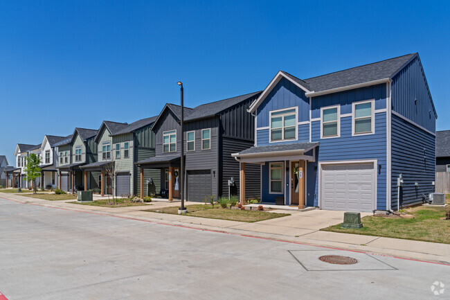
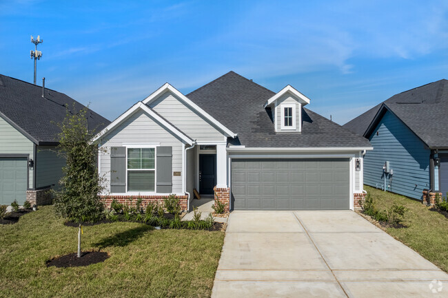
You May Also Like
Similar Rentals Nearby

What Are Walk Score®, Transit Score®, and Bike Score® Ratings?
Walk Score® measures the walkability of any address. Transit Score® measures access to public transit. Bike Score® measures the bikeability of any address.
What is a Sound Score Rating?
A Sound Score Rating aggregates noise caused by vehicle traffic, airplane traffic and local sources
531 Dogwood St
Houston, TX 77022