
$2,495 / Month
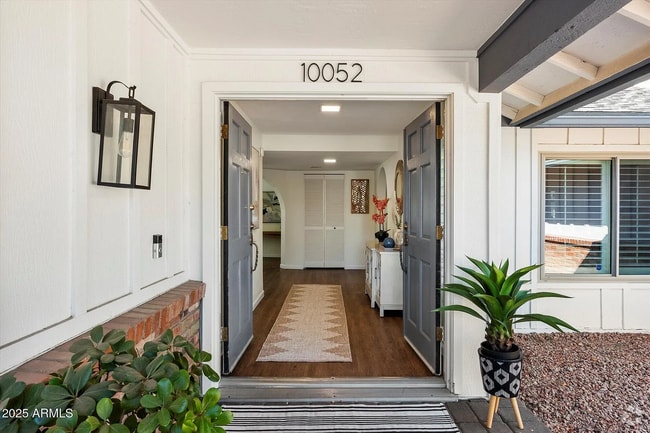
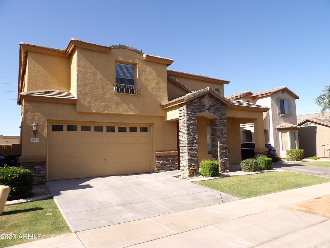
5311 E Hopi Ave
Mesa, AZ 85206
Today
Favorites
-
Bedrooms
4
-
Bathrooms
3
-
Square Feet
2,630 sq ft
-
Available
Available Now
Highlights
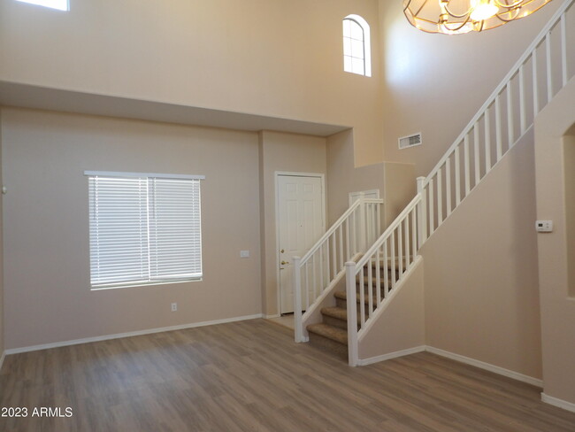
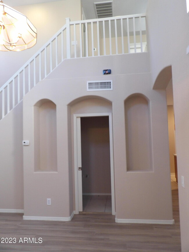
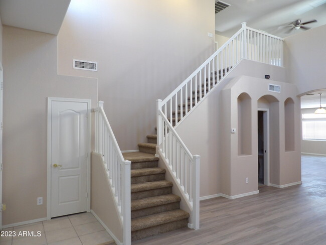
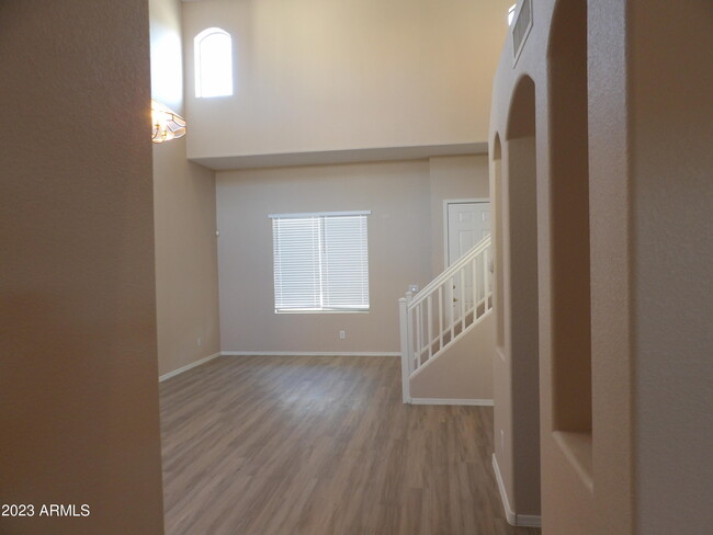
- Vaulted Ceiling
- Community Pool
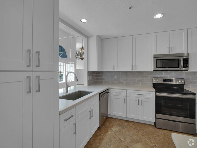
- Eat-In Kitchen
- Double Pane Windows
- Dual Vanity Sinks in Primary Bathroom
- Cooling Available
5311 E Hopi Ave

Favorites
About This Home
$2,495 deposit,
Available Now
ALL NEW PAINT 04/04/2025 GOOD SIZE FAMILY ROOM AND KITCHEN ISLAND,TALL CEILINGS LIGHT AND BRIGHT. COMMUNITY POOL,GATED,CHILDREN'S PLAY AREA LOTS OF SQ FTG HERE FOR A LARGE GROWING FAMILY. . $250 PET DEPOSIT PER PET AND PET RENT AT $30 A MONTH PER PET WILL APPLY. ALL INFORMATION DEEMED RELIABLE BUT NOT GUARANTEED
5311 E Hopi Ave is a house located in Maricopa County and the 85206 ZIP Code. This area is served by the Mesa Unified attendance zone.
* Price shown is base rent and may not include non-optional fees and utilities.
Price, availability, fees, and any applicable rent special are subject to change without notice.
* Square footage definitions vary. Displayed square footage is approximate.
Home Details
Year Built
Built in 2002
Bedrooms and Bathrooms
Dual Vanity Sinks in Primary Bathroom
2.5 Bathrooms
4 Bedrooms
Flooring
Tile
Carpet
Home Design
Tile Roof
Stucco
Wood Frame Construction
Interior Spaces
Vaulted Ceiling
Double Pane Windows
Ceiling Fan
2,630 Sq Ft Home
2-Story Property
Vinyl Clad Windows
Kitchen
Eat-In Kitchen
Built-In Microwave
Laminate Countertops
Laundry
Laundry in unit
Listing and Financial Details
Property Available on 4/9/25
$100 Move-In Fee
12-Month Minimum Lease Term
$45 Application Fee
Tax Lot 66
Assessor Parcel Number 141-53-592
Lot Details
Block Wall Fence
Front and Back Yard Sprinklers
Parking
2 Car Garage
Schools
Wilson Elementary School
Taylor Junior High School
Mesa High School
Utilities
Cooling Available
Heating Available
Cable TV Available
Community Details
Overview
Property has a Home Owners Association
Vision Association, Phone Number (480) 759-4945
Built by Great Western Homes
San Michelle Subdivision
Recreation
Community Pool
Contact
- Listed by Derek R Habbeshaw | AZ Residential Management LLC
- Contact
-
Source
Arizona Regional MLS
Copyright 2025 Arizona Regional MLS. All rights reserved. Information is deemed reliable but not guaranteed.
$2,782 / month
$455,000 Listing Price
5 Beds
•3 Baths
•
2,038 Sq Ft
$2,782 / month
$449,900 Listing Price
4 Beds
•3 Baths
•
2,038 Sq Ft
$2,757 / month
$480,000 Listing Price
5 Beds
•3 Baths
•
1,704 Sq Ft
Location
Get Directions
North of the Phoenix Mesa Gateway Airport is Superstition Springs, a community just 20 minutes outside of Mesa. The north section of the neighborhood boasts an expansive variety of shops and dining establishments.
The Superstition Springs Center mall is a major fashion hub, surrounded by Burlington, Target, and WinCo Foods market. Restaurants in the area include Olive Garden, The Cheesecake Factory, and BJ’s Restaurant and Brewhouse. The mall itself houses its own food court, along with an outdoor amphitheater and movie theater. Residents enjoy the convenience of being close to Mesa, Scottsdale, and Phoenix. Golfers will appreciate the championship golf course at the Superstition Springs Golf Club off Baseline Road.
Learn more about living in Superstition Springs
Education
| Colleges & Universities | Distance | ||
|---|---|---|---|
| Colleges & Universities | Distance | ||
| Drive: | 6 min | 2.3 mi | |
| Drive: | 14 min | 7.3 mi | |
| Drive: | 17 min | 8.7 mi | |
| Drive: | 17 min | 9.0 mi |
5311 E Hopi Ave is within 6 minutes or 2.3 miles from A.T. Still Univ. AZ. It is also near Mesa C.C., Red Mountain Campus and Chandler-Gilbert C.C., Mesa.
Schools


Public Elementary School
Grades PK-6
465 Students
Attendance Zone
Public Elementary School
Grades PK-6
768 Students
Nearby
Public Middle School
Grades 7-8
995 Students
Attendance Zone
Public High School
Grades 9-12
3,475 Students
Attendance Zone
Private Elementary School
Grades PK-5
Nearby
Private Elementary & Middle School
Grades PK-8
325 Students
Nearby
Private Elementary, Middle & High School
Grades K-12
92 Students
Nearby
School data provided by
 The GreatSchools Rating helps parents compare schools within a state based on a variety of school quality indicators and provides a helpful picture of how effectively each school serves all of its students. Ratings are on a scale of 1 (below average) to 10 (above average) and can include test scores, college readiness, academic progress, advanced courses, equity, discipline and attendance data. We also advise parents to visit schools, consider other information on school performance and programs, and consider family needs as part of the school selection process.
View GreatSchools Rating Methodology
View GreatSchools Rating Methodology
Transportation options available in Mesa include Gilbert Rd/Main St, located 6.7 miles from 5311 E Hopi Ave. 5311 E Hopi Ave is near Phoenix-Mesa Gateway, located 9.1 miles or 17 minutes away, and Phoenix Sky Harbor International, located 20.8 miles or 29 minutes away.
| Transit / Subway | Distance | ||
|---|---|---|---|
| Transit / Subway | Distance | ||
|
|
Drive: | 12 min | 6.7 mi |
|
|
Drive: | 12 min | 7.7 mi |
|
|
Drive: | 14 min | 8.5 mi |
|
|
Drive: | 15 min | 9.1 mi |
|
|
Drive: | 14 min | 9.6 mi |
| Commuter Rail | Distance | ||
|---|---|---|---|
| Commuter Rail | Distance | ||
|
|
Drive: | 51 min | 38.9 mi |
| Airports | Distance | ||
|---|---|---|---|
| Airports | Distance | ||
|
Phoenix-Mesa Gateway
|
Drive: | 17 min | 9.1 mi |
|
Phoenix Sky Harbor International
|
Drive: | 29 min | 20.8 mi |
Time and distance from 5311 E Hopi Ave.
| Shopping Centers | Distance | ||
|---|---|---|---|
| Shopping Centers | Distance | ||
| Walk: | 6 min | 0.4 mi | |
| Walk: | 10 min | 0.5 mi | |
| Drive: | 4 min | 1.2 mi |
5311 E Hopi Ave has 3 shopping centers within 1.2 miles, which is about a 4-minute walk. The miles and minutes will be for the farthest away property.
| Parks and Recreation | Distance | ||
|---|---|---|---|
| Parks and Recreation | Distance | ||
|
Riparian Preserve at Water Ranch
|
Drive: | 6 min | 3.1 mi |
|
Red Mountain Park
|
Drive: | 12 min | 6.9 mi |
|
Arizona Museum of Natural History
|
Drive: | 15 min | 9.3 mi |
|
i.d.e.a. Museum
|
Drive: | 15 min | 9.8 mi |
|
Usery Mountain Recreation Area
|
Drive: | 25 min | 13.3 mi |
5311 E Hopi Ave has 5 parks within 13.3 miles, including Riparian Preserve at Water Ranch, Red Mountain Park, and Arizona Museum of Natural History.
| Hospitals | Distance | ||
|---|---|---|---|
| Hospitals | Distance | ||
| Walk: | 9 min | 0.5 mi | |
| Drive: | 4 min | 1.9 mi | |
| Drive: | 7 min | 3.6 mi |
5311 E Hopi Ave has 3 hospitals within 3.6 miles, the nearest is Banner Gateway Medical Center which is 0.5 mile away and a 9 minute walk.
| Military Bases | Distance | ||
|---|---|---|---|
| Military Bases | Distance | ||
| Drive: | 29 min | 21.6 mi | |
| Drive: | 58 min | 46.1 mi | |
| Drive: | 119 min | 97.7 mi |
5311 E Hopi Ave has 3 military bases within 97.7 miles, the nearest is Phoenix Sky Harbor Airport Air Guard Station which is 21.6 miles away and a 29 minute drive.
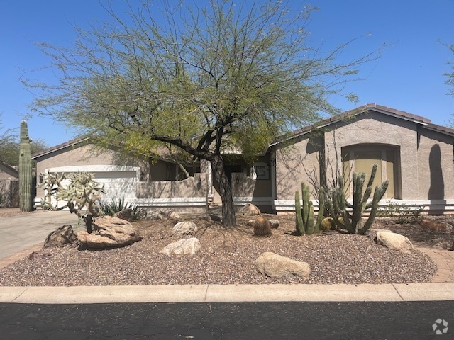
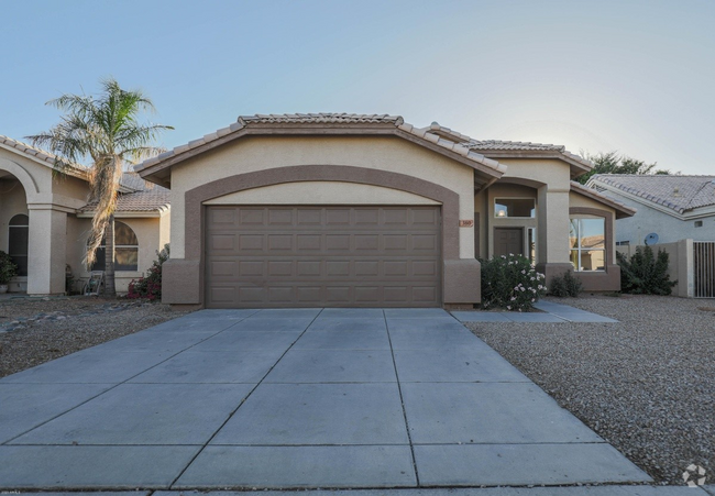
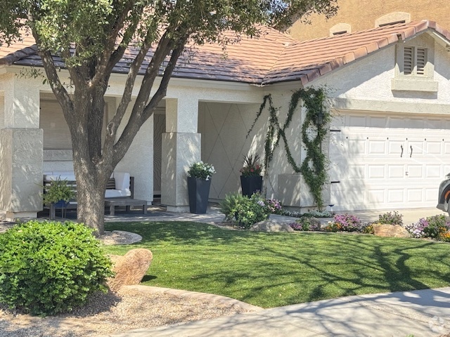
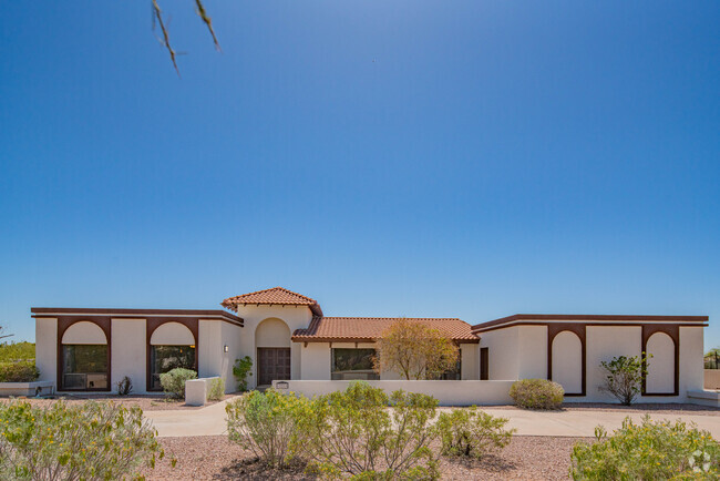
You May Also Like
Similar Rentals Nearby
-
-
-
-
-
-
-
-
1 / 18
-
1 / 18
-
What Are Walk Score®, Transit Score®, and Bike Score® Ratings?
Walk Score® measures the walkability of any address. Transit Score® measures access to public transit. Bike Score® measures the bikeability of any address.
What is a Sound Score Rating?
A Sound Score Rating aggregates noise caused by vehicle traffic, airplane traffic and local sources
5311 E Hopi Ave
Mesa, AZ 85206