-
Monthly Rent
$4,400
-
Bedrooms
4 bd
-
Bathrooms
3 ba
-
Square Feet
1,400 sq ft
Details

About This Property
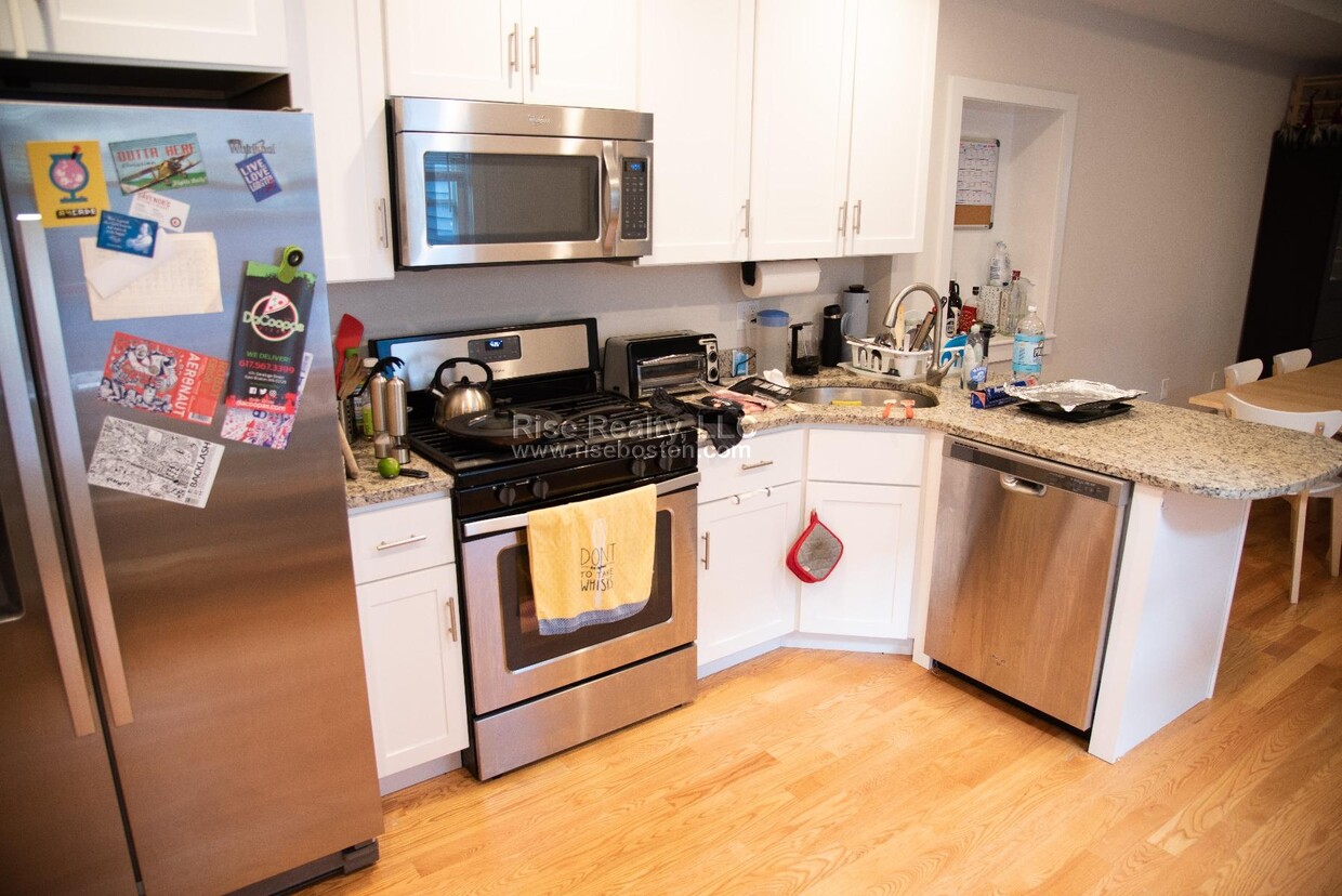
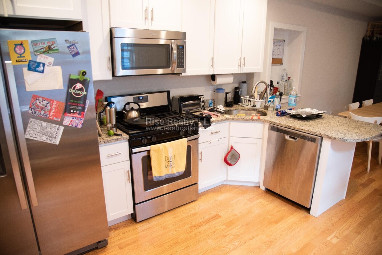
– Summary – Unit with 4 Beds and 3 Baths located in East Boston. If the price isn’t right or you don’t love the location, reach out to me anyways as I have many available units that will better suit your preferences.? – Transportation – Bus: 117 Meridian St @ Eutaw St (0.09 mi) Bus: Shuttle Airport Subway Station (0.55 mi) Bus: 116 Meridian St @ Eutaw St (0.10 mi) Subway: Blue Line Airport (0.51 mi) Bus: SL3 Airport (0.53 mi) Bus: 120 Bennington St @ Marion St (0.25 mi) Bus: 121 Lexington St @ Marion St (0.11 mi) ---------
54 Eutaw St is a house located in Suffolk County and the 02128 ZIP Code. This area is served by the Boston Public Schools attendance zone.
Discover Homeownership
Renting vs. Buying
-
Housing Cost Per Month: $4,400
-
Rent for 30 YearsRenting doesn't build equity Future EquityRenting isn't tax deductible Mortgage Interest Tax Deduction$0 Net Return
-
Buy Over 30 Years$1.73M - $3.08M Future Equity$1.02M Mortgage Interest Tax Deduction$148K - $1.5M Gain Net Return
-
Contact
Fees and Policies
The fees below are based on community-supplied data and may exclude additional fees and utilities.
- Dogs Allowed
-
Fees not specified
- Cats Allowed
-
Fees not specified
- Parking
-
Street--
Eagle Hill is one of Boston’s most historic neighborhoods, with many well-preserved Victorian homes scattered around the community. Bordered on two sides by water, numerous marinas are close at hand in this triangular neighborhood, making it a popular area among boaters and fishermen.
The local dining scene offers plenty to please every taste, representing every corner of Boston’s diverse cultural landscape. With Logan International Airport positioned just a few streets away, Eagle Hill is an excellent location for folks who work at the airport or for the airlines.
Learn more about living in Eagle Hill| Colleges & Universities | Distance | ||
|---|---|---|---|
| Colleges & Universities | Distance | ||
| Drive: | 6 min | 2.5 mi | |
| Drive: | 8 min | 3.0 mi | |
| Drive: | 8 min | 3.4 mi | |
| Drive: | 9 min | 4.0 mi |
Transportation options available in Boston include Maverick Station, located 0.8 miles from 54 Eutaw St. 54 Eutaw St is near General Edward Lawrence Logan International, located 2.2 miles or 5 minutes away.
| Transit / Subway | Distance | ||
|---|---|---|---|
| Transit / Subway | Distance | ||
|
|
Walk: | 15 min | 0.8 mi |
|
|
Drive: | 3 min | 1.2 mi |
|
|
Drive: | 4 min | 1.9 mi |
|
|
Drive: | 5 min | 2.1 mi |
|
|
Drive: | 6 min | 2.7 mi |
| Commuter Rail | Distance | ||
|---|---|---|---|
| Commuter Rail | Distance | ||
| Drive: | 5 min | 1.7 mi | |
|
|
Drive: | 6 min | 2.2 mi |
|
|
Drive: | 6 min | 3.0 mi |
|
|
Drive: | 12 min | 4.2 mi |
|
|
Drive: | 10 min | 4.7 mi |
| Airports | Distance | ||
|---|---|---|---|
| Airports | Distance | ||
|
General Edward Lawrence Logan International
|
Drive: | 5 min | 2.2 mi |
Time and distance from 54 Eutaw St.
| Shopping Centers | Distance | ||
|---|---|---|---|
| Shopping Centers | Distance | ||
| Walk: | 7 min | 0.4 mi | |
| Drive: | 4 min | 1.6 mi | |
| Drive: | 5 min | 2.2 mi |
| Parks and Recreation | Distance | ||
|---|---|---|---|
| Parks and Recreation | Distance | ||
|
Boston National Historical Park
|
Drive: | 6 min | 2.4 mi |
|
New England Aquarium
|
Drive: | 6 min | 2.6 mi |
|
Boston Harbor Islands National Recreation Area
|
Drive: | 6 min | 2.7 mi |
|
Boston African American National Historic Site
|
Drive: | 7 min | 2.7 mi |
|
Museum of Science
|
Drive: | 8 min | 2.8 mi |
| Hospitals | Distance | ||
|---|---|---|---|
| Hospitals | Distance | ||
| Drive: | 6 min | 2.5 mi | |
| Drive: | 7 min | 2.6 mi | |
| Drive: | 8 min | 3.5 mi |
| Military Bases | Distance | ||
|---|---|---|---|
| Military Bases | Distance | ||
| Drive: | 27 min | 15.6 mi | |
| Drive: | 32 min | 16.7 mi |
54 Eutaw St Photos
What Are Walk Score®, Transit Score®, and Bike Score® Ratings?
Walk Score® measures the walkability of any address. Transit Score® measures access to public transit. Bike Score® measures the bikeability of any address.
What is a Sound Score Rating?
A Sound Score Rating aggregates noise caused by vehicle traffic, airplane traffic and local sources


