$3,200 / Month
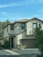
542 Sacagawea Ct
Paso Robles, CA 93446
2 Weeks Ago
Favorites
542 Sacagawea Ct

Favorites
Check Back Soon for Upcoming Availability
| Beds | Baths | Average SF |
|---|---|---|
| 3 Bedrooms 3 Bedrooms 3 Br | 2 Baths 2 Baths 2 Ba | — |
About This Property
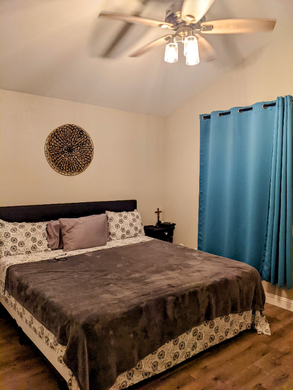
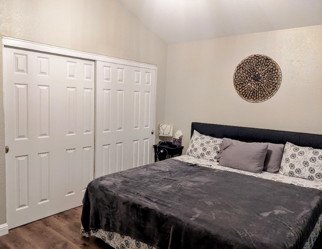
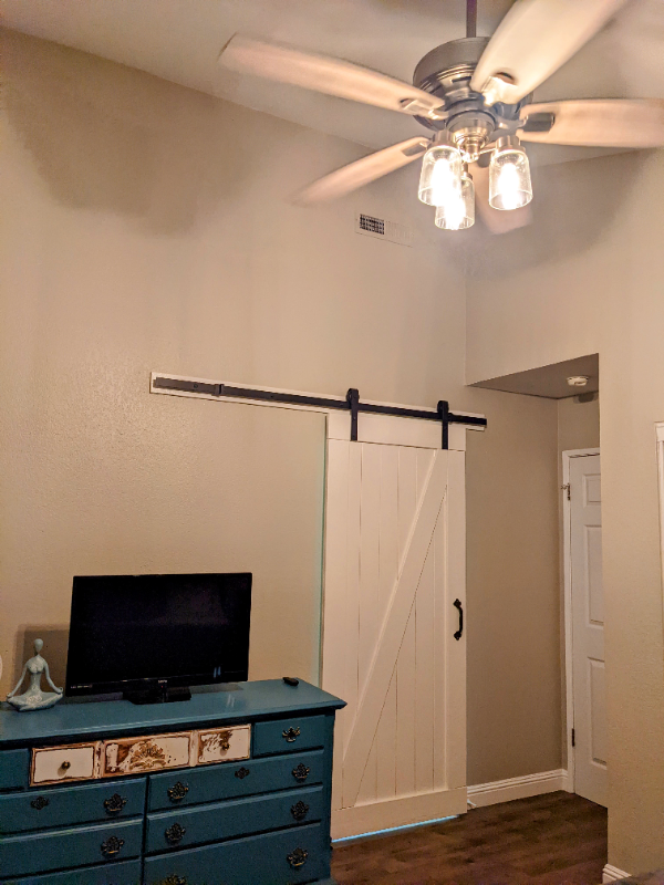
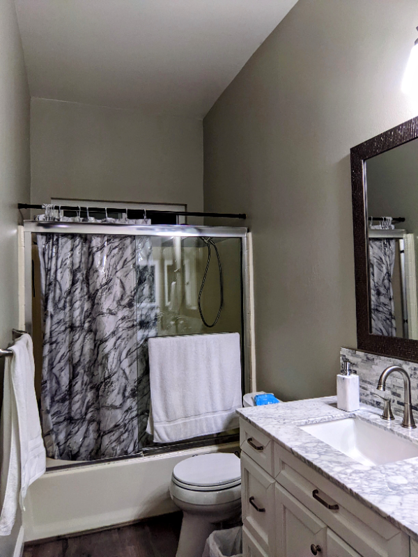
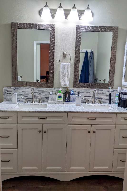
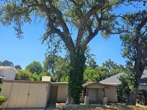
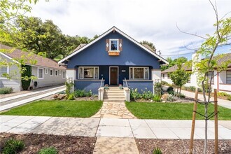
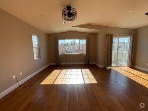
Property Id: 977705 With a white picket fence surrounding the front yard, this 3-bedroom, 2-full bathroom cul-de-sac home is located in a quiet and desired area of town within walking distance to Albertsons, Walmart, Centennial Park, Paso Robles High School and other stores. Walk into the living room to be invited by a fully functional gas fireplace, high ceilings and laminate floors all throughout. The spacious kitchen has wall-to-wall quartz countertop and an attractive backsplash, a five-burner gas stove oven, and a deep sink equipped with a retractable faucet and garbage disposal. The house also has new ductwork, new dual pane windows in the living, bedrooms and bathrooms, and solar panels. All the ones have ceiling fans except the bathrooms. The master bedroom has oversized closets and a barn door that opens into an ensuite with dual sinks. The property sits on a 7,800 sq ft lot with a covered patio and firepit.
542 Sacagawea Ct is a house located in San Luis Obispo County and the 93446 ZIP Code. This area is served by the Paso Robles Joint Unified attendance zone.
House Features
Washer/Dryer
Dishwasher
Microwave
Refrigerator
- Washer/Dryer
- Cable Ready
- Security System
- Fireplace
- Dishwasher
- Disposal
- Microwave
- Oven
- Refrigerator
- Freezer
- Fenced Lot
Fees and Policies
The fees below are based on community-supplied data and may exclude additional fees and utilities.
- Dogs Allowed
-
Fees not specified
-
Weight limit--
-
Pet Limit--
- Parking
-
Garage--
Location
Get Directions
Cradled in the coastal mountain range of Central California, Paso Robles sits about halfway between San Francisco and Los Angeles, serving as a gateway to vibrant metropolitan areas. Paso Robles is famous in its own right, best known for its thriving wineries and vineyards in addition to its healing hot springs. Located on the Salinas River, Paso Robles offers residents and visitors access to plenty of recreational opportunities in its local parks and golf courses as well as the nearby mountains, beaches, and deserts.
Paso Robles maintains a small-town charm, hosting dozens of annual events for the community such as the California Mid-State Fair, Olive Festival, Lavender Festival, and the Zinfandel Festival. Paso Robles also boasts a historic downtown area brimming with boutiques, wine tasting rooms, and local restaurants. Getting around from Paso Robles is easy with convenience to U.S. 101, Route 46, Paso Robles Intermodal Station, and Paso Robles Municipal Airport.
Learn more about living in Paso Robles
Amenities
- Washer/Dryer
- Cable Ready
- Security System
- Fireplace
- Dishwasher
- Disposal
- Microwave
- Oven
- Refrigerator
- Freezer
- Fenced Lot
Education
| Colleges & Universities | Distance | ||
|---|---|---|---|
| Colleges & Universities | Distance | ||
| Drive: | 9 min | 3.6 mi | |
| Drive: | 37 min | 28.9 mi | |
| Drive: | 44 min | 33.7 mi |
542 Sacagawea Ct is within 9 minutes or 3.6 miles from Cuesta College, North County. It is also near Cal Poly and Cuesta Coll., San Luis Obispo.
Schools


Public Elementary School
Grades K-5
388 Students
Attendance Zone
Public Middle School
Grades 6-8
665 Students
Attendance Zone
Public High School
Grades 9-12
2,093 Students
Attendance Zone
Private Elementary, Middle & High School
Grades 1-12
Nearby
Private Elementary, Middle & High School
Grades K-10
68 Students
Nearby
Private Elementary & Middle School
Grades PK-8
196 Students
Nearby
School data provided by
 The GreatSchools Rating helps parents compare schools within a state based on a variety of school quality indicators and provides a helpful picture of how effectively each school serves all of its students. Ratings are on a scale of 1 (below average) to 10 (above average) and can include test scores, college readiness, academic progress, advanced courses, equity, discipline and attendance data. We also advise parents to visit schools, consider other information on school performance and programs, and consider family needs as part of the school selection process.
View GreatSchools Rating Methodology
View GreatSchools Rating Methodology
You May Also Like
Similar Rentals Nearby
What Are Walk Score®, Transit Score®, and Bike Score® Ratings?
Walk Score® measures the walkability of any address. Transit Score® measures access to public transit. Bike Score® measures the bikeability of any address.
What is a Sound Score Rating?
A Sound Score Rating aggregates noise caused by vehicle traffic, airplane traffic and local sources

542 Sacagawea Ct
Paso Robles, CA 93446