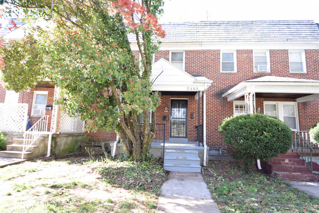
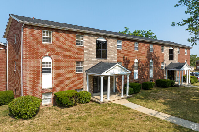
5460 Frederick Ave
Baltimore, MD 21229
Favorites

5460 Frederick Ave
Favorites
Check Back Soon for Upcoming Availability
| Beds | Baths | Average SF |
|---|---|---|
| 3 Bedrooms 3 Bedrooms 3 Br | 2 Baths 2 Baths 2 Ba | 1,800 SF |
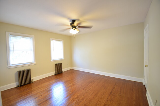
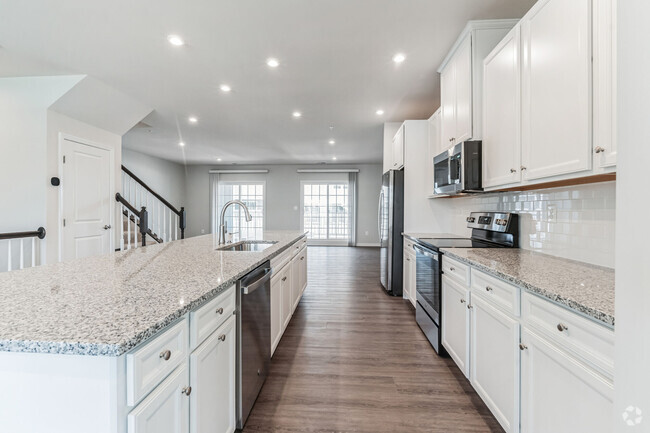
About This Property
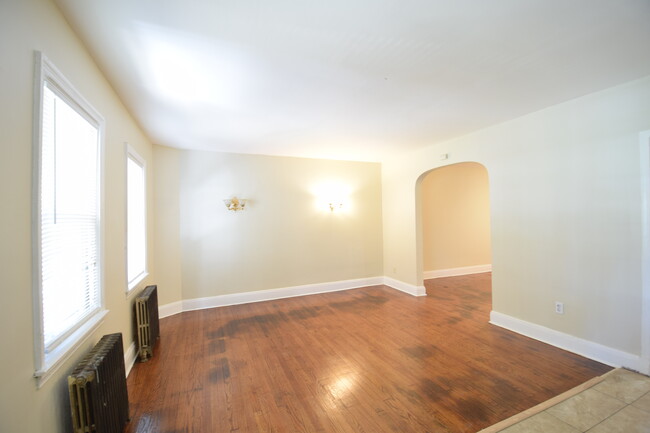
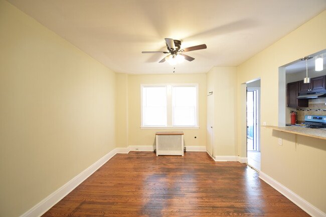
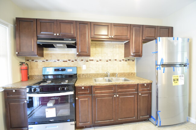
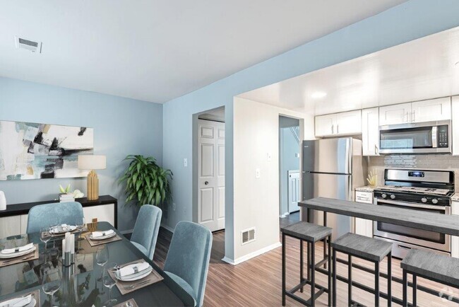
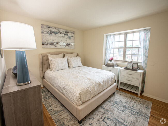
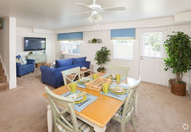
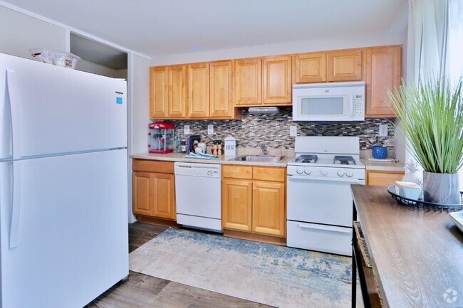
Beautiful, freshly painted 3-level, 3 bedroom, 2 bath in the Norwood Heights community. Home boasts a large living room, dining room, refinished hardwood floors, updated kitchen, nice-sized bedrooms, front/back porch for relaxation in the summer. Lower level is partially finished with a rec room, full bath, and laundry hookups. Close to I95, 695, Route 1, and public transportation. Come see, come rent!
5460 Frederick Ave is a townhome located in Baltimore City County and the 21229 ZIP Code.
Townhome Features
Washer/Dryer Hookup
Hardwood Floors
Refrigerator
Tub/Shower
- Washer/Dryer Hookup
- Ceiling Fans
- Smoke Free
- Tub/Shower
- Stainless Steel Appliances
- Kitchen
- Range
- Refrigerator
- Hardwood Floors
- Tile Floors
- Dining Room
- Basement
- Large Bedrooms
- Porch
- Yard
- Lawn
Fees and Policies
The fees below are based on community-supplied data and may exclude additional fees and utilities.
- Dogs Allowed
-
Fees not specified
- Cats Allowed
-
Fees not specified
- Parking
-
Other--
Details
Utilities Included
-
Trash Removal
Property Address:
5460 Frederick Ave,
Baltimore,
MD
21229
 This Property
 Available Property
In 1899, Baltimore was connected to Ellicott City by trolley. An undeveloped area about halfway between these two cities developed, and by 1913, Westgate was beginning to take shape. As a result, most of the homes in Westgate were built in the early 1900s. These homes tend to be bungalows, Cape Cods, and Tudor-style. Westgate begins along the Baltimore National Pike and extends south to Frederic Avenue, roughly three miles north of the University of Maryland-Baltimore County. Described as family-friendly and close-knit, Westgate is a terrific option for your Baltimore apartment, especially if you'd like to be close to the city but in a quieter community. Westgate has easy access to mass transit, with a MARC station leading to DC, roughly 38 miles southwest. Downtown Baltimore is about five miles east.
Several shops and restaurants are located just outside the neighborhood along Baltimore National Pike. The nearest grocery store, Giant Food, is on Edmonson Avenue.
Learn more about living in WestgateBelow are rent ranges for similar nearby apartments
Amenities
- Washer/Dryer Hookup
- Ceiling Fans
- Smoke Free
- Tub/Shower
- Stainless Steel Appliances
- Kitchen
- Range
- Refrigerator
- Hardwood Floors
- Tile Floors
- Dining Room
- Basement
- Large Bedrooms
- Porch
- Yard
- Lawn
Expenses
Utilities Included
Trash Removal
Included
Education
| Colleges & Universities | Distance | ||
|---|---|---|---|
| Colleges & Universities | Distance | ||
| Drive: | 8 min | 3.2 mi | |
| Drive: | 10 min | 3.8 mi | |
| Drive: | 12 min | 4.8 mi | |
| Drive: | 13 min | 4.9 mi |
5460 Frederick Ave is within 10 minutes or 3.8 miles from UMBC. It is also near CCBC Cantonsville and Univ. of Maryland-Baltimore.
Transportation options available in Baltimore include Upton, located 5.4 miles from 5460 Frederick Ave. 5460 Frederick Ave is near Baltimore/Washington International Thurgood Marshall, located 9.2 miles or 16 minutes away, and Ronald Reagan Washington Ntl, located 41.9 miles or 63 minutes away.
| Transit / Subway | Distance | ||
|---|---|---|---|
| Transit / Subway | Distance | ||
| Drive: | 15 min | 5.4 mi | |
| Drive: | 15 min | 5.5 mi | |
|
|
Drive: | 15 min | 5.6 mi |
| Drive: | 16 min | 5.6 mi | |
|
|
Drive: | 15 min | 6.1 mi |
| Commuter Rail | Distance | ||
|---|---|---|---|
| Commuter Rail | Distance | ||
|
|
Drive: | 10 min | 3.8 mi |
|
|
Drive: | 9 min | 4.5 mi |
|
|
Drive: | 14 min | 5.2 mi |
|
|
Drive: | 12 min | 6.3 mi |
|
|
Drive: | 17 min | 6.4 mi |
| Airports | Distance | ||
|---|---|---|---|
| Airports | Distance | ||
|
Baltimore/Washington International Thurgood Marshall
|
Drive: | 16 min | 9.2 mi |
|
Ronald Reagan Washington Ntl
|
Drive: | 63 min | 41.9 mi |
Time and distance from 5460 Frederick Ave.
| Shopping Centers | Distance | ||
|---|---|---|---|
| Shopping Centers | Distance | ||
| Walk: | 10 min | 0.5 mi | |
| Walk: | 10 min | 0.6 mi | |
| Drive: | 4 min | 1.3 mi |
5460 Frederick Ave has 3 shopping centers within 1.3 miles, which is about a 4-minute drive. The miles and minutes will be for the farthest away property.
| Parks and Recreation | Distance | ||
|---|---|---|---|
| Parks and Recreation | Distance | ||
|
Gwynns Falls Trail
|
Drive: | 8 min | 2.4 mi |
|
Banneker Planetarium
|
Drive: | 8 min | 3.2 mi |
|
Carrie Murray Nature Center
|
Drive: | 9 min | 3.3 mi |
|
Gwynns Falls - Leakin Park
|
Drive: | 9 min | 3.3 mi |
|
Carroll Park
|
Drive: | 14 min | 6.9 mi |
5460 Frederick Ave has 5 parks within 6.9 miles, including Gwynns Falls Trail, Gwynns Falls - Leakin Park, and Carrie Murray Nature Center.
| Hospitals | Distance | ||
|---|---|---|---|
| Hospitals | Distance | ||
| Drive: | 4 min | 1.4 mi | |
| Drive: | 7 min | 2.6 mi | |
| Drive: | 8 min | 3.0 mi |
5460 Frederick Ave has 3 hospitals within 3.0 miles, the nearest is Spring Grove Hospital Center which is 1.4 miles away and a 4 minutes drive.
| Military Bases | Distance | ||
|---|---|---|---|
| Military Bases | Distance | ||
| Drive: | 30 min | 17.2 mi |
5460 Frederick Ave is 17.2 miles and a 30 minutes from Fort George Meade.
You May Also Like
Similar Rentals Nearby


What Are Walk Score®, Transit Score®, and Bike Score® Ratings?
Walk Score® measures the walkability of any address. Transit Score® measures access to public transit. Bike Score® measures the bikeability of any address.
What is a Sound Score Rating?
A Sound Score Rating aggregates noise caused by vehicle traffic, airplane traffic and local sources

5460 Frederick Ave
Baltimore, MD 21229