$3,100 / Month
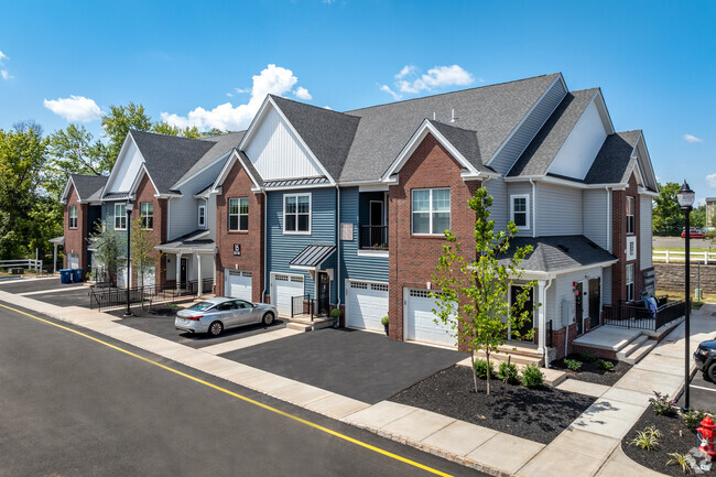
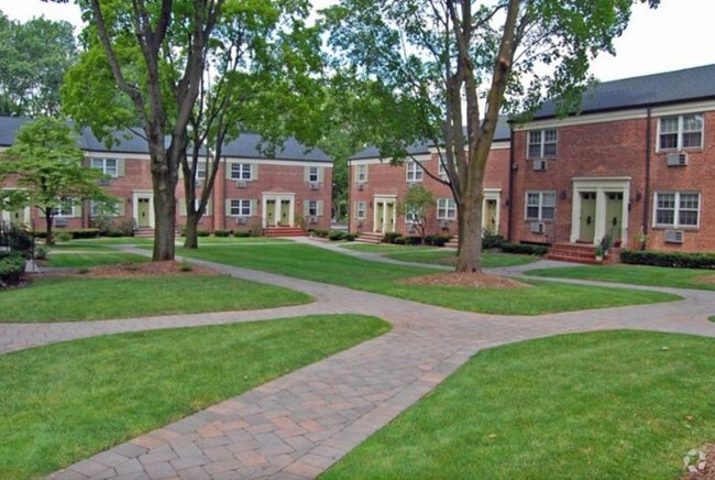
553 N Ave E
Westfield, NJ 07090
2 Weeks Ago
Favorites
553 N Ave E

Favorites
Check Back Soon for Upcoming Availability
| Beds | Baths | Average SF |
|---|---|---|
| 2 Bedrooms 2 Bedrooms 2 Br | 1.5 Baths 1.5 Baths 1.5 Ba | 1,200 SF |
About This Property
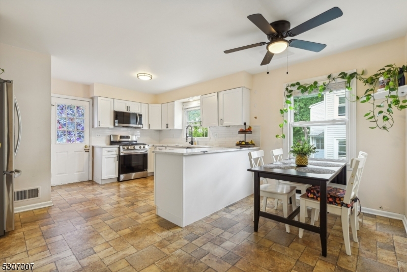
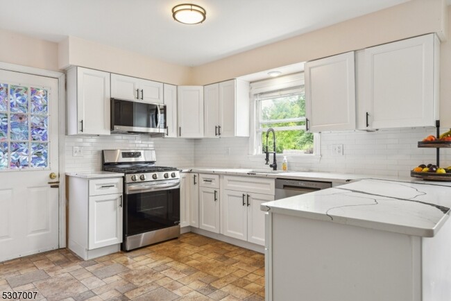
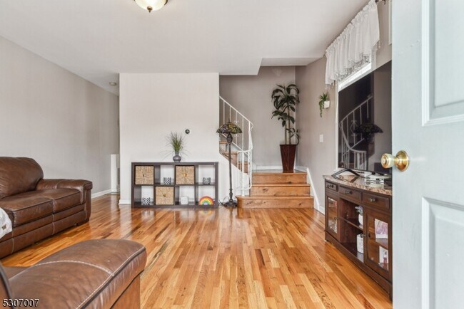
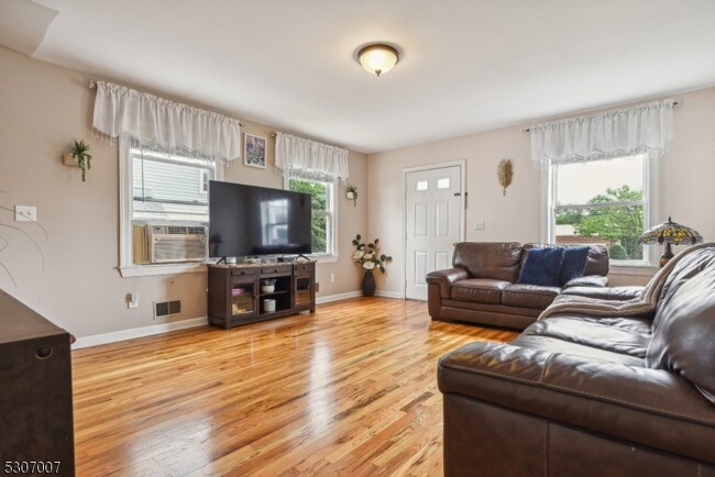
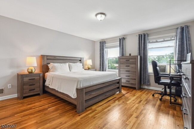
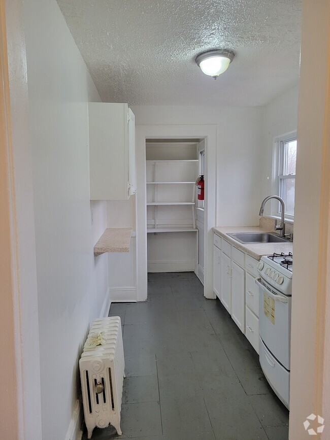
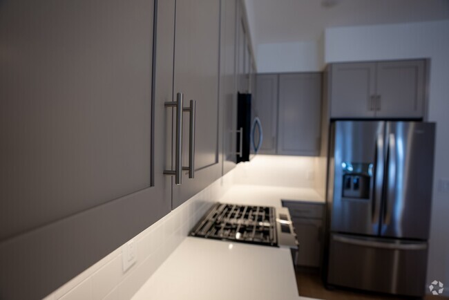
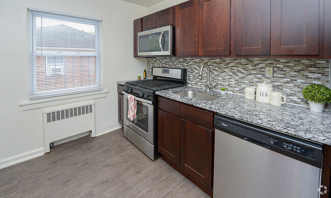
EASY ACCESS TO NYC TRAIN! Renovated HUGE Duplex! Step inside to discover a FULLY RENOVATED large eat-in kitchen, with NEW Quartz counters, shaker cabinets, SS Appliances and subway backsplash. You will LOVE the spacious living room, ideal for relaxation and entertaining. On the second floor, you will find two oversized bedrooms with large closets. The backyard patio is perfect for outdoor gatherings with grill and natural gas hookup, while the 1-car garage and EV charging station provides added convenience. Basement includes expansive storage space, private in-unit laundry, and additional play area. AMAZING location close to downtown Westfield, Garwood, and easy proximity to schools and parks. Great opportunity to be in TOP RATED Westfield school district. Don't miss out on this HUGE rental!!
553 N Ave E is a townhome located in Union County and the 07090 ZIP Code. This area is served by the Westfield Public attendance zone.
Townhome Features
- Air Conditioning
- Dishwasher
- Tile Floors
- Grill
Fees and Policies
The fees below are based on community-supplied data and may exclude additional fees and utilities.
- Cats Allowed
-
Fees not specified
-
Weight limit--
-
Pet Limit--
- Parking
-
Garage--
Location
Get Directions
Westfield is a picturesque Union County suburb located about 20 miles southwest of New York City. Westfield offers residents the best of urban and suburban living within its own borders. Residents enjoy a true sense of community, top-notch public schools, and manicured homes in Westfield as well as access to a walkable downtown, dynamic arts scene, and reliable transportation options.
Downtown Westfield is a vibrant combination of national retailers and local shops, award-winning restaurants and cozy cafes, and modern art galleries and historic buildings. Westfield’s cultural scene boasts an orchestra, community theater, movie house, and various events such as the summer jazz series. Nine parks in town provide a host of recreational opportunities in addition to many surrounding parks in the area. Access to NJ Transit and multiple highways makes getting around from Westfield simple.
Learn more about living in Westfield
Amenities
- Air Conditioning
- Dishwasher
- Tile Floors
- Grill
Education
| Colleges & Universities | Distance | ||
|---|---|---|---|
| Colleges & Universities | Distance | ||
| Drive: | 6 min | 1.5 mi | |
| Drive: | 14 min | 5.8 mi | |
| Drive: | 15 min | 6.6 mi | |
| Drive: | 16 min | 7.8 mi |
553 N Ave E is within 6 minutes or 1.5 miles from Union County College, Cranford. It is also near Union Co. Coll., Plainfield and Kean University.
Schools


Public Elementary & Middle School
Grades PK-8
357 Students
Nearby
Public Elementary School
Grades 1-5
263 Students
Attendance Zone
Public Middle School
Grades 6-8
781 Students
Attendance Zone
Public High School
Grades 9-12
1,818 Students
Attendance Zone
Private Elementary & Middle School
Grades PK-8
264 Students
Nearby
Private Elementary School
Grades PK-1
73 Students
Nearby
Private High School
Grades 9-12
75 Students
Nearby
School data provided by
 The GreatSchools Rating helps parents compare schools within a state based on a variety of school quality indicators and provides a helpful picture of how effectively each school serves all of its students. Ratings are on a scale of 1 (below average) to 10 (above average) and can include test scores, college readiness, academic progress, advanced courses, equity, discipline and attendance data. We also advise parents to visit schools, consider other information on school performance and programs, and consider family needs as part of the school selection process.
View GreatSchools Rating Methodology
View GreatSchools Rating Methodology
Transportation options available in Westfield include Warren Street, located 11.6 miles from 553 N Ave E. 553 N Ave E is near Newark Liberty International, located 13.4 miles or 20 minutes away, and Laguardia, located 32.6 miles or 55 minutes away.
| Transit / Subway | Distance | ||
|---|---|---|---|
| Transit / Subway | Distance | ||
|
|
Drive: | 20 min | 11.6 mi |
|
|
Drive: | 20 min | 11.7 mi |
|
|
Drive: | 20 min | 11.8 mi |
|
|
Drive: | 20 min | 12.1 mi |
|
|
Drive: | 20 min | 12.5 mi |
| Commuter Rail | Distance | ||
|---|---|---|---|
| Commuter Rail | Distance | ||
|
|
Walk: | 14 min | 0.7 mi |
|
|
Walk: | 17 min | 0.9 mi |
|
|
Drive: | 4 min | 1.7 mi |
|
|
Drive: | 8 min | 2.9 mi |
|
|
Drive: | 11 min | 4.4 mi |
| Airports | Distance | ||
|---|---|---|---|
| Airports | Distance | ||
|
Newark Liberty International
|
Drive: | 20 min | 13.4 mi |
|
Laguardia
|
Drive: | 55 min | 32.6 mi |
Time and distance from 553 N Ave E.
| Shopping Centers | Distance | ||
|---|---|---|---|
| Shopping Centers | Distance | ||
| Walk: | 14 min | 0.7 mi | |
| Walk: | 16 min | 0.9 mi | |
| Walk: | 17 min | 0.9 mi |
553 N Ave E has 3 shopping centers within 0.9 mile, which is about a 17-minute walk. The miles and minutes will be for the farthest away property.
| Parks and Recreation | Distance | ||
|---|---|---|---|
| Parks and Recreation | Distance | ||
|
William Miller Sperry Observatory
|
Drive: | 6 min | 1.9 mi |
|
Trailside Museum Watchung Reservation
|
Drive: | 9 min | 3.7 mi |
|
Cora Hartshorn Arboretum
|
Drive: | 18 min | 7.2 mi |
|
Reeves-Reed Arboretum
|
Drive: | 18 min | 7.8 mi |
|
Merrill Park
|
Drive: | 18 min | 9.0 mi |
553 N Ave E has 5 parks within 9.0 miles, including William Miller Sperry Observatory, Trailside Museum Watchung Reservation, and Cora Hartshorn Arboretum.
| Hospitals | Distance | ||
|---|---|---|---|
| Hospitals | Distance | ||
| Drive: | 12 min | 4.7 mi | |
| Drive: | 15 min | 6.8 mi | |
| Drive: | 15 min | 6.9 mi |
553 N Ave E has 3 hospitals within 6.9 miles, the nearest is Robert Wood Johnson University Hospital at Rahway which is 4.7 miles away and a 12 minute drive.
| Military Bases | Distance | ||
|---|---|---|---|
| Military Bases | Distance | ||
| Drive: | 10 min | 3.3 mi | |
| Drive: | 11 min | 4.6 mi | |
| Drive: | 26 min | 17.2 mi |
553 N Ave E has 3 military bases within 17.2 miles, the nearest is Tamdques Reservation which is 3.3 miles away and a 10 minute drive.
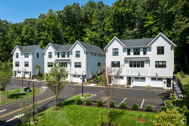
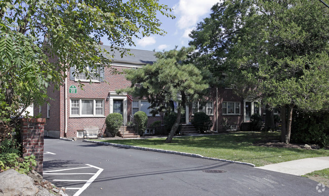
You May Also Like
Similar Rentals Nearby
-
-
1 / 23
-
-
-
-
-
-
-
-


What Are Walk Score®, Transit Score®, and Bike Score® Ratings?
Walk Score® measures the walkability of any address. Transit Score® measures access to public transit. Bike Score® measures the bikeability of any address.
What is a Sound Score Rating?
A Sound Score Rating aggregates noise caused by vehicle traffic, airplane traffic and local sources

553 N Ave E
Westfield, NJ 07090