


$4,000 / Month
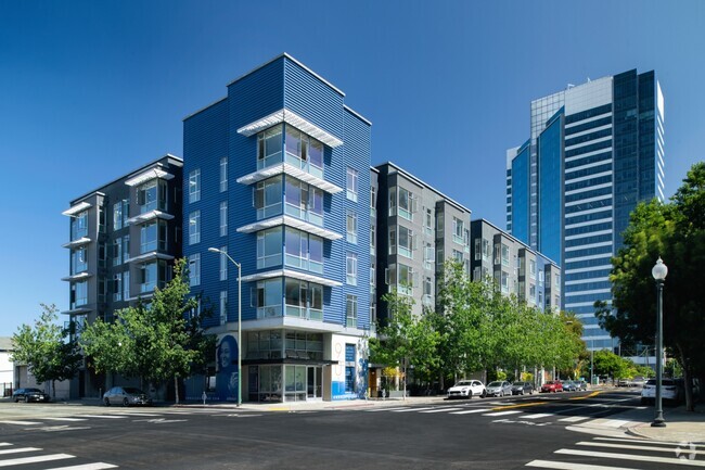
555 4th St
San Francisco, CA 94107
Today
Favorites
415-370-3776
-
Bedrooms
2
-
Bathrooms
2
-
Square Feet
904 sq ft
-
Available
Available May 3
Highlights
- Fitness Center
- City View
- Contemporary Architecture
- Wood Flooring
- Quartz Countertops
- Covered patio or porch
555 4th St

Favorites
About This Home
$4,000 deposit,
Available May 3
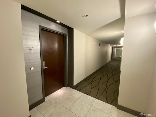
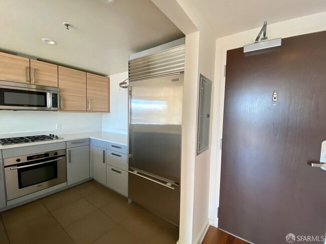
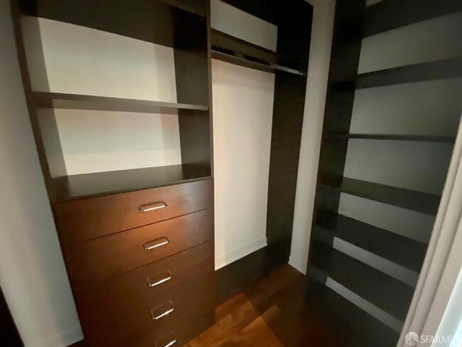
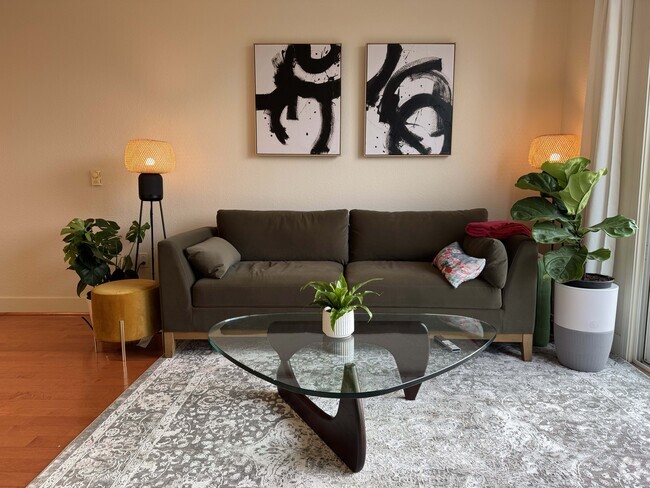
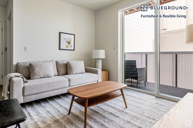
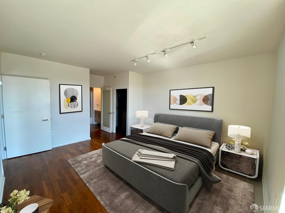
Gorgeous Penthouse level with unobstructed San Francisco skyline view. Premier SOMA Location with just minutes to freeway and public transportation! This beautifully upgraded unit is convenient located in many shops and restaurants nearby. Easy access to Freeway 280 and walking distance to Caltrain. At The Palms, you will experience exceptional services with fitness center, 24 hrs security, conference room, concierge service, residence theater, yoga studio, beautiful landscaped courtyard. Modern kitchen with stainless steel appliances. Beautiful rich hardwood floor throughout. Large floor-to-ceiling windows which offers plenty of natural lights with sliding door to private patio. Marble bathroom and custom closet systems throughout. In unit washer and dryer and a walk in pantry. Welcome to this home sweet home.
555 4th St is a condo located in San Francisco County and the 94107 ZIP Code.
* Price shown is base rent and may not include non-optional fees and utilities.
Price, availability, fees, and any applicable rent special are subject to change without notice.
* Square footage definitions vary. Displayed square footage is approximate.
Home Details
Home Type
Condominium
Year Built
Built in 2006 | Remodeled
Bedrooms and Bathrooms
2 Full Bathrooms
Flooring
Wood
Tile
Carpet
Home Design
Contemporary Architecture
Home Security
Fire and Smoke Detector
Interior Spaces
904 Sq Ft Home
9-Story Property
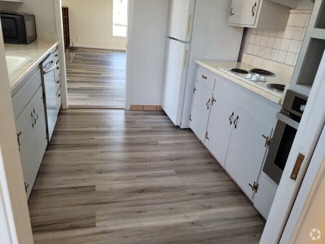
Kitchen
Quartz Countertops
Built-In Gas Oven
Gas Cooktop
Microwave
Self-Cleaning Oven
Listing and Financial Details
Security Deposit $4,000
12 Month Lease Term
Assessor Parcel Number 3776-432
Tenant pays for cable TV, electricity
Min Lease Term (not numerical): 12
Lot Details
1.45 Acre Lot
Outdoor Features
Covered patio or porch
Parking
1 Car Garage
Assigned Parking
Open Parking
Parking Available
Garage Door Opener
Views
City Views
Community Details
Pet Policy
Pets allowed on a case-by-case basis
Recreation
Fitness Center
Contact
- Listed by Kathy Chan | Parc Bay Real Estate
- Phone Number
- Website View Property Website
- Contact
-
Source
San Francisco Association of Realtors
Copyright © 2025 San Francisco Association of REALTORS. All rights reserved. All information provided by the listing agent/broker is deemed reliable but is not guaranteed and should be independently verified.
Location
Get Directions
Amenities
- Air Conditioning
- Smoke Free
- Tub/Shower
- Sprinkler System
- Oven
- Range
- Breakfast Nook
- Hardwood Floors
- Carpet
- Tile Floors
- Patio
Stretched along the bay just east of Downtown San Francisco, Mission Bay is one of the city's most sought-after neighborhoods. It's next door to AT&T Park -- home of the San Francisco Giants -- and it contains the UCSF Medical Center at Mission Bay. The Chase Center, the new home of the Golden State Warriors, will open in 2019. Mission Bay is bordered on its north side by South of Market and to its southwest by the Design District.
With its mixed-use buildings lining wide sidewalks, Mission Bay is both walkable and bike-friendly. Bicycle lanes line most streets, and mass transit is easily accessible with BART. This trendy neighborhood is also home to the UCSF Mission Bay research campus. In addition to a variety of shops and restaurants, Mission Bay is home to some terrific parks with amazing views, including Mission Creek Park, Mission Bay Kids' Park, and Mission Bay Commons Park.
Learn more about living in Mission Bay
Education
| Colleges & Universities | Distance | ||
|---|---|---|---|
| Colleges & Universities | Distance | ||
| Drive: | 3 min | 1.1 mi | |
| Drive: | 3 min | 1.1 mi | |
| Drive: | 4 min | 1.2 mi | |
| Drive: | 4 min | 1.6 mi |
555 4th St is within 3 minutes or 1.1 miles from Golden Gate Univ., San Fran.. It is also near California College of the Arts and UC San Francisco, Mission Bay.
Transportation options available in San Francisco include 4Th & Brannan Southbound, located 0.1 mile from 555 4th St. 555 4th St is near San Francisco International, located 13.3 miles or 20 minutes away, and Metro Oakland International, located 18.9 miles or 28 minutes away.
| Transit / Subway | Distance | ||
|---|---|---|---|
| Transit / Subway | Distance | ||
| Walk: | 1 min | 0.1 mi | |
|
|
Walk: | 5 min | 0.3 mi |
|
|
Walk: | 5 min | 0.3 mi |
| Walk: | 6 min | 0.3 mi | |
|
|
Walk: | 10 min | 0.5 mi |
| Commuter Rail | Distance | ||
|---|---|---|---|
| Commuter Rail | Distance | ||
| Walk: | 4 min | 0.2 mi | |
| Drive: | 3 min | 1.8 mi | |
| Drive: | 9 min | 5.4 mi | |
|
|
Drive: | 14 min | 8.4 mi |
|
|
Drive: | 17 min | 10.5 mi |
| Airports | Distance | ||
|---|---|---|---|
| Airports | Distance | ||
|
San Francisco International
|
Drive: | 20 min | 13.3 mi |
|
Metro Oakland International
|
Drive: | 28 min | 18.9 mi |
Time and distance from 555 4th St.
| Shopping Centers | Distance | ||
|---|---|---|---|
| Shopping Centers | Distance | ||
| Drive: | 3 min | 1.1 mi | |
| Drive: | 2 min | 1.3 mi | |
| Drive: | 3 min | 1.5 mi |
555 4th St has 3 shopping centers within 1.5 miles, which is about a 3-minute drive. The miles and minutes will be for the farthest away property.
| Parks and Recreation | Distance | ||
|---|---|---|---|
| Parks and Recreation | Distance | ||
|
Children's Creativity Museum
|
Walk: | 7 min | 0.4 mi |
|
Aquarium of The Bay
|
Drive: | 7 min | 2.7 mi |
|
San Francisco Maritime National Historical Park
|
Drive: | 8 min | 2.8 mi |
|
Buena Vista Park
|
Drive: | 8 min | 3.0 mi |
|
Randall Museum
|
Drive: | 9 min | 3.2 mi |
555 4th St has 5 parks within 3.2 miles, including Children's Creativity Museum, San Francisco Maritime National Historical Park, and Aquarium of The Bay.
| Hospitals | Distance | ||
|---|---|---|---|
| Hospitals | Distance | ||
| Drive: | 4 min | 1.9 mi | |
| Drive: | 5 min | 2.0 mi | |
| Drive: | 5 min | 2.1 mi |
555 4th St has 3 hospitals within 2.1 miles, the nearest is Chinese Hospital which is 1.9 miles away and a 4 minute drive.
| Military Bases | Distance | ||
|---|---|---|---|
| Military Bases | Distance | ||
| Drive: | 11 min | 5.0 mi | |
| Drive: | 25 min | 13.4 mi |
555 4th St is 5.0 miles from Treasure Island Naval Station, and is convenient to other military bases, including Alameda/US Naval Air Station San Francisco.
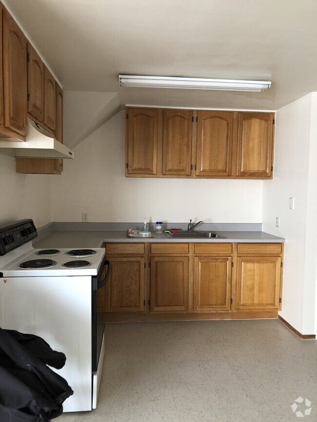
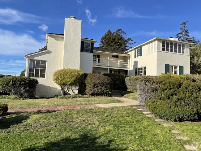
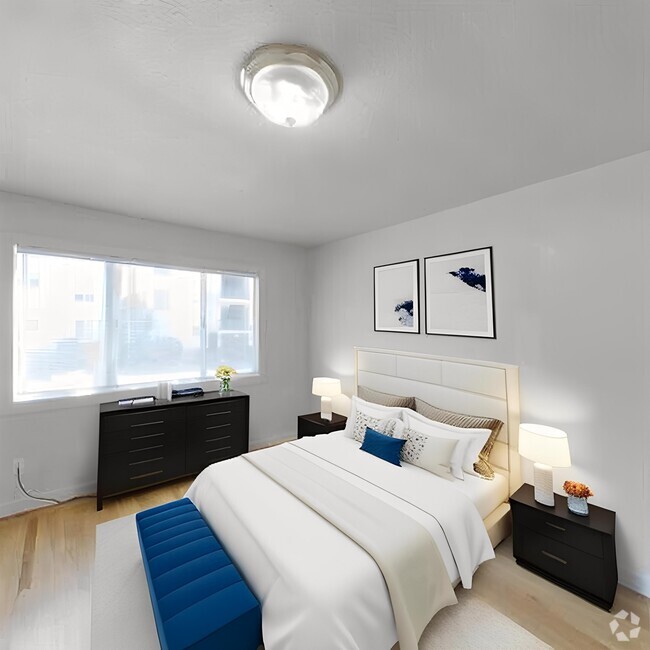
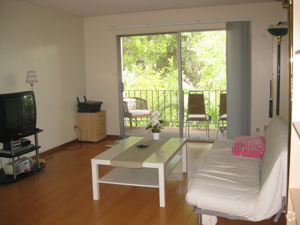
You May Also Like
Similar Rentals Nearby
What Are Walk Score®, Transit Score®, and Bike Score® Ratings?
Walk Score® measures the walkability of any address. Transit Score® measures access to public transit. Bike Score® measures the bikeability of any address.
What is a Sound Score Rating?
A Sound Score Rating aggregates noise caused by vehicle traffic, airplane traffic and local sources
555 4th St
San Francisco, CA 94107