
Check Back Soon for Upcoming Availability
| Beds | Baths | Average SF |
|---|---|---|
| 3 Bedrooms 3 Bedrooms 3 Br | 2 Baths 2 Baths 2 Ba | 1,708 SF |
About This Property
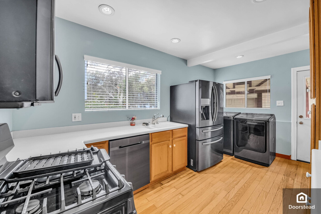
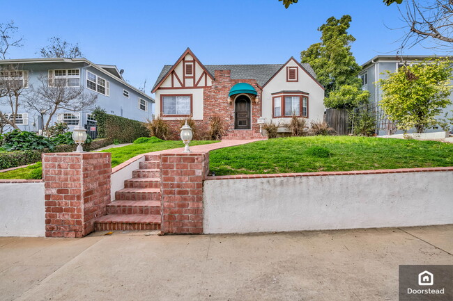
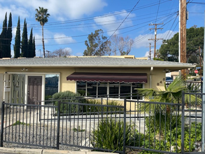
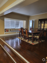
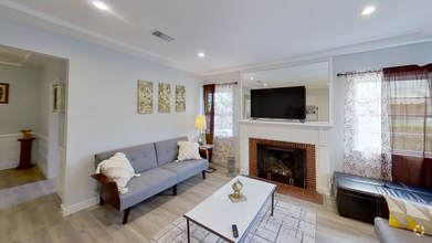
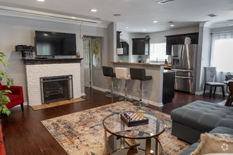
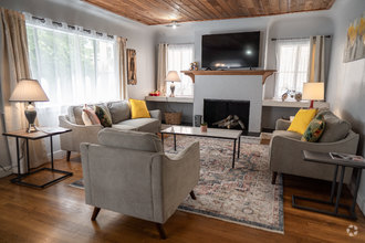
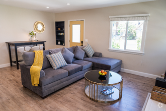
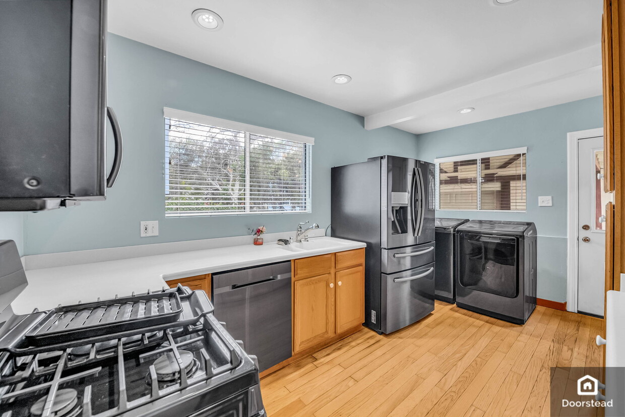
Charming 3-Bed/2-Bath Home in Pasadena's South Arroyo Neighborhood Welcome to 555 Avenue 64, where comfort meets style in this beautifully maintained 3-bedroom, 2-bathroom home. Located in the serene South Arroyo neighborhood, this home offers the perfect blend of suburban tranquility and urban convenience. Key Features: ??? Bedrooms: 3 ?? Bathrooms: 2 ?? Square Footage: 1,708 sq ft ?? Parking: 1 car attached garage ?? Laundry: In-unit washer and dryer ??? Appliances: Stainless steel kitchen appliances ?? Pet-Friendly: Pets are welcome ?? Outdoor Space: Spacious yard ?? Utilities: Tenant in charge for electricity, water, gas, garbage/recycling, and cable/internet Additional Features: This home features a space-maximizing floor plan with well-proportioned rooms, including a cozy primary suite with a large closet and serene hardwood flooring. The primary bathroom offers a shower bath, vessel sink, and tiled flooring. Enjoy the sleek finishes in the efficiently designed kitchen with stainless steel appliances, quartz countertops, and wooden cabinetry. Central air conditioning, heating, and an in-unit washer/dryer ensure maximum comfort and convenience. The charming front yard includes a stone patio and a beautifully manicured lawn, perfect for creating wonderful memories. Location and Neighborhood: Located in the relaxed South Arroyo neighborhood, this home is within easy reach of walking and biking trails, great shopping, schools, and restaurants. Enjoy the amenities of suburban living while being just minutes from all the conveniences you need. The spacious single-car detached garage provides plenty of room for vehicles and belongings. Lease Terms and Application: ?? Lease Terms: 12 months, available for move-in now ?? Platform Fee: $45 per adult (non-refundable) ?? Security Deposit: Equal to 1x the monthly rent based upon approved credit ?? Security deposit and the first month’s rent will be due at the time of lease signing ?? Qualifications: Renters should have a minimum credit score of 650 or above and a gross income of at least 3x the monthly rent ??? Lease Start: Preference will be given to applicants with the earliest start date ?? Section 8 or Housing Vouchers are accepted. If approved, the process may take up to 30 days based on the Housing Authority timeline ?? Please view our statement of Rental Policy for further details Don't miss your chance to make this beautiful house in Pasadena's South Arroyo neighborhood your new home. Contact us today to schedule a showing!
555 Avenue 64 is a house located in Los Angeles County and the 91105 ZIP Code.
House Features
Washer/Dryer
Air Conditioning
Stainless Steel Appliances
Heating
- Washer/Dryer
- Air Conditioning
- Heating
- Stainless Steel Appliances
- Kitchen
- Recycling
- Patio
- Yard
- Lawn
Fees and Policies
The fees below are based on community-supplied data and may exclude additional fees and utilities.
- Dogs Allowed
-
Fees not specified
- Cats Allowed
-
Fees not specified
- Parking
-
Garage--
Details
Utilities Included
-
Air Conditioning
 This Property
 Available Property
Annandale is nestled in a quaint, high-end section of Pasadena in the outskirts of Los Angeles. Many visitors pass through Annandale to cross the landmark Colorado Street Bridge or exit the Ventura Freeway heading to events at the Rose Bowl. The neighborhood contains mostly million-dollar homes and grand estates, along with a few upscale rental properties. The only commercial zone rests along Colorado Boulevard, comprising of a few small businesses. The Arroyo Seco defines the eastern border, a dry riverbed that extends from the San Gabriel Mountains down to Elysian Park. Annandale sits only two miles west of Pasadena City Hall and nine miles northeast of Downtown Los Angeles.
Learn more about living in AnnandaleBelow are rent ranges for similar nearby apartments
- Washer/Dryer
- Air Conditioning
- Heating
- Stainless Steel Appliances
- Kitchen
- Recycling
- Patio
- Yard
- Lawn
| Colleges & Universities | Distance | ||
|---|---|---|---|
| Colleges & Universities | Distance | ||
| Drive: | 6 min | 2.5 mi | |
| Drive: | 6 min | 3.3 mi | |
| Drive: | 8 min | 3.5 mi | |
| Drive: | 9 min | 3.9 mi |
Transportation options available in Pasadena include Fillmore Station, located 2.0 miles from 555 Avenue 64. 555 Avenue 64 is near Bob Hope, located 15.5 miles or 22 minutes away, and Los Angeles International, located 22.2 miles or 36 minutes away.
| Transit / Subway | Distance | ||
|---|---|---|---|
| Transit / Subway | Distance | ||
|
|
Drive: | 5 min | 2.0 mi |
|
|
Drive: | 5 min | 2.1 mi |
|
|
Drive: | 6 min | 2.3 mi |
|
|
Drive: | 5 min | 2.6 mi |
|
|
Drive: | 5 min | 2.7 mi |
| Commuter Rail | Distance | ||
|---|---|---|---|
| Commuter Rail | Distance | ||
|
|
Drive: | 13 min | 7.2 mi |
|
|
Drive: | 15 min | 7.2 mi |
|
|
Drive: | 12 min | 7.9 mi |
|
|
Drive: | 14 min | 10.0 mi |
| Drive: | 17 min | 11.3 mi |
| Airports | Distance | ||
|---|---|---|---|
| Airports | Distance | ||
|
Bob Hope
|
Drive: | 22 min | 15.5 mi |
|
Los Angeles International
|
Drive: | 36 min | 22.2 mi |
Time and distance from 555 Avenue 64.
| Shopping Centers | Distance | ||
|---|---|---|---|
| Shopping Centers | Distance | ||
| Drive: | 4 min | 1.5 mi | |
| Drive: | 4 min | 1.6 mi | |
| Drive: | 3 min | 1.7 mi |
| Parks and Recreation | Distance | ||
|---|---|---|---|
| Parks and Recreation | Distance | ||
|
Kidspace Children's Museum
|
Drive: | 5 min | 2.4 mi |
|
Audubon Center at Debs Park
|
Drive: | 7 min | 3.2 mi |
|
Jet Propulsion Laboratory
|
Drive: | 8 min | 5.1 mi |
|
Huntington Botanical Gardens
|
Drive: | 12 min | 5.6 mi |
|
Elyria Canyon Park
|
Drive: | 13 min | 5.9 mi |
| Hospitals | Distance | ||
|---|---|---|---|
| Hospitals | Distance | ||
| Drive: | 4 min | 1.7 mi | |
| Drive: | 9 min | 4.5 mi | |
| Drive: | 11 min | 4.7 mi |
| Military Bases | Distance | ||
|---|---|---|---|
| Military Bases | Distance | ||
| Drive: | 33 min | 23.8 mi | |
| Drive: | 46 min | 31.3 mi |
You May Also Like
Similar Rentals Nearby
-
-
1 / 22
-
-
-
$3,8003 Beds, 1 Bath, 1,350 sq ftHouse for Rent
-
-
$6,0003 Beds, 2 Baths, 1,800 sq ftHouse for Rent
-
$6,0003 Beds, 2 Baths, 1,500 sq ftHouse for Rent
-
$5,5003 Beds, 2 Baths, 1,700 sq ftHouse for Rent
-
$6,5003 Beds, 2 Baths, 1,218 sq ftHouse for Rent
What Are Walk Score®, Transit Score®, and Bike Score® Ratings?
Walk Score® measures the walkability of any address. Transit Score® measures access to public transit. Bike Score® measures the bikeability of any address.
What is a Sound Score Rating?
A Sound Score Rating aggregates noise caused by vehicle traffic, airplane traffic and local sources
