$439 / Month
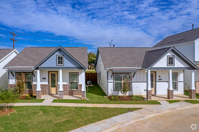
556 Bright Angel Trail
DeSoto, TX 75115
2 Weeks Ago
Favorites
556 Bright Angel Trail

Favorites
Check Back Soon for Upcoming Availability
| Beds | Baths | Average SF |
|---|---|---|
| 1 Bedroom 1 Bedroom 1 Br | 1 Bath 1 Bath 1 Ba | 197 SF |
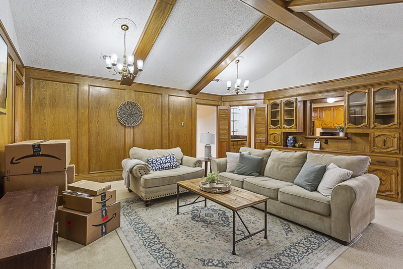
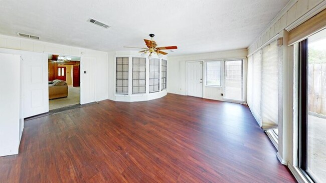
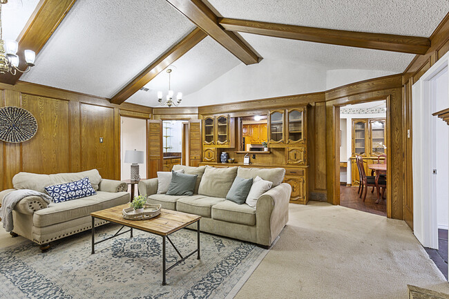
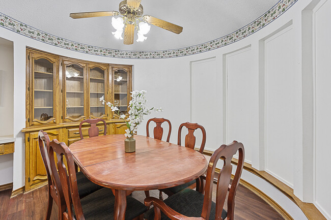
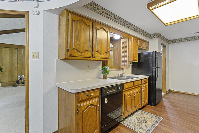
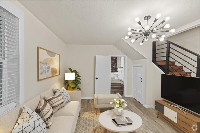
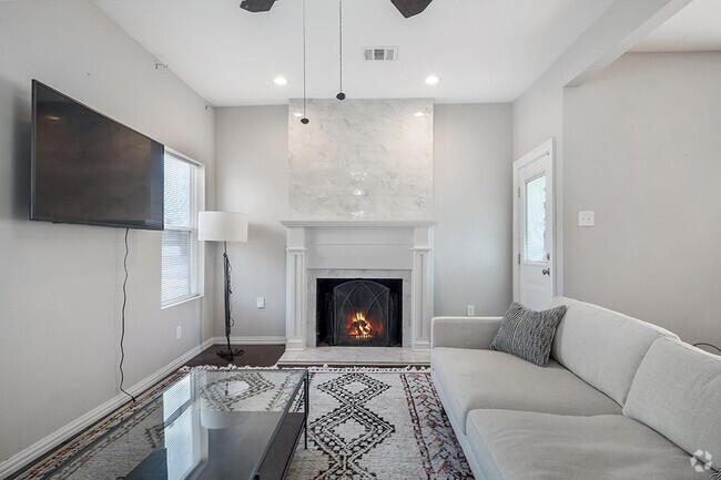
About This Property
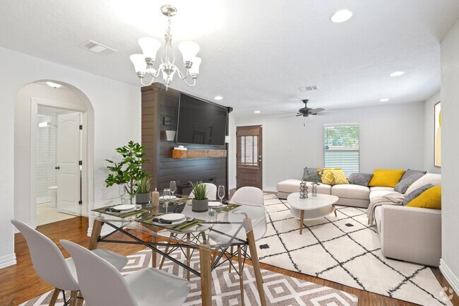
Elevate your lifestyle with HomeRoom - DeSoto's premier shared-living community! This house boasts ample space and has been meticulously updated with tasteful and thoughtful touches throughout. It offers the perfect combination of privacy and comfort - an unfurnished private bedroom to make your own, fully furnished common spaces featuring stylish and contemporary furniture, and a Smart TV for optimal entertainment. To discover more or browse available rooms, text our leasing experts at 1- or visit
556 Bright Angel Trail is a house located in Dallas County and the 75115 ZIP Code. This area is served by the Desoto Independent attendance zone.
Location
Get Directions
This all-American city was first settled in 1847. Today, DeSoto is an up-and-coming suburb of Dallas boasting a large park system and a community cultural arts program.
Avid hikers (or those who enjoy a brisk hike) will find solace on the Roy Orr Trail. With almost four miles of trail, you’ll be walking among the natural beauty of the Tenmile Creek.
Living in a DeSoto apartment, you’ll be relieved at the convenience of getting into the DFW metro. Bordering Interstate 35E, renters can hop onto Interstate 20 or commute into Dallas in no time at all.
Learn more about living in DeSoto
Education
| Colleges & Universities | Distance | ||
|---|---|---|---|
| Colleges & Universities | Distance | ||
| Drive: | 15 min | 7.2 mi | |
| Drive: | 20 min | 9.8 mi | |
| Drive: | 19 min | 11.1 mi | |
| Drive: | 19 min | 11.6 mi |
556 Bright Angel Trail is within 15 minutes or 7.2 miles from Cedar Valley College. It is also near Paul Quinn College and Mountain View College.
Schools


Charter Elementary, Middle & High School
Grades PK-12
2,473 Students
Nearby
Public Elementary School
Grades K-5
392 Students
Attendance Zone
Public Middle School
Grades 6-8
439 Students
Attendance Zone
Public High School
Grades 9-12
2,216 Students
Attendance Zone
Private Elementary, Middle & High School
Grades K-12
237 Students
Nearby
Private Elementary, Middle & High School
Grades PK-10
Nearby
School data provided by
 The GreatSchools Rating helps parents compare schools within a state based on a variety of school quality indicators and provides a helpful picture of how effectively each school serves all of its students. Ratings are on a scale of 1 (below average) to 10 (above average) and can include test scores, college readiness, academic progress, advanced courses, equity, discipline and attendance data. We also advise parents to visit schools, consider other information on school performance and programs, and consider family needs as part of the school selection process.
View GreatSchools Rating Methodology
View GreatSchools Rating Methodology
Transportation options available in DeSoto include Unt Dallas Station, located 6.5 miles from 556 Bright Angel Trail. 556 Bright Angel Trail is near Dallas Love Field, located 20.4 miles or 31 minutes away, and Dallas-Fort Worth International, located 29.8 miles or 40 minutes away.
| Transit / Subway | Distance | ||
|---|---|---|---|
| Transit / Subway | Distance | ||
|
|
Drive: | 12 min | 6.5 mi |
|
|
Drive: | 16 min | 8.7 mi |
|
|
Drive: | 19 min | 9.4 mi |
|
|
Drive: | 17 min | 9.7 mi |
|
|
Drive: | 17 min | 10.2 mi |
| Commuter Rail | Distance | ||
|---|---|---|---|
| Commuter Rail | Distance | ||
|
|
Drive: | 28 min | 17.2 mi |
|
|
Drive: | 25 min | 18.0 mi |
|
|
Drive: | 30 min | 22.5 mi |
|
|
Drive: | 35 min | 23.8 mi |
|
|
Drive: | 32 min | 23.9 mi |
| Airports | Distance | ||
|---|---|---|---|
| Airports | Distance | ||
|
Dallas Love Field
|
Drive: | 31 min | 20.4 mi |
|
Dallas-Fort Worth International
|
Drive: | 40 min | 29.8 mi |
Time and distance from 556 Bright Angel Trail.
| Shopping Centers | Distance | ||
|---|---|---|---|
| Shopping Centers | Distance | ||
| Drive: | 3 min | 1.3 mi | |
| Drive: | 3 min | 1.3 mi | |
| Drive: | 3 min | 1.3 mi |
556 Bright Angel Trail has 3 shopping centers within 1.3 miles, which is about a 3-minute drive. The miles and minutes will be for the farthest away property.
| Parks and Recreation | Distance | ||
|---|---|---|---|
| Parks and Recreation | Distance | ||
|
Windmill Hill Preserve
|
Drive: | 5 min | 2.8 mi |
|
Cedar Mountain Preserve
|
Drive: | 11 min | 5.9 mi |
|
Cedar Ridge Preserve
|
Drive: | 16 min | 8.1 mi |
|
Cedar Hill State Park
|
Drive: | 17 min | 8.5 mi |
|
Dogwood Canyon Audubon Center
|
Drive: | 17 min | 10.4 mi |
556 Bright Angel Trail has 5 parks within 10.4 miles, including Windmill Hill Preserve, Cedar Mountain Preserve, and Dogwood Canyon Audubon Center.
| Hospitals | Distance | ||
|---|---|---|---|
| Hospitals | Distance | ||
| Walk: | 20 min | 1.0 mi | |
| Drive: | 6 min | 2.7 mi | |
| Drive: | 6 min | 3.0 mi |
556 Bright Angel Trail has 3 hospitals within 3.0 miles, the nearest is Hickory Trail Hospital which is 1.0 miles away and a 20 minute walk.
| Military Bases | Distance | ||
|---|---|---|---|
| Military Bases | Distance | ||
| Drive: | 28 min | 14.8 mi | |
| Drive: | 55 min | 43.5 mi |
556 Bright Angel Trail is 14.8 miles from Dallas Naval Air Station, and is convenient to other military bases, including NAS Fort Worth Joint Reserve Base.
You May Also Like
Similar Rentals Nearby


What Are Walk Score®, Transit Score®, and Bike Score® Ratings?
Walk Score® measures the walkability of any address. Transit Score® measures access to public transit. Bike Score® measures the bikeability of any address.
What is a Sound Score Rating?
A Sound Score Rating aggregates noise caused by vehicle traffic, airplane traffic and local sources

556 Bright Angel Trail
DeSoto, TX 75115