$4,750 / Month
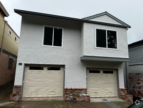
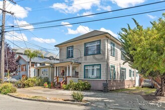
56 Manzanita Ave
San Francisco, CA 94118
Today
Favorites
415-370-0949
-
Bedrooms
3
-
Bathrooms
2
-
Square Feet
--
-
Available
Available Now
Highlights
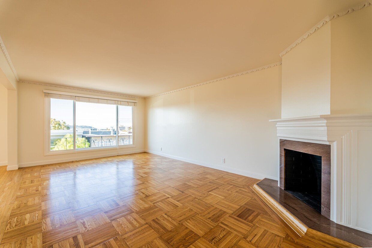
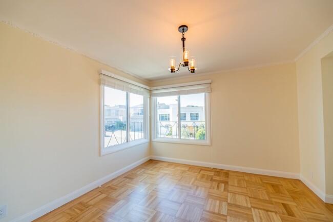
- Hardwood Floors
- Controlled Access
56 Manzanita Ave

Favorites
About This Home
Available Now
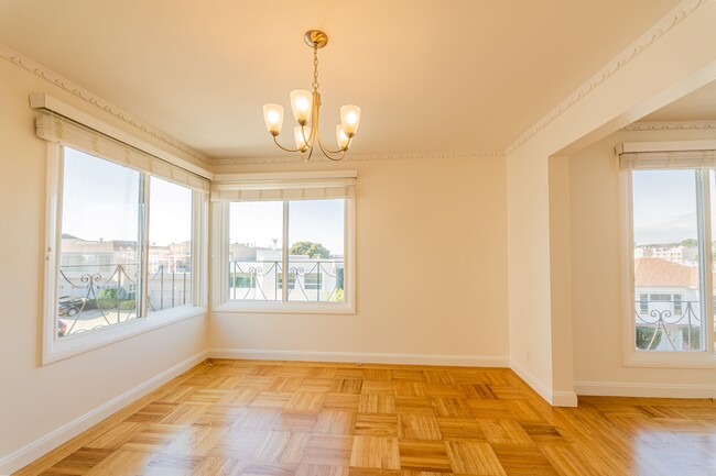
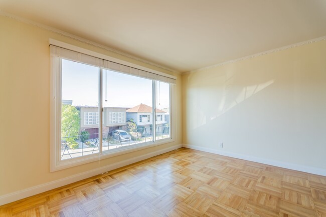
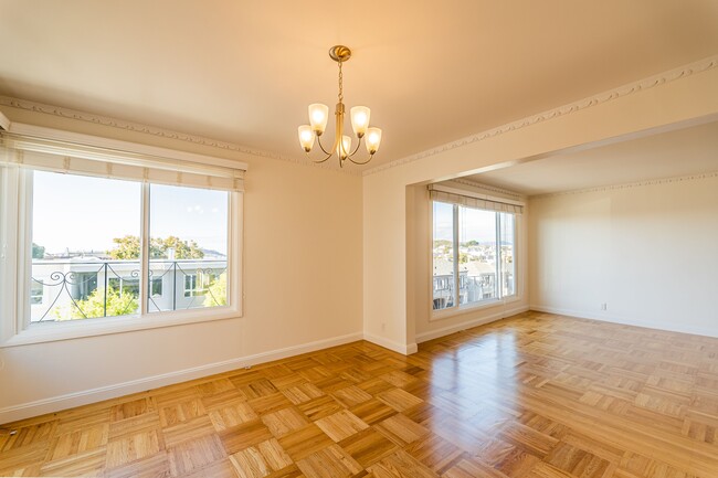
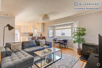
ID#1958: Beautifully updated full-floor flat located in the heart of the fantastic Laurel Heights neighborhood. This top-floor apartment in a 2-unit building is bathed in natural light. The remodeled kitchen boasts stainless-steel appliances, including a dishwasher and gas range with hood vent, as well as ample countertops and custom cabinetry. A bright dining room adjoins the kitchen and flows into the living room, which features a wall of west-facing windows and a decorative corner fireplace. Two generously-sized bedrooms with ample closet space are at the back of the home that overlook the shared terraced backyard. The wonderfully updated marble bathroom offers both a stall shower and a separate soaking tub. Hardwood floors are throughout. Plenty of storage space is in the garage with laundry hookups and 1 parking spot, plus an additional parking space in the driveway. 96 Walk Score: just steps away from the lovely Laurel Village shopping center with Starbucks, Pete's, Walgreens, Ace 5 & 10 Hardware, Cal-Mart, Bryan's Grocery, Super Duper Burgers, Proposition Chicken, and Susie Cakes. Nearby Trader Joe's, Target, Laurel Hill Playground and a short walk to Presidio Heights Playground. Rental Terms: Annual: $4,750 Per Month
56 Manzanita Ave is a house located in San Francisco County and the 94118 ZIP Code.
* Price shown is base rent and may not include non-optional fees and utilities.
Price, availability, fees, and any applicable rent special are subject to change without notice.
* Square footage definitions vary. Displayed square footage is approximate.
House Features
- Air Conditioning
- Hardwood Floors
- Tile Floors
- Package Service
- Laundry Facilities
- Controlled Access
Contact
- Listed by Mary Landeros
- Phone Number (415) 370-0949
- Contact
$5,235 / month
$850,000 Listing Price
5 Beds
•3 Baths
•
1,400 Sq Ft
$3,826 / month
$625,000 Listing Price
4 Beds
•3 Baths
•
2,811 Sq Ft
$5,294 / month
$899,999 Listing Price
4 Beds
•2 Baths
•
1,726 Sq Ft
Location
Get Directions
Amenities
- Air Conditioning
- Hardwood Floors
- Tile Floors
- Package Service
- Laundry Facilities
- Controlled Access
Elegant newer homes, Victorian and Edwardian style architecture, and a breathtaking view of the San Francisco cityscape make the hilly neighborhood of Laurel Heights a particularly sought-after location for high-end homes for rent. Located less than three miles west of downtown San Francisco, this stylish community offers a taste of suburbia right in the middle of this Bay Area city. Laurel Heights is home to the University of California, San Francisco Laurel Heights campus, giving it a somewhat college-town feel.
Residents also find themselves just a short walk or bike ride from the shopping and dining options along California Street and Geary Boulevard, which offer eclectic restaurants, quirky boutiques, and more. Living in Laurel Heights will also give you easy access to some of San Francisco’s biggest hotspots and attractions. The famed “Full House” location, the Presidio of San Francisco, and Golden Gate Park are all about 15 minutes away.
Learn more about living in Laurel Heights
Education
| Colleges & Universities | Distance | ||
|---|---|---|---|
| Colleges & Universities | Distance | ||
| Walk: | 15 min | 0.8 mi | |
| Walk: | 16 min | 0.8 mi | |
| Drive: | 7 min | 2.5 mi | |
| Drive: | 7 min | 2.6 mi |
56 Manzanita Ave is within 15 minutes or 0.8 mile from University of San Francisco. It is also near UC San Francisco, Mount Zion and Academy of Art University.
Transportation options available in San Francisco include Carl And Stanyan, located 1.7 miles from 56 Manzanita Ave. 56 Manzanita Ave is near San Francisco International, located 15.7 miles or 27 minutes away, and Metro Oakland International, located 21.7 miles or 36 minutes away.
| Transit / Subway | Distance | ||
|---|---|---|---|
| Transit / Subway | Distance | ||
|
|
Drive: | 4 min | 1.7 mi |
|
|
Drive: | 5 min | 1.9 mi |
|
|
Drive: | 5 min | 1.9 mi |
|
|
Drive: | 5 min | 2.0 mi |
|
|
Drive: | 6 min | 2.0 mi |
| Commuter Rail | Distance | ||
|---|---|---|---|
| Commuter Rail | Distance | ||
| Drive: | 10 min | 4.8 mi | |
| Drive: | 12 min | 5.7 mi | |
| Drive: | 15 min | 7.9 mi | |
|
|
Drive: | 22 min | 11.2 mi |
| Drive: | 21 min | 12.3 mi |
| Airports | Distance | ||
|---|---|---|---|
| Airports | Distance | ||
|
San Francisco International
|
Drive: | 27 min | 15.7 mi |
|
Metro Oakland International
|
Drive: | 36 min | 21.7 mi |
Time and distance from 56 Manzanita Ave.
| Shopping Centers | Distance | ||
|---|---|---|---|
| Shopping Centers | Distance | ||
| Walk: | 14 min | 0.7 mi | |
| Drive: | 3 min | 1.3 mi | |
| Drive: | 5 min | 1.9 mi |
56 Manzanita Ave has 3 shopping centers within 1.9 miles, which is about a 5-minute drive. The miles and minutes will be for the farthest away property.
| Parks and Recreation | Distance | ||
|---|---|---|---|
| Parks and Recreation | Distance | ||
|
Conservatory of Flowers
|
Drive: | 3 min | 1.2 mi |
|
Buena Vista Park
|
Drive: | 5 min | 1.9 mi |
|
Exploratorium
|
Drive: | 5 min | 1.9 mi |
|
California Academy of Sciences
|
Drive: | 6 min | 2.0 mi |
|
Steinhart Aquarium
|
Drive: | 6 min | 2.0 mi |
56 Manzanita Ave has 5 parks within 2.0 miles, including Conservatory of Flowers, Buena Vista Park, and California Academy of Sciences.
| Hospitals | Distance | ||
|---|---|---|---|
| Hospitals | Distance | ||
| Walk: | 12 min | 0.6 mi | |
| Walk: | 19 min | 1.0 mi | |
| Drive: | 5 min | 2.0 mi |
56 Manzanita Ave has 3 hospitals within 2.0 miles, the nearest is Kaiser Foundation Hospital - San Francisco which is 0.6 mile away and a 12 minutes drive.
| Military Bases | Distance | ||
|---|---|---|---|
| Military Bases | Distance | ||
| Drive: | 10 min | 3.1 mi | |
| Drive: | 11 min | 3.5 mi | |
| Drive: | 19 min | 7.8 mi |
56 Manzanita Ave has 3 military bases within 7.8 miles, the nearest is East Fort Miley which is 3.1 miles away and a 10 minutes .
You May Also Like
Similar Rentals Nearby
-
-
-
-
-
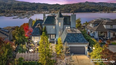 $35,0005 Beds, 5 Baths, 4,500 sq ftHouse for Rent
 -
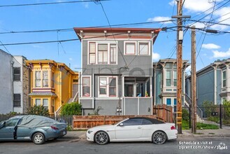
 $4,3703 Beds, 2 Baths, 1,100 sq ftHouse for Rent
 -
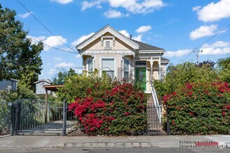 $2,6003 Beds, 1.5 Baths, 1,200 sq ftHouse for Rent
 -
-
-
What Are Walk Score®, Transit Score®, and Bike Score® Ratings?
Walk Score® measures the walkability of any address. Transit Score® measures access to public transit. Bike Score® measures the bikeability of any address.
What is a Sound Score Rating?
A Sound Score Rating aggregates noise caused by vehicle traffic, airplane traffic and local sources

56 Manzanita Ave
San Francisco, CA 94118