
$1,200 / Month
56 Westville Rd
Plaistow, NH 03865
2 Weeks Ago
Favorites
56 Westville Rd

Favorites
Check Back Soon for Upcoming Availability
| Beds | Baths | Average SF |
|---|---|---|
| 1 Bedroom 1 Bedroom 1 Br | 1 Bath 1 Bath 1 Ba | 800 SF |
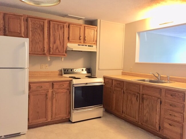
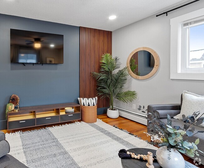
About This Property
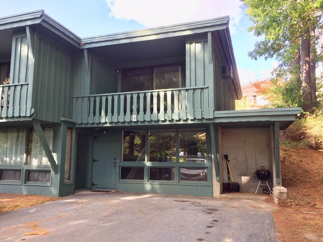
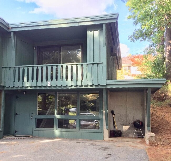
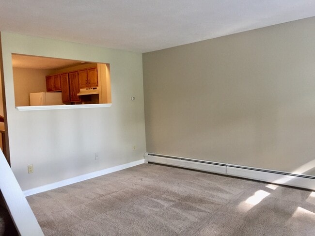
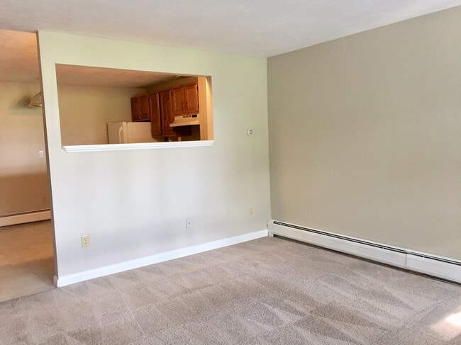
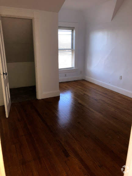
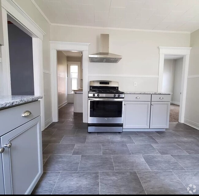
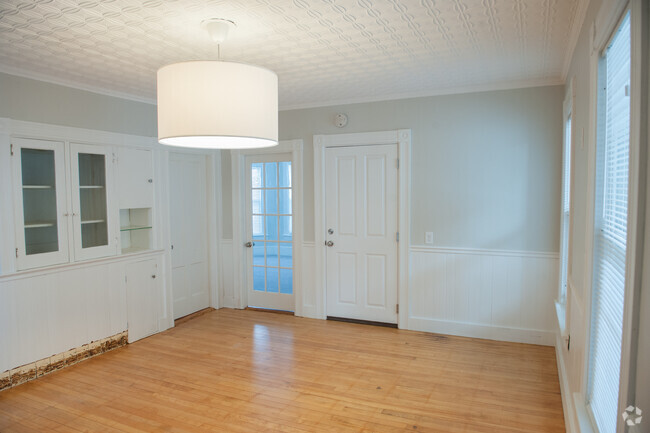
For rent 1 bedroom, 1 bath townhouse with additional office/den space. This very clean end unit rental has been freshly painted throughout and offers spacious livingroom with 3 large windows for natural light, eat in kitchen, and first floor laundry hookups. The 2nd level has a large bedroom with slider leading directly to a private balcony including 2 outside storage spaces. Also on the 2nd level, you will find a full bath and additional room that can be used for office/den. This unit offers an abundance of privacy while still being an excellent commuter location! Conveniently located to route 125 and 495, shopping, restaurants, and all other necessary amenities. Parking for 2 vehicles is available. No pets.
56 Westville Rd is a townhome located in Rockingham County and the 03865 ZIP Code. This area is served by the Timberlane Regional attendance zone.
Property Address:
56 Westville Rd,
Plaistow,
NH
03865
Education
| Colleges & Universities | Distance | ||
|---|---|---|---|
| Colleges & Universities | Distance | ||
| Drive: | 13 min | 5.4 mi | |
| Drive: | 22 min | 13.2 mi | |
| Drive: | 32 min | 21.2 mi | |
| Drive: | 33 min | 22.2 mi |
56 Westville Rd is within 13 minutes or 5.4 miles from Northern Essex Comm. Coll.. It is also near Merrimack College and Middlesex C.C., Lowell Campus.
Schools
Public Elementary School
Grades PK-5
469 Students
Attendance Zone
6
Out of 10
Public Middle School
Grades 6-8
735 Students
Attendance Zone
5
Out of 10
Public High School
Grades 9-12
1,003 Students
Attendance Zone
5
Out of 10
Private Elementary & Middle School
Grades PK-7
26 Students
Nearby
Private Elementary School
Grades PK-5
Nearby
Private High School
Grades 9-12
Nearby
School data provided by
GreatSchools
The GreatSchools Rating helps parents compare schools within a state based on a variety of school quality indicators and provides a helpful picture of how effectively each school serves all of its students. Ratings are on a scale of 1 (below average) to 10 (above average) and can include test scores, college readiness, academic progress, advanced courses, equity, discipline and attendance data. We also advise parents to visit schools, consider other information on school performance and programs, and consider family needs as part of the school selection process.
Transportation options available in Plaistow include Oak Grove Station, located 32.3 miles from 56 Westville Rd. 56 Westville Rd is near Portsmouth International at Pease, located 31.8 miles or 45 minutes away, and Manchester Boston Regional, located 33.1 miles or 51 minutes away.
| Transit / Subway | Distance | ||
|---|---|---|---|
| Transit / Subway | Distance | ||
|
|
Drive: | 45 min | 32.3 mi |
|
|
Drive: | 45 min | 33.7 mi |
| Drive: | 45 min | 33.9 mi | |
|
|
Drive: | 47 min | 34.9 mi |
|
|
Drive: | 56 min | 38.8 mi |
| Commuter Rail | Distance | ||
|---|---|---|---|
| Commuter Rail | Distance | ||
|
|
Drive: | 10 min | 4.6 mi |
|
|
Drive: | 11 min | 5.0 mi |
|
|
Drive: | 17 min | 10.5 mi |
|
|
Drive: | 22 min | 13.8 mi |
|
|
Drive: | 29 min | 17.3 mi |
| Airports | Distance | ||
|---|---|---|---|
| Airports | Distance | ||
|
Portsmouth International at Pease
|
Drive: | 45 min | 31.8 mi |
|
Manchester Boston Regional
|
Drive: | 51 min | 33.1 mi |
Time and distance from 56 Westville Rd.
| Shopping Centers | Distance | ||
|---|---|---|---|
| Shopping Centers | Distance | ||
| Walk: | 8 min | 0.5 mi | |
| Walk: | 12 min | 0.7 mi | |
| Walk: | 16 min | 0.8 mi |
56 Westville Rd has 3 shopping centers within 0.8 mile, which is about a 16-minute walk. The miles and minutes will be for the farthest away property.
| Parks and Recreation | Distance | ||
|---|---|---|---|
| Parks and Recreation | Distance | ||
|
America's Stonehenge
|
Drive: | 16 min | 6.9 mi |
|
Bradford Ski Area
|
Drive: | 16 min | 7.2 mi |
|
Kingston State Park
|
Drive: | 23 min | 10.1 mi |
|
Lawrence Heritage State Park
|
Drive: | 16 min | 10.4 mi |
|
Maudslay State Park
|
Drive: | 26 min | 16.3 mi |
56 Westville Rd has 5 parks within 16.3 miles, including America's Stonehenge, Bradford Ski Area, and Kingston State Park.
| Hospitals | Distance | ||
|---|---|---|---|
| Hospitals | Distance | ||
| Drive: | 10 min | 4.2 mi | |
| Drive: | 10 min | 4.6 mi | |
| Drive: | 16 min | 9.7 mi |
56 Westville Rd has 3 hospitals within 9.7 miles, the nearest is Hampstead Hospital which is 4.2 miles away and a 10 minute drive.
| Military Bases | Distance | ||
|---|---|---|---|
| Military Bases | Distance | ||
| Drive: | 54 min | 30.2 mi | |
| Drive: | 46 min | 32.1 mi | |
| Drive: | 60 min | 33.3 mi |
56 Westville Rd has 3 military bases within 33.3 miles, the nearest is Fort Pickering which is 30.2 miles away and a 54 minute drive.
You May Also Like
Similar Rentals Nearby
-
-
-
-
-
-
 $2,3503 Beds, 1 Bath, 900 sq ftTownhome for Rent
 -
-
-
-


What Are Walk Score®, Transit Score®, and Bike Score® Ratings?
Walk Score® measures the walkability of any address. Transit Score® measures access to public transit. Bike Score® measures the bikeability of any address.
What is a Sound Score Rating?
A Sound Score Rating aggregates noise caused by vehicle traffic, airplane traffic and local sources

56 Westville Rd
Plaistow, NH 03865