
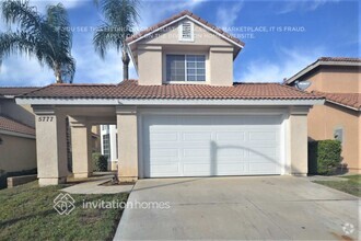
$3,200 / Month
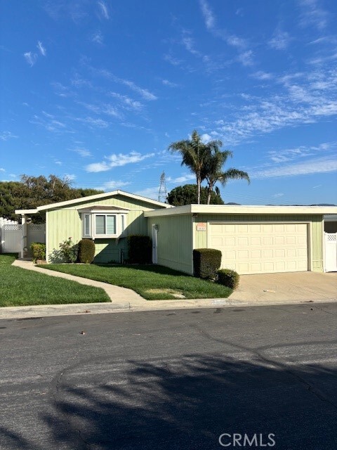
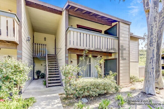
5660 Westfield St
Yorba Linda, CA 92887
2 Weeks Ago
Favorites
5660 Westfield St

Favorites
Check Back Soon for Upcoming Availability
| Beds | Baths | Average SF |
|---|---|---|
| 2 Bedrooms 2 Bedrooms 2 Br | 2 Baths 2 Baths 2 Ba | 1,056 SF |
About This Property
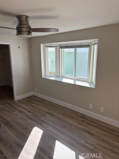
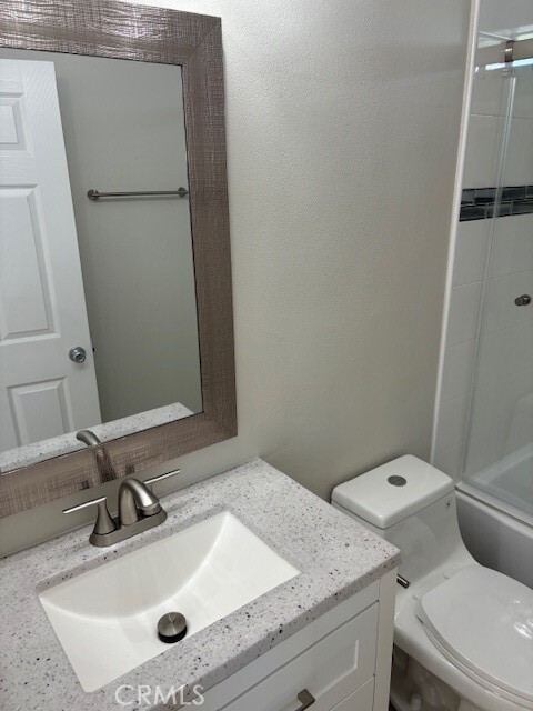
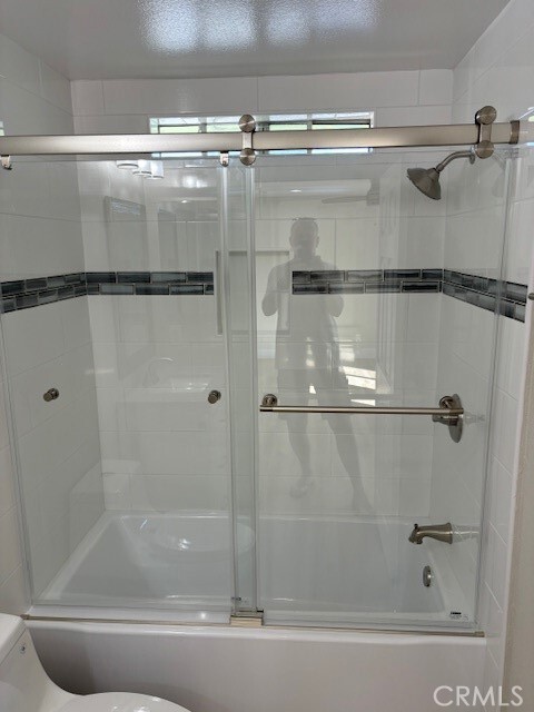
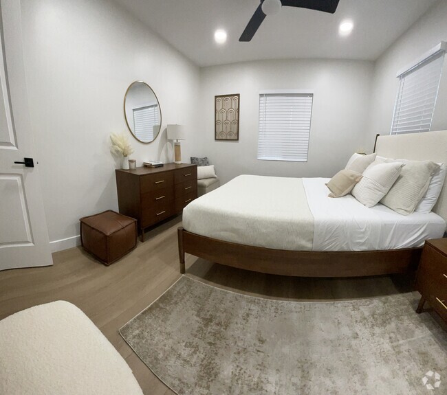
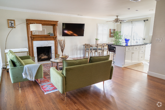
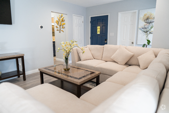
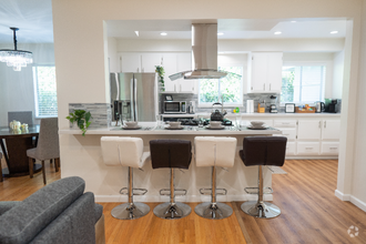
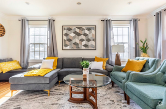
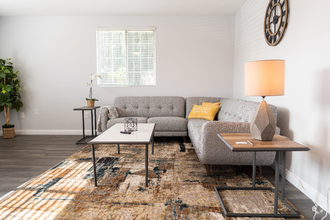
**Single family home features 2 bedrooms with each there own private baths with a large living room with cathedral ceiling between then. Home has been freshly paint inside and out with new vinyl flooring throughout the home. Features a two car garage and central air conditioning. Very relaxing rear yard with room to play. Remodeled bathrooms, recessed lighting throughout. Dining room off the kitchen. Very quiet neighborhood. Located North of La Palma and East of Yorba Linda Blvd. Call for private showing.
5660 Westfield St is a house located in Orange County and the 92887 ZIP Code. This area is served by the Placentia-Yorba Linda Unified attendance zone.
House Features
Air Conditioning
Dishwasher
Washer/Dryer Hookup
Disposal
- Washer/Dryer Hookup
- Air Conditioning
- Heating
- Dishwasher
- Disposal
- Range
- Vinyl Flooring
- Double Pane Windows
- Fenced Lot
- Patio
Fees and Policies
The fees below are based on community-supplied data and may exclude additional fees and utilities.
Pet policies are negotiable.
- Dogs Allowed
-
Fees not specified
- Cats Allowed
-
Fees not specified
- Parking
-
Garage--
-
Other--
Property Address:
5660 Westfield St,
Yorba Linda,
CA
92887
Regarded as the “Land of Gracious Living,” Yorba Linda is a picturesque suburb brimming with peaceful residential neighborhoods, rolling hills, and expansive mountain views. Yorba Linda is famously the hometown of Richard Nixon, the 37th President of the United States. Locals and visitors alike can learn more about Nixon, and his connection to Yorba Linda, at the Richard Nixon Presidential Library and Museum.
Opportunities for outdoor recreation abound near Yorba Linda, with Chino Hills State Park, Yorba Regional Park, Craig Regional Park, Carbon Canyon Regional Park, and Black Gold Golf Club all located within close proximity. Yorba Linda is also about a 30-minute drive from vibrant seaside towns Newport Beach and Huntington Beach.
Yorba Linda neighbors Anaheim, and sits within minutes of exciting attractions like Disneyland and Knott’s Berry Farm. Retail destinations such as Brea Mall and the Outlets at Orange are also convenient to Yorba Linda via quick freeway access.
Learn more about living in Yorba Linda
Amenities
- Washer/Dryer Hookup
- Air Conditioning
- Heating
- Dishwasher
- Disposal
- Range
- Vinyl Flooring
- Double Pane Windows
- Fenced Lot
- Patio
Education
| Colleges & Universities | Distance | ||
|---|---|---|---|
| Colleges & Universities | Distance | ||
| Drive: | 17 min | 8.8 mi | |
| Drive: | 16 min | 8.9 mi | |
| Drive: | 16 min | 10.9 mi | |
| Drive: | 16 min | 11.2 mi |
5660 Westfield St is within 16 minutes or 10.9 miles from Santiago Canyon College. It is also near Hope International University and Cal State Fullerton.
Schools


Public Elementary School
Grades K-6
507 Students
Nearby
Public Elementary & Middle School
Grades K-8
1,217 Students
Attendance Zone
Public High School
Grades 9-12
1,568 Students
Attendance Zone
Private Elementary School
Grades K-4
61 Students
Nearby
Private Elementary, Middle & High School
Grades K-12
Nearby
Private Elementary & Middle School
Grades PK-8
521 Students
Nearby
School data provided by
 The GreatSchools Rating helps parents compare schools within a state based on a variety of school quality indicators and provides a helpful picture of how effectively each school serves all of its students. Ratings are on a scale of 1 (below average) to 10 (above average) and can include test scores, college readiness, academic progress, advanced courses, equity, discipline and attendance data. We also advise parents to visit schools, consider other information on school performance and programs, and consider family needs as part of the school selection process.
View GreatSchools Rating Methodology
View GreatSchools Rating Methodology
Transportation options available in Yorba Linda include Norwalk, located 25.4 miles from 5660 Westfield St. 5660 Westfield St is near John Wayne/Orange County, located 19.1 miles or 24 minutes away, and Ontario International, located 24.0 miles or 36 minutes away.
| Transit / Subway | Distance | ||
|---|---|---|---|
| Transit / Subway | Distance | ||
|
|
Drive: | 31 min | 25.4 mi |
| Drive: | 43 min | 30.1 mi | |
| Drive: | 42 min | 30.6 mi | |
| Drive: | 43 min | 31.9 mi | |
| Drive: | 46 min | 34.3 mi |
| Commuter Rail | Distance | ||
|---|---|---|---|
| Commuter Rail | Distance | ||
|
|
Drive: | 12 min | 7.8 mi |
|
|
Drive: | 15 min | 10.0 mi |
|
|
Drive: | 17 min | 11.7 mi |
| Drive: | 17 min | 11.8 mi | |
|
|
Drive: | 17 min | 11.9 mi |
| Airports | Distance | ||
|---|---|---|---|
| Airports | Distance | ||
|
John Wayne/Orange County
|
Drive: | 24 min | 19.1 mi |
|
Ontario International
|
Drive: | 36 min | 24.0 mi |
Time and distance from 5660 Westfield St.
| Shopping Centers | Distance | ||
|---|---|---|---|
| Shopping Centers | Distance | ||
| Walk: | 5 min | 0.3 mi | |
| Drive: | 2 min | 1.2 mi | |
| Drive: | 3 min | 1.3 mi |
5660 Westfield St has 3 shopping centers within 1.3 miles, which is about a 3-minute walk. The miles and minutes will be for the farthest away property.
| Parks and Recreation | Distance | ||
|---|---|---|---|
| Parks and Recreation | Distance | ||
|
Oak Canyon Nature Center
|
Drive: | 12 min | 7.0 mi |
|
Santiago Oaks Regional Park
|
Drive: | 17 min | 8.9 mi |
|
Orange County Zoo
|
Drive: | 15 min | 10.6 mi |
|
Irvine Regional Park
|
Drive: | 15 min | 10.7 mi |
|
Chino Hills State Park
|
Drive: | 43 min | 19.4 mi |
5660 Westfield St has 5 parks within 19.4 miles, including Oak Canyon Nature Center, Chino Hills State Park, and Santiago Oaks Regional Park.
| Hospitals | Distance | ||
|---|---|---|---|
| Hospitals | Distance | ||
| Drive: | 10 min | 5.7 mi | |
| Drive: | 11 min | 7.8 mi | |
| Drive: | 15 min | 10.8 mi |
5660 Westfield St has 3 hospitals within 10.8 miles, the nearest is Placentia Linda Hospital which is 5.7 miles away and a 10 minute drive.
You May Also Like
Similar Rentals Nearby


What Are Walk Score®, Transit Score®, and Bike Score® Ratings?
Walk Score® measures the walkability of any address. Transit Score® measures access to public transit. Bike Score® measures the bikeability of any address.
What is a Sound Score Rating?
A Sound Score Rating aggregates noise caused by vehicle traffic, airplane traffic and local sources

5660 Westfield St
Yorba Linda, CA 92887