
$2,100 / Month
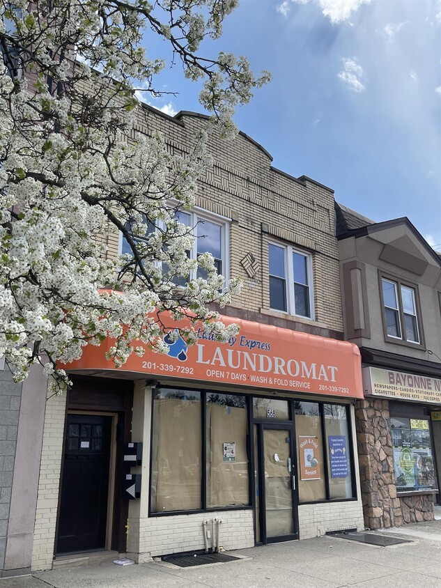
568 Avenue C Unit Back
Bayonne, NJ 07002
Today
Favorites
201-259-7053
-
Bedrooms
2
-
Bathrooms
1
-
Square Feet
--
-
Available
Available Apr 30
Highlight
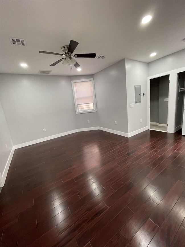
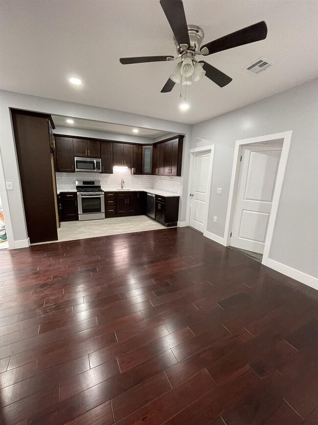
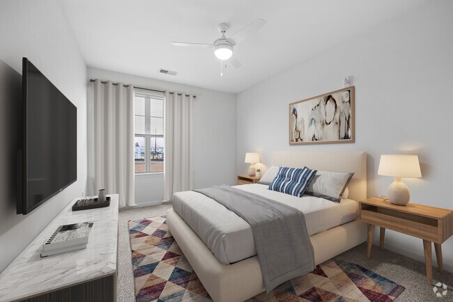
- Hardwood Floors
568 Avenue C Unit Back

Favorites
About This Home
Available Apr 30
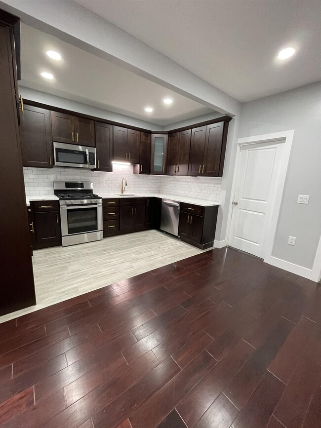
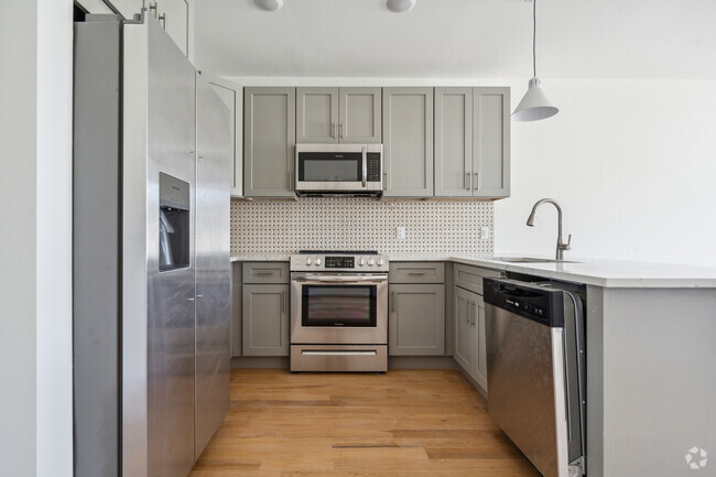
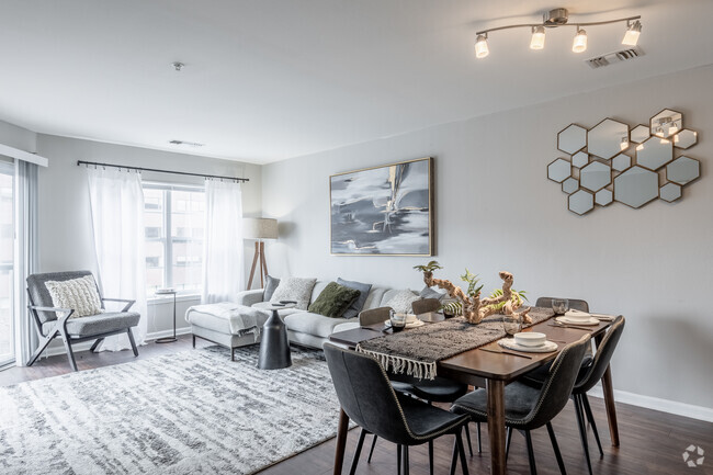
Move right into this beautifully renovated apartment featuring new kitchen with stainless steel appliances, spacious living room with hardwood floors, and two comfortable bedrooms. Prime location with Shop-Rite directly across the street. Easy access to transportation. Situated above a washer/dryer business for added convenience. Don't miss this fantastic opportunity in a great location.
568 Avenue C is an apartment community located in Hudson County and the 07002 ZIP Code.
* Price shown is base rent and may not include non-optional fees and utilities.
Price, availability, fees, and any applicable rent special are subject to change without notice.
* Square footage definitions vary. Displayed square footage is approximate.
Features
- Oven
- Hardwood Floors
Fees and Policies
The fees below are based on community-supplied data and may exclude additional fees and utilities.
Contact
- Listed by SHERYL SIMON | BERKSHIRE HATHAWAY HOME SERVICES MCGEEHAN & PINEIRO REALTY
- Phone Number
- Contact
-
Source
Hudson County Multiple Listing Service
Copyright © 2025 Hudson County Multiple Listing Service. All rights reserved. All information provided by the listing agent/broker is deemed reliable but is not guaranteed and should be independently verified.
Location
Get Directions
Amenities
- Oven
- Hardwood Floors
Also known as Constable's Hook, historic Constable Hook is one of New Jersey and the East Coast’s oldest communities. Nestled between the Hudson River and Newark Bay, Constable Hook consists of the southern portion of Bayonne. Bayonne prides itself on natural conservation and the area is home to several marinas and waterfront greenspaces. Golf fans spend days on the green at the Bayonne Golf Club, while Dennis P. Collins Park is a local favorite for its skatepark and views of the Bayonne Bridge and freight and cruise ships. Along Broadway, residents have access to restaurants, shops, and bars giving the area the feel of a small town. The neighborhood has a relatively low cost of living and has a variety of mid-range to upscale options available for rent.
Learn more about living in Constable Hook
Education
| Colleges & Universities | Distance | ||
|---|---|---|---|
| Colleges & Universities | Distance | ||
| Drive: | 9 min | 3.9 mi | |
| Drive: | 12 min | 5.3 mi | |
| Drive: | 13 min | 5.6 mi | |
| Drive: | 17 min | 7.2 mi |
568 Avenue C Unit Back is within 9 minutes or 3.9 miles from New Jersey City University. It is also near Saint Peter's College and Coll. of Staten Island, CUNY.
Transportation options available in Bayonne include 22Nd Street, located 0.5 mile from 568 Avenue C Unit Back. 568 Avenue C Unit Back is near Newark Liberty International, located 7.0 miles or 12 minutes away, and Laguardia, located 19.3 miles or 39 minutes away.
| Transit / Subway | Distance | ||
|---|---|---|---|
| Transit / Subway | Distance | ||
|
|
Walk: | 10 min | 0.5 mi |
|
|
Walk: | 18 min | 1.0 mi |
| Walk: | 20 min | 1.1 mi | |
|
|
Drive: | 6 min | 2.7 mi |
|
|
Drive: | 6 min | 2.8 mi |
| Commuter Rail | Distance | ||
|---|---|---|---|
| Commuter Rail | Distance | ||
|
|
Drive: | 19 min | 7.8 mi |
|
|
Drive: | 19 min | 8.0 mi |
|
|
Drive: | 19 min | 8.4 mi |
|
|
Drive: | 17 min | 8.8 mi |
|
|
Drive: | 19 min | 10.3 mi |
| Airports | Distance | ||
|---|---|---|---|
| Airports | Distance | ||
|
Newark Liberty International
|
Drive: | 12 min | 7.0 mi |
|
Laguardia
|
Drive: | 39 min | 19.3 mi |
Time and distance from 568 Avenue C Unit Back.
| Shopping Centers | Distance | ||
|---|---|---|---|
| Shopping Centers | Distance | ||
| Walk: | 16 min | 0.8 mi | |
| Walk: | 18 min | 0.9 mi | |
| Drive: | 4 min | 1.2 mi |
568 Avenue C Unit Back has 3 shopping centers within 1.2 miles, which is about a 4-minute walk. The miles and minutes will be for the farthest away property.
| Parks and Recreation | Distance | ||
|---|---|---|---|
| Parks and Recreation | Distance | ||
|
G. Thomas DiDomenico Park
|
Walk: | 16 min | 0.8 mi |
|
Stephen Gregg Park
|
Drive: | 6 min | 2.1 mi |
|
Faber Park
|
Drive: | 8 min | 4.0 mi |
|
Snug Harbor Cultural Center & Botanical Garden
|
Drive: | 14 min | 6.2 mi |
|
Staten Island Children's Museum
|
Drive: | 14 min | 6.2 mi |
568 Avenue C Unit Back has 5 parks within 6.2 miles, including G. Thomas DiDomenico Park, Stephen Gregg Park, and Faber Park.
| Hospitals | Distance | ||
|---|---|---|---|
| Hospitals | Distance | ||
| Walk: | 9 min | 0.5 mi | |
| Drive: | 12 min | 5.8 mi | |
| Drive: | 13 min | 6.1 mi |
568 Avenue C Unit Back has 3 hospitals within 6.1 miles, the nearest is Bayonne Medical Center which is 0.5 mile away and a 9 minute walk.
| Military Bases | Distance | ||
|---|---|---|---|
| Military Bases | Distance | ||
| Drive: | 7 min | 2.4 mi | |
| Drive: | 20 min | 8.0 mi | |
| Drive: | 22 min | 11.5 mi |
568 Avenue C Unit Back has 3 military bases within 11.5 miles, the nearest is Military Ocean Terminal which is 2.4 miles away and a 7 minute drive.
You May Also Like
Similar Rentals Nearby


What Are Walk Score®, Transit Score®, and Bike Score® Ratings?
Walk Score® measures the walkability of any address. Transit Score® measures access to public transit. Bike Score® measures the bikeability of any address.
What is a Sound Score Rating?
A Sound Score Rating aggregates noise caused by vehicle traffic, airplane traffic and local sources

568 Avenue C
Bayonne, NJ 07002