$1,900 / Month
58 Knight St
Providence, RI 02909
Today
Favorites
401-523-2428
-
Bedrooms
2
-
Bathrooms
1
-
Square Feet
638 sq ft
-
Available
Available Now
Highlights
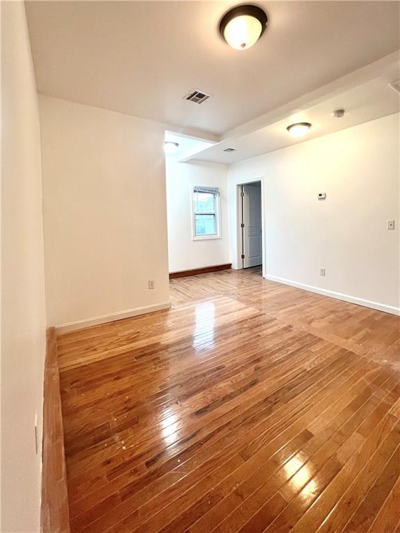
- Wood Flooring
- Corner Lot
- Recreation Facilities
- Public Transportation
- Shops
- Property near a hospital
58 Knight St Unit 2

Favorites
About This Home
$1,600 deposit,
Available Now
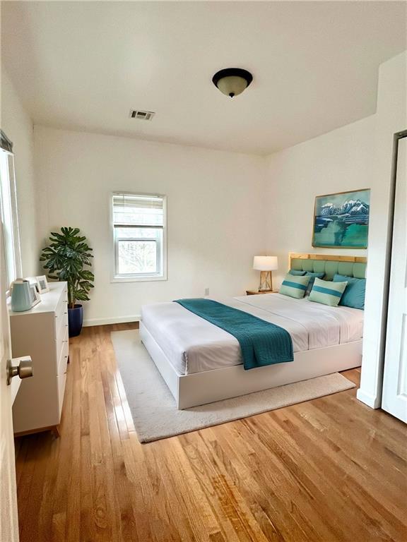
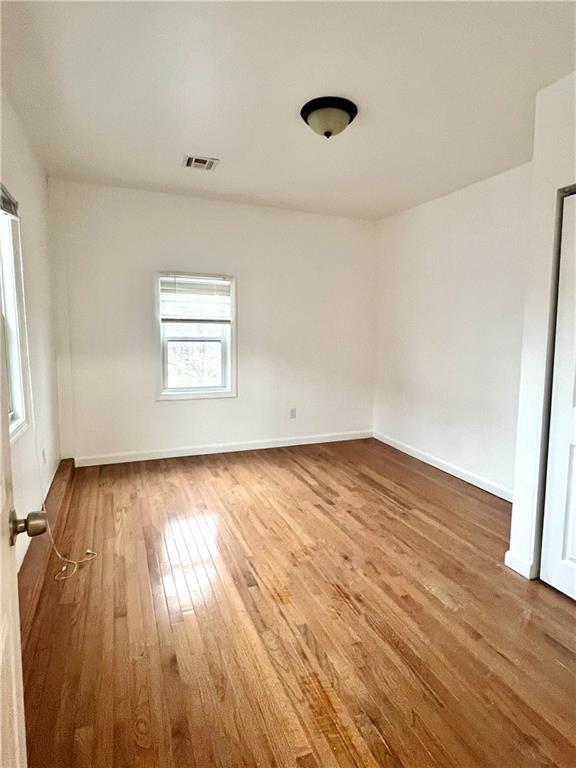
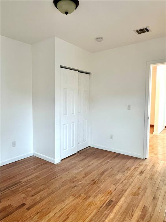
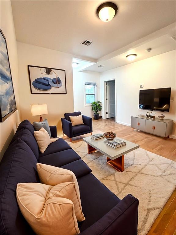
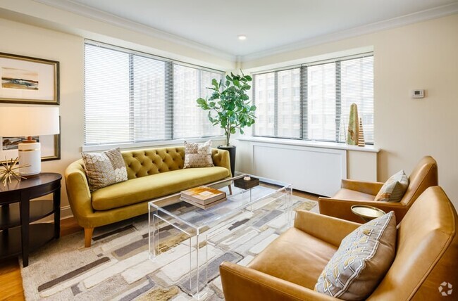
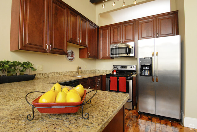
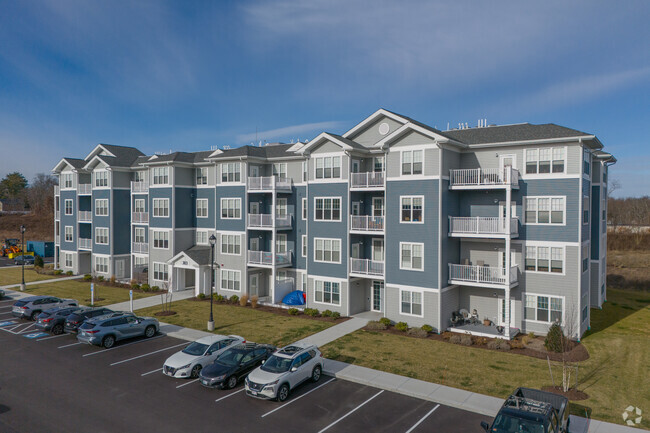
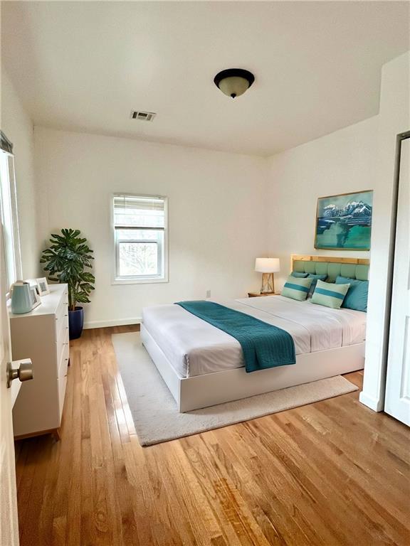
GAS AND ELECTRIC INCLUDED!! Come take a look at this gorgeous 2 bedroom apartment located in the historic Federal Hill. Just a short walk away you will find award winning restaurants,cozy coffee shops,boutiques and night life. This apartment offers two generous sized bedrooms complimented by gleaming hardwood floors. A bright space with a fresh new coat of paint. Equipped with new appliances and plenty of storage. The bathroom has recently been updated as well. Enjoy the convenience of central air during hot summer nights. Easy highway access. No off street parking. Landlord will provide parking permit.
58 Knight St is an apartment community located in Providence County and the 02909 ZIP Code.
* Price shown is base rent and may not include non-optional fees and utilities.
Price, availability, fees, and any applicable rent special are subject to change without notice.
* Square footage definitions vary. Displayed square footage is approximate.
Home Details
Year Built
Built in 1920
Accessible Home Design
Entry on the 2nd floor
Bedrooms and Bathrooms
1 Full Bathroom
2 Bedrooms
Finished Basement
Basement Fills Entire Space Under The House
Interior Basement Entry
Home Design
Apartment
Vinyl Siding
Interior Spaces
Wood Flooring
638 Sq Ft Home
2-Story Property
Kitchen
Range
Oven
Listing and Financial Details
Property Available on 2/17/25
Month-to-Month Lease Term
Assessor Parcel Number 58KNIGHTST2PROV
The owner pays for hot water
Location
Property near a hospital
Lot Details
Corner Lot
Parking
No Garage
Utilities
Central Air
Baseboard Heating
Gas Water Heater
Heating System Uses Gas
Community Details
Amenities
Public Transportation
Shops
Restaurant
Overview
No Home Owners Association
Federal Hill Subdivision
Pet Policy
Pets Allowed
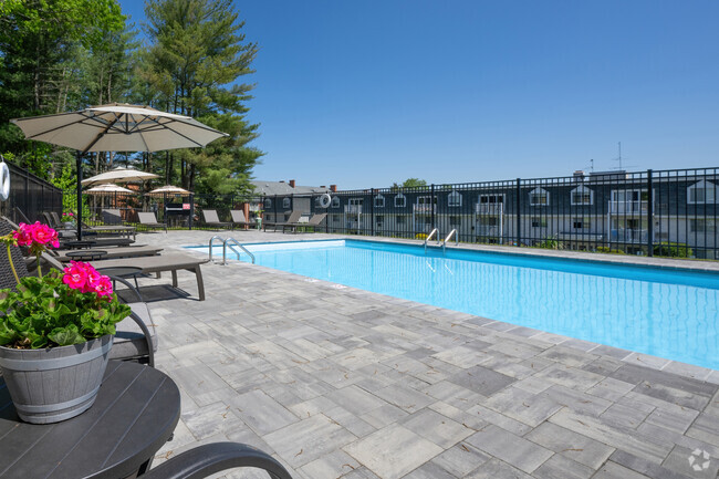
Recreation
Recreation Facilities
Fees and Policies
The fees below are based on community-supplied data and may exclude additional fees and utilities.
- Dogs Allowed
-
Fees not specified
-
Restrictions:true
- Cats Allowed
-
Fees not specified
-
Restrictions:true
Details
Utilities Included
-
Gas
-
Water
-
Heat
-
Air Conditioning
Contact
- Listed by Jessica Ribeiro
- Phone Number (401) 523-2428
- Contact
Location
Get Directions
Amenities
- Air Conditioning
- Security System
- Fireplace
- Range
- Refrigerator
- Hardwood Floors
- Attic
- Views
- Pool
Expenses
Utilities Included
Gas, Water, Heat, Air Conditioning
Included
Also referred to as the Armory District or simply the West End, West End Providence is the largest neighborhood in the city. This diverse, historic neighborhood is home to the Cranston Street Armory, a landmark listed as its own National Historic District. The armory was built in 1907 and is often used as a filming location by movie studios. The West End underwent revitalization during recent years and continues to offer amazing amenities. The West End is known for its authentic eateries, quirky shops, a vibrant youth arts scene, and strong sense of community. Despite being the largest neighborhood in the city, the West End feels close-knit with community organizations like the West Broadway Neighborhood Association bringing together family and friends to preserve the cultural richness of the area. Fittingly, the West End has a wide range of rentals available ranging from highly affordable to upscale.
Learn more about living in West End Providence
Education
| Colleges & Universities | Distance | ||
|---|---|---|---|
| Colleges & Universities | Distance | ||
| Drive: | 3 min | 1.3 mi | |
| Drive: | 3 min | 1.4 mi | |
| Drive: | 5 min | 1.7 mi | |
| Drive: | 4 min | 1.8 mi |
58 Knight St Unit 2 is within 3 minutes or 1.3 miles from C.C. of Rhode Island, Downcity. It is also near Johnson & Wales Univ Downcity and Rhode Island School of Design.
Transportation options available in Providence include Braintree Station, located 41.6 miles from 58 Knight St Unit 2. 58 Knight St Unit 2 is near Rhode Island Tf Green International, located 9.3 miles or 19 minutes away.
| Transit / Subway | Distance | ||
|---|---|---|---|
| Transit / Subway | Distance | ||
|
|
Drive: | 57 min | 41.6 mi |
| Commuter Rail | Distance | ||
|---|---|---|---|
| Commuter Rail | Distance | ||
|
|
Drive: | 4 min | 1.7 mi |
| Drive: | 9 min | 5.2 mi | |
|
|
Drive: | 14 min | 8.2 mi |
| Drive: | 16 min | 8.5 mi | |
|
|
Drive: | 20 min | 13.0 mi |
| Airports | Distance | ||
|---|---|---|---|
| Airports | Distance | ||
|
Rhode Island Tf Green International
|
Drive: | 19 min | 9.3 mi |
Time and distance from 58 Knight St Unit 2.
| Shopping Centers | Distance | ||
|---|---|---|---|
| Shopping Centers | Distance | ||
| Walk: | 7 min | 0.4 mi | |
| Walk: | 19 min | 1.0 mi | |
| Drive: | 4 min | 1.4 mi |
58 Knight St Unit 2 has 3 shopping centers within 1.4 miles, which is about a 4-minute drive. The miles and minutes will be for the farthest away property.
| Parks and Recreation | Distance | ||
|---|---|---|---|
| Parks and Recreation | Distance | ||
|
Woonasquatucket River Greenway - Riverside Park
|
Drive: | 4 min | 1.3 mi |
|
Providence Children's Museum
|
Drive: | 4 min | 1.6 mi |
|
Roger Williams National Memorial
|
Drive: | 5 min | 1.9 mi |
|
Ladd Observatory
|
Drive: | 7 min | 3.1 mi |
|
Roger Williams Park Zoo
|
Drive: | 10 min | 3.8 mi |
58 Knight St Unit 2 has 5 parks within 3.8 miles, including Woonasquatucket River Greenway - Riverside Park, Providence Children's Museum, and Roger Williams National Memorial.
| Hospitals | Distance | ||
|---|---|---|---|
| Hospitals | Distance | ||
| Drive: | 3 min | 1.2 mi | |
| Drive: | 4 min | 1.5 mi | |
| Drive: | 4 min | 1.8 mi |
58 Knight St Unit 2 has 3 hospitals within 1.8 miles, the nearest is Roger Williams Medical Center which is 1.2 miles away and a 3 minutes drive.
| Military Bases | Distance | ||
|---|---|---|---|
| Military Bases | Distance | ||
| Drive: | 34 min | 21.5 mi | |
| Drive: | 65 min | 42.8 mi |
58 Knight St Unit 2 is 21.5 miles from Rhode Island National Gaurd, and is convenient to other military bases, including US Military Reservation.
You May Also Like
Similar Rentals Nearby


What Are Walk Score®, Transit Score®, and Bike Score® Ratings?
Walk Score® measures the walkability of any address. Transit Score® measures access to public transit. Bike Score® measures the bikeability of any address.
What is a Sound Score Rating?
A Sound Score Rating aggregates noise caused by vehicle traffic, airplane traffic and local sources
58 Knight St
Providence, RI 02909