


$2,975 / Month
58 Leo M Birmingham Pkwy Unit 1
Boston, MA 02135
Today
Favorites
860-424-2782
-
Bedrooms
3
-
Bathrooms
1
-
Square Feet
--
-
Available
Available Sep 1
58 Leo M Birmingham Pkwy Unit 1

Favorites
About This Home
12 Month Lease
,
Available Sep 1
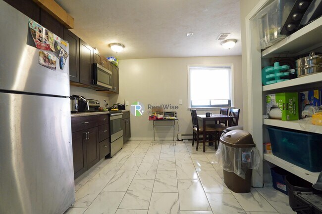
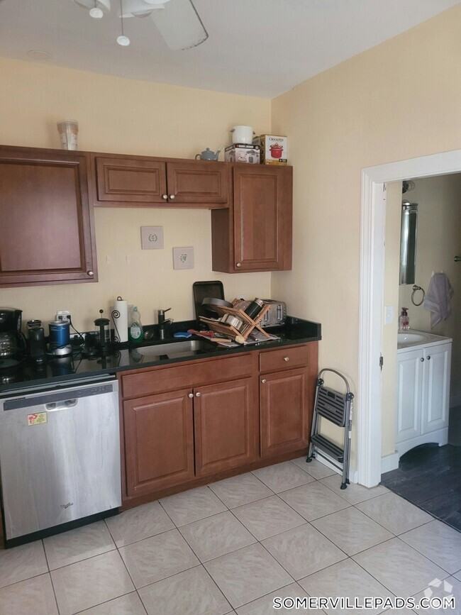
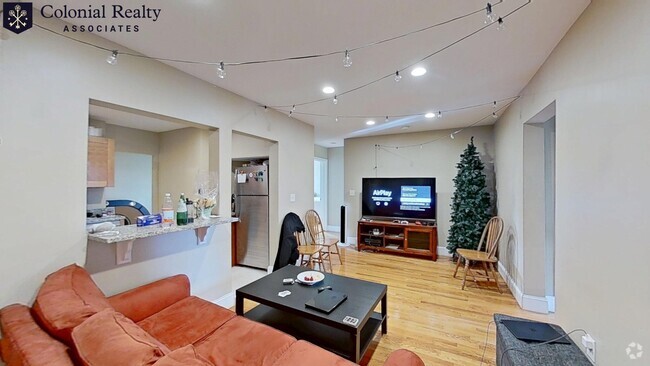
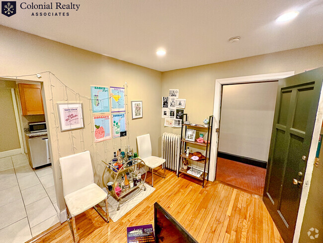
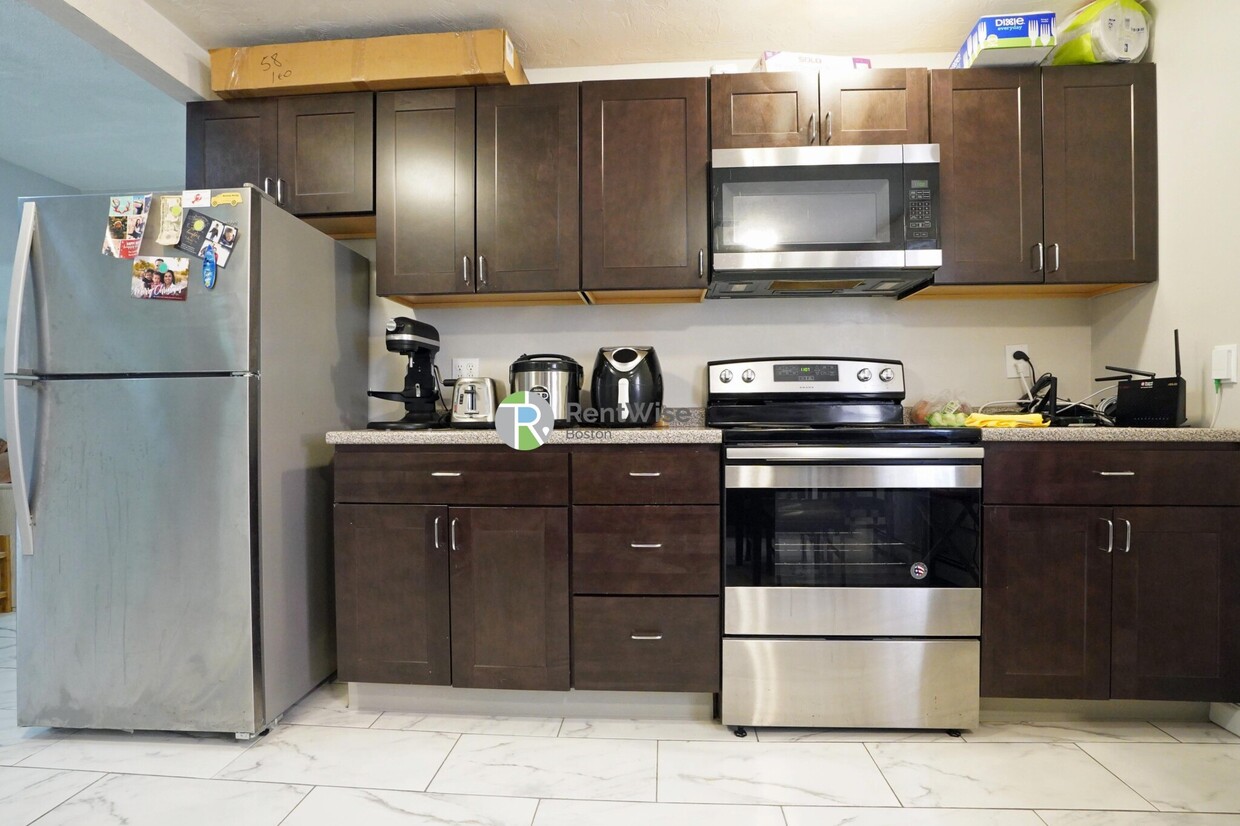
Renovated 3 bedroom 1.5 bathroom in Lower Allston/Brighton off of Western Ave. available September 1st! Located on Leo Birmingham Pkwy. in Brighton just off of Western Ave, in an up-and-coming area close to Harvard Business School and easy access to Storrow Drive and the Mass Pike. There is a brand new Trader Joe's a 1/2 of a mile away! This listing has a renovated kitchen with stainless steel appliances. - Professionally Managed - Cat-Friendly - Rent includes cold water/sewer. Subway/Commuter Rail Lines Boston Landing Commuter Rail Spot (0.70 miles) Bus Routes 64 - Cambridge St & N Harvard St 501 - Cambridge St & N Harvard St 70 - Western Ave & N Harvard St 70A - Western Ave & N Harvard St 66 - N Harvard St & Western Ave 86 - N Harvard St & Western Ave 57 - Brighton Ave. & Chester Ave.
58 Leo M Birmingham Pkwy is a condo located in Suffolk County and the 02135 ZIP Code.
* Price shown is base rent and may not include non-optional fees and utilities.
Price, availability, fees, and any applicable rent special are subject to change without notice.
* Square footage definitions vary. Displayed square footage is approximate.
Condo Features
- Washer/Dryer
Fees and Policies
The fees below are based on community-supplied data and may exclude additional fees and utilities.
- Cats Allowed
-
Fees not specified
-
Weight limit--
-
Pet Limit--
- Parking
-
Surface Lot--
Details
Utilities Included
-
Water
-
Trash Removal
Lease Options
-
12 Months
Contact
- Listed by Daniel Briggs | Daniel Briggs
- Phone Number (860) 424-2782
- Contact
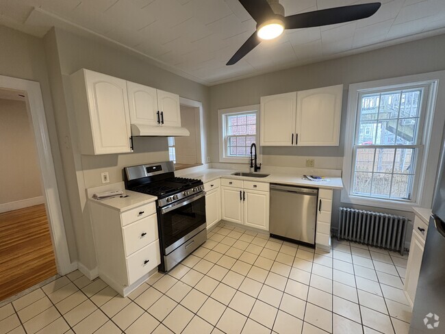
$3,231 / month
$499,000 Listing Price
3 Beds
•2 Baths
•
1,152 Sq Ft
$3,400 / month
$525,000 Listing Price
3 Beds
•2 Baths
•
1,264 Sq Ft
$3,310 / month
$500,000 Listing Price
3 Beds
•1 Baths
•
935 Sq Ft
Location
Get Directions
Amenities
- Washer/Dryer
Expenses
Utilities Included
Water, Trash Removal
Included
North Allston, also known as Lower Allston, is a peaceful neighborhood just five miles west of downtown Boston. This community is nestled along the Charles River and houses part of Harvard University, particularly Harvard Business School, Harvard Stadium, and the University’s other athletic fields.
In North Allston, you’ll find bike and pedestrian-friendly streets with an abundance of walking, biking, and jogging trails, community parks, and open green space overlooking the river. Enjoy delicious eats and drinks at Article 24, or try an old-school breakfast at a quaint corner diner known as the Breakfast Club. For the freshest baked goods in town, venture over to Swissbäkers on Western Avenue.
North Allston is a wonderful mix of student housing, upscale homes, and amenity-filled apartments and condos available for rent. Explore your options and find your ideal apartment in this quiet, affluent neighborhood near all of Boston’s major attractions.
Learn more about living in North Allston
Education
| Colleges & Universities | Distance | ||
|---|---|---|---|
| Colleges & Universities | Distance | ||
| Drive: | 4 min | 1.8 mi | |
| Drive: | 6 min | 1.9 mi | |
| Drive: | 5 min | 2.3 mi | |
| Drive: | 7 min | 2.5 mi |
58 Leo M Birmingham Pkwy Unit 1 is within 6 minutes or 1.9 miles from Boston College, Brighton. It is also near Harvard University and Boston College.
Transportation options available in Boston include Harvard Avenue Station, located 1.7 miles from 58 Leo M Birmingham Pkwy Unit 1. 58 Leo M Birmingham Pkwy Unit 1 is near General Edward Lawrence Logan International, located 8.9 miles or 16 minutes away.
| Transit / Subway | Distance | ||
|---|---|---|---|
| Transit / Subway | Distance | ||
|
|
Drive: | 3 min | 1.7 mi |
|
|
Drive: | 4 min | 1.7 mi |
|
|
Drive: | 4 min | 1.8 mi |
|
|
Drive: | 4 min | 1.8 mi |
|
|
Drive: | 4 min | 1.9 mi |
| Commuter Rail | Distance | ||
|---|---|---|---|
| Commuter Rail | Distance | ||
|
|
Drive: | 6 min | 2.9 mi |
|
|
Drive: | 6 min | 3.0 mi |
|
|
Drive: | 7 min | 3.5 mi |
|
|
Drive: | 8 min | 3.6 mi |
| Drive: | 9 min | 4.7 mi |
| Airports | Distance | ||
|---|---|---|---|
| Airports | Distance | ||
|
General Edward Lawrence Logan International
|
Drive: | 16 min | 8.9 mi |
Time and distance from 58 Leo M Birmingham Pkwy Unit 1.
| Shopping Centers | Distance | ||
|---|---|---|---|
| Shopping Centers | Distance | ||
| Walk: | 10 min | 0.6 mi | |
| Walk: | 11 min | 0.6 mi | |
| Walk: | 14 min | 0.8 mi |
58 Leo M Birmingham Pkwy Unit 1 has 3 shopping centers within 0.8 mile, which is about a 14-minute walk. The miles and minutes will be for the farthest away property.
| Parks and Recreation | Distance | ||
|---|---|---|---|
| Parks and Recreation | Distance | ||
|
Chestnut Hill Reservation
|
Drive: | 6 min | 2.1 mi |
|
John Fitzgerald Kennedy National Historic Site
|
Drive: | 5 min | 2.2 mi |
|
Longfellow National Historic Site
|
Drive: | 5 min | 2.3 mi |
|
Harvard-Smithsonian Center for Astrophysics
|
Drive: | 6 min | 2.6 mi |
|
Coit Observatory
|
Drive: | 7 min | 3.1 mi |
58 Leo M Birmingham Pkwy Unit 1 has 5 parks within 3.1 miles, including Chestnut Hill Reservation, John Fitzgerald Kennedy National Historic Site, and Longfellow National Historic Site.
| Hospitals | Distance | ||
|---|---|---|---|
| Hospitals | Distance | ||
| Drive: | 3 min | 1.2 mi | |
| Drive: | 4 min | 1.7 mi | |
| Drive: | 4 min | 2.1 mi |
58 Leo M Birmingham Pkwy Unit 1 has 3 hospitals within 2.1 miles, the nearest is St. Elizabeth's Medical Center which is 1.2 miles away and a 3 minute drive.
| Military Bases | Distance | ||
|---|---|---|---|
| Military Bases | Distance | ||
| Drive: | 23 min | 11.2 mi | |
| Drive: | 26 min | 14.3 mi |
58 Leo M Birmingham Pkwy Unit 1 is 11.2 miles from Hanscom Air Force Base, and is convenient to other military bases, including US Military Reservation.
You May Also Like
Similar Rentals Nearby

What Are Walk Score®, Transit Score®, and Bike Score® Ratings?
Walk Score® measures the walkability of any address. Transit Score® measures access to public transit. Bike Score® measures the bikeability of any address.
What is a Sound Score Rating?
A Sound Score Rating aggregates noise caused by vehicle traffic, airplane traffic and local sources
58 Leo M Birmingham Pkwy
Boston, MA 02135