58 Tyngsboro Rd Unit 1
Dracut, MA 01826
-
Bedrooms
2
-
Bathrooms
1
-
Square Feet
1,000 sq ft
-
Available
Available Now

About This Home
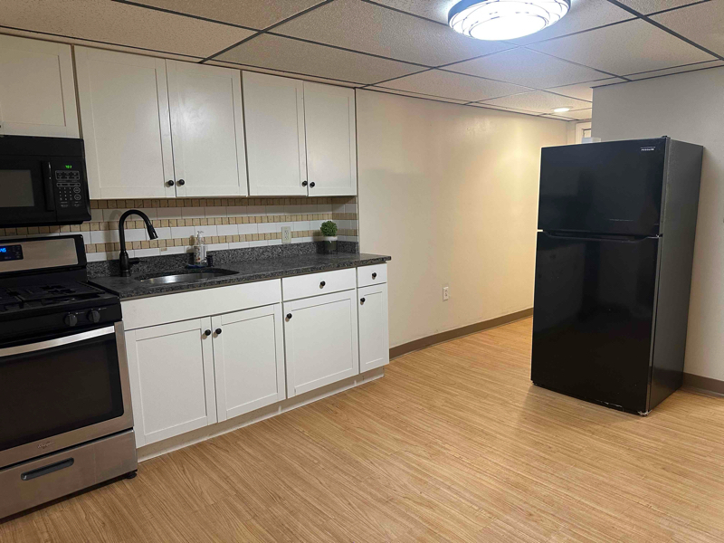
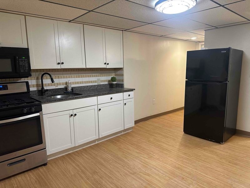
Property Id: 1641751 First floor, 2 bedroom apartment with 2 parking spaces.
58 Tyngsboro Rd is an apartment community located in Middlesex County and the 01826 ZIP Code.
Features
- Lawn
Fees and Policies
The fees below are based on community-supplied data and may exclude additional fees and utilities.
Details
Utilities Included
-
Water
-
Trash Removal
-
Sewer
Contact
- Phone Number
- Contact
-
Source

- Lawn
The city of Dracut is settled on the Massachusetts-New Hampshire state line to the north and the Merrimack River to the south. This riverfront suburb offers a quaint, peaceful atmosphere with a park-like environment that you’re sure to enjoy.
Though the residential streets of Dracut are calm, once you take a leap over the Merrimack River, you’ll be in Downtown Lowell where you’ll discover historic museums, galleries, restaurants, shops, and more! Situated 32 miles northwest of Boston, Dracut is far enough from the hustle and bustle of urban living while still being in easy driving distance. Directly north of the University of Massachusetts Lowell, the city has a youthful vibe that comes from this popular university just minutes from your potential new home.
To the east, Dracut shares a portion of national state forest with its neighboring cities of Lowell and Tyngsborough.
Learn more about living in Dracut| Colleges & Universities | Distance | ||
|---|---|---|---|
| Colleges & Universities | Distance | ||
| Drive: | 6 min | 3.3 mi | |
| Drive: | 8 min | 4.2 mi | |
| Drive: | 17 min | 7.7 mi | |
| Drive: | 26 min | 13.6 mi |
Transportation options available in Dracut include Alewife Station, located 25.5 miles from 58 Tyngsboro Rd Unit 1. 58 Tyngsboro Rd Unit 1 is near Manchester Boston Regional, located 24.6 miles or 40 minutes away, and General Edward Lawrence Logan International, located 34.7 miles or 53 minutes away.
| Transit / Subway | Distance | ||
|---|---|---|---|
| Transit / Subway | Distance | ||
|
|
Drive: | 42 min | 25.5 mi |
|
|
Drive: | 44 min | 25.8 mi |
| Drive: | 43 min | 25.9 mi | |
|
|
Drive: | 43 min | 26.8 mi |
|
|
Drive: | 43 min | 28.1 mi |
| Commuter Rail | Distance | ||
|---|---|---|---|
| Commuter Rail | Distance | ||
|
|
Drive: | 9 min | 4.5 mi |
|
|
Drive: | 18 min | 8.7 mi |
|
|
Drive: | 27 min | 13.3 mi |
|
|
Drive: | 26 min | 13.7 mi |
|
|
Drive: | 25 min | 15.3 mi |
| Airports | Distance | ||
|---|---|---|---|
| Airports | Distance | ||
|
Manchester Boston Regional
|
Drive: | 40 min | 24.6 mi |
|
General Edward Lawrence Logan International
|
Drive: | 53 min | 34.7 mi |
Time and distance from 58 Tyngsboro Rd Unit 1.
| Shopping Centers | Distance | ||
|---|---|---|---|
| Shopping Centers | Distance | ||
| Drive: | 3 min | 1.5 mi | |
| Drive: | 5 min | 3.1 mi | |
| Drive: | 6 min | 3.1 mi |
| Parks and Recreation | Distance | ||
|---|---|---|---|
| Parks and Recreation | Distance | ||
|
Lowell National Historical Park
|
Drive: | 8 min | 4.0 mi |
|
Lowell-Dracut-Tyngsboro State Forest
|
Drive: | 11 min | 4.6 mi |
|
Lowell Heritage State Park
|
Drive: | 9 min | 4.7 mi |
|
The Butterfly Place
|
Drive: | 13 min | 6.4 mi |
|
MIT Haystack Observatory
|
Drive: | 22 min | 10.8 mi |
| Hospitals | Distance | ||
|---|---|---|---|
| Hospitals | Distance | ||
| Drive: | 6 min | 3.4 mi | |
| Drive: | 19 min | 8.7 mi | |
| Drive: | 19 min | 10.0 mi |
| Military Bases | Distance | ||
|---|---|---|---|
| Military Bases | Distance | ||
| Drive: | 33 min | 19.0 mi |
You May Also Like
What Are Walk Score®, Transit Score®, and Bike Score® Ratings?
Walk Score® measures the walkability of any address. Transit Score® measures access to public transit. Bike Score® measures the bikeability of any address.
What is a Sound Score Rating?
A Sound Score Rating aggregates noise caused by vehicle traffic, airplane traffic and local sources


