
59 Burbank St Unit 34920
Boston, MA 02115

-
Monthly Rent
$2,767
-
Bedrooms
1 bd
-
Bathrooms
1 ba
-
Square Feet
521 sq ft
Details
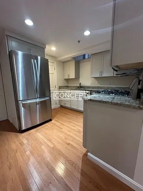
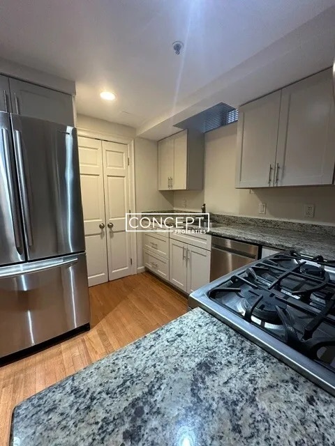
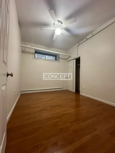
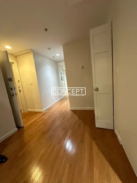
About This Property
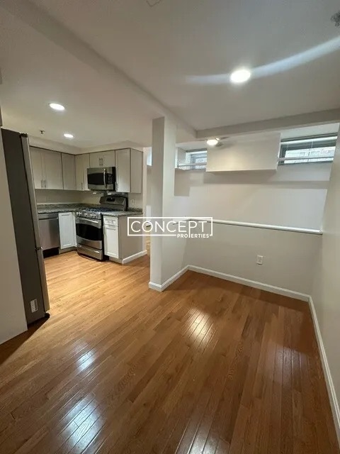
1-bed and 1-bath in Fenway. No broker fee with a 12-month lease or longer.
59 Burbank St is an apartment community located in Suffolk County and the 02115 ZIP Code. This area is served by the Boston Public Schools attendance zone.
Tree-filled, historic, and packed with educational opportunity, there's no other neighborhood quite like Fenway. The neighborhood may be most well-known for its titular attraction, Fenway Park, home of the Boston Red Sox. However, the area is also renowned for its sprawling greenspace. The name "Fenway" refers to the neighborhood’s lush parkway and tree-filled paths that wind lazily through the area, forming part of Frederick Law Olmsted’s “Emerald Necklace Plan” (a chain of parks throughout Boston). The Fenway opened in 1876, and its route includes the Museum of Fine Arts and the Isabella Steward Gardner Museum.
Learn more about living in Fenway| Colleges & Universities | Distance | ||
|---|---|---|---|
| Colleges & Universities | Distance | ||
| Walk: | 5 min | 0.3 mi | |
| Walk: | 10 min | 0.5 mi | |
| Walk: | 13 min | 0.7 mi | |
| Drive: | 3 min | 1.2 mi |
Transportation options available in Boston include Symphony Station, located 0.2 mile from 59 Burbank St Unit 34920. 59 Burbank St Unit 34920 is near General Edward Lawrence Logan International, located 6.0 miles or 13 minutes away.
| Transit / Subway | Distance | ||
|---|---|---|---|
| Transit / Subway | Distance | ||
|
|
Walk: | 4 min | 0.2 mi |
|
|
Walk: | 6 min | 0.3 mi |
|
|
Walk: | 8 min | 0.4 mi |
|
|
Walk: | 8 min | 0.5 mi |
|
|
Walk: | 10 min | 0.5 mi |
| Commuter Rail | Distance | ||
|---|---|---|---|
| Commuter Rail | Distance | ||
|
|
Walk: | 15 min | 0.8 mi |
|
|
Drive: | 6 min | 1.3 mi |
| Drive: | 4 min | 1.8 mi | |
|
|
Drive: | 7 min | 2.8 mi |
|
|
Drive: | 7 min | 3.7 mi |
| Airports | Distance | ||
|---|---|---|---|
| Airports | Distance | ||
|
General Edward Lawrence Logan International
|
Drive: | 13 min | 6.0 mi |
Time and distance from 59 Burbank St Unit 34920.
| Shopping Centers | Distance | ||
|---|---|---|---|
| Shopping Centers | Distance | ||
| Drive: | 3 min | 1.2 mi | |
| Drive: | 8 min | 4.7 mi | |
| Drive: | 8 min | 4.8 mi |
| Parks and Recreation | Distance | ||
|---|---|---|---|
| Parks and Recreation | Distance | ||
|
Charles River Reservation
|
Drive: | 3 min | 1.3 mi |
|
Boston Public Garden
|
Drive: | 5 min | 1.7 mi |
|
Coit Observatory
|
Drive: | 3 min | 1.7 mi |
|
Roxbury Heritage State Park
|
Drive: | 5 min | 1.9 mi |
|
Boston African American National Historic Site
|
Drive: | 7 min | 2.1 mi |
| Hospitals | Distance | ||
|---|---|---|---|
| Hospitals | Distance | ||
| Drive: | 3 min | 1.3 mi | |
| Drive: | 3 min | 1.4 mi | |
| Drive: | 4 min | 1.4 mi |
| Military Bases | Distance | ||
|---|---|---|---|
| Military Bases | Distance | ||
| Drive: | 29 min | 15.5 mi | |
| Drive: | 30 min | 16.7 mi |
59 Burbank St Unit 34920 Photos
What Are Walk Score®, Transit Score®, and Bike Score® Ratings?
Walk Score® measures the walkability of any address. Transit Score® measures access to public transit. Bike Score® measures the bikeability of any address.
What is a Sound Score Rating?
A Sound Score Rating aggregates noise caused by vehicle traffic, airplane traffic and local sources
59 Burbank St
Boston, MA 02115