-
-
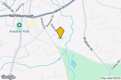
Map Image of the Property
59 School St
59 School St,
Northborough,
MA
01532
-
Monthly Rent
Call for Rent
-
Bedrooms
2 bd
-
Bathrooms
2 ba
-
Square Feet
--

Pricing & Floor Plans
Fees and Policies
Details
Property Information
-
3 units/1 story
Situated just moments east of Worcester is the Route 9 Corridor, a large neighborhood compiled of several communities including Shrewsbury, Westborough, Northborough, and Southborough. Not only is Worcester at residents’ fingertips, but Downtown Boston is less than 40 miles east. The Route 9 Corridor is a commuter’s dream, offering easy city access and entry onto Interstates 290, 495, and 90.
The suburb is dotted with ponds, reservoirs, brooks, and rivers, providing ample outdoor recreation. Renters craving a beach day can bask on the sunny shores of Lake Chauncy Beach. Route 9 Corridor’s Prospect Park allows locals to take their dog for a stroll while Assabet Park gives children ample space to play on the playground. Those looking for winter recreation won’t want to miss the powdery slopes of Ski Ward Ski Area. No matter the season, renters settling in this diverse community can choose from gorgeous apartments ranging in price and amenities.
Learn more about living in Route 9 Corridor| Colleges & Universities | Distance | ||
|---|---|---|---|
| Colleges & Universities | Distance | ||
| Drive: | 15 min | 7.3 mi | |
| Drive: | 17 min | 8.8 mi | |
| Drive: | 17 min | 11.4 mi | |
| Drive: | 21 min | 12.3 mi |
Transportation options available in Northborough include Riverside Station, located 25.3 miles from 59 School St. 59 School St is near Worcester Regional, located 16.5 miles or 28 minutes away, and General Edward Lawrence Logan International, located 38.4 miles or 56 minutes away.
| Transit / Subway | Distance | ||
|---|---|---|---|
| Transit / Subway | Distance | ||
|
|
Drive: | 39 min | 25.3 mi |
|
|
Drive: | 39 min | 25.6 mi |
|
|
Drive: | 40 min | 26.3 mi |
|
|
Drive: | 43 min | 27.9 mi |
|
|
Drive: | 43 min | 28.1 mi |
| Commuter Rail | Distance | ||
|---|---|---|---|
| Commuter Rail | Distance | ||
|
|
Drive: | 11 min | 4.6 mi |
|
|
Drive: | 14 min | 6.9 mi |
|
|
Drive: | 19 min | 10.2 mi |
|
|
Drive: | 19 min | 12.1 mi |
|
|
Drive: | 31 min | 14.9 mi |
| Airports | Distance | ||
|---|---|---|---|
| Airports | Distance | ||
|
Worcester Regional
|
Drive: | 28 min | 16.5 mi |
|
General Edward Lawrence Logan International
|
Drive: | 56 min | 38.4 mi |
Time and distance from 59 School St.
| Shopping Centers | Distance | ||
|---|---|---|---|
| Shopping Centers | Distance | ||
| Walk: | 11 min | 0.6 mi | |
| Drive: | 3 min | 1.5 mi | |
| Drive: | 4 min | 1.7 mi |
| Parks and Recreation | Distance | ||
|---|---|---|---|
| Parks and Recreation | Distance | ||
|
Ward Hill Ski Area
|
Drive: | 6 min | 3.0 mi |
|
Felton Conservation Area
|
Drive: | 8 min | 3.1 mi |
|
Mount Pisgah Conservation Area
|
Drive: | 16 min | 4.2 mi |
|
Walkup And Robinson Memorial Reservation
|
Drive: | 13 min | 6.5 mi |
|
Cedar Hill and Sawink Farm Reservation
|
Drive: | 14 min | 6.6 mi |
| Hospitals | Distance | ||
|---|---|---|---|
| Hospitals | Distance | ||
| Drive: | 11 min | 6.0 mi | |
| Drive: | 16 min | 8.4 mi | |
| Drive: | 16 min | 8.7 mi |
| Military Bases | Distance | ||
|---|---|---|---|
| Military Bases | Distance | ||
| Drive: | 32 min | 18.2 mi |
59 School St Photos
-
-
Map Image of the Property
59 School St Northborough, MA 01532 has two bedrooms available and rents for /mo.
Yes, to view the floor plan in person, please schedule a personal tour.
59 School St Northborough, MA 01532 is in Route 9 Corridor in the city of Northborough. Here you’ll find three shopping centers within 1.7 miles of the property. Five parks are within 6.6 miles, including Ward Hill Ski Area, Felton Conservation Area, and Mount Pisgah Conservation Area.
What Are Walk Score®, Transit Score®, and Bike Score® Ratings?
Walk Score® measures the walkability of any address. Transit Score® measures access to public transit. Bike Score® measures the bikeability of any address.
What is a Sound Score Rating?
A Sound Score Rating aggregates noise caused by vehicle traffic, airplane traffic and local sources

59 School St
Northborough, MA 01532
Responded To This Review