

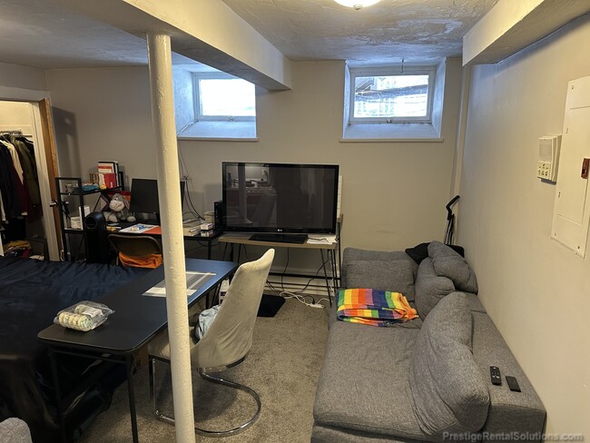
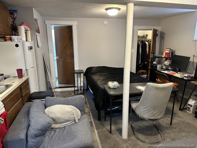
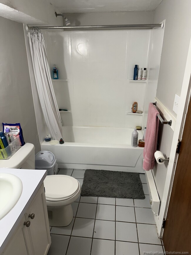

$1,895 / Month
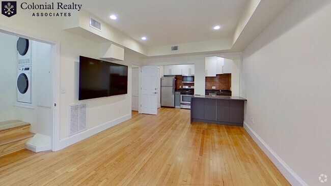
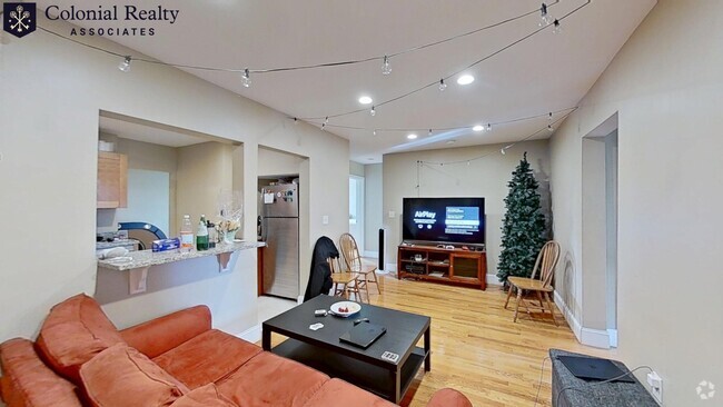
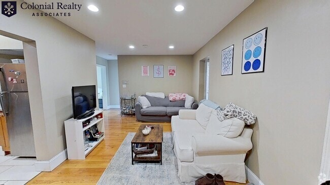
592 Cambridge St Unit B2
Boston, MA 02134
Today
Favorites
617-590-0455
-
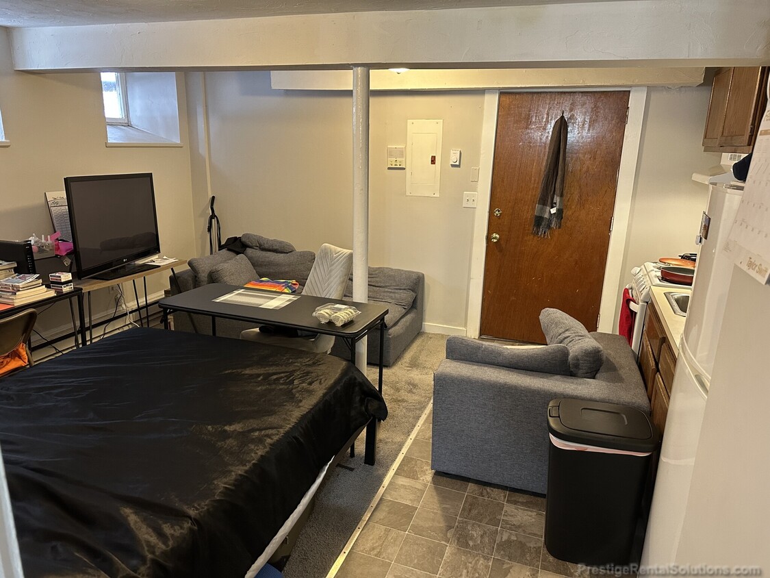
Bedrooms
Studio
-
Bathrooms
1
-
Square Feet
350 sq ft
-
Available
Available Jun 1
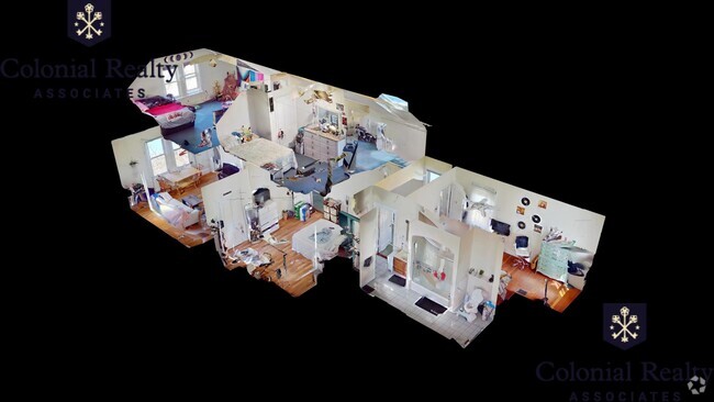
592 Cambridge St Unit B2

Favorites
About This Home
12 Month Lease
,
Available Jun 1
Neighborhood Description: Corey Hill in Brighton, and Brookline is a quiet, residential area. It is bordered by Commonwealth Avenue, Winchester Street, Beacon Street in Brookline, and Washington Street. It is far enough removed from popular destinations that parking becomes more readily available, but still easily accessible by the B, or C lines, and with bus access to Brookline Village, and Longwood medical area. It is a convenient spot for students at Boston College, Boston University, or urban professionals, particularly those, who want to be within walking distance of Saint Elizabeths, Franciscan, or Kindred hospitals in Brighton. You can pick your favorite spot in Cleveland Circle, Allston Village, Brighton Center, Coolidge Corner, or Washington Square and still be close to home at the end of the night.
592 Cambridge St is a condo located in Suffolk County and the 02134 ZIP Code.
* Price shown is base rent and may not include non-optional fees and utilities.
Price, availability, fees, and any applicable rent special are subject to change without notice.
* Square footage definitions vary. Displayed square footage is approximate.
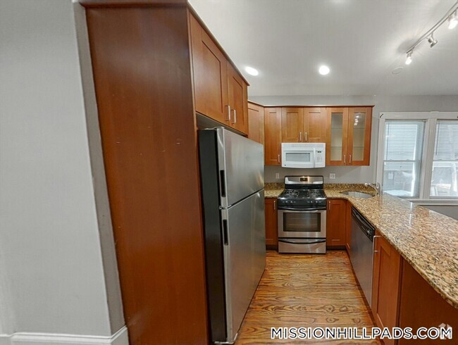
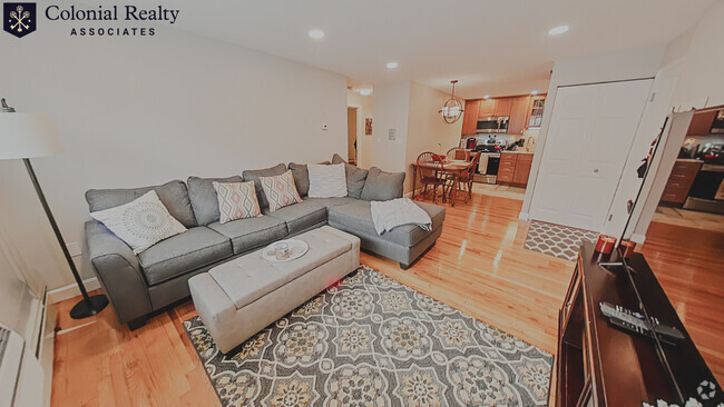
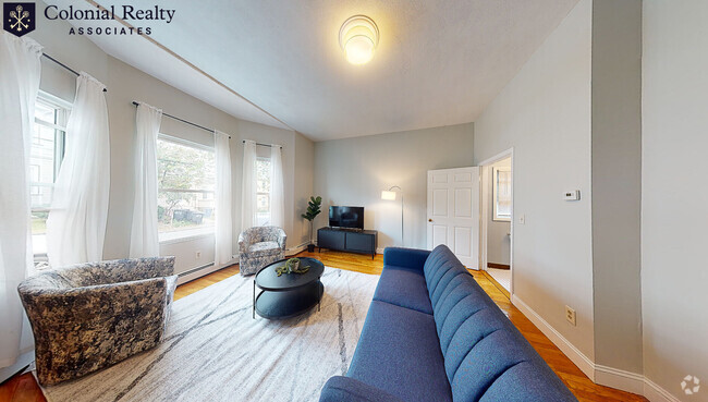
Condo Features
- Laundry Facilities
Fees and Policies
The fees below are based on community-supplied data and may exclude additional fees and utilities.
- Cats Allowed
-
Fees not specified
-
Weight limit--
-
Pet Limit--
- Parking
-
Surface Lot--
Details
Utilities Included
-
Water
-
Trash Removal
Lease Options
-
12 Months
Contact
- Listed by John Hanrahan | Prestige Rental Solutions
- Phone Number
- Contact
$2,114 / month
$280,000 Listing Price
1 Beds
•1 Baths
•
318 Sq Ft
$2,042 / month
$299,000 Listing Price
1 Beds
•1 Baths
•
450 Sq Ft
$2,156 / month
$284,900 Listing Price
1 Beds
•1 Baths
•
532 Sq Ft
Location
Get Directions
Amenities
- Laundry Facilities
Expenses
Utilities Included
Water, Trash Removal
Included
Saint Elizabeth’s is a Brighton neighborhood situated about 10 miles away from Boston. Thanks to Saint Elizabeth’s top border sitting on Highway 20, commuting in and out of Brighton is easy. Some residents travel by car, but buses and railways make commuting via public transportation a breeze.
The neighborhood’s best amenities are two world-renowned hospitals, Saint Elizabeth’s Medical Center and Franciscan Children’s, that sit on the edge of town. Other great amenities of Saint Elizabeth’s include many local parks like Ringer Playground and Chestnut Hill Reservoir, which has great trails and greenspace. This neighborhood is also equipped with cozy coffee shops, restaurants serving international and American classics, and shopping plazas with grocers and convenience stores.
Saint Elizabeth’s has several rental options ranging from apartments to single-family homes.
Learn more about living in St Elizabeth's
Education
| Colleges & Universities | Distance | ||
|---|---|---|---|
| Colleges & Universities | Distance | ||
| Drive: | 5 min | 1.5 mi | |
| Drive: | 4 min | 1.7 mi | |
| Drive: | 5 min | 2.1 mi | |
| Drive: | 5 min | 2.4 mi |
592 Cambridge St Unit B2 is within 5 minutes or 1.5 miles from Boston College, Brighton. It is also near Boston University and Boston College.
Transportation options available in Boston include Warren Street Station, located 0.4 mile from 592 Cambridge St Unit B2. 592 Cambridge St Unit B2 is near General Edward Lawrence Logan International, located 8.4 miles or 15 minutes away.
| Transit / Subway | Distance | ||
|---|---|---|---|
| Transit / Subway | Distance | ||
|
|
Walk: | 6 min | 0.4 mi |
|
|
Walk: | 8 min | 0.4 mi |
|
|
Walk: | 10 min | 0.5 mi |
|
|
Walk: | 12 min | 0.6 mi |
|
|
Walk: | 14 min | 0.7 mi |
| Commuter Rail | Distance | ||
|---|---|---|---|
| Commuter Rail | Distance | ||
|
|
Drive: | 5 min | 2.5 mi |
|
|
Drive: | 8 min | 3.4 mi |
|
|
Drive: | 7 min | 3.5 mi |
|
|
Drive: | 7 min | 3.7 mi |
| Drive: | 9 min | 4.4 mi |
| Airports | Distance | ||
|---|---|---|---|
| Airports | Distance | ||
|
General Edward Lawrence Logan International
|
Drive: | 15 min | 8.4 mi |
Time and distance from 592 Cambridge St Unit B2.
| Shopping Centers | Distance | ||
|---|---|---|---|
| Shopping Centers | Distance | ||
| Walk: | 9 min | 0.5 mi | |
| Walk: | 16 min | 0.8 mi | |
| Walk: | 16 min | 0.9 mi |
592 Cambridge St Unit B2 has 3 shopping centers within 0.9 mile, which is about a 16-minute walk. The miles and minutes will be for the farthest away property.
| Parks and Recreation | Distance | ||
|---|---|---|---|
| Parks and Recreation | Distance | ||
|
John Fitzgerald Kennedy National Historic Site
|
Drive: | 3 min | 1.3 mi |
|
Chestnut Hill Reservation
|
Drive: | 4 min | 1.7 mi |
|
Coit Observatory
|
Drive: | 5 min | 2.2 mi |
|
Frederick Law Olmsted National Historic Site
|
Drive: | 7 min | 2.5 mi |
|
Longfellow National Historic Site
|
Drive: | 7 min | 3.0 mi |
592 Cambridge St Unit B2 has 5 parks within 3.0 miles, including John Fitzgerald Kennedy National Historic Site, Chestnut Hill Reservation, and Coit Observatory.
| Hospitals | Distance | ||
|---|---|---|---|
| Hospitals | Distance | ||
| Walk: | 6 min | 0.3 mi | |
| Walk: | 7 min | 0.4 mi | |
| Drive: | 2 min | 1.1 mi |
592 Cambridge St Unit B2 has 3 hospitals within 1.1 miles, the nearest is Franciscan Children's Hospital & Rehab Center which is 0.3 mile away and a 6 minute walk.
| Military Bases | Distance | ||
|---|---|---|---|
| Military Bases | Distance | ||
| Drive: | 25 min | 12.1 mi | |
| Drive: | 25 min | 14.2 mi |
592 Cambridge St Unit B2 is 12.1 miles from Hanscom Air Force Base, and is convenient to other military bases, including US Military Reservation.
You May Also Like
Similar Rentals Nearby
What Are Walk Score®, Transit Score®, and Bike Score® Ratings?
Walk Score® measures the walkability of any address. Transit Score® measures access to public transit. Bike Score® measures the bikeability of any address.
What is a Sound Score Rating?
A Sound Score Rating aggregates noise caused by vehicle traffic, airplane traffic and local sources
592 Cambridge St
Boston, MA 02134