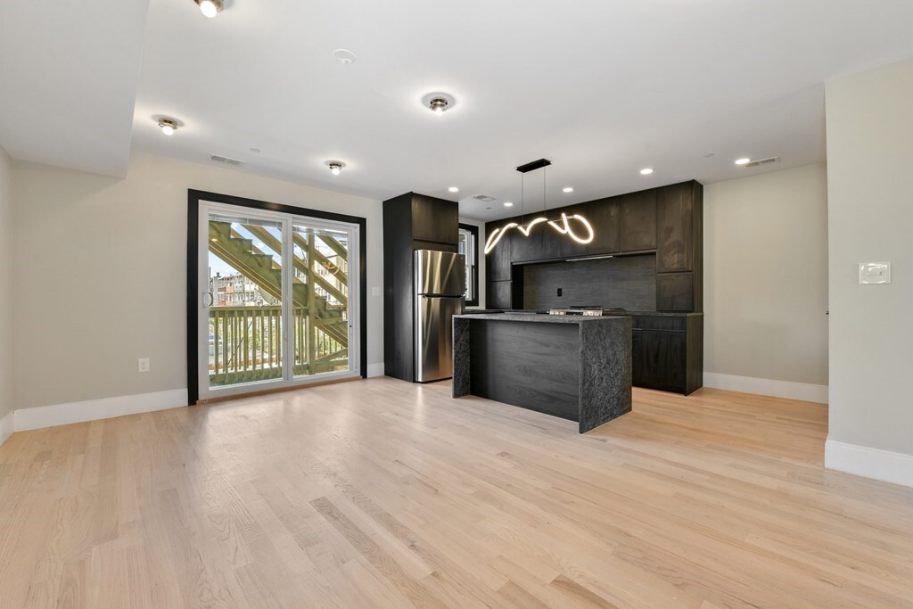
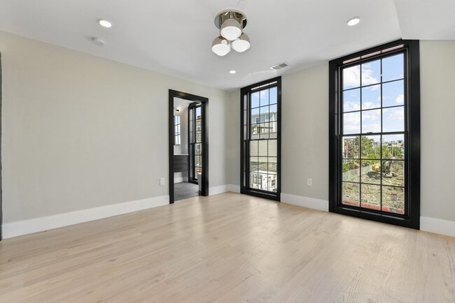
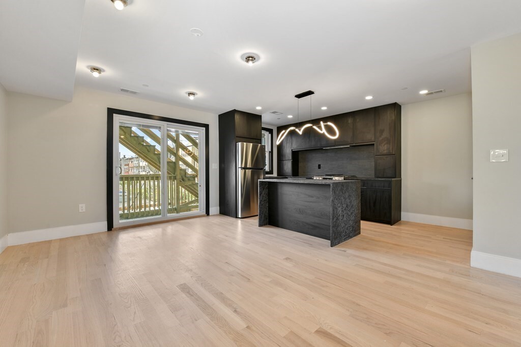
6 Brooks St Unit 2
Boston, MA 02128
-
Bedrooms
1
-
Bathrooms
1.5
-
Square Feet
700 sq ft
-
Available
Available Now

6 Brooks St is an apartment community located in Suffolk County and the 02128 ZIP Code. This area is served by the Boston Public Schools attendance zone.
Apartment Features
- Washer/Dryer
Fees and Policies
The fees below are based on community-supplied data and may exclude additional fees and utilities.
Details
Property Information
-
4 units
Contact
- Contact
A diverse, energetic, close-knit area that also has quiet green spaces, the Jeffries Point-Airport neighborhood of East Boston sits just 10 minutes from downtown Boston. Commuters can take the Maverick station of the MBTA blue line to reach other parts of the city, while a bus shuttle from the airport MBTA station connects Jeffries Point-Airport to Logan International Airport. The area features a mix of modern-style condos and older multi-family homes for rent.
One of the defining landmarks of Jeffries Point-Airport, Piers Park provides residents an escape from city life right in their own neighborhood, with magnificent views of the Boston skyline. Stroll along the harbor, take in a free concert, or just sit back underneath the gazebo and watch the world go by. Afterwards, head over to cozy Ko Catering and Pies to enjoy a savory Australian meat pie on the patio.
Learn more about living in Jeffries Point-Airport| Colleges & Universities | Distance | ||
|---|---|---|---|
| Colleges & Universities | Distance | ||
| Drive: | 6 min | 2.5 mi | |
| Drive: | 8 min | 3.0 mi | |
| Drive: | 8 min | 3.4 mi | |
| Drive: | 9 min | 4.0 mi |
 The GreatSchools Rating helps parents compare schools within a state based on a variety of school quality indicators and provides a helpful picture of how effectively each school serves all of its students. Ratings are on a scale of 1 (below average) to 10 (above average) and can include test scores, college readiness, academic progress, advanced courses, equity, discipline and attendance data. We also advise parents to visit schools, consider other information on school performance and programs, and consider family needs as part of the school selection process.
View GreatSchools Rating Methodology
Transportation options available in Boston include Maverick Station, located 0.6 mile from 6 Brooks St Unit 2. 6 Brooks St Unit 2 is near General Edward Lawrence Logan International, located 2.1 miles or 5 minutes away.
| Transit / Subway | Distance | ||
|---|---|---|---|
| Transit / Subway | Distance | ||
|
|
Walk: | 12 min | 0.6 mi |
|
|
Walk: | 12 min | 0.7 mi |
|
|
Drive: | 4 min | 1.7 mi |
|
|
Drive: | 5 min | 2.2 mi |
|
|
Drive: | 6 min | 2.5 mi |
| Commuter Rail | Distance | ||
|---|---|---|---|
| Commuter Rail | Distance | ||
| Drive: | 6 min | 2.0 mi | |
|
|
Drive: | 6 min | 2.2 mi |
|
|
Drive: | 6 min | 3.0 mi |
|
|
Drive: | 12 min | 4.2 mi |
| Drive: | 11 min | 5.2 mi |
| Airports | Distance | ||
|---|---|---|---|
| Airports | Distance | ||
|
General Edward Lawrence Logan International
|
Drive: | 5 min | 2.1 mi |
Time and distance from 6 Brooks St Unit 2.
| Shopping Centers | Distance | ||
|---|---|---|---|
| Shopping Centers | Distance | ||
| Walk: | 10 min | 0.6 mi | |
| Drive: | 5 min | 2.1 mi | |
| Drive: | 5 min | 2.2 mi |
| Parks and Recreation | Distance | ||
|---|---|---|---|
| Parks and Recreation | Distance | ||
|
Boston National Historical Park
|
Drive: | 6 min | 2.4 mi |
|
New England Aquarium
|
Drive: | 6 min | 2.6 mi |
|
Boston African American National Historic Site
|
Drive: | 7 min | 2.7 mi |
|
Boston Harbor Islands National Recreation Area
|
Drive: | 6 min | 2.7 mi |
|
Boston Children's Museum
|
Drive: | 7 min | 3.0 mi |
| Hospitals | Distance | ||
|---|---|---|---|
| Hospitals | Distance | ||
| Drive: | 6 min | 2.5 mi | |
| Drive: | 6 min | 2.6 mi | |
| Drive: | 8 min | 3.5 mi |
| Military Bases | Distance | ||
|---|---|---|---|
| Military Bases | Distance | ||
| Drive: | 27 min | 15.1 mi | |
| Drive: | 27 min | 15.7 mi |
- Washer/Dryer
6 Brooks St Unit 2 Photos
What Are Walk Score®, Transit Score®, and Bike Score® Ratings?
Walk Score® measures the walkability of any address. Transit Score® measures access to public transit. Bike Score® measures the bikeability of any address.
What is a Sound Score Rating?
A Sound Score Rating aggregates noise caused by vehicle traffic, airplane traffic and local sources


