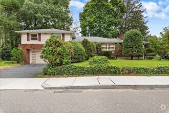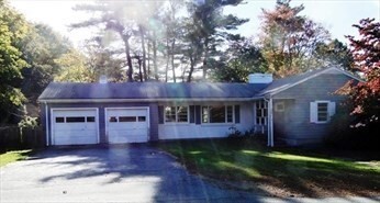
-
Monthly Rent
$3,900
-
Bedrooms
4 bd
-
Bathrooms
2 ba
-
Square Feet
2,038 sq ft
Details

About This Property
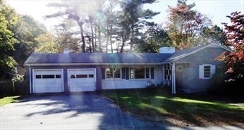
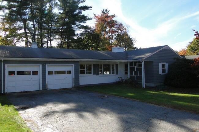
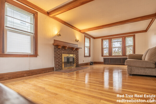
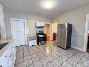
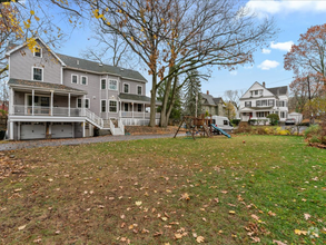
Wonderful Ranch in move in condition. First floor has three bedrooms,one full bath,living,room,dining room and kitchen. Compleely finished lower level with carpeting includes playroom,family room,office,bedroom and bathroom. Private level yard with patio. Convenient to routes 128 & 109,shops,restaurants and town center.
6 Conant Rd is a house located in Norfolk County and the 02090 ZIP Code. This area is served by the Westwood attendance zone.
Discover Homeownership
Renting vs. Buying
-
Housing Cost Per Month: $3,900
-
Rent for 30 YearsRenting doesn't build equity Future EquityRenting isn't tax deductible Mortgage Interest Tax Deduction$0 Net Return
-
Buy Over 30 Years$1.53M - $2.73M Future Equity$687K Mortgage Interest Tax Deduction$131K - $1.33M Gain Net Return
-
Contact
House Features
Dishwasher
Refrigerator
Disposal
Range
- Dishwasher
- Disposal
- Range
- Refrigerator
- Patio
Fees and Policies
The fees below are based on community-supplied data and may exclude additional fees and utilities.
 This Property
 Available Property
- Dishwasher
- Disposal
- Range
- Refrigerator
- Patio
Approximately 25 miles from Boston, the town of Westwood offers residents the simplicity of suburban living and the closeness to metropolitan nightlife and attractions. CNN/Money and Money Magazine named Westwood in their “100 Best Places to Live” in 2005.
Expansive greenspaces like Rice Reservation, Mulvehill- and Grimm Conservation, and Pheasant Hill makeup this unique, charming Norfolk County town. Ready for some fun-in-the-sun? Hale Reservation’s North Beach is a prime spot for sun and swim. Shopping and dining destinations include University Station, and college campuses and universities are easily accessible by I-95 and rail services provided by Massachusetts Bay Transportation Authority (MBTA).
Learn more about living in Westwood| Colleges & Universities | Distance | ||
|---|---|---|---|
| Colleges & Universities | Distance | ||
| Drive: | 12 min | 5.6 mi | |
| Drive: | 15 min | 6.7 mi | |
| Drive: | 17 min | 7.9 mi | |
| Drive: | 14 min | 8.6 mi |
Transportation options available in Westwood include Newton Highlands Station, located 7.8 miles from 6 Conant Rd. 6 Conant Rd is near General Edward Lawrence Logan International, located 17.3 miles or 33 minutes away, and Worcester Regional, located 47.2 miles or 67 minutes away.
| Transit / Subway | Distance | ||
|---|---|---|---|
| Transit / Subway | Distance | ||
|
|
Drive: | 13 min | 7.8 mi |
|
|
Drive: | 13 min | 8.3 mi |
|
|
Drive: | 14 min | 8.5 mi |
|
|
Drive: | 17 min | 8.7 mi |
|
|
Drive: | 15 min | 8.9 mi |
| Commuter Rail | Distance | ||
|---|---|---|---|
| Commuter Rail | Distance | ||
|
|
Drive: | 6 min | 3.0 mi |
|
|
Drive: | 6 min | 3.3 mi |
|
|
Drive: | 6 min | 3.5 mi |
|
|
Drive: | 8 min | 3.7 mi |
|
|
Drive: | 8 min | 4.5 mi |
| Airports | Distance | ||
|---|---|---|---|
| Airports | Distance | ||
|
General Edward Lawrence Logan International
|
Drive: | 33 min | 17.3 mi |
|
Worcester Regional
|
Drive: | 67 min | 47.2 mi |
Time and distance from 6 Conant Rd.
| Shopping Centers | Distance | ||
|---|---|---|---|
| Shopping Centers | Distance | ||
| Drive: | 6 min | 3.0 mi | |
| Drive: | 6 min | 3.2 mi | |
| Drive: | 6 min | 3.4 mi |
| Parks and Recreation | Distance | ||
|---|---|---|---|
| Parks and Recreation | Distance | ||
|
Brook Farm Historic Site
|
Drive: | 9 min | 4.6 mi |
|
Stony Brook Reservation
|
Drive: | 10 min | 5.2 mi |
|
Cutler Park Reservation
|
Drive: | 9 min | 5.9 mi |
|
Lookout Farm
|
Drive: | 14 min | 6.7 mi |
|
Weezie's Garden for Children
|
Drive: | 20 min | 9.1 mi |
| Hospitals | Distance | ||
|---|---|---|---|
| Hospitals | Distance | ||
| Drive: | 6 min | 3.5 mi | |
| Drive: | 8 min | 3.8 mi | |
| Drive: | 14 min | 7.6 mi |
| Military Bases | Distance | ||
|---|---|---|---|
| Military Bases | Distance | ||
| Drive: | 20 min | 10.5 mi |
You May Also Like
Similar Rentals Nearby
-
-
-
-
-
$3,9004 Beds, 2 Baths, 2,300 sq ftHouse for Rent
-
-
-
-
-
What Are Walk Score®, Transit Score®, and Bike Score® Ratings?
Walk Score® measures the walkability of any address. Transit Score® measures access to public transit. Bike Score® measures the bikeability of any address.
What is a Sound Score Rating?
A Sound Score Rating aggregates noise caused by vehicle traffic, airplane traffic and local sources
