-
Monthly Rent
$2,850
-
Bedrooms
1 bd
-
Bathrooms
1 ba
-
Square Feet
700 sq ft
Details

About This Property
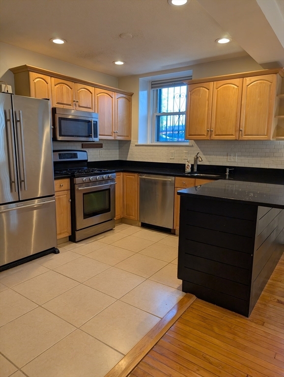
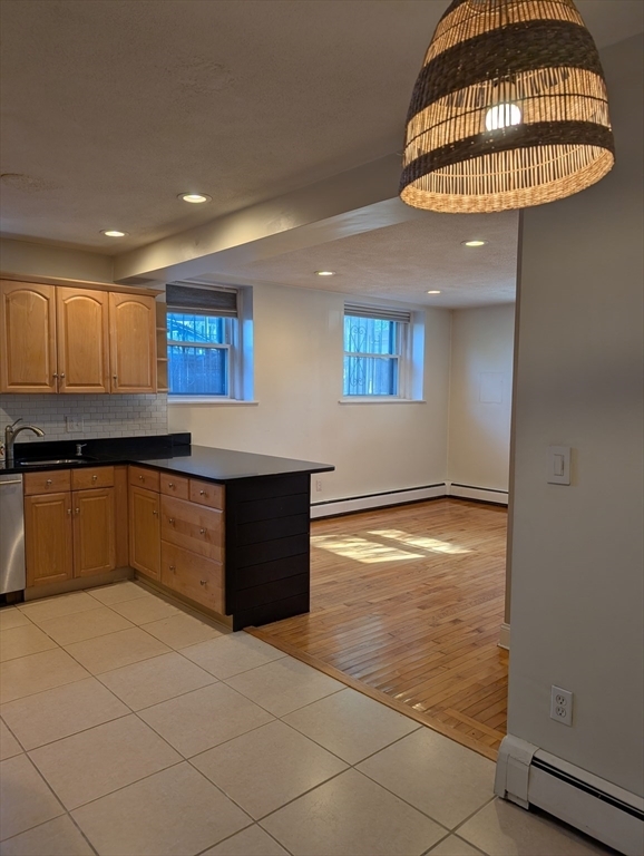
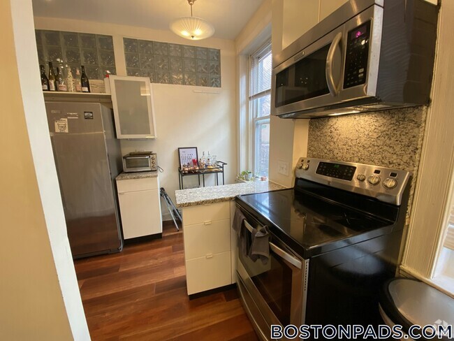
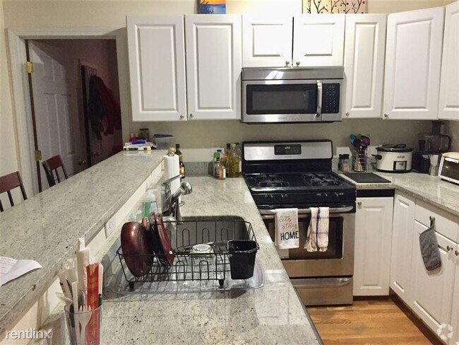
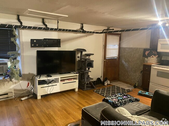
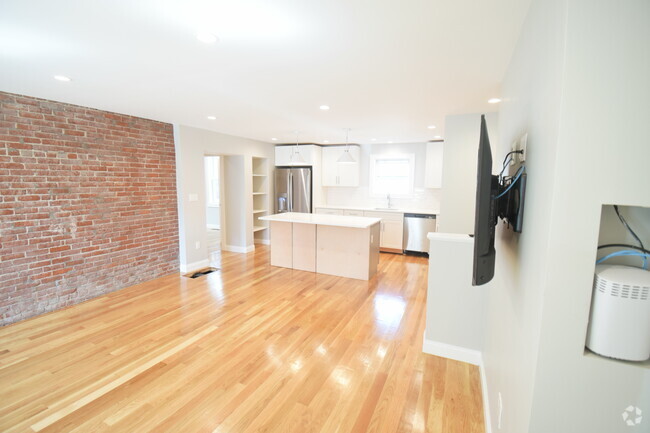
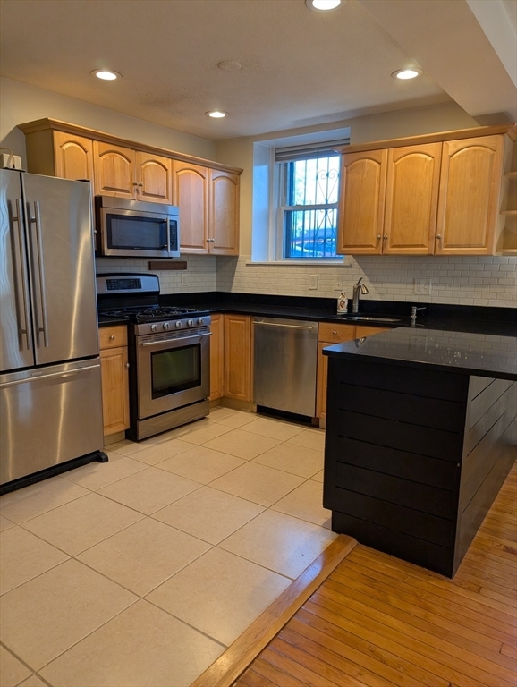
Kenmore Square spacious 1 bedroom for 9/1! This lower level unit gets great light,has high ceilings,hardwood floors throughout and a great layout! Big kitchen with breakfast bar,gas cooking,dishwasher,lots of cabinets and granite counters. Nice sized living room. Dining room nook/office nook when you walk in along with HUGE pantry/coat closet! Extra linen closet outside the bathroom that features marble tiles. Great bedroom with closet and a wall of built in storage. Heat and hot water included,pets considered and off street parking for $250/month. All of this in a professionally managed building with an elevator and AMAZING common roof deck! Easy access to the Back Bay,T,shopping and restaurants.
60 Charlesgate W is a condo located in Suffolk County and the 02215 ZIP Code.
Discover Homeownership
Renting vs. Buying
-
Housing Cost Per Month: $2,850
-
Rent for 30 YearsRenting doesn't build equity Future EquityRenting isn't tax deductible Mortgage Interest Tax Deduction$0 Net Return
-
Buy Over 30 Years$1.13M - $2.01M Future Equity$501K Mortgage Interest Tax Deduction$100K - $979K Gain Net Return
-
Contact
 This Property
 Available Property
Tree-filled, historic, and packed with educational opportunity, there's no other neighborhood quite like Fenway. The neighborhood may be most well-known for its titular attraction, Fenway Park, home of the Boston Red Sox. However, the area is also renowned for its sprawling greenspace. The name "Fenway" refers to the neighborhood’s lush parkway and tree-filled paths that wind lazily through the area, forming part of Frederick Law Olmsted’s “Emerald Necklace Plan” (a chain of parks throughout Boston). The Fenway opened in 1876, and its route includes the Museum of Fine Arts and the Isabella Steward Gardner Museum.
Learn more about living in Fenway| Colleges & Universities | Distance | ||
|---|---|---|---|
| Colleges & Universities | Distance | ||
| Walk: | 7 min | 0.4 mi | |
| Walk: | 10 min | 0.5 mi | |
| Walk: | 16 min | 0.8 mi | |
| Drive: | 3 min | 1.1 mi |
Transportation options available in Boston include Kenmore Station, located 0.2 miles from 60 Charlesgate W Unit BA. 60 Charlesgate W Unit BA is near General Edward Lawrence Logan International, located 5.8 miles or 13 minutes away.
| Transit / Subway | Distance | ||
|---|---|---|---|
| Transit / Subway | Distance | ||
|
|
Walk: | 3 min | 0.2 mi |
|
|
Walk: | 7 min | 0.4 mi |
|
|
Walk: | 8 min | 0.4 mi |
|
|
Walk: | 12 min | 0.6 mi |
|
|
Walk: | 15 min | 0.8 mi |
| Commuter Rail | Distance | ||
|---|---|---|---|
| Commuter Rail | Distance | ||
|
|
Walk: | 23 min | 1.2 mi |
|
|
Drive: | 6 min | 1.5 mi |
|
|
Drive: | 7 min | 2.3 mi |
|
|
Drive: | 7 min | 2.7 mi |
|
|
Drive: | 6 min | 3.6 mi |
| Airports | Distance | ||
|---|---|---|---|
| Airports | Distance | ||
|
General Edward Lawrence Logan International
|
Drive: | 13 min | 5.8 mi |
Time and distance from 60 Charlesgate W Unit BA.
| Shopping Centers | Distance | ||
|---|---|---|---|
| Shopping Centers | Distance | ||
| Walk: | 7 min | 0.4 mi | |
| Drive: | 8 min | 4.6 mi | |
| Drive: | 8 min | 4.7 mi |
| Parks and Recreation | Distance | ||
|---|---|---|---|
| Parks and Recreation | Distance | ||
|
Charles River Reservation
|
Walk: | 9 min | 0.5 mi |
|
Coit Observatory
|
Walk: | 17 min | 0.9 mi |
|
Boston Public Garden
|
Drive: | 5 min | 1.7 mi |
|
John Fitzgerald Kennedy National Historic Site
|
Drive: | 4 min | 2.0 mi |
|
Roxbury Heritage State Park
|
Drive: | 5 min | 2.1 mi |
| Hospitals | Distance | ||
|---|---|---|---|
| Hospitals | Distance | ||
| Walk: | 18 min | 1.0 mi | |
| Drive: | 3 min | 1.5 mi | |
| Drive: | 3 min | 1.7 mi |
| Military Bases | Distance | ||
|---|---|---|---|
| Military Bases | Distance | ||
| Drive: | 27 min | 14.7 mi | |
| Drive: | 27 min | 15.8 mi |
You May Also Like
Similar Rentals Nearby
What Are Walk Score®, Transit Score®, and Bike Score® Ratings?
Walk Score® measures the walkability of any address. Transit Score® measures access to public transit. Bike Score® measures the bikeability of any address.
What is a Sound Score Rating?
A Sound Score Rating aggregates noise caused by vehicle traffic, airplane traffic and local sources
