$1,951 / Month
60 Roosevelt Ave
Carteret, NJ 07008
Today
Favorites
732-253-8530
-
Bedrooms
1
-
Bathrooms
1
-
Square Feet
817 sq ft
-
Available
Available Now
Highlights
- Deck
- Wood Flooring
- Ground Level Unit
- Shades
- Separate Shower in Primary Bathroom
- Intercom
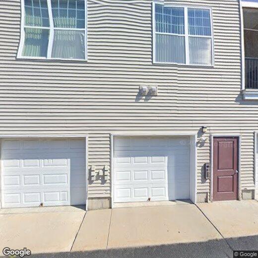
60 Roosevelt Ave Unit 3105

Favorites
About This Home
12 Month Lease
,
Available Now
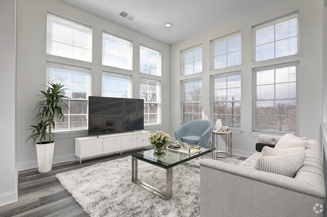
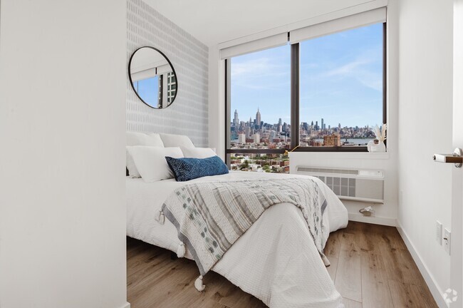
Beautiful 1stfloor 1 bedroom unit. Hardwood floors in Living/Dining room. Large open space great for Entertaining. Good sized bedroom with Oversized closet. Modern kitchen with stainless steel appliances. Make this your new home today.
60 Roosevelt Ave is an apartment community located in Middlesex County and the 07008 ZIP Code.
* Price shown is base rent and may not include non-optional fees and utilities.
Price, availability, fees, and any applicable rent special are subject to change without notice.
* Square footage definitions vary. Displayed square footage is approximate.
Home Details
Bedrooms and Bathrooms
Separate Shower in Primary Bathroom
Walk-in Shower
1 Full Bathroom
1 Bedroom
Flooring
Wood
Ceramic Tile
Carpet
Home Design
Apartment
Home Security
Storm Screens
Intercom
Fire and Smoke Detector
Interior Spaces
Shades
Combination Dining and Living Room
817 Sq Ft Home
1-Story Property
Kitchen
Breakfast Bar
Gas Oven or Range
Stove
Microwave
Dishwasher
Recirculated Exhaust Fan
Laundry
Laundry Room
Washer and Dryer
Listing and Financial Details
12 Month Lease Term
Tenant pays for all utilities, electricity, sewer, gas, hot water, water
Location
Ground Level Unit
Outdoor Features
Deck
Parking
Unassigned Parking
On-Street Parking
On-Site Parking
Open Parking
Utilities
Forced Air Heating System
Gas Water Heater
Cable TV Available
Underground Utilities
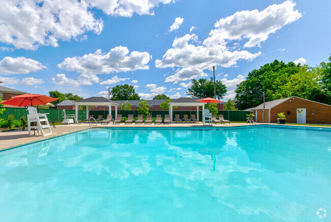
Community Details
Overview
The community has rules related to vehicle restrictions
Gateway At Carteret Subdivision
Fees and Policies
The fees below are based on community-supplied data and may exclude additional fees and utilities.
- Parking
-
Street--
Details
Lease Options
-
12 Months
Contact
- Listed by JASON F. KAPLAN
- Phone Number (732) 253-8530
- Contact
-
Source
 CENTRAL JERSEY MULTIPLE LISTING SYSTEM, INC
The CENTRAL JERSEY MULTIPLE LISTING SYSTEM, INC does not warrant the accuracy, quality, reliability, suitability, completeness, usefulness or effectiveness of any information provided. The information being provided is for consumers' personal, non-commercial use and may not be used for any purpose other than to identify properties the consumer may be interested in purchasing or renting. Copyright 2025, CENTRAL JERSEY MULTIPLE LISTING SYSTEM, INC. All rights reserved. “The CENTRAL JERSEY MULTIPLE LISTING SYSTEM, INC retains all rights, title and interest in and to its trademarks, service marks and copyrighted material.
Location
Get Directions
Amenities
- Washer/Dryer
- Air Conditioning
- Dishwasher
- Kitchen
- Microwave
- Oven
- Range
- Refrigerator
- Hardwood Floors
- Carpet
- Tile Floors
Located directly across the Arthur Kill from Staten Island, Carteret was once part of the Woodbridge Township. It became the borough of Roosevelt in 1906 and was renamed Carteret in 1922. This popular community is bordered by the Rahway River to the north, Arthur Kill to the east, and the Ernest L. Oros Wildlife Preserve to the west. Due to its central location, the borough bills itself as the "Center of it All."
Residents enjoy a fantastic location and beautiful parks. Carteret Waterfront Park has a fishing pier and access to two hiking trails: Danielle's Garden Trail and the Waterfront Fitness Trail. Shopping in Carteret is plentiful -- the brick-paved sidewalks and outdoor cafes along Washington Avenue provide historic charm and locally-owned businesses, while the shops and restaurants along Roosevelt Avenue have a more modern feel. With just 22 miles to Manhattan, 10 miles to Newark, and 70 miles to Philadelphia, residents can easily commute to nearby cities.
Learn more about living in Carteret
Education
| Colleges & Universities | Distance | ||
|---|---|---|---|
| Colleges & Universities | Distance | ||
| Drive: | 16 min | 8.4 mi | |
| Drive: | 19 min | 10.1 mi | |
| Drive: | 20 min | 11.3 mi | |
| Drive: | 25 min | 14.3 mi |
60 Roosevelt Ave Unit 3105 is within 16 minutes or 8.4 miles from Union County Coll., Elizabeth. It is also near Kean University and Coll. of Staten Island, CUNY.
Transportation options available in Carteret include 8Th Street Light Rail Station, located 12.9 miles from 60 Roosevelt Ave Unit 3105. 60 Roosevelt Ave Unit 3105 is near Newark Liberty International, located 14.5 miles or 24 minutes away, and Laguardia, located 31.9 miles or 53 minutes away.
| Transit / Subway | Distance | ||
|---|---|---|---|
| Transit / Subway | Distance | ||
| Drive: | 22 min | 12.9 mi | |
|
|
Drive: | 24 min | 14.1 mi |
|
|
Drive: | 23 min | 15.8 mi |
|
|
Drive: | 22 min | 15.8 mi |
|
|
Drive: | 28 min | 17.9 mi |
| Commuter Rail | Distance | ||
|---|---|---|---|
| Commuter Rail | Distance | ||
|
|
Drive: | 7 min | 3.1 mi |
|
|
Drive: | 10 min | 4.4 mi |
|
|
Drive: | 18 min | 8.7 mi |
|
|
Drive: | 19 min | 9.6 mi |
|
|
Drive: | 21 min | 11.0 mi |
| Airports | Distance | ||
|---|---|---|---|
| Airports | Distance | ||
|
Newark Liberty International
|
Drive: | 24 min | 14.5 mi |
|
Laguardia
|
Drive: | 53 min | 31.9 mi |
Time and distance from 60 Roosevelt Ave Unit 3105.
| Shopping Centers | Distance | ||
|---|---|---|---|
| Shopping Centers | Distance | ||
| Drive: | 5 min | 1.5 mi | |
| Drive: | 4 min | 1.8 mi | |
| Drive: | 6 min | 2.6 mi |
60 Roosevelt Ave Unit 3105 has 3 shopping centers within 2.6 miles, which is about a 6-minute drive. The miles and minutes will be for the farthest away property.
| Parks and Recreation | Distance | ||
|---|---|---|---|
| Parks and Recreation | Distance | ||
|
Liberty State Park
|
Drive: | 7 min | 2.5 mi |
|
Hawk Rise Sanctuary
|
Drive: | 14 min | 5.8 mi |
|
Bloomingdale Park
|
Drive: | 17 min | 8.6 mi |
|
Clay Pit Ponds State Park Preserve
|
Drive: | 20 min | 9.1 mi |
|
Freshkills Park
|
Drive: | 23 min | 12.0 mi |
60 Roosevelt Ave Unit 3105 has 5 parks within 12.0 miles, including Liberty State Park, Hawk Rise Sanctuary, and Bloomingdale Park.
| Hospitals | Distance | ||
|---|---|---|---|
| Hospitals | Distance | ||
| Drive: | 14 min | 5.8 mi | |
| Drive: | 12 min | 6.1 mi | |
| Drive: | 17 min | 7.8 mi |
60 Roosevelt Ave Unit 3105 has 3 hospitals within 7.8 miles, the nearest is Robert Wood Johnson University Hospital at Rahway which is 5.8 miles away and a 14 minutes drive.
| Military Bases | Distance | ||
|---|---|---|---|
| Military Bases | Distance | ||
| Drive: | 22 min | 8.8 mi | |
| Drive: | 25 min | 9.6 mi | |
| Drive: | 29 min | 15.9 mi |
60 Roosevelt Ave Unit 3105 has 3 military bases within 15.9 miles, the nearest is Ash Brook Reservation which is 8.8 miles away and a 22 minutes .
You May Also Like
Similar Rentals Nearby


What Are Walk Score®, Transit Score®, and Bike Score® Ratings?
Walk Score® measures the walkability of any address. Transit Score® measures access to public transit. Bike Score® measures the bikeability of any address.
What is a Sound Score Rating?
A Sound Score Rating aggregates noise caused by vehicle traffic, airplane traffic and local sources

60 Roosevelt Ave
Carteret, NJ 07008