

601 Minnesota St Unit 225
San Francisco, CA 94107
Favorites

601 Minnesota St Unit 225
Favorites
Check Back Soon for Upcoming Availability
| Beds | Baths | Average SF |
|---|---|---|
| 1 Bedroom 1 Bedroom 1 Br | 1 Bath 1 Bath 1 Ba | — |
About This Property
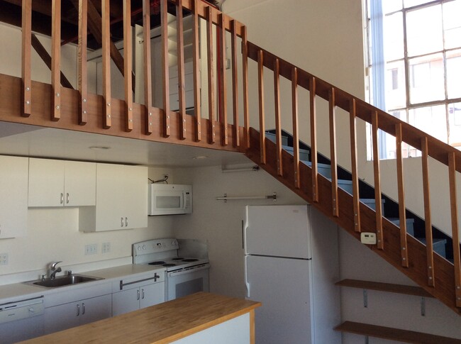
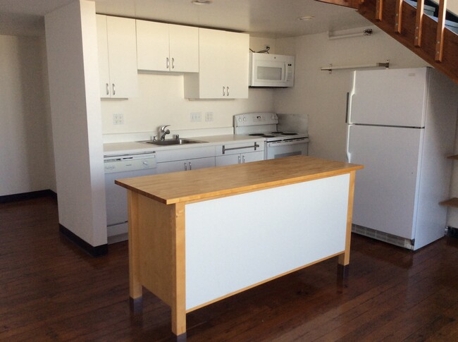
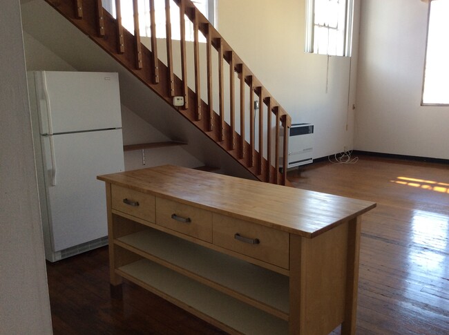
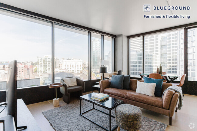
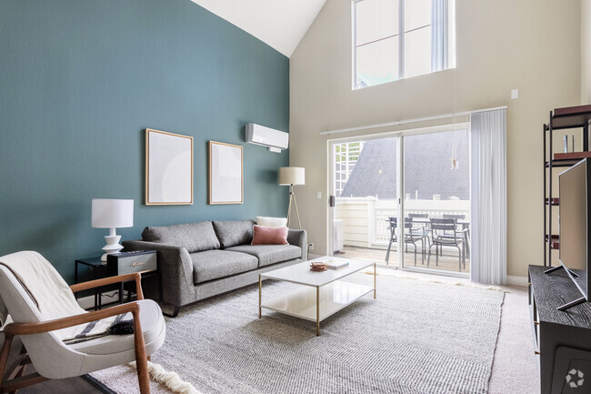
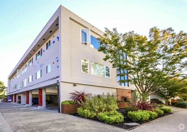
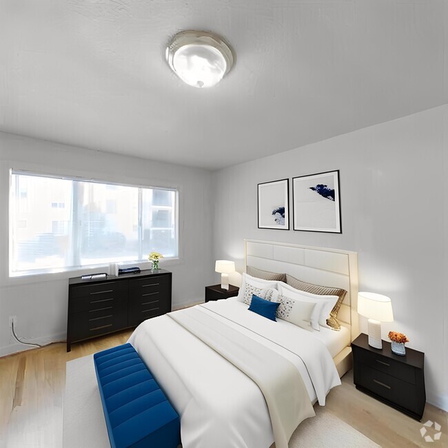
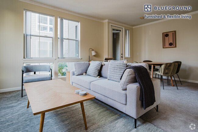
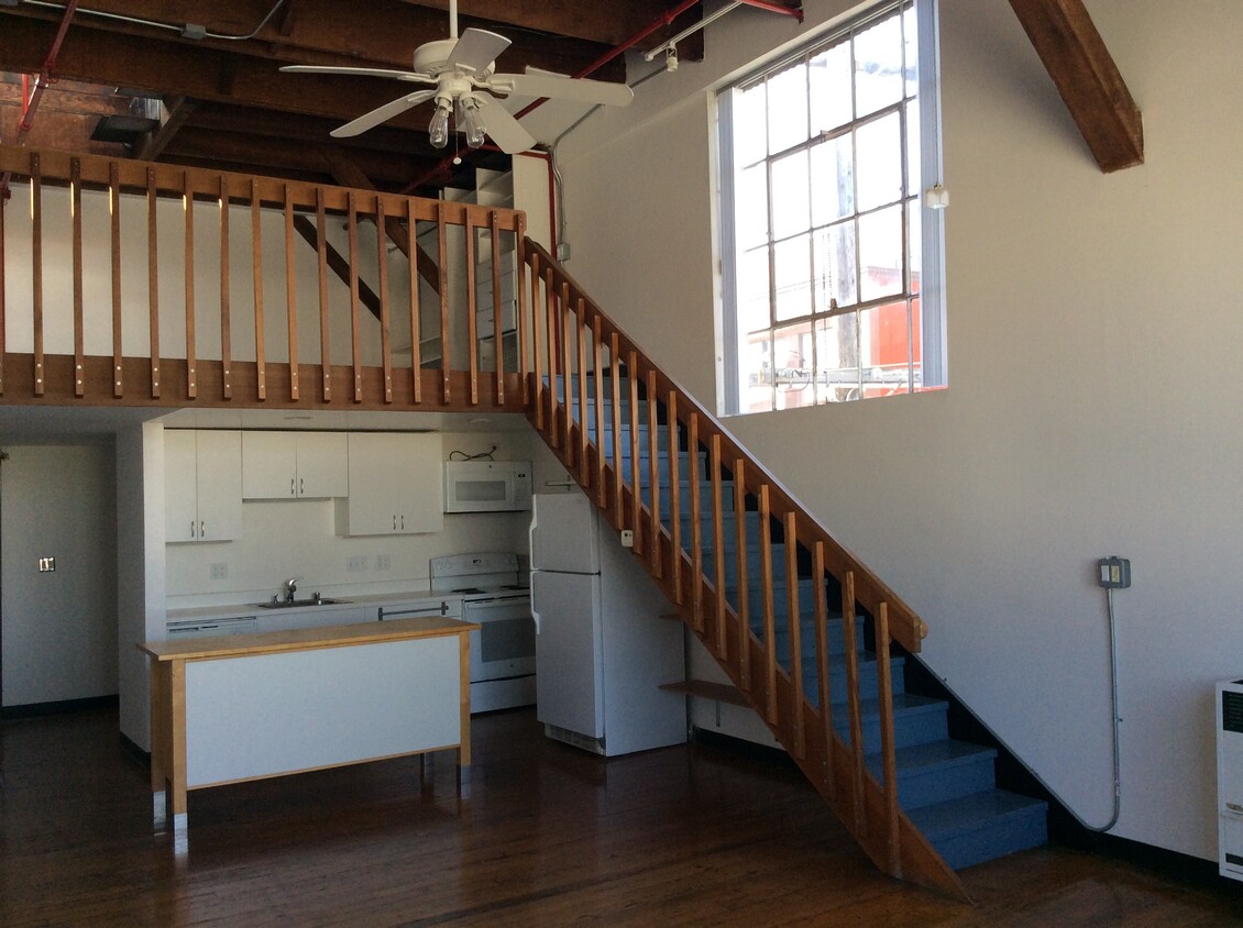
This sunny unit is located in a 1930’s Cannery converted to 32 live/work Lofts one block from the new UCSF Mission Bay Campus. The building is a few blocks from Cal-Trains second depot, several bus lines, the Third Street Light Rail, Potrero Hill shops, restaurants, a Whole Foods and the Mission Bay Community Center offering gym memberships. This Loft is located on the second floor of a two story building and features: 1) A large North facing window. 2) Two large west facing factory windows. 3) 15 ft ceiling. 4) Exposed ceiling rafters. 5) Soft wood floors. 6) All Electric Kitchen 7) A recently renovated bathroom. The Loft is ready for occupancy and the building is located at 601 Minnesota st @ 18th st. The unit is a rental unit subject to the San Francisco Rent Ordinance,which limits evictions without just cause and which states that any waiver by tenants of their rights under the Rent Ordinance void as contrary to public policy. Equal Opportunity Housing. . Calbre#990193
601 Minnesota St is a condo located in San Francisco County and the 94107 ZIP Code. This area is served by the San Francisco Unified attendance zone.
Property Address:
601 Minnesota St,
San Francisco,
CA
94107
 This Property
 Available Property
Small in size but big on character, Dogpatch is a trendy, historic neighborhood that blends its industrial roots with a modern, artistic vibe. The area developed during the 1800s as a shipbuilding district. The large warehouses and factories that once dominated this part of San Francisco now serve as apartments, art studios, and offices. Slightly secluded and infinitely cool, this historic district has developed into a community of artists – but some of that grit still remains.
Dogpatch sits along the waterfront, directly east of Potrero Hill and south of Mission Bay. Unlike most of San Francisco, the neighborhood is fairly flat and very walkable. Residents also get around by bicycle and by mass transit – the T-line serves the neighborhood, and you can catch the train at the 20th Street Station. It’s also less foggy than the rest of San Francisco, and locals claim this neighborhood has the best weather in the city.
Learn more about living in DogpatchBelow are rent ranges for similar nearby apartments
Education
| Colleges & Universities | Distance | ||
|---|---|---|---|
| Colleges & Universities | Distance | ||
| Walk: | 9 min | 0.5 mi | |
| Walk: | 16 min | 0.8 mi | |
| Drive: | 5 min | 2.5 mi | |
| Drive: | 6 min | 3.0 mi |
601 Minnesota St Unit 225 is within 9 minutes or 0.5 mile from UC San Francisco, Mission Bay. It is also near California College of the Arts and Golden Gate Univ., San Fran..
Schools
Public Elementary School
Grades K-5
347 Students
Nearby
2
Out of 10
Charter Elementary & Middle School
Grades K-8
469 Students
Nearby
5
Out of 10
Public Elementary School
Grades K-5
346 Students
Attendance Zone
7
Out of 10
Charter High School
Grades 9-12
41 Students
Nearby
3
Out of 10
Private Elementary & Middle School
Grades PK-8
21 Students
Nearby
Private Middle & High School
Grades 6-12
37 Students
Nearby
School data provided by
GreatSchools
The GreatSchools Rating helps parents compare schools within a state based on a variety of school quality indicators and provides a helpful picture of how effectively each school serves all of its students. Ratings are on a scale of 1 (below average) to 10 (above average) and can include test scores, college readiness, academic progress, advanced courses, equity, discipline and attendance data. We also advise parents to visit schools, consider other information on school performance and programs, and consider family needs as part of the school selection process.
Transportation options available in San Francisco include Mariposa Station, located 0.2 mile from 601 Minnesota St Unit 225. 601 Minnesota St Unit 225 is near San Francisco International, located 12.2 miles or 18 minutes away, and Metro Oakland International, located 20.3 miles or 31 minutes away.
| Transit / Subway | Distance | ||
|---|---|---|---|
| Transit / Subway | Distance | ||
|
|
Walk: | 4 min | 0.2 mi |
|
|
Walk: | 4 min | 0.2 mi |
|
|
Walk: | 4 min | 0.2 mi |
|
|
Walk: | 10 min | 0.5 mi |
|
|
Walk: | 11 min | 0.6 mi |
| Commuter Rail | Distance | ||
|---|---|---|---|
| Commuter Rail | Distance | ||
| Walk: | 10 min | 0.5 mi | |
| Drive: | 3 min | 1.6 mi | |
| Drive: | 7 min | 4.3 mi | |
| Drive: | 13 min | 8.8 mi | |
|
|
Drive: | 20 min | 11.9 mi |
| Airports | Distance | ||
|---|---|---|---|
| Airports | Distance | ||
|
San Francisco International
|
Drive: | 18 min | 12.2 mi |
|
Metro Oakland International
|
Drive: | 31 min | 20.3 mi |
Time and distance from 601 Minnesota St Unit 225.
| Shopping Centers | Distance | ||
|---|---|---|---|
| Shopping Centers | Distance | ||
| Drive: | 3 min | 1.4 mi | |
| Drive: | 4 min | 1.4 mi | |
| Drive: | 4 min | 1.6 mi |
601 Minnesota St Unit 225 has 3 shopping centers within 1.6 miles, which is about a 4-minute drive. The miles and minutes will be for the farthest away property.
| Parks and Recreation | Distance | ||
|---|---|---|---|
| Parks and Recreation | Distance | ||
|
Heron's Head Park
|
Drive: | 5 min | 2.0 mi |
|
Children's Creativity Museum
|
Drive: | 5 min | 2.3 mi |
|
Buena Vista Park
|
Drive: | 8 min | 3.3 mi |
|
Randall Museum
|
Drive: | 9 min | 3.6 mi |
|
Candlestick Point State Recreation Area
|
Drive: | 11 min | 5.1 mi |
601 Minnesota St Unit 225 has 5 parks within 5.1 miles, including Children's Creativity Museum, Heron's Head Park, and Randall Museum.
| Hospitals | Distance | ||
|---|---|---|---|
| Hospitals | Distance | ||
| Drive: | 5 min | 1.6 mi | |
| Drive: | 7 min | 2.9 mi | |
| Drive: | 8 min | 3.5 mi |
601 Minnesota St Unit 225 has 3 hospitals within 3.5 miles, the nearest is Zuckerberg San Francisco General Hospital & Trauma Center which is 1.6 miles away and a 5 minutes drive.
| Military Bases | Distance | ||
|---|---|---|---|
| Military Bases | Distance | ||
| Drive: | 13 min | 6.4 mi | |
| Drive: | 27 min | 14.8 mi |
601 Minnesota St Unit 225 is 6.4 miles from Treasure Island Naval Station, and is convenient to other military bases, including Alameda/US Naval Air Station San Francisco.
You May Also Like
Similar Rentals Nearby
What Are Walk Score®, Transit Score®, and Bike Score® Ratings?
Walk Score® measures the walkability of any address. Transit Score® measures access to public transit. Bike Score® measures the bikeability of any address.
What is a Sound Score Rating?
A Sound Score Rating aggregates noise caused by vehicle traffic, airplane traffic and local sources
601 Minnesota St
San Francisco, CA 94107