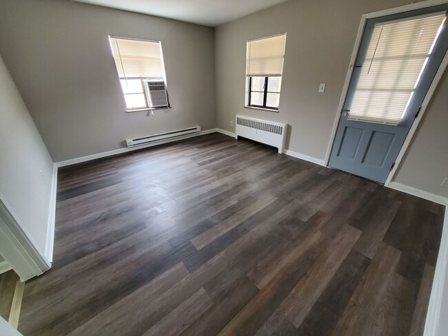
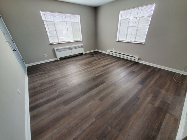
$995 / Month
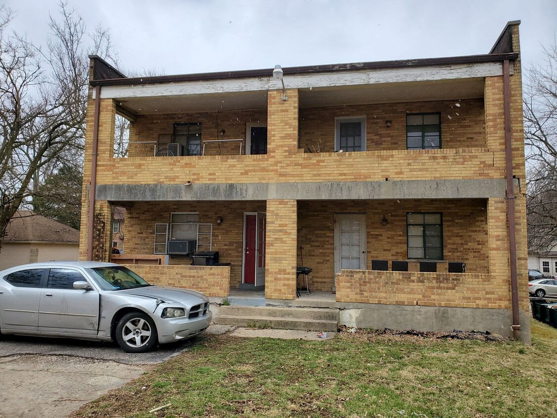
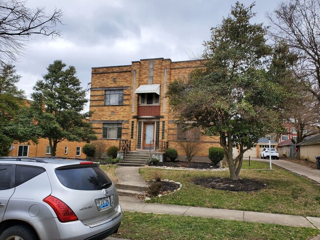
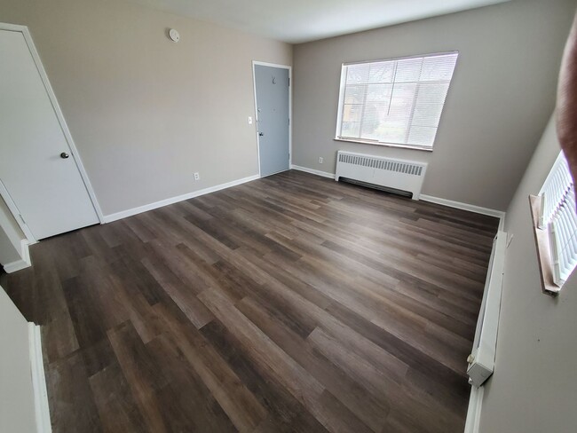
6012 Budmar Ave Unit Apt #3
Cincinnati, OH 45224
Today
Favorites
513-371-5468
-
Bedrooms
1
-
Bathrooms
1
-
Square Feet
650 sq ft
-
Available
Available Now
6012 Budmar Ave Unit Apt #3

Favorites
Contact
- Listed by LRE Western Hills Office | LRE Western Hills Office
- Phone Number
- Contact
Location
Get Directions
Located about five miles northwest of Downtown Cincinnati, College Hill blends the urban with the suburban, touting vibrant storefronts along Hamilton Avenue and historic residences along tranquil backroads. College Hill is home to a diverse, close-knit community known for being welcoming to all.
Delectable restaurants, independent shops, and cozy cafes are among the many eclectic businesses lining the charming and walkable Hamilton Avenue. Recreational opportunities abound at a number of neighborhood parks as well as the nearby Mount Airy Forest. College Hill is also within a 15-minute drive to Downtown Cincinnati.
Learn more about living in College Hill
Education
| Colleges & Universities | Distance | ||
|---|---|---|---|
| Colleges & Universities | Distance | ||
| Drive: | 13 min | 4.3 mi | |
| Drive: | 16 min | 6.6 mi | |
| Drive: | 15 min | 6.6 mi | |
| Drive: | 17 min | 6.9 mi |
6012 Budmar Ave Unit Apt #3 is within 13 minutes or 4.3 miles from Cincinnati State. It is also near University of Cincinnati and Univ. of Cincinnati, Medical.
Transportation options available in Cincinnati include Brewery District Station, Elm & Henry, located 7.3 miles from 6012 Budmar Ave Unit Apt #3. 6012 Budmar Ave Unit Apt #3 is near Cincinnati/Northern Kentucky International, located 21.3 miles or 40 minutes away.
| Transit / Subway | Distance | ||
|---|---|---|---|
| Transit / Subway | Distance | ||
| Drive: | 16 min | 7.3 mi | |
| Drive: | 16 min | 7.4 mi | |
| Drive: | 16 min | 7.5 mi | |
| Drive: | 16 min | 7.5 mi | |
| Drive: | 16 min | 7.6 mi |
| Commuter Rail | Distance | ||
|---|---|---|---|
| Commuter Rail | Distance | ||
|
|
Drive: | 15 min | 7.3 mi |
| Airports | Distance | ||
|---|---|---|---|
| Airports | Distance | ||
|
Cincinnati/Northern Kentucky International
|
Drive: | 40 min | 21.3 mi |
Time and distance from 6012 Budmar Ave Unit Apt #3.
| Shopping Centers | Distance | ||
|---|---|---|---|
| Shopping Centers | Distance | ||
| Walk: | 4 min | 0.2 mi | |
| Drive: | 3 min | 1.2 mi | |
| Drive: | 4 min | 1.4 mi |
6012 Budmar Ave Unit Apt #3 has 3 shopping centers within 1.4 miles, which is about a 4-minute walk. The miles and minutes will be for the farthest away property.
| Parks and Recreation | Distance | ||
|---|---|---|---|
| Parks and Recreation | Distance | ||
|
LaBoiteaux Woods
|
Walk: | 20 min | 1.1 mi |
|
Buttercup Valley
|
Drive: | 6 min | 2.1 mi |
|
Mt. Airy Forest
|
Drive: | 9 min | 3.6 mi |
|
Caldwell Preserve
|
Drive: | 8 min | 3.6 mi |
|
Farbach-Werner Nature Preserve
|
Drive: | 10 min | 4.3 mi |
6012 Budmar Ave Unit Apt #3 has 5 parks within 4.3 miles, including LaBoiteaux Woods, Buttercup Valley, and Mt. Airy Forest.
| Hospitals | Distance | ||
|---|---|---|---|
| Hospitals | Distance | ||
| Drive: | 12 min | 4.7 mi | |
| Drive: | 11 min | 4.9 mi | |
| Drive: | 13 min | 5.7 mi |
6012 Budmar Ave Unit Apt #3 has 3 hospitals within 5.7 miles, the nearest is Mercy Health - West Hospital which is 4.7 miles away and a 12 minute drive.
| Military Bases | Distance | ||
|---|---|---|---|
| Military Bases | Distance | ||
| Drive: | 68 min | 51.0 mi | |
| Drive: | 74 min | 56.0 mi | |
| Drive: | 77 min | 59.3 mi |
6012 Budmar Ave Unit Apt #3 has 3 military bases within 59.3 miles, the nearest is Gentile Air Force Station which is 51.0 miles away and a 68 minute drive.
You May Also Like
Similar Rentals Nearby


What Are Walk Score®, Transit Score®, and Bike Score® Ratings?
Walk Score® measures the walkability of any address. Transit Score® measures access to public transit. Bike Score® measures the bikeability of any address.
What is a Sound Score Rating?
A Sound Score Rating aggregates noise caused by vehicle traffic, airplane traffic and local sources

6012 Budmar Ave
Cincinnati, OH 45224