$1,500 / Month
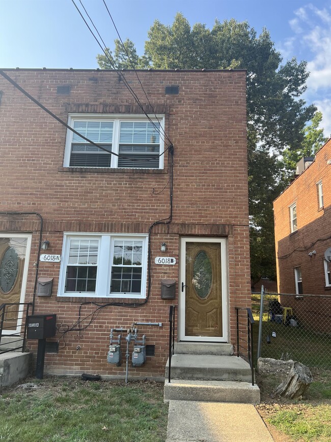
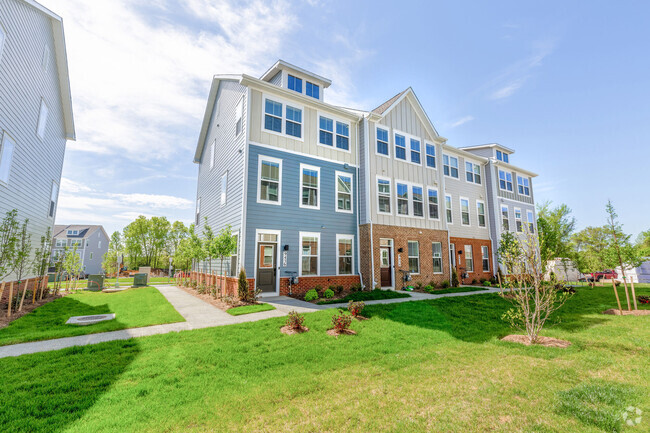
6018 Clay St NE
Washington, DC 20019
Today
Favorites
202-562-2779
-
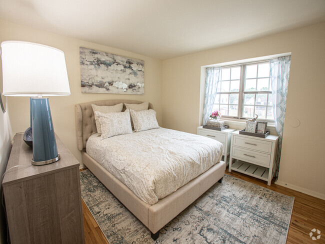
Bedrooms
1
-
Bathrooms
1
-
Square Feet
1,330 sq ft
-
Available
Available Now
6018 Clay St NE

Favorites
About This Home
$1,500 deposit,
Available Now
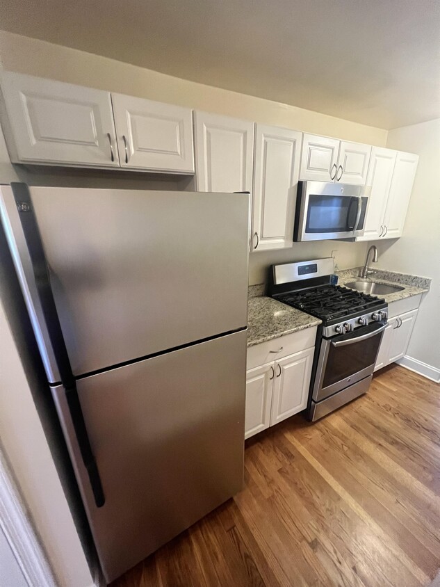
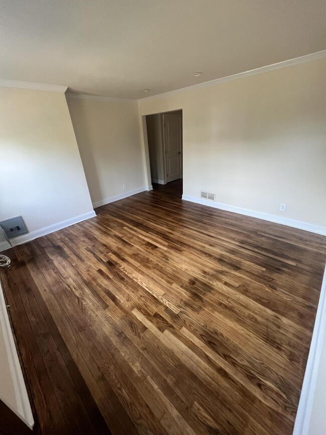
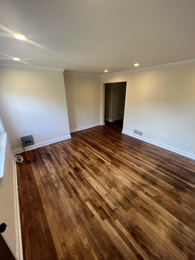
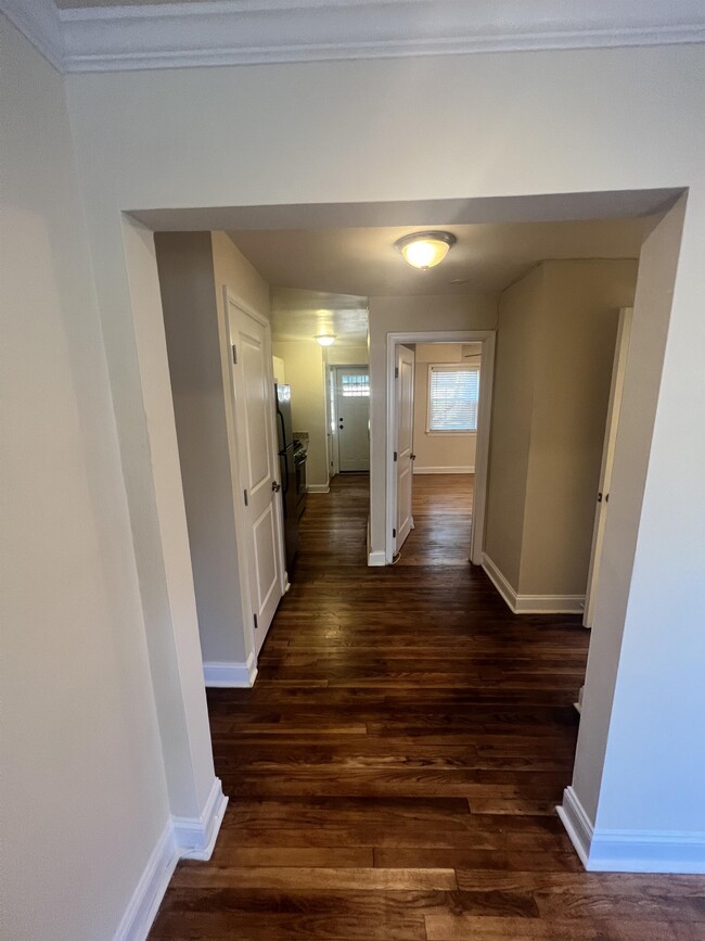
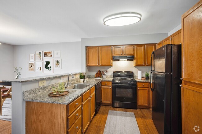
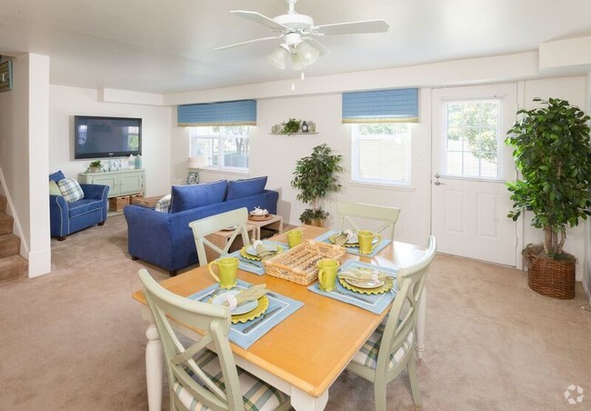
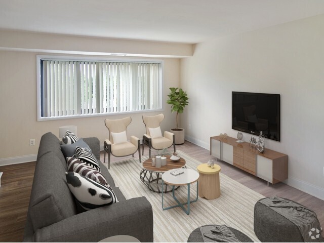
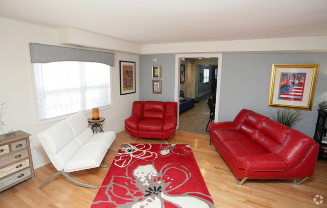
!!Beautiful and spacious 1 bedroom, 1 full bath condo apartment in Northeast!! Recently renovated, full kitchen with gas stove, hard wood floor all through the apartment. Enjoy the bright and airy living room, spacious bedroom and ample closet storage space. This unit has Central HVAC system and laundry on site. The property is close to supermarkets, coffee shops, restaurants. The property is minutes away from Capital Heights Station and Martin Luther King Jr HWY. Walking distance to public transportation, and short commute to downtown DC. To set up a showing, visit Unit features * Microwave * Hardwood floors * Air conditioning * Refrigerator * Oven / range * Heat - gas * 1 Full Bathroom For inquiries and appointments, please contact us at:
6018 Clay St NE is a townhome located in District of Columbia County and the 20019 ZIP Code. This area is served by the District Of Columbia Public Schools attendance zone.
* Price shown is base rent and may not include non-optional fees and utilities.
Price, availability, fees, and any applicable rent special are subject to change without notice.
* Square footage definitions vary. Displayed square footage is approximate.
Contact
- Listed by Robtco Property Management
- Phone Number
- Contact
Location
Get Directions
Grant Park is a hilly, wooded neighborhood located on the north side of Capitol View and directly east of Lincoln Heights. The narrow streets are lined with square, brick houses and a variety of apartment communities. At the east end of the neighborhood, the Watts Branch Playground includes a spray ground, picnic areas, and the Marvin Gaye Recreation Center. Grant Park is an affordable, mostly residential neighborhood located about seven miles southeast of Downtown DC. Residents have easy access to the Tenleytown Metro Station for car-free commutes into the city.
Learn more about living in Grant Park
Education
| Colleges & Universities | Distance | ||
|---|---|---|---|
| Colleges & Universities | Distance | ||
| Drive: | 9 min | 4.9 mi | |
| Drive: | 11 min | 5.2 mi | |
| Drive: | 11 min | 6.1 mi | |
| Drive: | 12 min | 6.1 mi |
6018 Clay St NE is within 9 minutes or 4.9 miles from Univ. of Md. Univ. Coll.. It is also near Gallaudet University and Georgetown Law.
Schools


Public Elementary School
Grades PK-5
189 Students
Attendance Zone
Public Middle School
Grades 6-8
351 Students
Attendance Zone
Public High School
Grades 9-12
543 Students
Attendance Zone
Private Elementary & Middle School
Grades PK-8
Nearby
Private Elementary School
Grades PK-6
50 Students
Nearby
Private High School
Grades 9-12
Nearby
School data provided by
 The GreatSchools Rating helps parents compare schools within a state based on a variety of school quality indicators and provides a helpful picture of how effectively each school serves all of its students. Ratings are on a scale of 1 (below average) to 10 (above average) and can include test scores, college readiness, academic progress, advanced courses, equity, discipline and attendance data. We also advise parents to visit schools, consider other information on school performance and programs, and consider family needs as part of the school selection process.
View GreatSchools Rating Methodology
View GreatSchools Rating Methodology
Transportation options available in Washington include Capitol Heights, Blue/Silver Line Center Platform, located 0.4 mile from 6018 Clay St NE. 6018 Clay St NE is near Ronald Reagan Washington Ntl, located 11.6 miles or 21 minutes away, and Baltimore/Washington International Thurgood Marshall, located 28.2 miles or 42 minutes away.
| Transit / Subway | Distance | ||
|---|---|---|---|
| Transit / Subway | Distance | ||
| Walk: | 7 min | 0.4 mi | |
|
|
Drive: | 3 min | 1.6 mi |
|
|
Drive: | 4 min | 1.6 mi |
|
|
Drive: | 4 min | 1.9 mi |
|
|
Drive: | 7 min | 3.4 mi |
| Commuter Rail | Distance | ||
|---|---|---|---|
| Commuter Rail | Distance | ||
|
|
Drive: | 11 min | 5.6 mi |
|
|
Drive: | 12 min | 6.0 mi |
|
|
Drive: | 14 min | 6.9 mi |
| Drive: | 16 min | 7.2 mi | |
|
|
Drive: | 12 min | 7.4 mi |
| Airports | Distance | ||
|---|---|---|---|
| Airports | Distance | ||
|
Ronald Reagan Washington Ntl
|
Drive: | 21 min | 11.6 mi |
|
Baltimore/Washington International Thurgood Marshall
|
Drive: | 42 min | 28.2 mi |
Time and distance from 6018 Clay St NE.
| Shopping Centers | Distance | ||
|---|---|---|---|
| Shopping Centers | Distance | ||
| Walk: | 13 min | 0.7 mi | |
| Drive: | 3 min | 1.2 mi | |
| Drive: | 3 min | 1.6 mi |
6018 Clay St NE has 3 shopping centers within 1.6 miles, which is about a 3-minute walk. The miles and minutes will be for the farthest away property.
| Parks and Recreation | Distance | ||
|---|---|---|---|
| Parks and Recreation | Distance | ||
|
Fort Dupont Park
|
Drive: | 8 min | 2.8 mi |
|
Kingman and Heritage Island Park
|
Drive: | 7 min | 3.4 mi |
|
Bladensburg Waterfront Park
|
Drive: | 7 min | 4.1 mi |
|
Walker Mill Regional Park
|
Drive: | 8 min | 4.2 mi |
|
National Arboretum
|
Drive: | 11 min | 5.6 mi |
6018 Clay St NE has 5 parks within 5.6 miles, including Fort Dupont Park, Kingman and Heritage Island Park, and Walker Mill Regional Park.
| Hospitals | Distance | ||
|---|---|---|---|
| Hospitals | Distance | ||
| Drive: | 7 min | 3.4 mi | |
| Drive: | 15 min | 6.2 mi | |
| Drive: | 15 min | 6.3 mi |
6018 Clay St NE has 3 hospitals within 6.3 miles, the nearest is University of Maryland Prince George's Hospital Center which is 3.4 miles away and a 7 minute drive.
| Military Bases | Distance | ||
|---|---|---|---|
| Military Bases | Distance | ||
| Drive: | 12 min | 5.7 mi | |
| Drive: | 15 min | 7.5 mi |
6018 Clay St NE is 5.7 miles from Washington Navy Yard, and is convenient to other military bases, including Anacostia Naval Station.
You May Also Like
Similar Rentals Nearby


What Are Walk Score®, Transit Score®, and Bike Score® Ratings?
Walk Score® measures the walkability of any address. Transit Score® measures access to public transit. Bike Score® measures the bikeability of any address.
What is a Sound Score Rating?
A Sound Score Rating aggregates noise caused by vehicle traffic, airplane traffic and local sources

6018 Clay St NE
Washington, DC 20019