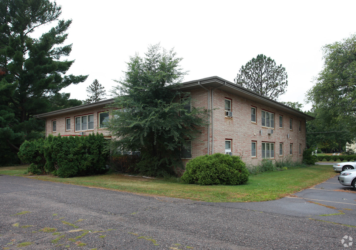
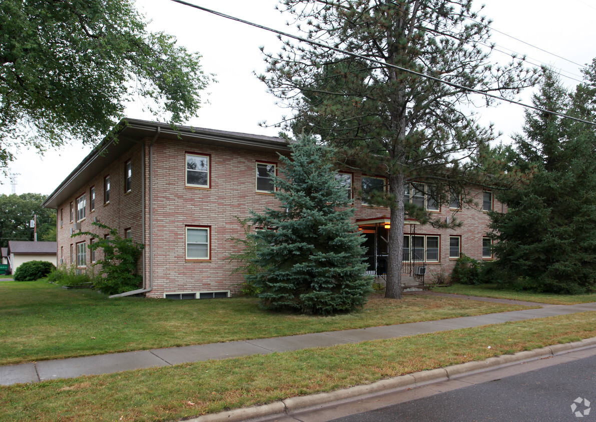
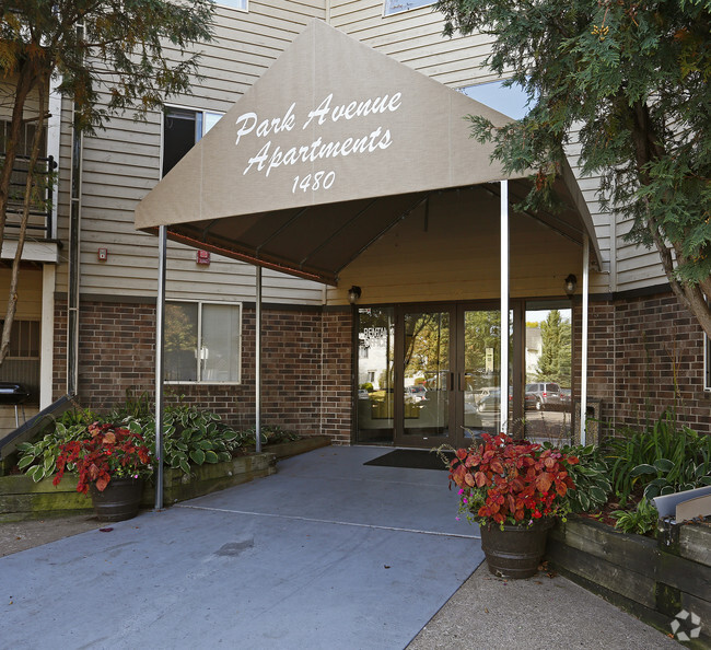
610 Chieftain St
610 Chieftain St,
Osceola,
WI
54020
2 Weeks Ago
Favorites
610 Chieftain St
Favorites
Check Back Soon for Upcoming Availability
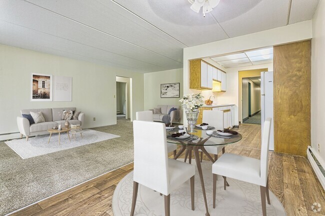
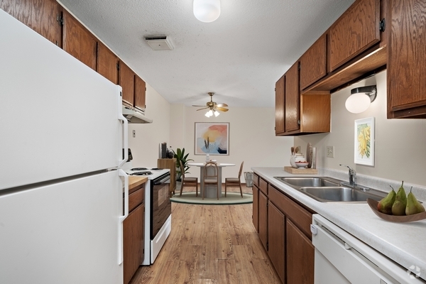
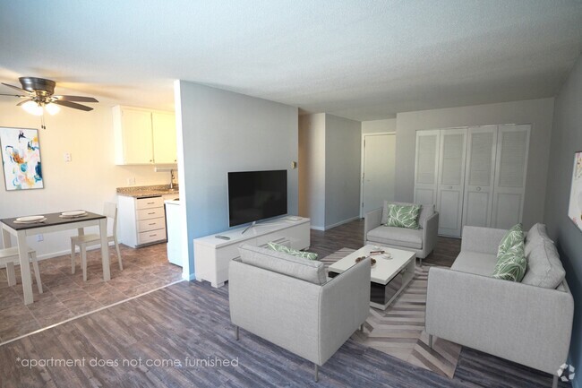
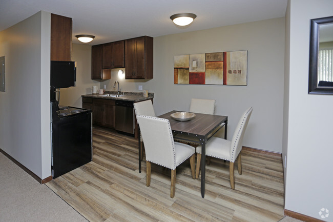
About 610 Chieftain St Osceola, WI 54020
Explore your new apartment at 610 Chieftain St in Osceola. The 54020 location has much to offer its residents. The leasing team is available to assist you in finding your perfect new apartment. Be sure to view the available floorplans. Contact us or drop by the leasing office to schedule a tour today and find your new place at 610 Chieftain St.
610 Chieftain St is an apartment community located in Polk County and the 54020 ZIP Code. This area is served by the Osceola attendance zone.
Fees and Policies
The fees below are based on community-supplied data and may exclude additional fees and utilities.
- Parking
-
Surface Lot--1 Max
Details
Property Information
-
12 units/2 stories
Location
Get Directions
Education
| Colleges & Universities | Distance | ||
|---|---|---|---|
| Colleges & Universities | Distance | ||
| Drive: | 47 min | 33.9 mi | |
| Drive: | 53 min | 39.5 mi | |
| Drive: | 54 min | 41.2 mi | |
| Drive: | 58 min | 43.8 mi |
610 Chieftain St is within 47 minutes or 33.9 miles from Century College. It is also near Metropolitan State University and Bethel University, Saint Paul.
Schools


Public Elementary School
Grades 3-5
307 Students
Attendance Zone
Public Elementary School
Grades PK-2
397 Students
Attendance Zone
Public Middle School
Grades 6-8
339 Students
Attendance Zone
Public High School
Grades 9-12
551 Students
Attendance Zone
Private Elementary, Middle & High School
Grades PK-12
91 Students
Nearby
Private Elementary, Middle & High School
Grades K-12
28 Students
Nearby
School data provided by
 The GreatSchools Rating helps parents compare schools within a state based on a variety of school quality indicators and provides a helpful picture of how effectively each school serves all of its students. Ratings are on a scale of 1 (below average) to 10 (above average) and can include test scores, college readiness, academic progress, advanced courses, equity, discipline and attendance data. We also advise parents to visit schools, consider other information on school performance and programs, and consider family needs as part of the school selection process.
View GreatSchools Rating Methodology
View GreatSchools Rating Methodology
Transportation options available in Osceola include Robert St Station, located 42.9 miles from 610 Chieftain St.
| Transit / Subway | Distance | ||
|---|---|---|---|
| Transit / Subway | Distance | ||
| Drive: | 56 min | 42.9 mi | |
| Drive: | 57 min | 43.1 mi | |
| Drive: | 57 min | 43.1 mi | |
| Drive: | 57 min | 43.1 mi | |
| Drive: | 58 min | 43.2 mi |
| Commuter Rail | Distance | ||
|---|---|---|---|
| Commuter Rail | Distance | ||
|
|
Drive: | 57 min | 42.9 mi |
|
|
Drive: | 57 min | 43.2 mi |
|
|
Drive: | 60 min | 44.9 mi |
|
|
Drive: | 61 min | 46.5 mi |
Time and distance from 610 Chieftain St.
| Shopping Centers | Distance | ||
|---|---|---|---|
| Shopping Centers | Distance | ||
| Drive: | 15 min | 9.1 mi | |
| Drive: | 15 min | 9.1 mi | |
| Drive: | 15 min | 9.2 mi |
610 Chieftain St has 3 shopping centers within 9.2 miles, which is about a 15-minute drive. The miles and minutes will be for the farthest away property.
| Parks and Recreation | Distance | ||
|---|---|---|---|
| Parks and Recreation | Distance | ||
|
Osceola & St. Croix Valley Railway
|
Walk: | 13 min | 0.7 mi |
|
Interstate State Park (WI)
|
Drive: | 18 min | 9.0 mi |
|
Interstate State Park (MN)
|
Drive: | 14 min | 9.0 mi |
|
Ironhorse Central Railroad Museum
|
Drive: | 24 min | 9.5 mi |
|
William O'Brien State Park
|
Drive: | 18 min | 10.2 mi |
610 Chieftain St has 5 parks within 10.2 miles, including Osceola & St. Croix Valley Railway, Interstate State Park (WI), and Interstate State Park (MN).
| Hospitals | Distance | ||
|---|---|---|---|
| Hospitals | Distance | ||
| Drive: | 4 min | 1.8 mi | |
| Drive: | 13 min | 8.1 mi |
610 Chieftain St is 1.8 miles from Ladd Memorial Hospital, and is convenient to other hospitals, including St. Croix Regional Medical Center.
| Military Bases | Distance | ||
|---|---|---|---|
| Military Bases | Distance | ||
| Drive: | 71 min | 51.3 mi |
610 Chieftain St is 51.3 miles and a 71 minute drive from Fort Snelling Military Reservation.
You May Also Like
Similar Rentals Nearby
-
-
-
-
-
-
-
-
1 / 13
-
-
What Are Walk Score®, Transit Score®, and Bike Score® Ratings?
Walk Score® measures the walkability of any address. Transit Score® measures access to public transit. Bike Score® measures the bikeability of any address.
What is a Sound Score Rating?
A Sound Score Rating aggregates noise caused by vehicle traffic, airplane traffic and local sources
Responded To This Review