
$2,195 / Month
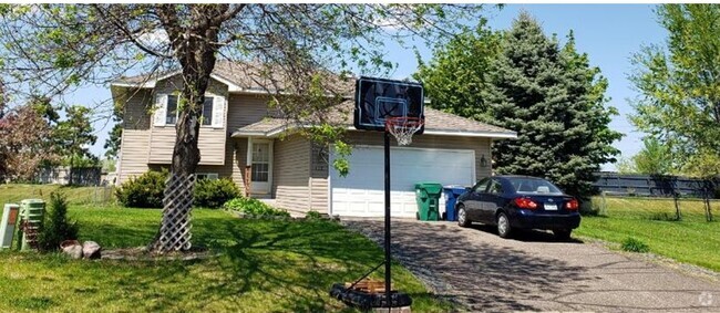
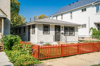
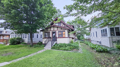
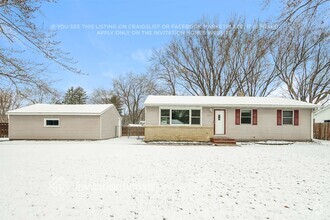
6219 Regent Ave N
Minneapolis, MN 55429
Today
Favorites
651-789-9536
-
Bedrooms
3
-
Bathrooms
1
-
Square Feet
1,479 sq ft
-
Available
Available May 9
6219 Regent Ave N

Favorites
About This Home
$2,195 deposit,
Available May 9
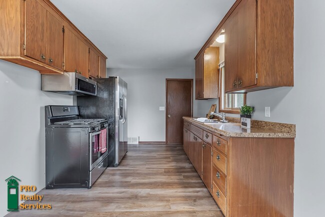
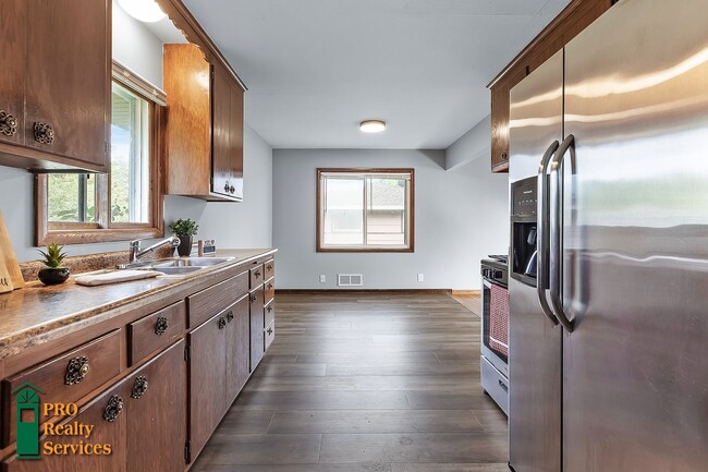
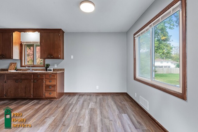
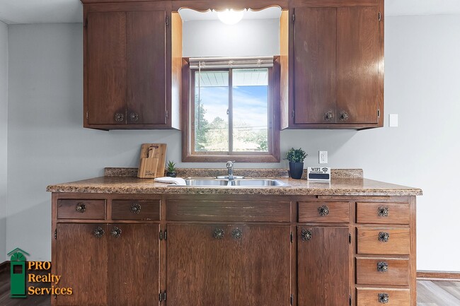
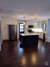
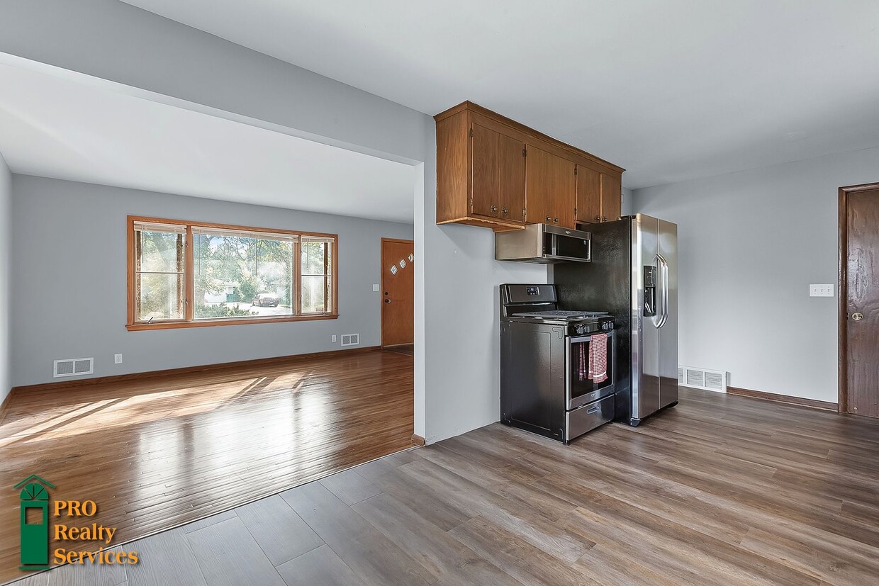
3 bedroom, 1 bathroom home with stainless steel kitchen appliances, LVT flooring, hardwood floors, a bonus living room space, an unfinished basement with laundry, a patio, a huge partially fenced in backyard, and a 1 car attached garage! All bedrooms are located on the upper level. Video Link: SHOWINGS: Go here to apply or schedule a showing: prs.rentals or call David with PRO Realty Services today at ! Utilities paid by resident: Electricity, Gas, Water/Sewer, & Trash A monthly utility billing fee of $8 may be charged to offset administrative costs. Many homes for rent are currently occupied. Please respect the convenience and privacy of our residents. Showings are by appointment only. One month rent and security deposit due at lease signing. Qualifications: Max occupants: 6. Must have satisfactory rental history, must pass criminal history background check and must have documented income of 2.5 times the monthly rent, pet subject to approval and additional rent may apply, no recent evictions. Property is not Section 8. Please see detailed rental criteria on our application. PRO Realty Services is the property owner’s agent and has no ownership interest in the properties it manages.
6219 Regent Ave N is a house located in Hennepin County and the 55429 ZIP Code. This area is served by the Osseo Public attendance zone.
* Price shown is base rent and may not include non-optional fees and utilities.
Price, availability, fees, and any applicable rent special are subject to change without notice.
* Square footage definitions vary. Displayed square footage is approximate.
Contact
- Listed by PRO Realty Services | PRO Realty Services
- Phone Number
- Contact
Location
Get Directions
The Skyway neighborhood consists of the businesses, shops, and apartments that line the Minneapolis Skyway System. A climate-controlled series of pedestrian footbridges, located one or two stories above ground, the Minneapolis Skyway links multiple buildings over a eighty-block area of downtown Minneapolis.
The Skyway System hosts thousands of commuters and visitors every day. If you live in an apartment connected to the Skyway System and work in one of the major buildings in downtown Minneapolis, you can avoid stepping outside all winter long, as the Skyway provides access to home, work, shops, entertainment from theater to professional sports, and almost everything else you could possibly need.
Learn more about living in Skyway
Education
| Colleges & Universities | Distance | ||
|---|---|---|---|
| Colleges & Universities | Distance | ||
| Drive: | 9 min | 4.3 mi | |
| Drive: | 16 min | 10.8 mi | |
| Drive: | 18 min | 11.2 mi | |
| Drive: | 22 min | 12.6 mi |
6219 Regent Ave N is within 9 minutes or 4.3 miles from North Hennepin Comm. Coll.. It is also near University of St. Thomas and Minneapolis College.
Schools


Public Elementary School
Grades PK-5
335 Students
Attendance Zone
Public Middle School
Grades 6-8
978 Students
Attendance Zone
Public High School
Grades 9-12
1,908 Students
Attendance Zone
Private Elementary & Middle School
Grades PK-8
189 Students
Nearby
Private Elementary, Middle & High School
Grades PK-12
683 Students
Nearby
School data provided by
 The GreatSchools Rating helps parents compare schools within a state based on a variety of school quality indicators and provides a helpful picture of how effectively each school serves all of its students. Ratings are on a scale of 1 (below average) to 10 (above average) and can include test scores, college readiness, academic progress, advanced courses, equity, discipline and attendance data. We also advise parents to visit schools, consider other information on school performance and programs, and consider family needs as part of the school selection process.
View GreatSchools Rating Methodology
View GreatSchools Rating Methodology
Transportation options available in Minneapolis include Target Field Station Platform 2, located 10.0 miles from 6219 Regent Ave N. 6219 Regent Ave N is near Minneapolis-St Paul International/Wold-Chamberlain, located 21.8 miles or 35 minutes away.
| Transit / Subway | Distance | ||
|---|---|---|---|
| Transit / Subway | Distance | ||
| Drive: | 16 min | 10.0 mi | |
|
|
Drive: | 16 min | 10.2 mi |
|
|
Drive: | 16 min | 10.2 mi |
|
|
Drive: | 16 min | 10.3 mi |
|
|
Drive: | 17 min | 10.5 mi |
| Commuter Rail | Distance | ||
|---|---|---|---|
| Commuter Rail | Distance | ||
|
|
Drive: | 9 min | 5.1 mi |
|
|
Drive: | 16 min | 10.1 mi |
|
|
Drive: | 20 min | 11.7 mi |
|
|
Drive: | 23 min | 13.4 mi |
| Drive: | 24 min | 15.2 mi |
| Airports | Distance | ||
|---|---|---|---|
| Airports | Distance | ||
|
Minneapolis-St Paul International/Wold-Chamberlain
|
Drive: | 35 min | 21.8 mi |
Time and distance from 6219 Regent Ave N.
| Shopping Centers | Distance | ||
|---|---|---|---|
| Shopping Centers | Distance | ||
| Walk: | 18 min | 1.0 mi | |
| Walk: | 19 min | 1.0 mi | |
| Drive: | 5 min | 2.1 mi |
6219 Regent Ave N has 3 shopping centers within 2.1 miles, which is about a 5-minute walk. The miles and minutes will be for the farthest away property.
| Parks and Recreation | Distance | ||
|---|---|---|---|
| Parks and Recreation | Distance | ||
|
Shingle Creek Park
|
Drive: | 8 min | 3.5 mi |
|
Victory Park
|
Drive: | 8 min | 3.6 mi |
|
Bohanon Park
|
Drive: | 10 min | 4.1 mi |
|
North Mississippi Regional Park
|
Drive: | 9 min | 5.4 mi |
|
Carl Kroening Interpretive Center
|
Drive: | 9 min | 5.4 mi |
6219 Regent Ave N has 5 parks within 5.4 miles, including Shingle Creek Park, Victory Park, and Bohanon Park.
| Hospitals | Distance | ||
|---|---|---|---|
| Hospitals | Distance | ||
| Drive: | 10 min | 5.8 mi | |
| Drive: | 15 min | 9.8 mi | |
| Drive: | 19 min | 11.1 mi |
6219 Regent Ave N has 3 hospitals within 11.1 miles, the nearest is North Memorial Health which is 5.8 miles away and a 10 minute drive.
| Military Bases | Distance | ||
|---|---|---|---|
| Military Bases | Distance | ||
| Drive: | 30 min | 18.8 mi |
6219 Regent Ave N is 18.8 miles and a 30 minute drive from Fort Snelling Military Reservation.
You May Also Like
Similar Rentals Nearby
What Are Walk Score®, Transit Score®, and Bike Score® Ratings?
Walk Score® measures the walkability of any address. Transit Score® measures access to public transit. Bike Score® measures the bikeability of any address.
What is a Sound Score Rating?
A Sound Score Rating aggregates noise caused by vehicle traffic, airplane traffic and local sources
6219 Regent Ave N
Minneapolis, MN 55429