-
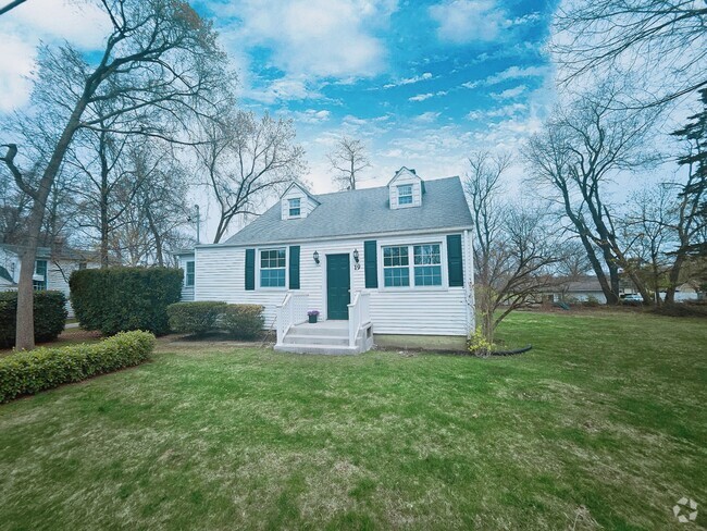
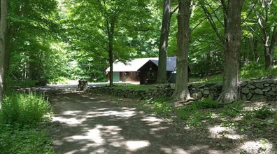
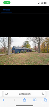
Cottage Exterior

-
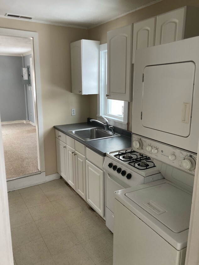
Kitchen
-
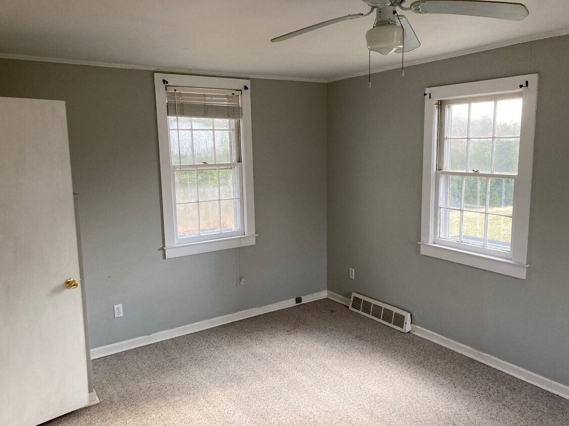
Bedroom image 1
-
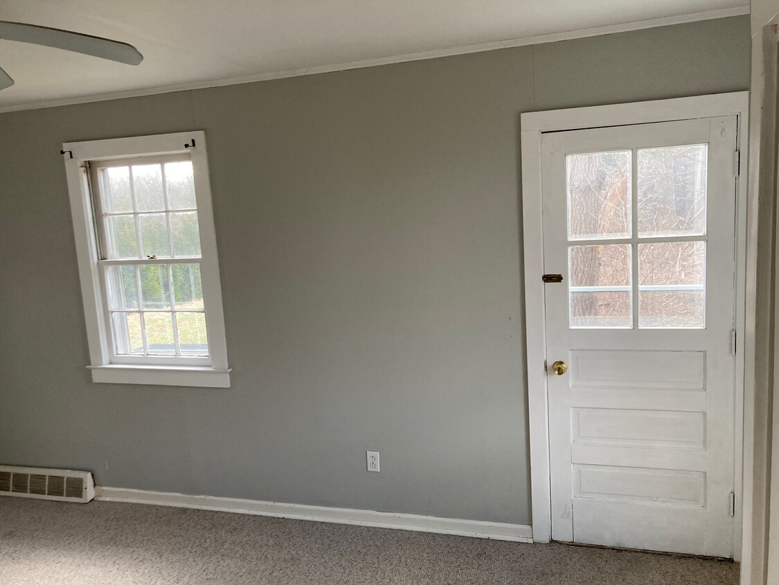
Bedroom image 2
$1,750 / Month
63 Norfield Rd
Weston, CT 06883
2 Weeks Ago
Favorites
63 Norfield Rd

Favorites
Check Back Soon for Upcoming Availability
| Beds | Baths | Average SF |
|---|---|---|
| 1 Bedroom 1 Bedroom 1 Br | 1 Bath 1 Bath 1 Ba | 650 SF |
About This Property
Cozy 1 bedroom cottage on large estate property in the very center of Weston. Very private but close to everything in Weston. True walking distance to schools. New washer / dryer. Electric and water included.
63 Norfield Rd is a house located in Fairfield County and the 06883 ZIP Code.
House Features
- Washer/Dryer
Fees and Policies
The fees below are based on community-supplied data and may exclude additional fees and utilities.
- Parking
-
Surface Lot--
Details
Utilities Included
-
Water
-
Electricity
-
Sewer
Location
Get Directions
Amenities
- Washer/Dryer
Expenses
Utilities Included
Water, Electricity, Sewer
Included
Education
| Colleges & Universities | Distance | ||
|---|---|---|---|
| Colleges & Universities | Distance | ||
| Drive: | 20 min | 11.1 mi | |
| Drive: | 21 min | 12.4 mi | |
| Drive: | 24 min | 14.5 mi | |
| Drive: | 27 min | 16.5 mi |
63 Norfield Rd is within 21 minutes or 12.4 miles from Fairfield University. It is also near Sacred Heart University and University of Bridgeport.
Transportation options available in Weston include Eastchester-Dyre Ave, located 36.5 miles from 63 Norfield Rd. 63 Norfield Rd is near Westchester County, located 27.6 miles or 42 minutes away, and Tweed/New Haven, located 35.3 miles or 54 minutes away.
| Transit / Subway | Distance | ||
|---|---|---|---|
| Transit / Subway | Distance | ||
|
|
Drive: | 54 min | 36.5 mi |
|
|
Drive: | 55 min | 37.0 mi |
|
|
Drive: | 56 min | 37.2 mi |
|
|
Drive: | 57 min | 37.6 mi |
|
|
Drive: | 57 min | 38.3 mi |
| Commuter Rail | Distance | ||
|---|---|---|---|
| Commuter Rail | Distance | ||
|
|
Drive: | 7 min | 4.1 mi |
|
|
Drive: | 9 min | 4.2 mi |
|
|
Drive: | 11 min | 6.3 mi |
|
|
Drive: | 12 min | 6.3 mi |
|
|
Drive: | 13 min | 6.9 mi |
| Airports | Distance | ||
|---|---|---|---|
| Airports | Distance | ||
|
Westchester County
|
Drive: | 42 min | 27.6 mi |
|
Tweed/New Haven
|
Drive: | 54 min | 35.3 mi |
Time and distance from 63 Norfield Rd.
| Shopping Centers | Distance | ||
|---|---|---|---|
| Shopping Centers | Distance | ||
| Walk: | 6 min | 0.4 mi | |
| Drive: | 7 min | 4.1 mi | |
| Drive: | 8 min | 4.2 mi |
63 Norfield Rd has 3 shopping centers within 4.2 miles, which is about a 8-minute walk. The miles and minutes will be for the farthest away property.
| Parks and Recreation | Distance | ||
|---|---|---|---|
| Parks and Recreation | Distance | ||
|
Earthplace
|
Drive: | 12 min | 5.5 mi |
|
The Rolnick Observatory
|
Drive: | 12 min | 5.7 mi |
|
Weir Farm National Historic Site
|
Drive: | 16 min | 7.8 mi |
|
Woodcock Nature Center
|
Drive: | 19 min | 9.4 mi |
|
Connecticut Audubon Center at Fairfield
|
Drive: | 19 min | 10.4 mi |
63 Norfield Rd has 5 parks within 10.4 miles, including The Rolnick Observatory, Earthplace, and Connecticut Audubon Center at Fairfield.
| Hospitals | Distance | ||
|---|---|---|---|
| Hospitals | Distance | ||
| Drive: | 13 min | 7.0 mi | |
| Drive: | 15 min | 8.2 mi | |
| Drive: | 23 min | 14.7 mi |
63 Norfield Rd has 3 hospitals within 14.7 miles, the nearest is Silver Hill Hospital which is 7.0 miles away and a 13 minute drive.
| Military Bases | Distance | ||
|---|---|---|---|
| Military Bases | Distance | ||
| Drive: | 59 min | 38.4 mi | |
| Drive: | 128 min | 78.8 mi |
63 Norfield Rd is 38.4 miles from Camp Smith NY State Military, and is convenient to other military bases, including Eatons Neck CG Station North.
You May Also Like
Similar Rentals Nearby
What Are Walk Score®, Transit Score®, and Bike Score® Ratings?
Walk Score® measures the walkability of any address. Transit Score® measures access to public transit. Bike Score® measures the bikeability of any address.
What is a Sound Score Rating?
A Sound Score Rating aggregates noise caused by vehicle traffic, airplane traffic and local sources

63 Norfield Rd
Weston, CT 06883