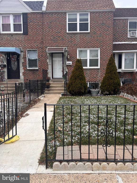
6330 Farnsworth St
Philadelphia, PA 19149
-
Bedrooms
3
-
Bathrooms
1
-
Square Feet
--
-
Available
Available Now
Highlights
- Straight Thru Architecture
- Double Pane Windows
- Patio
- 90% Forced Air Heating System
- Storm Doors

About This Home
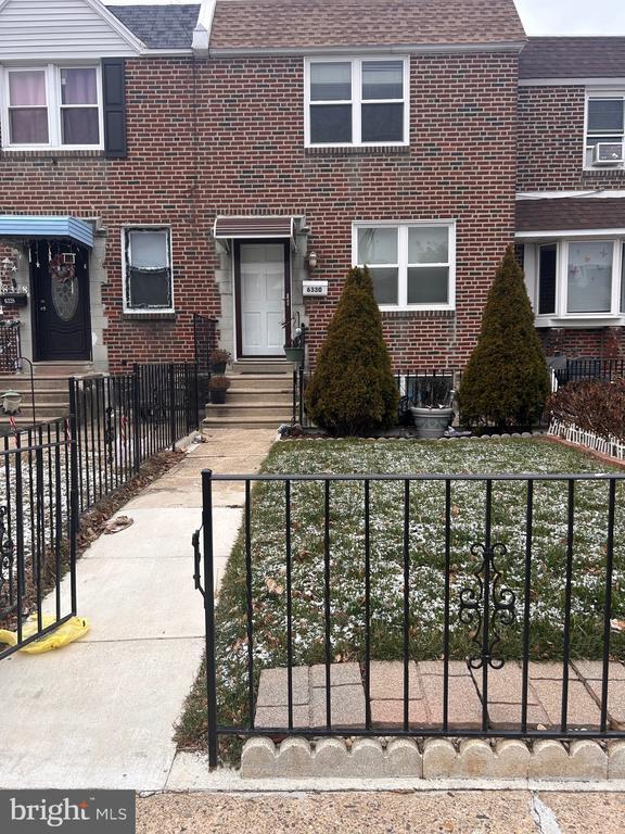
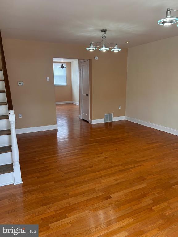
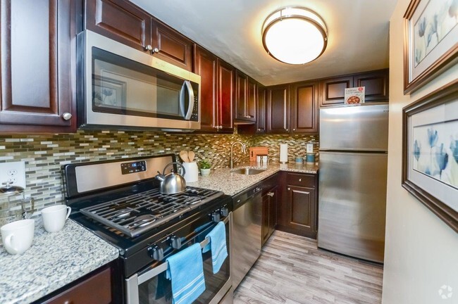
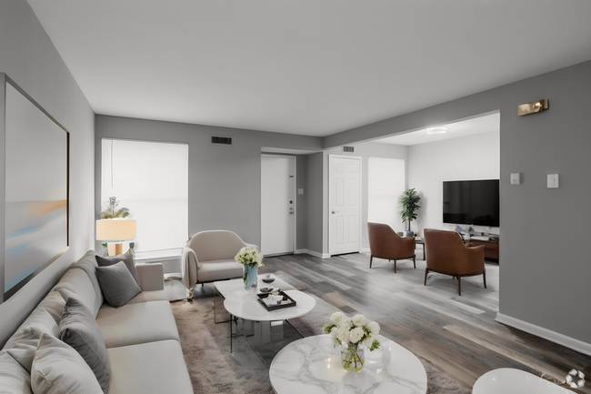
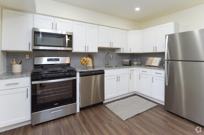
For Rent: 6330 Farnsworth St, Philadelphia, PA 19149 This well-maintained 3-bedroom, 1-bathroom townhouse in the Mayfair neighborhood offers 1,170 sq ft of comfortable living space. The property features a freshly painted interior, a tiled bathroom with an extended shower and separate bathtub, and a spacious living room with abundant natural light. Recent updates include new windows installed in 2021 (with a transferable warranty), a coated roof, and a new garage door. The lower level provides a walk-out entrance leading to a private driveway. Conveniently located near shopping centers, public transportation, schools, and major routes such as Route 1 and I-95. Property Details: Rent: $1,900 per month Bedrooms: 3 Bathrooms: 1 Square Footage: 1,170 sq ft Lot Size: 1,686 sq ft Year Built: 1950 MLS Number: PAPH2432318 Recent Updates: New windows installed in 2021 (transferable warranty) Roof coated in 2021 New garage door installed in 2021 Additional Features: Freshly painted interior Tiled bathroom with extended shower and separate bathtub Spacious living room with abundant natural light Potential to expand the kitchen into the dining room or add a deck Lower level with walk-out entrance to yard or private driveway Two-way street with parking on both sides and additional parking in the back Location Highlights: Close proximity to shopping centers Accessible to public transportation Nearby schools Easy access to Route 1 and I-95 Don't miss the opportunity to rent this beautifully maintained home in a prime location. Contact us today to schedule a viewing!
6330 Farnsworth St is a townhome located in Philadelphia County and the 19149 ZIP Code. This area is served by the The School District of Philadelphia attendance zone.
Home Details
Home Type
Year Built
Basement
Bedrooms and Bathrooms
Home Design
Home Security
Interior Spaces
Kitchen
Laundry
Listing and Financial Details
Lot Details
Outdoor Features
Parking
Utilities
Community Details
Overview
Pet Policy
Contact
- Listed by Johanna W Daye
- Phone Number (610) 909-8245
- Contact
-
Source
 Bright MLS, Inc.
- Basement
Located about nine miles northeast of Center City Philadelphia, Mayfair is a laidback suburban neighborhood home to a close-knit community. Mayfair is primarily residential, with most of its commercial offerings (shops, restaurants, and more) clustered on Roosevelt Boulevard and Frankford Avenue.
Excellent shopping is also easily accessible at the neighboring Roosevelt Mall. Mayfair residents also enjoy great recreational opportunities at Rolling Thunder Skating Center as well as nearby Pennypack Park and Wissinoming Park. Commuters delight in Mayfair’s convenience to the Frankford Transportation Center, affording residents easy access to Center City Philadelphia.
Learn more about living in Mayfair| Colleges & Universities | Distance | ||
|---|---|---|---|
| Colleges & Universities | Distance | ||
| Drive: | 9 min | 4.9 mi | |
| Drive: | 12 min | 5.8 mi | |
| Drive: | 13 min | 6.1 mi | |
| Drive: | 13 min | 6.5 mi |
Transportation options available in Philadelphia include Frankford Transportation Center, located 1.4 miles from 6330 Farnsworth St. 6330 Farnsworth St is near Philadelphia International, located 18.9 miles or 32 minutes away, and Trenton Mercer, located 24.2 miles or 40 minutes away.
| Transit / Subway | Distance | ||
|---|---|---|---|
| Transit / Subway | Distance | ||
|
|
Drive: | 3 min | 1.4 mi |
|
|
Drive: | 4 min | 2.0 mi |
|
|
Drive: | 5 min | 2.5 mi |
|
|
Drive: | 7 min | 3.0 mi |
|
|
Drive: | 8 min | 4.0 mi |
| Commuter Rail | Distance | ||
|---|---|---|---|
| Commuter Rail | Distance | ||
|
|
Drive: | 5 min | 1.8 mi |
|
|
Drive: | 6 min | 2.4 mi |
|
|
Drive: | 6 min | 2.4 mi |
|
|
Drive: | 6 min | 2.5 mi |
|
|
Drive: | 7 min | 3.5 mi |
| Airports | Distance | ||
|---|---|---|---|
| Airports | Distance | ||
|
Philadelphia International
|
Drive: | 32 min | 18.9 mi |
|
Trenton Mercer
|
Drive: | 40 min | 24.2 mi |
Time and distance from 6330 Farnsworth St.
| Shopping Centers | Distance | ||
|---|---|---|---|
| Shopping Centers | Distance | ||
| Walk: | 4 min | 0.2 mi | |
| Walk: | 6 min | 0.3 mi | |
| Walk: | 11 min | 0.6 mi |
| Parks and Recreation | Distance | ||
|---|---|---|---|
| Parks and Recreation | Distance | ||
|
Tacony Creek Park
|
Drive: | 6 min | 2.6 mi |
|
Insectarium
|
Drive: | 8 min | 2.7 mi |
|
Palmyra Cove Nature Park and Environmental Discovery Center
|
Drive: | 10 min | 2.8 mi |
|
Pennypack Park
|
Drive: | 7 min | 3.5 mi |
|
Lorimer Park
|
Drive: | 13 min | 5.7 mi |
| Hospitals | Distance | ||
|---|---|---|---|
| Hospitals | Distance | ||
| Drive: | 5 min | 2.6 mi | |
| Drive: | 6 min | 2.6 mi | |
| Drive: | 5 min | 2.6 mi |
| Military Bases | Distance | ||
|---|---|---|---|
| Military Bases | Distance | ||
| Drive: | 23 min | 13.3 mi |
You May Also Like
Similar Rentals Nearby
-
-
-
-
-
-
-
-
1 / 19
-
-
What Are Walk Score®, Transit Score®, and Bike Score® Ratings?
Walk Score® measures the walkability of any address. Transit Score® measures access to public transit. Bike Score® measures the bikeability of any address.
What is a Sound Score Rating?
A Sound Score Rating aggregates noise caused by vehicle traffic, airplane traffic and local sources
