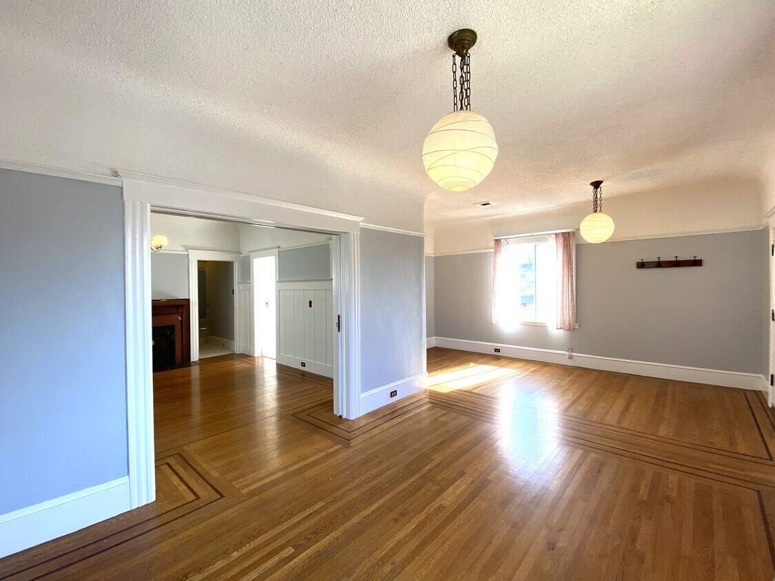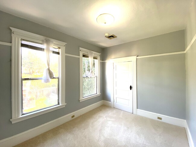
-
Monthly Rent
$4,500
-
Bedrooms
3 bd
-
Bathrooms
1 ba
-
Square Feet
1,400 sq ft
Details

 This Property
 Available Property
Upper Telegraph is a centrally located neighborhood in the city of Oakland. Upper Telegraph is home to numerous local staples like Bushrod Park and Community Garden, healthcare centers, and a busy commercial strip along Telegraph Avenue. Locals can easily shop in the neighborhood or head less than 10 miles south to Downtown Oakland for places like Jack London Square and the Uptown District. More great features offered by Downtown Oakland include scenic sites like the Bonsai Garden and Lake Merritt. While Downtown Oakland is Upper Telegraph’s southern neighbor, the city of Berkeley is the neighborhood’s northern neighbor. Downtown Berkeley, the University of California-Berkley, and several national and state parks sit just north of Upper Telegraph.
Learn more about living in Upper Telegraph| Colleges & Universities | Distance | ||
|---|---|---|---|
| Colleges & Universities | Distance | ||
| Drive: | 7 min | 2.3 mi | |
| Drive: | 7 min | 2.4 mi | |
| Drive: | 8 min | 2.4 mi | |
| Drive: | 7 min | 4.0 mi |
Transportation options available in Oakland include Rockridge Station, located 0.6 miles from 6380 Hillegass Ave Unit A. 6380 Hillegass Ave Unit A is near Metro Oakland International, located 13.1 miles or 20 minutes away, and San Francisco International, located 23.6 miles or 37 minutes away.
| Transit / Subway | Distance | ||
|---|---|---|---|
| Transit / Subway | Distance | ||
|
|
Walk: | 11 min | 0.6 mi |
|
|
Drive: | 3 min | 1.2 mi |
|
|
Drive: | 7 min | 2.3 mi |
|
|
Drive: | 9 min | 3.3 mi |
|
|
Drive: | 6 min | 3.6 mi |
| Commuter Rail | Distance | ||
|---|---|---|---|
| Commuter Rail | Distance | ||
|
|
Drive: | 7 min | 2.4 mi |
|
|
Drive: | 11 min | 3.8 mi |
|
|
Drive: | 8 min | 4.8 mi |
| Drive: | 18 min | 11.2 mi | |
| Drive: | 20 min | 12.4 mi |
| Airports | Distance | ||
|---|---|---|---|
| Airports | Distance | ||
|
Metro Oakland International
|
Drive: | 20 min | 13.1 mi |
|
San Francisco International
|
Drive: | 37 min | 23.6 mi |
Time and distance from 6380 Hillegass Ave Unit A.
| Shopping Centers | Distance | ||
|---|---|---|---|
| Shopping Centers | Distance | ||
| Walk: | 6 min | 0.3 mi | |
| Drive: | 4 min | 1.2 mi | |
| Drive: | 5 min | 1.4 mi |
| Parks and Recreation | Distance | ||
|---|---|---|---|
| Parks and Recreation | Distance | ||
|
Willard Park
|
Walk: | 15 min | 0.8 mi |
|
People's Park
|
Drive: | 4 min | 1.4 mi |
|
Temescal Regional Park
|
Drive: | 4 min | 1.6 mi |
|
Habitot Children's Museum
|
Drive: | 6 min | 2.0 mi |
|
Essig Museum of Entomology
|
Drive: | 9 min | 2.5 mi |
| Hospitals | Distance | ||
|---|---|---|---|
| Hospitals | Distance | ||
| Walk: | 9 min | 0.5 mi | |
| Drive: | 4 min | 1.3 mi | |
| Drive: | 6 min | 2.3 mi |
| Military Bases | Distance | ||
|---|---|---|---|
| Military Bases | Distance | ||
| Drive: | 18 min | 5.9 mi | |
| Drive: | 15 min | 6.6 mi |
You May Also Like
Similar Rentals Nearby
What Are Walk Score®, Transit Score®, and Bike Score® Ratings?
Walk Score® measures the walkability of any address. Transit Score® measures access to public transit. Bike Score® measures the bikeability of any address.
What is a Sound Score Rating?
A Sound Score Rating aggregates noise caused by vehicle traffic, airplane traffic and local sources
