
$1,350 / Month
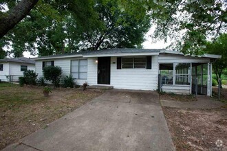
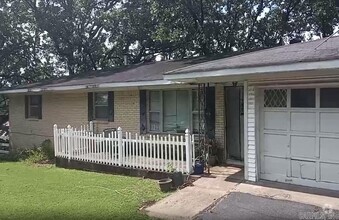
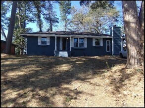
642 Stevenson St
Jacksonville, AR 72076
2 Weeks Ago
Favorites
642 Stevenson St

Favorites
Check Back Soon for Upcoming Availability
| Beds | Baths | Average SF |
|---|---|---|
| 4 Bedrooms 4 Bedrooms 4 Br | 2 Baths 2 Baths 2 Ba | 1,522 SF |
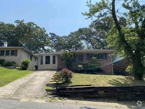
About This Property
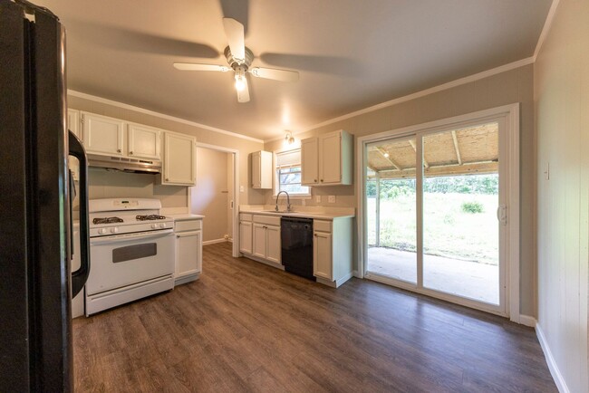
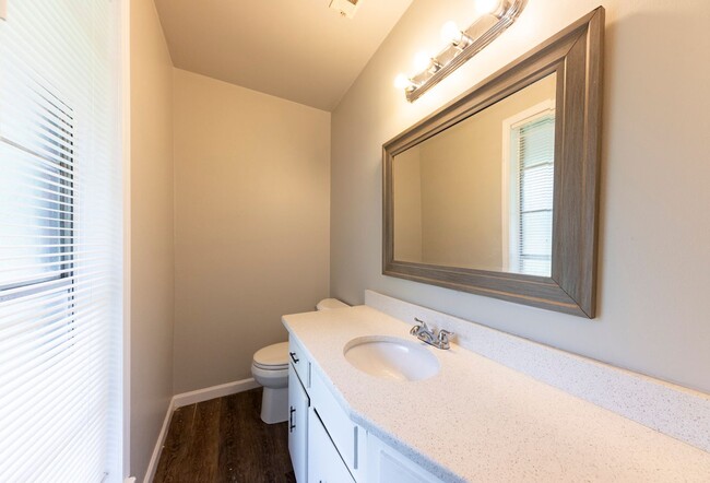
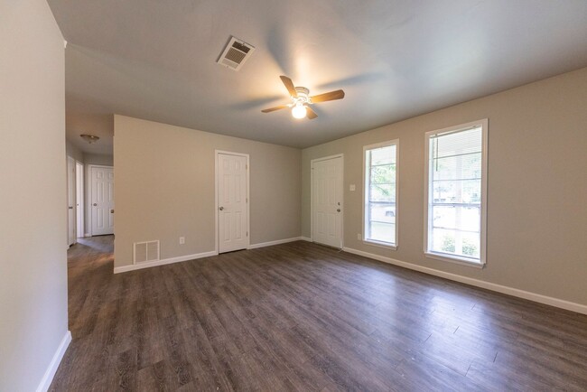
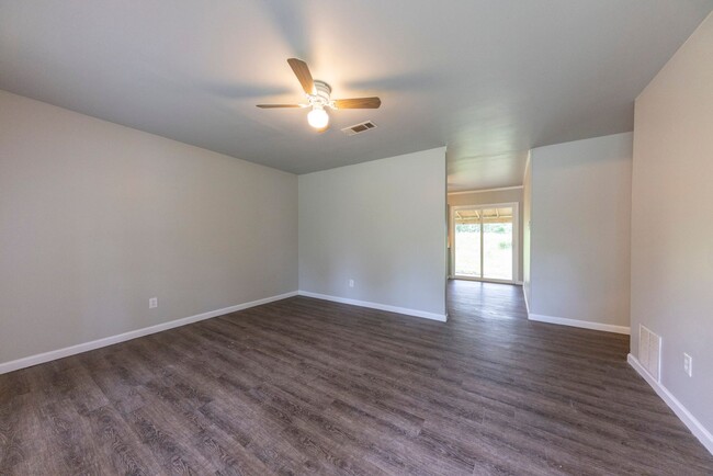
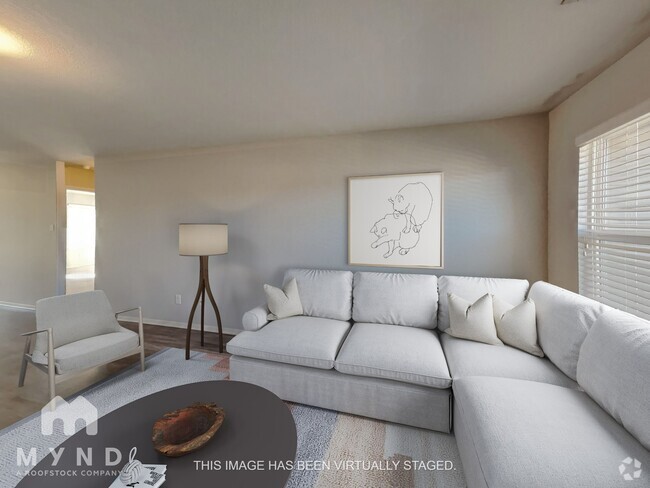
This 4 bedroom 2 bathroom house in Jacksonville is a great deal! This gorgeous home is ONLY $1,350 a month! This home offers plenty of space both indoors and outdoors with a 0.25 acre lot, storm cellar, and measuring over 1,500 sq ft! Fresh painting throughout the home and kitchen appliances included! Don't miss out on this deal! Apply Today! *No HUD, No Section 8, No Housing Vouchers*
642 Stevenson St is a house located in Pulaski County and the 72076 ZIP Code. This area is served by the Jacksonville North Pulaski attendance zone.
Property Address:
642 Stevenson St,
Jacksonville,
AR
72076
Jacksonville/Sherwood is a wooded area about 15 miles north of Little Rock. The community’s northern and western regions are mostly rural, but the town has a lot to offer. Jacksonville/ Sherwood has a diverse rental market with an abundance of affordable rental options. Modern amenities are located within and right outside of town, giving residents plenty of shopping and dining choices at places like McCain Mall and Lakewood Village. Outdoor recreation is abundant with forested parks and trails as well as the ones surrounding the Arkansas River. Commuters will appreciate Interstate 40 and Highway 167, which make traveling a breeze.
Learn more about living in Jacksonville/SherwoodBelow are rent ranges for similar nearby apartments
Education
| Colleges & Universities | Distance | ||
|---|---|---|---|
| Colleges & Universities | Distance | ||
| Drive: | 24 min | 15.5 mi | |
| Drive: | 24 min | 16.6 mi | |
| Drive: | 27 min | 18.3 mi | |
| Drive: | 31 min | 21.4 mi |
642 Stevenson St is within 24 minutes or 15.5 miles from Pulaski Technical College. It is also near Philander Smith College and Univ. of Ark. Medical Scis..
Schools


Public Elementary School
Grades K-5
351 Students
Attendance Zone
Public Elementary School
Grades PK-5
567 Students
Nearby
Public Elementary School
Grades K-5
350 Students
Nearby
Public Middle School
Grades 6-8
966 Students
Attendance Zone
Public High School
Grades 9-12
1,168 Students
Attendance Zone
Private Elementary, Middle & High School
Grades PK-12
24 Students
Nearby
School data provided by
 The GreatSchools Rating helps parents compare schools within a state based on a variety of school quality indicators and provides a helpful picture of how effectively each school serves all of its students. Ratings are on a scale of 1 (below average) to 10 (above average) and can include test scores, college readiness, academic progress, advanced courses, equity, discipline and attendance data. We also advise parents to visit schools, consider other information on school performance and programs, and consider family needs as part of the school selection process.
View GreatSchools Rating Methodology
View GreatSchools Rating Methodology
Transportation options available in Jacksonville include Main St & Bishop Lindsey Ave, located 14.2 miles from 642 Stevenson St. 642 Stevenson St is near Bill and Hillary Clinton Ntl/Adams Field, located 15.7 miles or 23 minutes away.
| Transit / Subway | Distance | ||
|---|---|---|---|
| Transit / Subway | Distance | ||
| Drive: | 20 min | 14.2 mi | |
| Drive: | 20 min | 14.3 mi | |
| Drive: | 20 min | 14.5 mi | |
| Drive: | 20 min | 14.5 mi | |
| Drive: | 20 min | 14.6 mi |
| Commuter Rail | Distance | ||
|---|---|---|---|
| Commuter Rail | Distance | ||
|
|
Drive: | 23 min | 16.0 mi |
| Airports | Distance | ||
|---|---|---|---|
| Airports | Distance | ||
|
Bill and Hillary Clinton Ntl/Adams Field
|
Drive: | 23 min | 15.7 mi |
Time and distance from 642 Stevenson St.
| Shopping Centers | Distance | ||
|---|---|---|---|
| Shopping Centers | Distance | ||
| Walk: | 18 min | 0.9 mi | |
| Drive: | 4 min | 1.8 mi | |
| Drive: | 4 min | 1.8 mi |
642 Stevenson St has 3 shopping centers within 1.8 miles, which is about a 4-minute walk. The miles and minutes will be for the farthest away property.
| Hospitals | Distance | ||
|---|---|---|---|
| Hospitals | Distance | ||
| Drive: | 6 min | 2.8 mi | |
| Drive: | 12 min | 8.4 mi | |
| Drive: | 16 min | 11.0 mi |
642 Stevenson St has 3 hospitals within 11.0 miles, the nearest is North Metro Medical Center which is 2.8 miles away and a 6 minute drive.
| Military Bases | Distance | ||
|---|---|---|---|
| Military Bases | Distance | ||
| Drive: | 17 min | 7.7 mi | |
| Drive: | 43 min | 25.0 mi | |
| Drive: | 49 min | 36.5 mi |
642 Stevenson St has 3 military bases within 36.5 miles, the nearest is Little Rock Air Force Base which is 7.7 miles away and a 17 minute drive.
You May Also Like
Similar Rentals Nearby
What Are Walk Score®, Transit Score®, and Bike Score® Ratings?
Walk Score® measures the walkability of any address. Transit Score® measures access to public transit. Bike Score® measures the bikeability of any address.
What is a Sound Score Rating?
A Sound Score Rating aggregates noise caused by vehicle traffic, airplane traffic and local sources
642 Stevenson St
Jacksonville, AR 72076