
$2,595 / Month
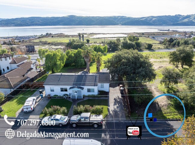
648 E I St
Benicia, CA 94510
Today
Favorites
707-297-6800
-
Bedrooms
2
-
Bathrooms
1
-
Square Feet
--
-
Available
Available Now
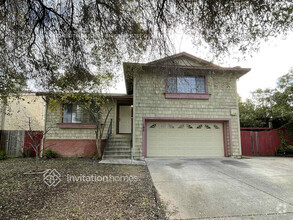
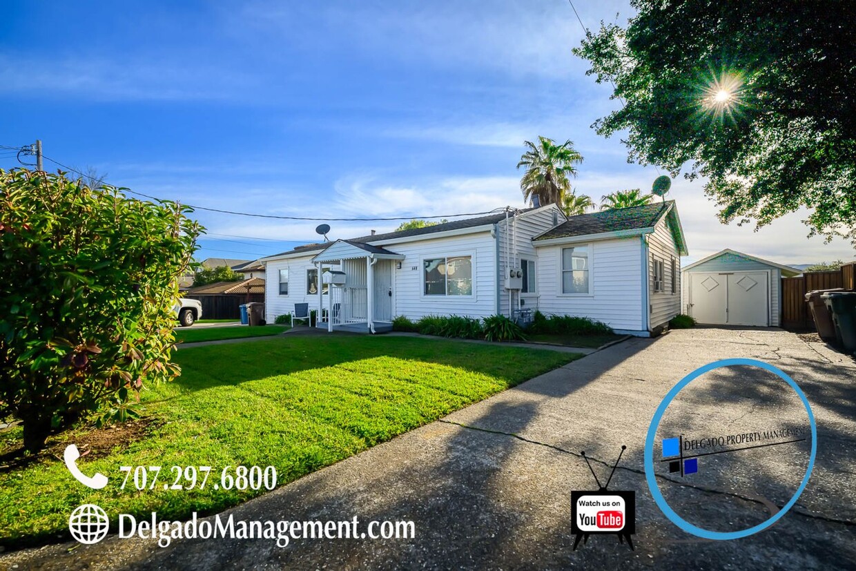
648 E I St

Favorites
About This Home
$2,595 deposit,
Available Now
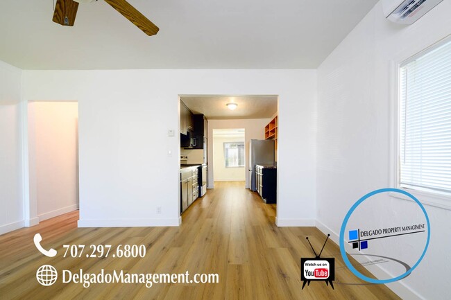
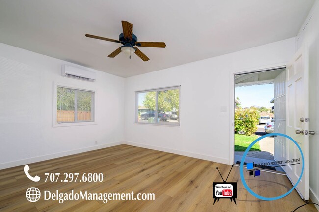
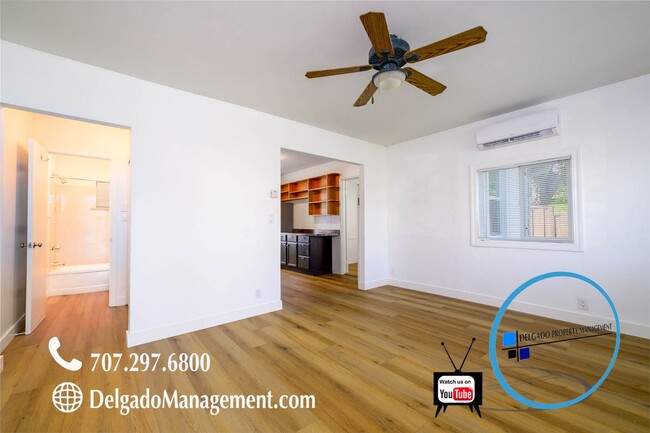
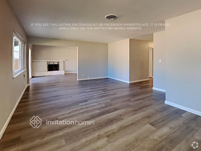
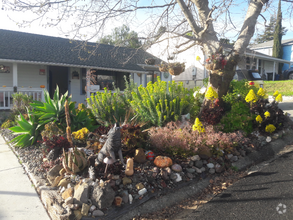
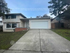
Beautiful home located in the heart of Benicia available now! Two bedrooms, one bath, living room, kitchen with all stainless steel appliances, and a washer and dryer. This beautiful home has been recently remodeled with new paint, new floors, new windows, AC units, detached garage, and so much more. Has an amazing large yard with partial water views perfect for outdoor gatherings. Only minutes from First Street where you can enjoy One House Bakery, The Loft Wine Bar, Palermos Italian Restaurant, Izaka Sushi, Benicia Antique Shop, Daughter of Luna Flower Shop, and so many more shops and restaurants you can enjoy. This location is hard to resist especially if you enjoy beautiful sunsets by the water! Don't miss out, call now and make Benicia your hometown! If you would like to check out a video of this property, please visit our website at delgadomanagement.c0m - Lease Duration 12 months - Must make 3 times the rent as income - $40 Application fee per adult - 2 Years of employment and rental history - Must carry renters insurance throughout tenancy - 650 or above credit score is required - Please submit your applications through Delgado Property Management website - We do not accept Zillow rental applications or any third party applications.
648 E I St is a house located in Solano County and the 94510 ZIP Code.
* Price shown is base rent and may not include non-optional fees and utilities.
Price, availability, fees, and any applicable rent special are subject to change without notice.
* Square footage definitions vary. Displayed square footage is approximate.
Contact
- Listed by Delgado Property Management Inc
- Phone Number (707) 297-6800
- Contact
$2,905 / month
$499,000 Listing Price
2 Beds
•1 Baths
•
811 Sq Ft
$2,725 / month
$399,000 Listing Price
2 Beds
•1 Baths
•
748 Sq Ft
$2,745 / month
$450,000 Listing Price
3 Beds
•1 Baths
•
966 Sq Ft
Location
Get Directions
Situated along the Carquinez Strait in the San Francisco Bay Area, Benicia is a scenic waterfront city rich in history, cultural amenities, and sweeping vistas. Benicia boasts an irresistible historic charm, especially in its quaint downtown area, which is brimming with one-of-a-kind shops, delectable eateries, and vibrant artists’ studios.
Founded in 1847, Benicia once served as California’s state capital for 13 months, and now touts the only state capitol building outside of Sacramento. Residents and visitors alike can uncover much of Benicia’s past at the Benicia Historical Museum.
Nearly 500 acres of parkland provides ample green space and tranquil trails for all kinds of outdoor recreation. Benicia’s thriving arts community creates a broad range of art, from glass art and sculptures to theatrical plays and music. Benicia’s friendly community comes together for a variety of events, like the Downtown Farmers Market, Opening Day on the Strait, and artist studio open houses.
Learn more about living in Benicia
Education
| Colleges & Universities | Distance | ||
|---|---|---|---|
| Colleges & Universities | Distance | ||
| Drive: | 15 min | 9.3 mi | |
| Drive: | 21 min | 11.9 mi | |
| Drive: | 23 min | 16.0 mi | |
| Drive: | 25 min | 18.2 mi |
648 E I St is within 15 minutes or 9.3 miles from Diablo Valley, Pleasant Hill. It is also near Touro University California and Solano Community College.
Transportation options available in Benicia include North Concord Martinez Station, located 10.4 miles from 648 E I St. 648 E I St is near Metro Oakland International, located 36.7 miles or 49 minutes away, and San Francisco International, located 47.9 miles or 65 minutes away.
| Transit / Subway | Distance | ||
|---|---|---|---|
| Transit / Subway | Distance | ||
|
|
Drive: | 16 min | 10.4 mi |
|
|
Drive: | 17 min | 10.9 mi |
|
|
Drive: | 17 min | 12.2 mi |
|
|
Drive: | 18 min | 13.4 mi |
|
|
Drive: | 21 min | 16.7 mi |
| Commuter Rail | Distance | ||
|---|---|---|---|
| Commuter Rail | Distance | ||
|
|
Drive: | 9 min | 5.4 mi |
|
|
Drive: | 26 min | 20.0 mi |
|
|
Drive: | 29 min | 22.0 mi |
|
|
Drive: | 33 min | 25.9 mi |
|
|
Drive: | 35 min | 27.7 mi |
| Airports | Distance | ||
|---|---|---|---|
| Airports | Distance | ||
|
Metro Oakland International
|
Drive: | 49 min | 36.7 mi |
|
San Francisco International
|
Drive: | 65 min | 47.9 mi |
Time and distance from 648 E I St.
| Shopping Centers | Distance | ||
|---|---|---|---|
| Shopping Centers | Distance | ||
| Walk: | 11 min | 0.6 mi | |
| Walk: | 17 min | 0.9 mi | |
| Walk: | 18 min | 1.0 mi |
648 E I St has 3 shopping centers within 1.0 mile, which is about a 18-minute walk. The miles and minutes will be for the farthest away property.
| Parks and Recreation | Distance | ||
|---|---|---|---|
| Parks and Recreation | Distance | ||
|
Benicia Capitol State Historic Park
|
Walk: | 15 min | 0.8 mi |
|
Waterbird Regional Preserve
|
Drive: | 7 min | 4.3 mi |
|
Martinez Regional Shoreline
|
Drive: | 11 min | 4.8 mi |
|
Alhambra Creek Watershed
|
Drive: | 8 min | 5.4 mi |
|
Carquinez Strait Regional Shoreline
|
Drive: | 19 min | 12.2 mi |
648 E I St has 5 parks within 12.2 miles, including Benicia Capitol State Historic Park, Waterbird Regional Preserve, and Martinez Regional Shoreline.
| Hospitals | Distance | ||
|---|---|---|---|
| Hospitals | Distance | ||
| Drive: | 10 min | 6.0 mi | |
| Drive: | 13 min | 8.8 mi | |
| Drive: | 14 min | 9.9 mi |
648 E I St has 3 hospitals within 9.9 miles, the nearest is Contra Costa Regional Medical Center which is 6.0 miles away and a 10 minutes drive.
| Military Bases | Distance | ||
|---|---|---|---|
| Military Bases | Distance | ||
| Drive: | 4 min | 1.5 mi | |
| Drive: | 30 min | 13.1 mi |
648 E I St is 1.5 miles from Armory Vallejo, and is convenient to other military bases, including US Naval Station Port Chicago.
You May Also Like
Similar Rentals Nearby
-
-
-
-
 $6,0005 Beds, 3.5 Baths, 2,500 sq ftHouse for Rent
 -
 $3,7495 Beds, 3 Baths, 2,088 sq ftHouse for Rent
 -
-
-
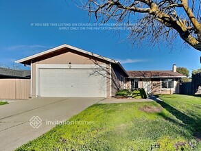 $2,8353 Beds, 1 Bath, 1,020 sq ftHouse for Rent
 -

-
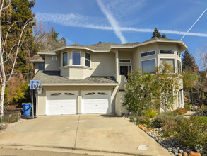 $5,9503 Beds, 2.5 Baths, 2,200 sq ftHouse for Rent

What Are Walk Score®, Transit Score®, and Bike Score® Ratings?
Walk Score® measures the walkability of any address. Transit Score® measures access to public transit. Bike Score® measures the bikeability of any address.
What is a Sound Score Rating?
A Sound Score Rating aggregates noise caused by vehicle traffic, airplane traffic and local sources
648 E I St
Benicia, CA 94510