65 Brainerd Rd
65 Brainerd Rd,
Boston,
MA
02134
2 Weeks Ago
Favorites
65 Brainerd Rd

Favorites
Check Back Soon for Upcoming Availability
About 65 Brainerd Rd Boston, MA 02134
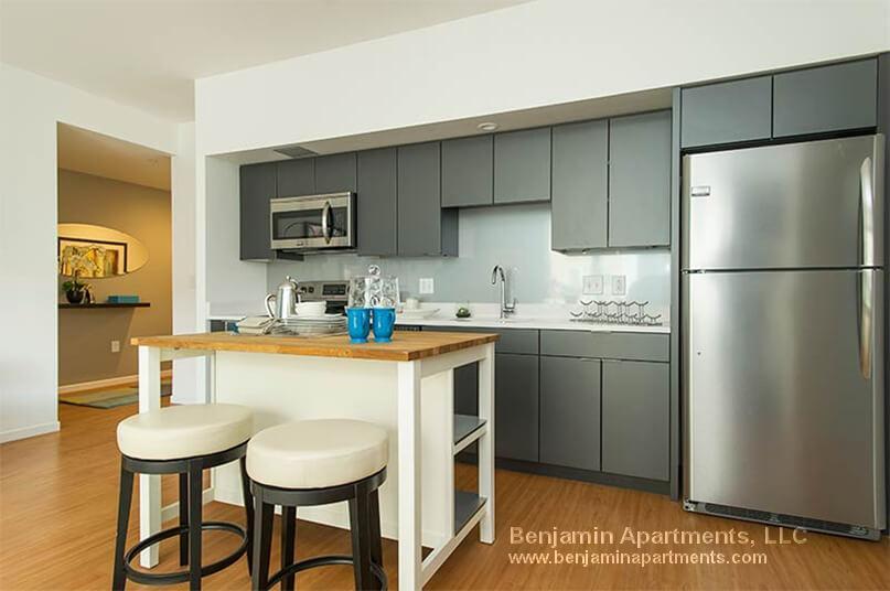
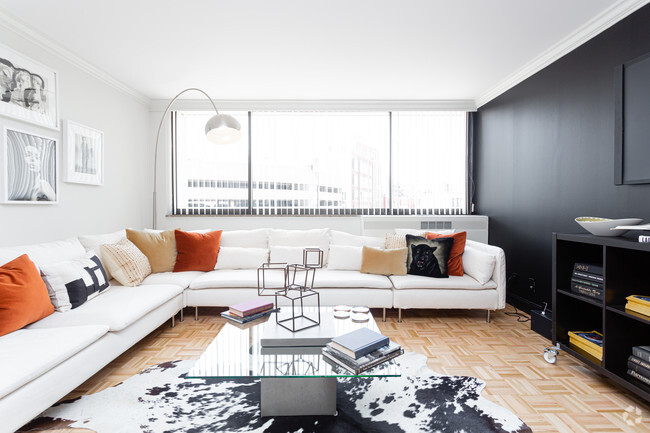
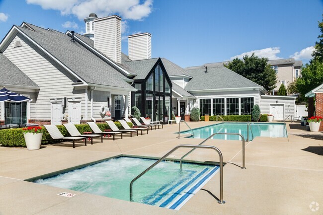
Stunning pet-friendly luxury building located in Allston. Features include - Washer/Dryer in-unit, common roof-deck, fitness center, outside patio, media & conference rooms & covered parking available for rent! ******** NO BROKER EEE ******* Available JUNE 4th. Transportation Bus: 65, Washington St @ Corey Rd (0.49 mi) Tram: B, Griggs Street (0.08 mi) Bus: 64, Cambridge St opp Hano St (0.45 mi) Bus: 57, Brighton Ave @ Linden St (0.39 mi) Bus: 66, Harvard St @ Verndale St (0.23 mi) Tram: C, Summit Avenue (0.62 mi)
65 Brainerd Rd is an apartment community located in Suffolk County and the 02134 ZIP Code.
Apartment Features
- Washer/Dryer
- Hardwood Floors
- Laundry Facilities
- Conference Rooms
- Fitness Center
- Patio
Fees and Policies
The fees below are based on community-supplied data and may exclude additional fees and utilities.
- Dogs Allowed
-
Fees not specified
- Cats Allowed
-
Fees not specified
Details
Lease Options
-
12 Months
Property Information
-
4 units
Location
Get Directions
Situated about five miles west of Downtown Boston, Commonwealth boasts a vibrant atmosphere with charming brick buildings, local shops, delectable restaurants, numerous entertainment options, lush parks and playgrounds, and a diverse population. Commonwealth is convenient to several renowned attractions, including the John Fitzgerald Kennedy National Historic Site, Coolidge Corner Theatre, Brookline Booksmith, and Brighton Music Hall.
Commonwealth residents also enjoy quick access to Boston College, making the area especially popular among the institution’s students, faculty, and staff. A host of T stops strewn along Commonwealth Avenue provide easy commutes and travels to Greater Boston as well as convenience to an array of metropolitan amenities.
Learn more about living in CommonwealthBelow are rent ranges for similar nearby apartments
| Beds | Average Size | Lowest | Typical | Premium |
|---|---|---|---|---|
| Studio Studio Studio | 3357-3358 Sq Ft | $1,600 | $2,299 | $12,869 |
| 1 Bed 1 Bed 1 Bed | 3441-3442 Sq Ft | $1,220 | $2,620 | $13,994 |
| 2 Beds 2 Beds 2 Beds | 3745-3746 Sq Ft | $2,000 | $3,287 | $25,723 |
| 3 Beds 3 Beds 3 Beds | 4841-4842 Sq Ft | $950 | $4,034 | $9,000 |
| 4 Beds 4 Beds 4 Beds | 5275-5276 Sq Ft | $800 | $5,394 | $23,500 |
Amenities
- Washer/Dryer
- Hardwood Floors
- Laundry Facilities
- Conference Rooms
- Patio
- Fitness Center
Education
| Colleges & Universities | Distance | ||
|---|---|---|---|
| Colleges & Universities | Distance | ||
| Drive: | 3 min | 1.4 mi | |
| Drive: | 5 min | 2.1 mi | |
| Drive: | 5 min | 2.1 mi | |
| Drive: | 6 min | 2.7 mi |
65 Brainerd Rd is within 3 minutes or 1.4 miles from Boston University. It is also near Simmons College and Boston College, Brighton.
Transportation options available in Boston include Griggs Street/Long Avenue Station, located 0.2 mile from 65 Brainerd Rd. 65 Brainerd Rd is near General Edward Lawrence Logan International, located 8.5 miles or 15 minutes away.
| Transit / Subway | Distance | ||
|---|---|---|---|
| Transit / Subway | Distance | ||
|
|
Walk: | 3 min | 0.2 mi |
|
|
Walk: | 4 min | 0.2 mi |
|
|
Walk: | 7 min | 0.4 mi |
|
|
Walk: | 9 min | 0.5 mi |
|
|
Walk: | 10 min | 0.6 mi |
| Commuter Rail | Distance | ||
|---|---|---|---|
| Commuter Rail | Distance | ||
|
|
Drive: | 5 min | 2.6 mi |
|
|
Drive: | 7 min | 2.9 mi |
|
|
Drive: | 8 min | 3.6 mi |
|
|
Drive: | 11 min | 4.4 mi |
| Drive: | 10 min | 5.2 mi |
| Airports | Distance | ||
|---|---|---|---|
| Airports | Distance | ||
|
General Edward Lawrence Logan International
|
Drive: | 15 min | 8.5 mi |
Time and distance from 65 Brainerd Rd.
| Shopping Centers | Distance | ||
|---|---|---|---|
| Shopping Centers | Distance | ||
| Walk: | 12 min | 0.6 mi | |
| Drive: | 3 min | 1.2 mi | |
| Drive: | 2 min | 1.3 mi |
65 Brainerd Rd has 3 shopping centers within 1.3 miles, which is about a 2-minute walk. The miles and minutes will be for the farthest away property.
| Parks and Recreation | Distance | ||
|---|---|---|---|
| Parks and Recreation | Distance | ||
|
John Fitzgerald Kennedy National Historic Site
|
Walk: | 12 min | 0.6 mi |
|
Coit Observatory
|
Drive: | 4 min | 1.8 mi |
|
Chestnut Hill Reservation
|
Drive: | 4 min | 2.0 mi |
|
Frederick Law Olmsted National Historic Site
|
Drive: | 6 min | 2.3 mi |
|
Charles River Reservation
|
Drive: | 6 min | 2.9 mi |
65 Brainerd Rd has 5 parks within 2.9 miles, including John Fitzgerald Kennedy National Historic Site, Coit Observatory, and Chestnut Hill Reservation.
| Hospitals | Distance | ||
|---|---|---|---|
| Hospitals | Distance | ||
| Walk: | 14 min | 0.7 mi | |
| Walk: | 14 min | 0.8 mi | |
| Drive: | 2 min | 1.2 mi |
65 Brainerd Rd has 3 hospitals within 1.2 miles, the nearest is Franciscan Children's Hospital & Rehab Center which is 0.7 mile away and a 14 minute walk.
| Military Bases | Distance | ||
|---|---|---|---|
| Military Bases | Distance | ||
| Drive: | 26 min | 13.8 mi | |
| Drive: | 25 min | 14.6 mi |
65 Brainerd Rd is 13.8 miles from Hanscom Air Force Base, and is convenient to other military bases, including US Military Reservation.
You May Also Like
Similar Rentals Nearby


What Are Walk Score®, Transit Score®, and Bike Score® Ratings?
Walk Score® measures the walkability of any address. Transit Score® measures access to public transit. Bike Score® measures the bikeability of any address.
What is a Sound Score Rating?
A Sound Score Rating aggregates noise caused by vehicle traffic, airplane traffic and local sources