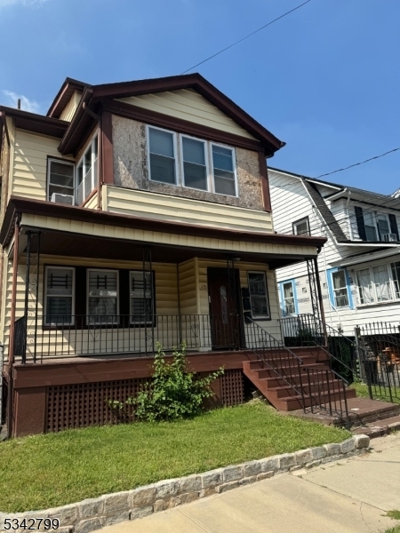
65 Monticello Ave
Newark, NJ 07106
-
Habitaciones
1
-
Baños
1
-
Pies cuadrados
--
-
Disponible
No está disponible

Acerca de esta casa
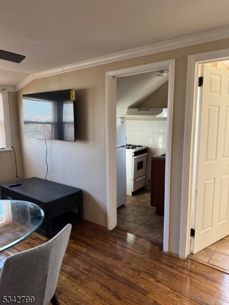
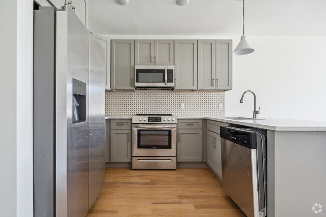
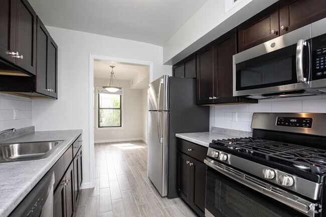
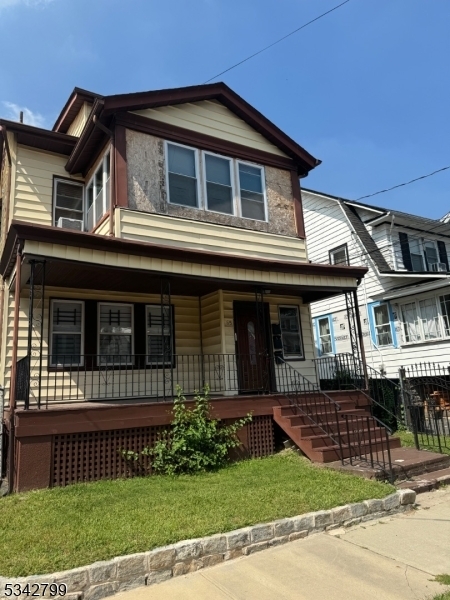
Excelente apartamento de 1 habitación, una casa para 3 familias muy bien mantenida, un espacio agradable ubicado en el tercer piso, convenientemente ubicado, recién pintado, muy limpio y esperando a su nuevo propietario. La propiedad está a unos minutos de Seton Hall, Mass Transit y todas las autopistas principales, a 5 minutos de SOPAC y la estación de tren de South Orange dentro y fuera de Nueva York. Todos los solicitantes deberán completar un formulario NTN, proporcionar recibos de pago y completar la solicitud de inquilino. No se admiten mascotas ni fumadores. Estacionamiento en la calle. La propiedad está vacía y es fácil de mostrar. Llame y muestre. Use el tiempo de visualización para una respuesta más inmediata. Envíe un mensaje de texto a LA. La propiedad también está parcialmente amueblada. No puede equivocarse. Esperando su llamada.
65 Monticello Ave se encuentra en Essex County en el código postal 07106.
Contactar
- Listado Por MELODY SCOTT | GardenStateMLS#NJ
- Número de Teléfono
- Contactar
-
Fuente
Garden State Multiple Listing Service, LLC
| Institutos y Universidades | Distancia de | ||
|---|---|---|---|
| Institutos y Universidades | Dist. | ||
| A pie: | 16 minutos | 0.9 mi | |
| En coche: | 8 minutos | 3.6 mi | |
| En coche: | 7 minutos | 3.6 mi | |
| En coche: | 8 minutos | 3.9 mi |
Las opciones de transporte disponibles en Newark incluyen Norfolk Street, a 3.4 millas de 65 Monticello Ave. 65 Monticello Ave está cerca de Newark Liberty International, a 8.4 millas o 14 minutos de distancia, y de Laguardia, a 31.1 millas o 48 minutos de distancia.
| Tránsito / metro | Distancia de | ||
|---|---|---|---|
| Tránsito / metro | Dist. | ||
|
|
En coche: | 7 minutos | 3.4 mi |
|
|
En coche: | 7 minutos | 3.5 mi |
|
|
En coche: | 7 minutos | 3.6 mi |
|
|
En coche: | 8 minutos | 4.0 mi |
|
|
En coche: | 10 minutos | 4.8 mi |
| Tren suburbano | Distancia de | ||
|---|---|---|---|
| Tren suburbano | Dist. | ||
|
|
En coche: | 4 minutos | 1.5 mi |
|
|
En coche: | 6 minutos | 1.7 mi |
|
|
En coche: | 4 minutos | 1.9 mi |
|
|
En coche: | 5 minutos | 2.5 mi |
|
|
En coche: | 6 minutos | 2.9 mi |
| Aeropuertos | Distancia de | ||
|---|---|---|---|
| Aeropuertos | Dist. | ||
|
Newark Liberty International
|
En coche: | 14 minutos | 8.4 mi |
|
Laguardia
|
En coche: | 48 minutos | 31.1 mi |
Tiempo y distancia desde 65 Monticello Ave.
| Centros comerciales | Distancia de | ||
|---|---|---|---|
| Centros comerciales | Dist. | ||
| En coche: | 5 minutos | 1.6 mi | |
| En coche: | 5 minutos | 2.1 mi | |
| En coche: | 5 minutos | 2.2 mi |
| Parques y recreación | Distancia de | ||
|---|---|---|---|
| Parques y recreación | Dist. | ||
|
Newark Museum and Dreyfuss Planetarium
|
En coche: | 8 minutos | 4.0 mi |
|
Edison National Historic Site
|
En coche: | 9 minutos | 4.0 mi |
|
Greenwood Gardens
|
En coche: | 11 minutos | 5.1 mi |
|
Branch Brook Park
|
En coche: | 11 minutos | 5.2 mi |
|
Turtle Back Zoo
|
En coche: | 12 minutos | 5.5 mi |
| Medico | Distancia de | ||
|---|---|---|---|
| Medico | Dist. | ||
| En coche: | 4 minutos | 2.0 mi | |
| En coche: | 5 minutos | 2.6 mi | |
| En coche: | 8 minutos | 3.8 mi |
| Bases militares | Distancia de | ||
|---|---|---|---|
| Bases militares | Dist. | ||
| En coche: | 19 minutos | 12.2 mi | |
| En coche: | 25 minutos | 13.2 mi | |
| En coche: | 23 minutos | 13.6 mi |
También te puede gustar
Alquileres Similares Cercanos
¿Qué son las clasificaciones Walk Score®, Transit Score® y Bike Score®?
Walk Score® mide la viabilidad peatonal de cualquier dirección. Transit Score® mide el acceso a transporte público. Bike Score® mide la infraestructura de rutas para bicicletas de cualquier dirección.
¿Qué es una clasificación de puntaje de ruido?
La clasificación de puntaje de ruido es el conjunto del ruido provocado por el transito de vehículos o de aviones y de fuentes locales.
