
$1,300 / Month
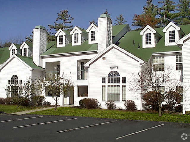
65 West St Unit 1
Auburn, MA 01501
2 Weeks Ago
Favorites
65 West St Unit 1

Favorites
Check Back Soon for Upcoming Availability
| Beds | Baths | Average SF |
|---|---|---|
| 1 Bedroom 1 Bedroom 1 Br | 1 Bath 1 Bath 1 Ba | 100 SF |
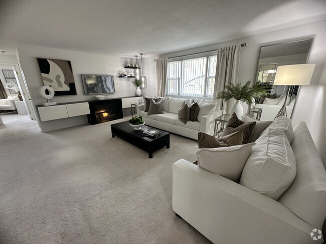
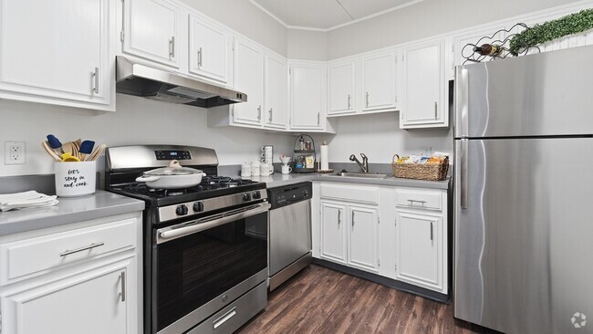
About This Property
Nice 1 Bedroom @ Elm Park! Just renovated with off street parking! Great Place!
65 West St is an apartment community located in Worcester County and the 01501 ZIP Code.
Location
Get Directions
Auburn sits along Interstate 290 nearly six miles south of Worcester and provides an even mix of small-town charisma with convenient, modern amenities. Auburn will delight all ages and interests with an array of affordable apartments and homes, as well as a variety of entertainment hotspots. Locals can enjoy the Massachusetts climate all year round thanks to places like Lemansky Park and the ice skating rink within it. Stick to Southbridge Street for the greatest selection of restaurants and more, including the Auburn Mall.
Those who commute into Worcester or anywhere else in the area will appreciate Auburn’s proximity to I-290, I-90, and I-395. Boston is just an hour’s drive east as well.
Learn more about living in Auburn
Education
| Colleges & Universities | Distance | ||
|---|---|---|---|
| Colleges & Universities | Distance | ||
| Drive: | 10 min | 6.0 mi | |
| Drive: | 13 min | 6.3 mi | |
| Drive: | 11 min | 7.2 mi | |
| Drive: | 16 min | 9.3 mi |
65 West St Unit 1 is within 10 minutes or 6.0 miles from College of the Holy Cross. It is also near Clark University and Becker College, Leicester.
Transportation options available in Auburn include Riverside Station, located 36.6 miles from 65 West St Unit 1. 65 West St Unit 1 is near Worcester Regional, located 8.8 miles or 19 minutes away.
| Transit / Subway | Distance | ||
|---|---|---|---|
| Transit / Subway | Distance | ||
|
|
Drive: | 47 min | 36.6 mi |
|
|
Drive: | 47 min | 36.9 mi |
|
|
Drive: | 48 min | 37.6 mi |
|
|
Drive: | 51 min | 39.2 mi |
| Commuter Rail | Distance | ||
|---|---|---|---|
| Commuter Rail | Distance | ||
|
|
Drive: | 11 min | 7.4 mi |
|
|
Drive: | 12 min | 7.5 mi |
|
|
Drive: | 21 min | 12.4 mi |
|
|
Drive: | 26 min | 16.2 mi |
|
|
Drive: | 34 min | 23.8 mi |
| Airports | Distance | ||
|---|---|---|---|
| Airports | Distance | ||
|
Worcester Regional
|
Drive: | 19 min | 8.8 mi |
Time and distance from 65 West St Unit 1.
| Shopping Centers | Distance | ||
|---|---|---|---|
| Shopping Centers | Distance | ||
| Walk: | 6 min | 0.4 mi | |
| Walk: | 13 min | 0.7 mi | |
| Walk: | 18 min | 0.9 mi |
65 West St Unit 1 has 3 shopping centers within 0.9 mile, which is about a 18-minute walk. The miles and minutes will be for the farthest away property.
| Parks and Recreation | Distance | ||
|---|---|---|---|
| Parks and Recreation | Distance | ||
|
Mass Audubon's Broad Meadow Brook Conservation Center and Wildlife Sanctuary
|
Drive: | 13 min | 7.6 mi |
|
EcoTarium
|
Drive: | 17 min | 9.2 mi |
|
Quinsigamond State Park
|
Drive: | 15 min | 9.7 mi |
|
Mass Audubon's Pierpont Meadow Wildlife Sanctuary
|
Drive: | 18 min | 10.2 mi |
|
Spencer State Forest
|
Drive: | 25 min | 12.4 mi |
65 West St Unit 1 has 5 parks within 12.4 miles, including Mass Audubon's Broad Meadow Brook Conservation Center and Wildlife Sanctuary, Mass Audubon's Pierpont Meadow Wildlife Sanctuary, and Spencer State Forest.
| Hospitals | Distance | ||
|---|---|---|---|
| Hospitals | Distance | ||
| Drive: | 12 min | 7.7 mi | |
| Drive: | 13 min | 8.4 mi | |
| Drive: | 15 min | 9.7 mi |
65 West St Unit 1 has 3 hospitals within 9.7 miles, the nearest is St. Vincent Hospital which is 7.7 miles away and a 12 minute drive.
| Military Bases | Distance | ||
|---|---|---|---|
| Military Bases | Distance | ||
| Drive: | 42 min | 30.3 mi |
65 West St Unit 1 is 30.3 miles and a 42 minute drive from US Military Reservation.
You May Also Like
Similar Rentals Nearby


What Are Walk Score®, Transit Score®, and Bike Score® Ratings?
Walk Score® measures the walkability of any address. Transit Score® measures access to public transit. Bike Score® measures the bikeability of any address.
What is a Sound Score Rating?
A Sound Score Rating aggregates noise caused by vehicle traffic, airplane traffic and local sources

65 West St
Auburn, MA 01501