-
Monthly Rent
Call for Rent
-
Bedrooms
2 bd
-
Bathrooms
2 ba
-
Square Feet
952 sq ft
Details

About This Property
---- SCHEDULE A SHOWING ONLINE AT: ----
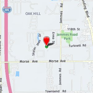
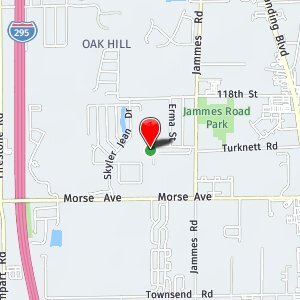
6523 Breezy Oaks Wy is an apartment community located in Duval County and the 32244 ZIP Code.
 This Property
 Available Property
Oak Hill is a residential neighborhood just 10 miles south of Jacksonville. The center of this wooded area is mainly residential, with low-rise apartments and ranch-style homes available for rent. The neighborhood’s eastern and western borders, Interstate 295 and Highway 21 respectively, have an abundance of shopping and dining options along them. Outdoor adventures await just outside of the neighborhood. To the east, residents can explore the banks of the Saint Johns River or travel a bit farther west to get to the pristine beaches of the Florida coast. Ponte Vedra Beach and Neptune Beach, as well as the Jacksonville Beach Pier, are all less than an hour from the center of Oak Hill.
Learn more about living in Oak Hill| Colleges & Universities | Distance | ||
|---|---|---|---|
| Colleges & Universities | Distance | ||
| Drive: | 21 min | 10.2 mi | |
| Drive: | 24 min | 11.5 mi | |
| Drive: | 30 min | 16.6 mi | |
| Drive: | 36 min | 16.9 mi |
Transportation options available in Jacksonville include Convention Center, located 10.6 miles from 6523 Breezy Oaks Wy Unit 201. 6523 Breezy Oaks Wy Unit 201 is near Jacksonville International, located 24.2 miles or 37 minutes away.
| Transit / Subway | Distance | ||
|---|---|---|---|
| Transit / Subway | Distance | ||
|
|
Drive: | 22 min | 10.6 mi |
|
|
Drive: | 22 min | 10.8 mi |
|
|
Drive: | 24 min | 11.4 mi |
|
|
Drive: | 24 min | 11.5 mi |
|
|
Drive: | 26 min | 13.4 mi |
| Commuter Rail | Distance | ||
|---|---|---|---|
| Commuter Rail | Distance | ||
|
|
Drive: | 24 min | 13.7 mi |
| Airports | Distance | ||
|---|---|---|---|
| Airports | Distance | ||
|
Jacksonville International
|
Drive: | 37 min | 24.2 mi |
Time and distance from 6523 Breezy Oaks Wy Unit 201.
| Shopping Centers | Distance | ||
|---|---|---|---|
| Shopping Centers | Distance | ||
| Drive: | 6 min | 1.9 mi | |
| Drive: | 7 min | 2.3 mi | |
| Drive: | 8 min | 2.5 mi |
| Parks and Recreation | Distance | ||
|---|---|---|---|
| Parks and Recreation | Distance | ||
|
Ringhaver Park
|
Drive: | 8 min | 2.6 mi |
|
McGirts Creek Park
|
Drive: | 10 min | 3.1 mi |
|
Fowler Regional Park
|
Drive: | 14 min | 6.8 mi |
|
The Cummer Museum of Art and Gardens
|
Drive: | 21 min | 8.9 mi |
|
Crystal Springs Road Park
|
Drive: | 20 min | 10.0 mi |
| Hospitals | Distance | ||
|---|---|---|---|
| Hospitals | Distance | ||
| Drive: | 13 min | 6.3 mi | |
| Drive: | 20 min | 8.2 mi | |
| Drive: | 20 min | 8.5 mi |
| Military Bases | Distance | ||
|---|---|---|---|
| Military Bases | Distance | ||
| Drive: | 19 min | 8.5 mi | |
| Drive: | 20 min | 10.1 mi |
You May Also Like
What Are Walk Score®, Transit Score®, and Bike Score® Ratings?
Walk Score® measures the walkability of any address. Transit Score® measures access to public transit. Bike Score® measures the bikeability of any address.
What is a Sound Score Rating?
A Sound Score Rating aggregates noise caused by vehicle traffic, airplane traffic and local sources

