6548 Cedar Waxwing St
North Las Vegas, NV 89084

Check Back Soon for Upcoming Availability
| Beds | Baths | Average SF |
|---|---|---|
| 4 Bedrooms 4 Bedrooms 4 Br | 2.5 Baths 2.5 Baths 2.5 Ba | 2,206 SF |
About This Property
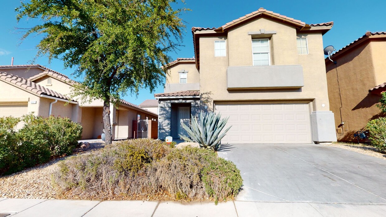
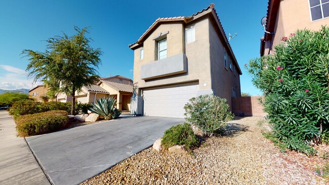
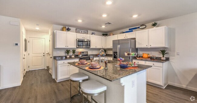
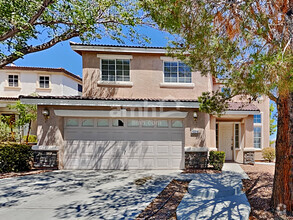
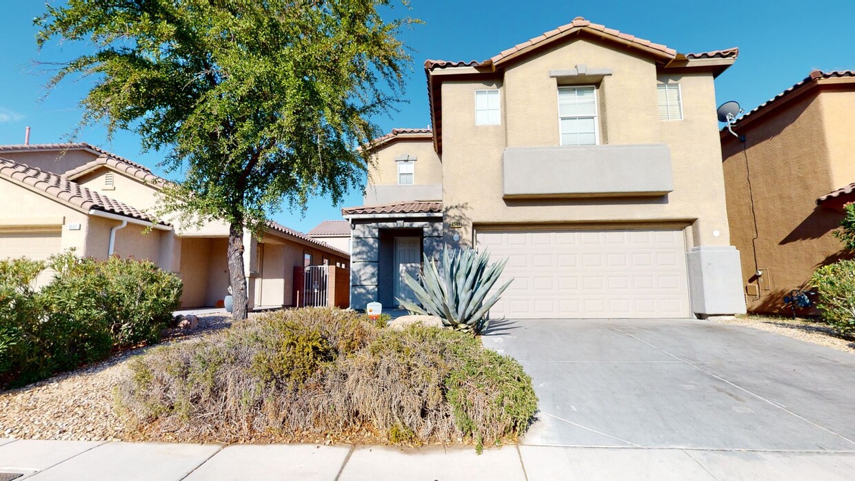
Beautiful 2 Story home fully upgraded 4 bedrooms 3 bathrooms 2 car garage. Ceiling fans in every room, upgraded kitchen, granite countertops, huge loft upstairs, and much more. Proximity to Costco, Walmart Supercenter, Walgreens, Seafood City, and 215. Your home is waiting for you! Must See!! Renter’s Insurance is required!
6548 Cedar Waxwing St is a house located in Clark County and the 89084 ZIP Code. This area is served by the Clark County attendance zone.
Aliante is one of Las Vegas’ premier destinations for entertainment seekers, families, and retirees. This neighborhood features lush green spaces and open desert fields. Aliante is home to the Tule Springs Fossil Beds National Monument. Residents and visitors come to this impressive desert park for hiking and admiring the remnants of the Ice Age through fossils. Family-friendly Aliante Nature Discovery Park offers a lake with a waterfall, a dinosaur-themed playground, and sports facilities including volleyball courts. Golf enthusiasts frequent the Aliante Golf Club. Residents certainly take full advantage of the gorgeous natural areas found in and around this neighborhood.
This small community embraces a relaxing, fun-filled lifestyle. The Aliante Casino and Hotel anchors Aliante and some would even consider it the heart of the neighborhood.
Learn more about living in AlianteBelow are rent ranges for similar nearby apartments
| Colleges & Universities | Distance | ||
|---|---|---|---|
| Colleges & Universities | Distance | ||
| Drive: | 19 min | 9.8 mi | |
| Drive: | 19 min | 10.2 mi | |
| Drive: | 21 min | 11.2 mi | |
| Drive: | 29 min | 15.2 mi |
Transportation options available in North Las Vegas include Sahara Station, located 12.1 miles from 6548 Cedar Waxwing St. 6548 Cedar Waxwing St is near Harry Reid International, located 16.4 miles or 31 minutes away, and Boulder City Municipal, located 36.4 miles or 51 minutes away.
| Transit / Subway | Distance | ||
|---|---|---|---|
| Transit / Subway | Distance | ||
|
|
Drive: | 22 min | 12.1 mi |
|
|
Drive: | 24 min | 12.5 mi |
|
|
Drive: | 23 min | 12.7 mi |
|
|
Drive: | 25 min | 13.4 mi |
|
|
Drive: | 25 min | 14.0 mi |
| Airports | Distance | ||
|---|---|---|---|
| Airports | Distance | ||
|
Harry Reid International
|
Drive: | 31 min | 16.4 mi |
|
Boulder City Municipal
|
Drive: | 51 min | 36.4 mi |
Time and distance from 6548 Cedar Waxwing St.
| Shopping Centers | Distance | ||
|---|---|---|---|
| Shopping Centers | Distance | ||
| Walk: | 15 min | 0.8 mi | |
| Walk: | 18 min | 1.0 mi | |
| Drive: | 5 min | 1.5 mi |
| Parks and Recreation | Distance | ||
|---|---|---|---|
| Parks and Recreation | Distance | ||
|
Spring Mountains National Recreation Area
|
Drive: | 10 min | 4.6 mi |
|
Craig Ranch Regional Park
|
Drive: | 12 min | 5.0 mi |
|
Floyd Lamb Park
|
Drive: | 17 min | 6.8 mi |
|
Springs Preserve
|
Drive: | 18 min | 9.3 mi |
|
College of Southern Nevada Planetarium
|
Drive: | 18 min | 9.5 mi |
| Hospitals | Distance | ||
|---|---|---|---|
| Hospitals | Distance | ||
| Drive: | 9 min | 5.9 mi | |
| Drive: | 14 min | 7.7 mi | |
| Drive: | 18 min | 9.9 mi |
| Military Bases | Distance | ||
|---|---|---|---|
| Military Bases | Distance | ||
| Drive: | 30 min | 15.4 mi |
You May Also Like
Similar Rentals Nearby
-
-
-
$3,2355 Beds, 3 Baths, 3,216 sq ftHouse for Rent
-
$2,3654 Beds, 2 Baths, 1,594 sq ftHouse for Rent
-
$2,2004 Beds, 2.5 Baths, 1,866 sq ftHouse for Rent
-
$2,7054 Beds, 3 Baths, 2,434 sq ftHouse for Rent
-
$2,1354 Beds, 3 Baths, 1,558 sq ftHouse for Rent
-
$2,3954 Beds, 3 Baths, 2,213 sq ftHouse for Rent
-
$2,1204 Beds, 2.5 Baths, 1,739 sq ftHouse for Rent
-
$2,9054 Beds, 3 Baths, 2,389 sq ftHouse for Rent
What Are Walk Score®, Transit Score®, and Bike Score® Ratings?
Walk Score® measures the walkability of any address. Transit Score® measures access to public transit. Bike Score® measures the bikeability of any address.
What is a Sound Score Rating?
A Sound Score Rating aggregates noise caused by vehicle traffic, airplane traffic and local sources
