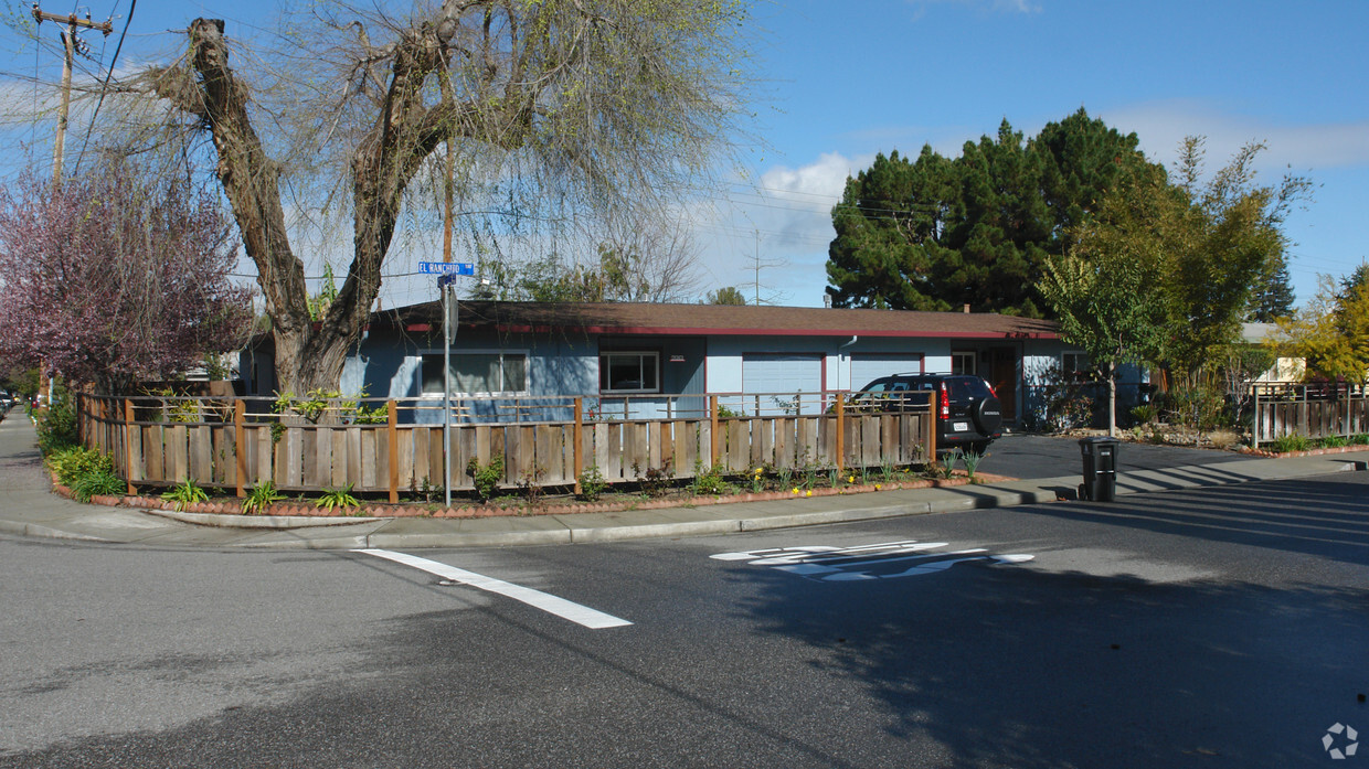
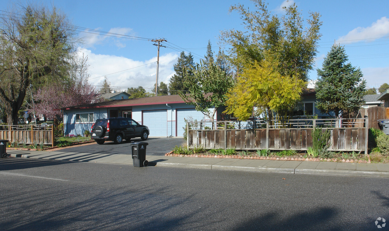
658-670 El Ranchito Way
658-670 El Ranchito Way,
Mountain View,
CA
94041
2 Weeks Ago
Favorites
658-670 El Ranchito Way
Favorites
Check Back Soon for Upcoming Availability
| Beds | Baths | Average SF | Availability |
|---|---|---|---|
| 2 Bedrooms 2 Bedrooms 2 Br | 1 Bath 1 Bath 1 Ba | — | Not Available |
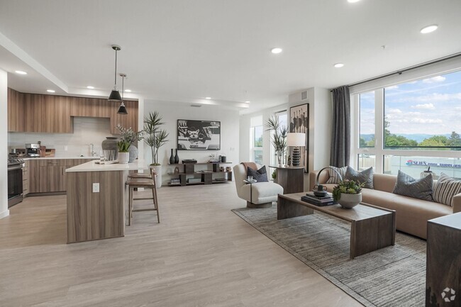
About 658-670 El Ranchito Way Mountain View, CA 94041
At 658-670 El Ranchito Way, experience great living. This community can be found on El Ranchito Way in the 94041 area of Mountain View. Make sure you to check out the apartment floorplan options. Here at this community, the professional leasing team is ready to help you find your perfect apartment. Stop by to find out the current floorplan availability.
658-670 El Ranchito Way is an apartment community located in Santa Clara County and the 94041 ZIP Code. This area is served by the Mountain View Whisman attendance zone.
Apartment Features
- High Speed Internet Access
- Smoke Free
- Balcony
Fees and Policies
Details
Property Information
-
Built in 1953
-
2 units/1 story
Location
Get Directions
Downtown Mountain View is largely concentrated on Castro Street, roughly between the Central Expressway in the north and El Camino Real in the south. The neighborhood is vibrant, boasting a slew of diverse restaurants, shops, cafes, and bars in a walkable locale. Downtown Mountain View also hosts a bevy of year-round events for the community, including the Farmer’s Market, Annual Spring Parade, Art and Wine Festival, and more.
Government buildings are clustered in the southern portion of the neighborhood, along with the Mountain View Public Library, Pioneer Memorial Park, Mountain View Center for the Performing Arts, and the sprawling Eagle Park. In addition to being close to these exciting amenities, Downtown Mountain View apartments are also convenient to multiple buses, commuter shuttles, and Caltrain lines.
Learn more about living in Downtown Mountain ViewBelow are rent ranges for similar nearby apartments
Amenities
- High Speed Internet Access
- Smoke Free
- Balcony
Education
| Colleges & Universities | Distance | ||
|---|---|---|---|
| Colleges & Universities | Distance | ||
| Drive: | 10 min | 4.1 mi | |
| Drive: | 11 min | 4.5 mi | |
| Drive: | 10 min | 5.6 mi | |
| Drive: | 16 min | 6.6 mi |
658-670 El Ranchito Way is within 10 minutes or 4.1 miles from Foothill College, Middlefield. It is also near Foothill Coll., Los Altos and De Anza College.
Schools


Public Elementary School
Grades K-5
367 Students
Nearby
Public Elementary School
Grades K-5
374 Students
Attendance Zone
Public Middle School
Grades 6-8
881 Students
Attendance Zone
Public High School
Grades 9-12
2,220 Students
Attendance Zone
Private Elementary & Middle School
Grades PK-8
188 Students
Nearby
Private Elementary & Middle School
Grades 1-8
13 Students
Nearby
Private Middle School
Grades 6-8
192 Students
Nearby
Private High School
Grades 9-12
130 Students
Nearby
School data provided by
 The GreatSchools Rating helps parents compare schools within a state based on a variety of school quality indicators and provides a helpful picture of how effectively each school serves all of its students. Ratings are on a scale of 1 (below average) to 10 (above average) and can include test scores, college readiness, academic progress, advanced courses, equity, discipline and attendance data. We also advise parents to visit schools, consider other information on school performance and programs, and consider family needs as part of the school selection process.
View GreatSchools Rating Methodology
View GreatSchools Rating Methodology
Transportation options available in Mountain View include Mountain View Station, located 1.3 miles from 658-670 El Ranchito Way. 658-670 El Ranchito Way is near Norman Y Mineta San Jose International, located 10.0 miles or 15 minutes away, and San Francisco International, located 27.1 miles or 35 minutes away.
| Transit / Subway | Distance | ||
|---|---|---|---|
| Transit / Subway | Distance | ||
|
|
Drive: | 3 min | 1.3 mi |
|
|
Drive: | 5 min | 1.8 mi |
|
|
Drive: | 5 min | 2.5 mi |
|
|
Drive: | 7 min | 3.4 mi |
|
|
Drive: | 7 min | 4.2 mi |
| Commuter Rail | Distance | ||
|---|---|---|---|
| Commuter Rail | Distance | ||
| Drive: | 3 min | 1.1 mi | |
| Drive: | 7 min | 3.2 mi | |
| Drive: | 8 min | 3.7 mi | |
| Drive: | 13 min | 5.8 mi | |
| Drive: | 11 min | 6.9 mi |
| Airports | Distance | ||
|---|---|---|---|
| Airports | Distance | ||
|
Norman Y Mineta San Jose International
|
Drive: | 15 min | 10.0 mi |
|
San Francisco International
|
Drive: | 35 min | 27.1 mi |
Time and distance from 658-670 El Ranchito Way.
| Shopping Centers | Distance | ||
|---|---|---|---|
| Shopping Centers | Distance | ||
| Walk: | 6 min | 0.4 mi | |
| Walk: | 7 min | 0.4 mi | |
| Walk: | 10 min | 0.6 mi |
658-670 El Ranchito Way has 3 shopping centers within 0.6 mile, which is about a 10-minute walk. The miles and minutes will be for the farthest away property.
| Parks and Recreation | Distance | ||
|---|---|---|---|
| Parks and Recreation | Distance | ||
|
Redwood Grove
|
Drive: | 10 min | 4.0 mi |
|
Terman Park
|
Drive: | 10 min | 4.2 mi |
|
Foothill College Observatory
|
Drive: | 12 min | 4.8 mi |
|
Stevens Creek Shoreline Nature Study Area
|
Drive: | 11 min | 5.0 mi |
|
Deer Hollow Farm
|
Drive: | 12 min | 6.2 mi |
658-670 El Ranchito Way has 5 parks within 6.2 miles, including Redwood Grove, Terman Park, and Stevens Creek Shoreline Nature Study Area.
| Hospitals | Distance | ||
|---|---|---|---|
| Hospitals | Distance | ||
| Drive: | 3 min | 1.3 mi | |
| Drive: | 13 min | 6.3 mi | |
| Drive: | 13 min | 6.5 mi |
658-670 El Ranchito Way has 3 hospitals within 6.5 miles, the nearest is El Camino Hospital which is 1.3 miles away and a 3 minute drive.
| Military Bases | Distance | ||
|---|---|---|---|
| Military Bases | Distance | ||
| Drive: | 10 min | 4.1 mi |
658-670 El Ranchito Way is 4.1 miles and a 10 minute drive from Ames Research Center.
You May Also Like
What neighborhood is the property located in?
658-670 El Ranchito Way Mountain View, CA 94041 is in Downtown Mountain View in the city of Mountain View. Here you’ll find three shopping centers within 0.6 mile of the property. Five parks are within 6.2 miles, including Redwood Grove, Terman Park, and Stevens Creek Shoreline Nature Study Area.
Similar Rentals Nearby


What Are Walk Score®, Transit Score®, and Bike Score® Ratings?
Walk Score® measures the walkability of any address. Transit Score® measures access to public transit. Bike Score® measures the bikeability of any address.
What is a Sound Score Rating?
A Sound Score Rating aggregates noise caused by vehicle traffic, airplane traffic and local sources

658-670 El Ranchito Way
Mountain View, CA 94041
Responded To This Review