

$6,000 / Month
66 Central St
Waltham, MA 02453
Today
Favorites
-
Bedrooms
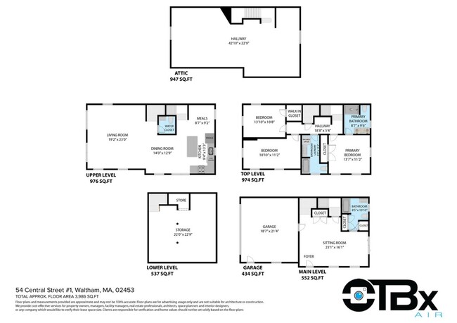
5
-
Bathrooms
3.5
-
Square Feet
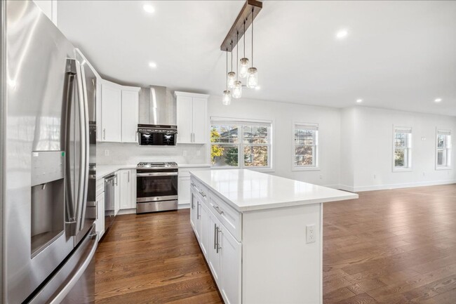
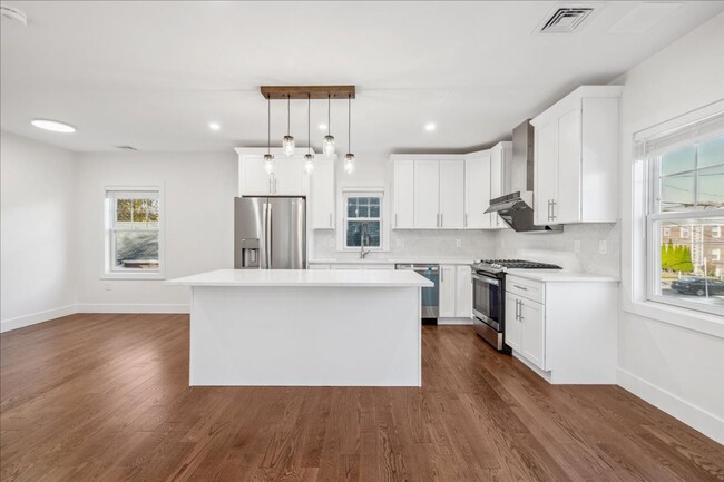
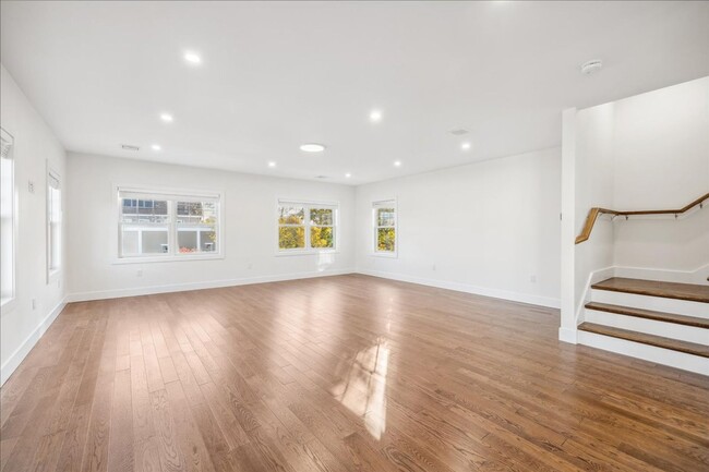
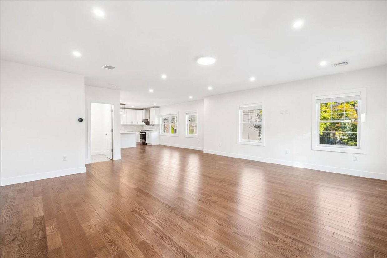
3,986 sq ft
66 Central St

Favorites
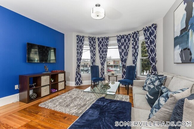
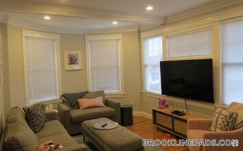
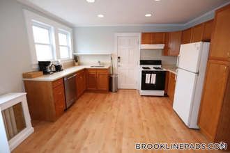
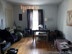
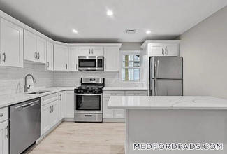
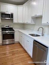
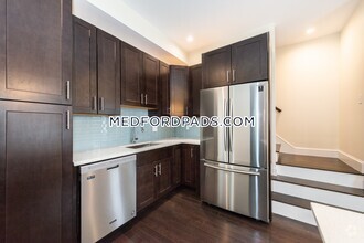
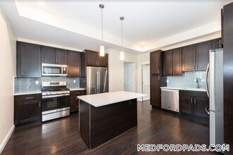
About This Home
Transportation Bus: 553 Elm St @ Main St (0.19 mi) Bus: 70 Main St @ Appleton St (0.11 mi) Bus: 505 Lexington St @ School St (0.27 mi) Bus: 554 School St @ Lexington St (0.27 mi) Rail: Fitchburg Line Waltham (0.23 mi) Bus: 558 River St @ Jackson St (0.08 mi)
66 Central St is a condo located in Middlesex County and the 02453 ZIP Code.
* Price shown is base rent and may not include non-optional fees and utilities.
Price, availability, fees, and any applicable rent special are subject to change without notice.
* Square footage definitions vary. Displayed square footage is approximate.
Location
Get Directions
Curved along the Charles River and bounded by Main Street, Waltham’s Bleachery is a quaint neighborhood, home to the Charles River Museum of Industry and Innovation. Celebrating Waltham as the foundation of the American Industrial Revolution, the popular museum aims to inspire innovation by examining the impact of industry on American culture.
The Bleachery is close to a number of universities, including Bentley University, University of Massachusetts College of Agriculture, and Brandeis University, making it a favored neighborhood for students and faculty alike. Residents enjoy access to the Colonial Shopping Mall and the Moody Street retail district. Many nearby parks offer options for hiking, biking, and playing sports.
Less than three miles from both Newton and Watertown, the Bleachery is also within close proximity to Cambridge and Boston. Access to public transportation and major roadways makes commuting and traveling from the Bleachery a breeze.
Learn more about living in Bleachery
Education
| Colleges & Universities | Distance | ||
|---|---|---|---|
| Colleges & Universities | Distance | ||
| Drive: | 4 min | 1.5 mi | |
| Drive: | 6 min | 2.3 mi | |
| Drive: | 13 min | 5.5 mi | |
| Drive: | 12 min | 5.9 mi |
66 Central St is within 4 minutes or 1.5 miles from Bentley University. It is also near Brandeis University and Boston College, Brighton.
Transportation options available in Waltham include Riverside Station, located 3.5 miles from 66 Central St. 66 Central St is near General Edward Lawrence Logan International, located 13.8 miles or 24 minutes away, and Worcester Regional, located 41.2 miles or 59 minutes away.
| Transit / Subway | Distance | ||
|---|---|---|---|
| Transit / Subway | Distance | ||
|
|
Drive: | 8 min | 3.5 mi |
|
|
Drive: | 8 min | 3.7 mi |
|
|
Drive: | 9 min | 4.2 mi |
|
|
Drive: | 10 min | 4.5 mi |
|
|
Drive: | 10 min | 4.7 mi |
| Commuter Rail | Distance | ||
|---|---|---|---|
| Commuter Rail | Distance | ||
|
|
Walk: | 4 min | 0.2 mi |
| Walk: | 7 min | 0.4 mi | |
|
|
Drive: | 5 min | 2.3 mi |
|
|
Drive: | 8 min | 4.5 mi |
|
|
Drive: | 10 min | 5.9 mi |
| Airports | Distance | ||
|---|---|---|---|
| Airports | Distance | ||
|
General Edward Lawrence Logan International
|
Drive: | 24 min | 13.8 mi |
|
Worcester Regional
|
Drive: | 59 min | 41.2 mi |
Time and distance from 66 Central St.
| Shopping Centers | Distance | ||
|---|---|---|---|
| Shopping Centers | Distance | ||
| Walk: | 12 min | 0.6 mi | |
| Walk: | 16 min | 0.9 mi | |
| Walk: | 17 min | 0.9 mi |
66 Central St has 3 shopping centers within 0.9 mile, which is about a 17-minute walk. The miles and minutes will be for the farthest away property.
| Parks and Recreation | Distance | ||
|---|---|---|---|
| Parks and Recreation | Distance | ||
|
Beaver Brook Reservation
|
Drive: | 4 min | 2.1 mi |
|
Land's Sake Farm
|
Drive: | 8 min | 4.0 mi |
|
Mass Audubon's Habitat Education Center and Wildlife Sanctuary
|
Drive: | 9 min | 4.0 mi |
|
Hammond Pond Reservation
|
Drive: | 11 min | 5.4 mi |
|
Hemlock Gorge Reservation
|
Drive: | 12 min | 5.5 mi |
66 Central St has 5 parks within 5.5 miles, including Beaver Brook Reservation, Mass Audubon's Habitat Education Center and Wildlife Sanctuary, and Land's Sake Farm.
| Hospitals | Distance | ||
|---|---|---|---|
| Hospitals | Distance | ||
| Drive: | 3 min | 1.2 mi | |
| Drive: | 5 min | 2.6 mi | |
| Drive: | 8 min | 3.8 mi |
66 Central St has 3 hospitals within 3.8 miles, the nearest is Walden Behavioral Care which is 1.2 miles away and a 3 minutes drive.
| Military Bases | Distance | ||
|---|---|---|---|
| Military Bases | Distance | ||
| Drive: | 16 min | 7.8 mi | |
| Drive: | 21 min | 11.8 mi |
66 Central St is 7.8 miles from Hanscom Air Force Base, and is convenient to other military bases, including US Military Reservation.
You May Also Like
Similar Rentals Nearby
-
-
-
 $10,0005 Beds, 3 BathsApartment for Rent
 -
-
-
-
 $5,0004 Beds, 2 BathsApartment for Rent
 -
-
-
What Are Walk Score®, Transit Score®, and Bike Score® Ratings?
Walk Score® measures the walkability of any address. Transit Score® measures access to public transit. Bike Score® measures the bikeability of any address.
What is a Sound Score Rating?
A Sound Score Rating aggregates noise caused by vehicle traffic, airplane traffic and local sources
66 Central St
Waltham, MA 02453