$3,500 / Month
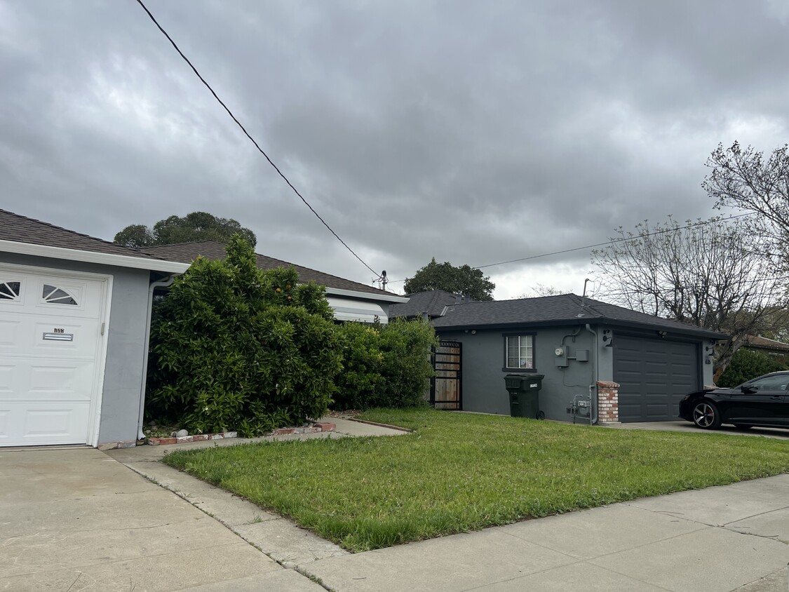
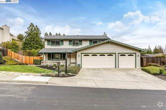
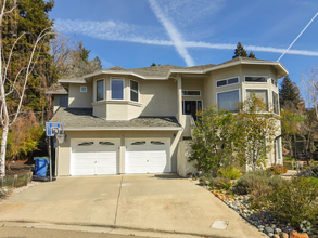
660 Andrews St
Livermore, CA 94551
Today
Favorites
925-443-3600
-
Bedrooms
3
-
Bathrooms
1
-
Square Feet
1,275 sq ft
-
Available
Available May 1
660 Andrews St

Favorites
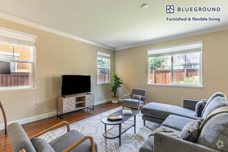
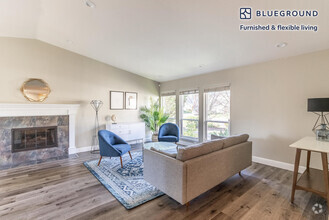
About This Home
$3,500 deposit,
Available May 1
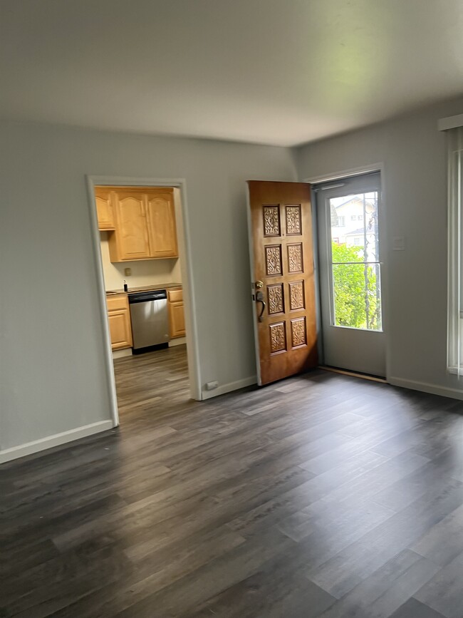
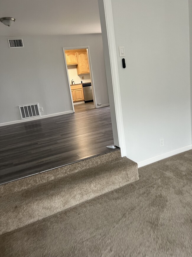
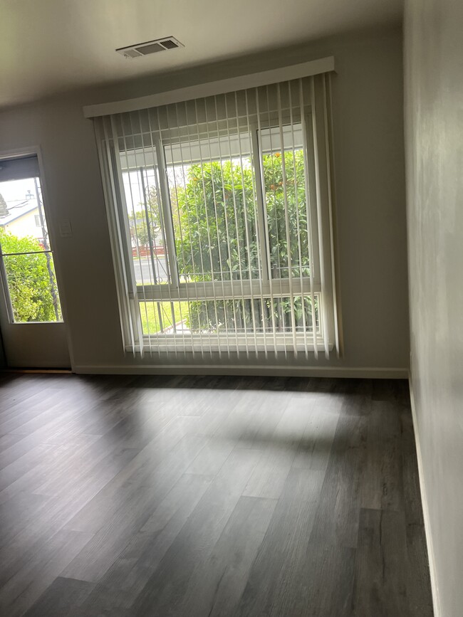
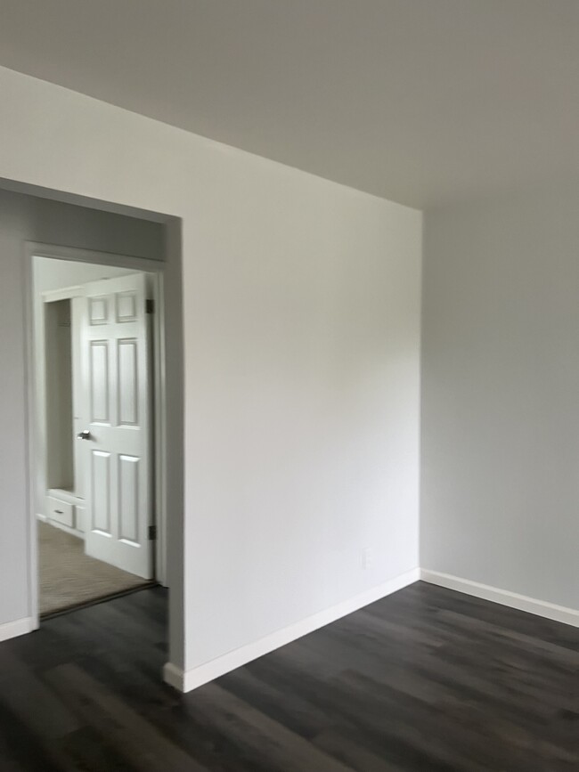
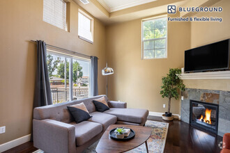
$3,500/mo, $3,500 Deposit * 3br/1ba 1275sqft. * Fenced backyard great for entertaining and BBQing * Garage, Driveway, and Street parking (follow posted street signs) * Tenant pays for all utilities: PG&E, water, garbage, Dish/cable/Internet/other communication services * NO SMOKING within the premises * NEWER flooring Renter's insurance required. Renter's Insurance policies are designed to cover YOU in the event of loss to your personal property and protect you in the event you are responsible for injury or property damage to others. A complete separate application is required from each adult (anyone 18 years and older) who intends to reside at the property. No smoking is allowed in the rental property or in any common areas that may affect other residents. A credit report will be obtained for each applicant. App of each prospective tenant 18 and over is required and must be approved for 1 year lease. No Pets except for service dogs or emotional support dogs with proper paperwork. Real Estate Depot 4749 Bennett Dr Suite E Livermore CA 94551 DRE#01476655 Call with any questions Unit amenities Air conditioner, Dishwasher, Disposal, Fenced yard, Garage parking, Heat, Kitchen island, Laundry hookup, Microwave, Pantry, Stove and oven, Vinyl floors, Window coverings
660 Andrews St is a house located in Alameda County and the 94551 ZIP Code. This area is served by the Livermore Valley Joint Unified attendance zone.
* Price shown is base rent and may not include non-optional fees and utilities.
Price, availability, fees, and any applicable rent special are subject to change without notice.
* Square footage definitions vary. Displayed square footage is approximate.
House Features
Air Conditioning
Dishwasher
Disposal
Range
- Air Conditioning
- Dishwasher
- Disposal
- Range
- Yard
Contact
- Listed by Tri
- Phone Number
- Contact
$3,267 / month
$565,000 Listing Price
3 Beds
•2 Baths
•
1,400 Sq Ft
$3,419 / month
$599,000 Listing Price
3 Beds
•1 Baths
•
1,130 Sq Ft
$3,999 / month
$699,000 Listing Price
3 Beds
•2 Baths
•
1,000 Sq Ft
Location
Get Directions
Amenities
- Air Conditioning
- Dishwasher
- Disposal
- Range
- Yard
About halfway between San Francisco and Modesto, Livermore’s local economy represents some of California’s oldest and youngest industries: the city is home to two major DOE laboratories and was the site of the state’s first commercial vineyards (several world-class wineries still operate there today).
The downtown area along First Street is a gorgeous tree-lined corridor of cafes, shops, and entertainment venues. Two ACE train stations in town give residents easy access to practically anywhere in the region. The local schools are top-notch and several quality parks are scattered throughout the community.
Learn more about living in Livermore
Education
| Colleges & Universities | Distance | ||
|---|---|---|---|
| Colleges & Universities | Distance | ||
| Drive: | 9 min | 3.7 mi | |
| Drive: | 20 min | 12.4 mi | |
| Drive: | 22 min | 15.2 mi | |
| Drive: | 26 min | 16.8 mi |
660 Andrews St is within 9 minutes or 3.7 miles from Las Positas College. It is also near Diablo Valley Coll, San Ramon and San Joaquin Delta, Mtn. House.
Schools


Public Elementary School
Grades K-5
478 Students
Nearby
Public Elementary & Middle School
Grades K-8
861 Students
Nearby
Public Elementary School
Grades K-5
358 Students
Attendance Zone
Public High School
Grades 9-12
2,279 Students
Attendance Zone
Private Elementary, Middle & High School
Grades 1-12
6 Students
Nearby
Private Elementary School
Grades PK-3
64 Students
Nearby
Private Elementary & Middle School
Grades PK-8
423 Students
Nearby
School data provided by
 The GreatSchools Rating helps parents compare schools within a state based on a variety of school quality indicators and provides a helpful picture of how effectively each school serves all of its students. Ratings are on a scale of 1 (below average) to 10 (above average) and can include test scores, college readiness, academic progress, advanced courses, equity, discipline and attendance data. We also advise parents to visit schools, consider other information on school performance and programs, and consider family needs as part of the school selection process.
View GreatSchools Rating Methodology
View GreatSchools Rating Methodology
Transportation options available in Livermore include Dublin Pleasanton Station, located 9.2 miles from 660 Andrews St. 660 Andrews St is near Metro Oakland International, located 28.0 miles or 37 minutes away, and Norman Y Mineta San Jose International, located 31.7 miles or 43 minutes away.
| Transit / Subway | Distance | ||
|---|---|---|---|
| Transit / Subway | Distance | ||
|
|
Drive: | 13 min | 9.2 mi |
|
|
Drive: | 13 min | 9.6 mi |
|
|
Drive: | 28 min | 19.2 mi |
|
|
Drive: | 30 min | 19.3 mi |
|
|
Drive: | 36 min | 21.7 mi |
| Commuter Rail | Distance | ||
|---|---|---|---|
| Commuter Rail | Distance | ||
| Walk: | 22 min | 1.2 mi | |
| Drive: | 9 min | 4.5 mi | |
| Drive: | 14 min | 7.1 mi | |
|
|
Drive: | 29 min | 20.5 mi |
| Drive: | 33 min | 20.9 mi |
| Airports | Distance | ||
|---|---|---|---|
| Airports | Distance | ||
|
Metro Oakland International
|
Drive: | 37 min | 28.0 mi |
|
Norman Y Mineta San Jose International
|
Drive: | 43 min | 31.7 mi |
Time and distance from 660 Andrews St.
| Shopping Centers | Distance | ||
|---|---|---|---|
| Shopping Centers | Distance | ||
| Walk: | 5 min | 0.3 mi | |
| Walk: | 8 min | 0.4 mi | |
| Walk: | 11 min | 0.6 mi |
660 Andrews St has 3 shopping centers within 0.6 mile, which is about a 11-minute walk. The miles and minutes will be for the farthest away property.
| Parks and Recreation | Distance | ||
|---|---|---|---|
| Parks and Recreation | Distance | ||
|
Shadow Cliffs Regional Recreation Area
|
Drive: | 10 min | 4.7 mi |
|
Brushy Peak Regional Preserve
|
Drive: | 15 min | 7.9 mi |
|
Los Vaqueros Watershed
|
Drive: | 16 min | 9.4 mi |
|
Del Valle Regional Park
|
Drive: | 27 min | 9.5 mi |
660 Andrews St has 4 parks within 9.5 miles, including Shadow Cliffs Regional Recreation Area, Brushy Peak Regional Preserve, and Los Vaqueros Watershed.
| Hospitals | Distance | ||
|---|---|---|---|
| Hospitals | Distance | ||
| Drive: | 12 min | 7.5 mi |
660 Andrews St is 7.5 miles and a 12 minute drive from Stanford Health Care - ValleyCare.
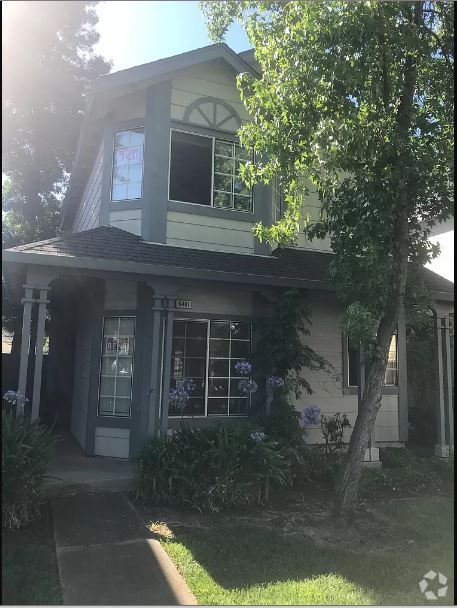
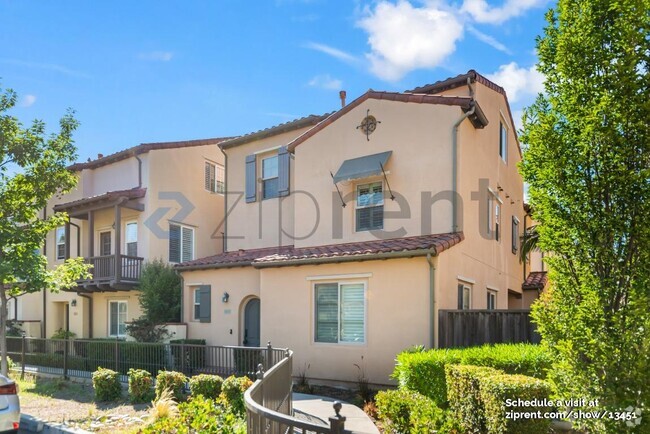
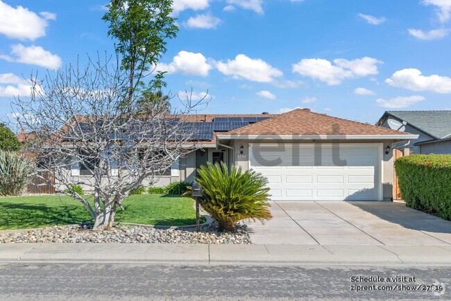
You May Also Like
Similar Rentals Nearby

What Are Walk Score®, Transit Score®, and Bike Score® Ratings?
Walk Score® measures the walkability of any address. Transit Score® measures access to public transit. Bike Score® measures the bikeability of any address.
What is a Sound Score Rating?
A Sound Score Rating aggregates noise caused by vehicle traffic, airplane traffic and local sources

660 Andrews St
Livermore, CA 94551