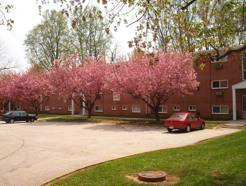
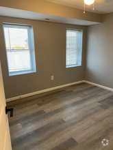
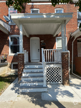
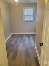
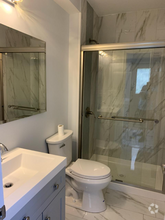
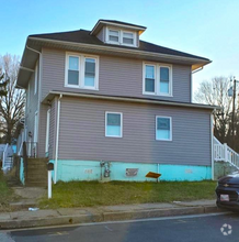
6609 Walther Ave
Baltimore, MD 21206
Favorites
6609 Walther Ave

Favorites
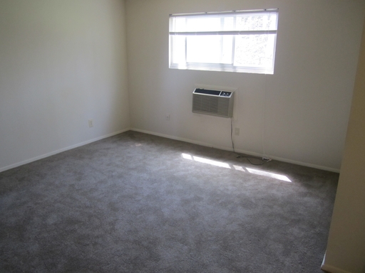
Check Back Soon for Upcoming Availability
Location
Get Directions
Located on the outskirts of Baltimore, North Harford Road seamlessly blends urban and suburban living. Residents of this charming community sit just seven miles northeast of the city center and are attracted to North Harford Road for its easy access to city amenities, mature, tree-lined streets, and highly-ranked schools. Renters appreciate the neighborhood’s close-knit community, family-friendly atmosphere, and big-city proximity. North Harford Road boasts attractive single-family homes and picturesque apartments that range from affordable to upscale. The neighborhood is highly walkable, so residents can easily get from one place to the next. Local businesses reside along Harford Road, with even more options extending outside of the community as well.
Learn more about living in North Harford RoadBelow are rent ranges for similar nearby apartments
Education
| Colleges & Universities | Distance | ||
|---|---|---|---|
| Colleges & Universities | Distance | ||
| Drive: | 10 min | 3.6 mi | |
| Drive: | 9 min | 4.1 mi | |
| Drive: | 13 min | 5.4 mi | |
| Drive: | 16 min | 6.1 mi |
6609 Walther Ave is within 10 minutes or 3.6 miles from Morgan State University. It is also near CCBC Essex and Loyola University Maryland.
Transportation options available in Baltimore include Johns Hopkins Hospital, located 5.9 miles from 6609 Walther Ave. 6609 Walther Ave is near Baltimore/Washington International Thurgood Marshall, located 22.2 miles or 35 minutes away.
| Transit / Subway | Distance | ||
|---|---|---|---|
| Transit / Subway | Distance | ||
| Drive: | 16 min | 5.9 mi | |
|
|
Drive: | 17 min | 6.2 mi |
|
|
Drive: | 17 min | 6.4 mi |
|
|
Drive: | 18 min | 6.5 mi |
| Drive: | 17 min | 6.6 mi |
| Commuter Rail | Distance | ||
|---|---|---|---|
| Commuter Rail | Distance | ||
|
|
Drive: | 16 min | 6.1 mi |
|
|
Drive: | 22 min | 7.7 mi |
|
|
Drive: | 24 min | 9.0 mi |
|
|
Drive: | 17 min | 9.3 mi |
|
|
Drive: | 31 min | 19.3 mi |
| Airports | Distance | ||
|---|---|---|---|
| Airports | Distance | ||
|
Baltimore/Washington International Thurgood Marshall
|
Drive: | 35 min | 22.2 mi |
Time and distance from 6609 Walther Ave.
| Shopping Centers | Distance | ||
|---|---|---|---|
| Shopping Centers | Distance | ||
| Walk: | 10 min | 0.5 mi | |
| Walk: | 11 min | 0.6 mi | |
| Walk: | 19 min | 1.0 mi |
6609 Walther Ave has 3 shopping centers within 1.0 miles, which is about a 19-minute walk. The miles and minutes will be for the farthest away property.
| Parks and Recreation | Distance | ||
|---|---|---|---|
| Parks and Recreation | Distance | ||
|
Maryland Natural History Society
|
Walk: | 12 min | 0.7 mi |
|
Herring Run Park
|
Drive: | 8 min | 3.1 mi |
|
Clifton Park
|
Drive: | 11 min | 4.2 mi |
|
Cromwell Valley Park
|
Drive: | 13 min | 5.4 mi |
|
Willow Grove Nature Education Center
|
Drive: | 13 min | 5.5 mi |
6609 Walther Ave has 5 parks within 5.5 miles, including Maryland Natural History Society, Herring Run Park, and Clifton Park.
| Hospitals | Distance | ||
|---|---|---|---|
| Hospitals | Distance | ||
| Drive: | 8 min | 3.6 mi | |
| Drive: | 9 min | 4.1 mi | |
| Drive: | 14 min | 5.3 mi |
6609 Walther Ave has 3 hospitals within 5.3 miles, the nearest is MedStar Good Samaritan Hospital which is 3.6 miles away and a 8 minute drive.
| Military Bases | Distance | ||
|---|---|---|---|
| Military Bases | Distance | ||
| Drive: | 46 min | 28.7 mi |
6609 Walther Ave is 28.7 miles and a 46 minute drive from Fort George Meade.
You May Also Like
Similar Rentals Nearby

What Are Walk Score®, Transit Score®, and Bike Score® Ratings?
Walk Score® measures the walkability of any address. Transit Score® measures access to public transit. Bike Score® measures the bikeability of any address.
What is a Sound Score Rating?
A Sound Score Rating aggregates noise caused by vehicle traffic, airplane traffic and local sources