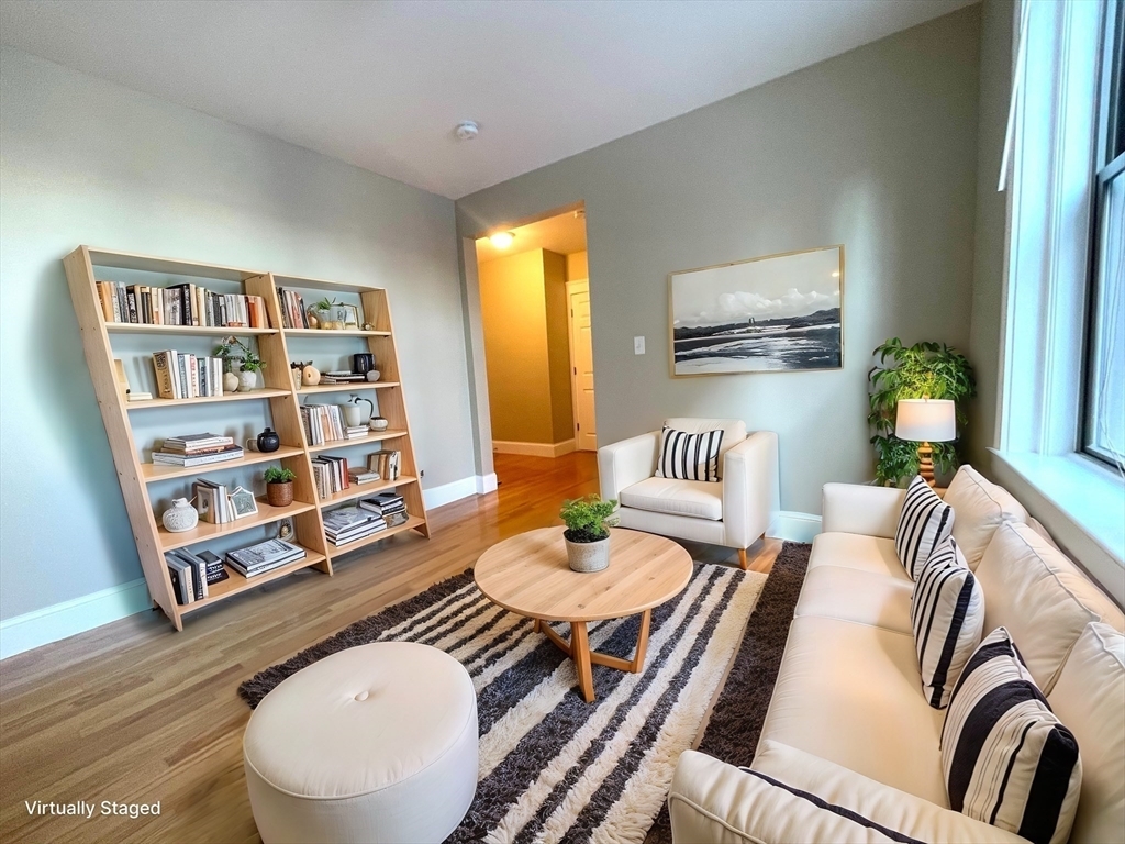
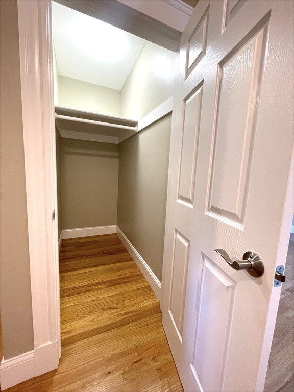
661 Huntington Ave Unit #38
Boston, MA 02115
-
Bedrooms
Studio
-
Bathrooms
1
-
Square Feet
350 sq ft
-
Available
Available Now

About This Home
A studio unit with 1 bath located in Mission Hill. Easy access to downtown and public transportation!
661 Huntington Ave is an apartment community located in Suffolk County and the 02115 ZIP Code. This area is served by the Boston Public Schools attendance zone.
Apartment Features
- Laundry Facilities
Fees and Policies
The fees below are based on community-supplied data and may exclude additional fees and utilities.
Details
Utilities Included
-
Water
-
Heat
-
Trash Removal
Contact
- Phone Number
- Contact
Longwood Medical Area is home to some of the most brilliant, innovating, and exciting minds in the region, with the left brain and the right brain represented in equal measure. As the name of the neighborhood suggests, several large medical centers form the centerpiece of the community—Beth Israel Deaconess Medical Center and Boston Medical Center in particular. The south side is rich with museums, with the Museum of Fine Arts and Isabella Stewart Gardner chief among them.
The neighborhood is also packed with schools, colleges, and universities, many of which train in medicine and the arts: Harvard Medical School, Massachusetts College of Art and Design, Massachusetts College of Pharmacy and Health Science, Simmons College, Wheelock College, and Emmanuel College, just to name a few.
The whole area is highly walkable, and nowhere in the neighborhood is more than a few blocks away from lush greenspaces, particularly the lush Riverway and the Emerald Necklace trails.
Learn more about living in Longwood Medical Area| Colleges & Universities | Distance | ||
|---|---|---|---|
| Colleges & Universities | Distance | ||
| Walk: | 1 min | 0.1 mi | |
| Walk: | 1 min | 0.1 mi | |
| Walk: | 8 min | 0.5 mi | |
| Walk: | 10 min | 0.5 mi |
 The GreatSchools Rating helps parents compare schools within a state based on a variety of school quality indicators and provides a helpful picture of how effectively each school serves all of its students. Ratings are on a scale of 1 (below average) to 10 (above average) and can include test scores, college readiness, academic progress, advanced courses, equity, discipline and attendance data. We also advise parents to visit schools, consider other information on school performance and programs, and consider family needs as part of the school selection process.
View GreatSchools Rating Methodology
Transportation options available in Boston include Fenway Station, located 0.4 mile from 661 Huntington Ave Unit #38. 661 Huntington Ave Unit #38 is near General Edward Lawrence Logan International, located 7.0 miles or 15 minutes away.
| Transit / Subway | Distance | ||
|---|---|---|---|
| Transit / Subway | Distance | ||
|
|
Walk: | 8 min | 0.4 mi |
|
|
Walk: | 10 min | 0.6 mi |
|
|
Walk: | 11 min | 0.6 mi |
|
|
Drive: | 4 min | 1.2 mi |
|
|
Drive: | 4 min | 1.3 mi |
| Commuter Rail | Distance | ||
|---|---|---|---|
| Commuter Rail | Distance | ||
|
|
Drive: | 3 min | 1.1 mi |
|
|
Drive: | 8 min | 2.2 mi |
| Drive: | 6 min | 2.6 mi | |
|
|
Drive: | 9 min | 4.8 mi |
| Drive: | 17 min | 7.5 mi |
| Airports | Distance | ||
|---|---|---|---|
| Airports | Distance | ||
|
General Edward Lawrence Logan International
|
Drive: | 15 min | 7.0 mi |
Time and distance from 661 Huntington Ave Unit #38.
| Shopping Centers | Distance | ||
|---|---|---|---|
| Shopping Centers | Distance | ||
| Walk: | 8 min | 0.4 mi | |
| Drive: | 4 min | 1.1 mi | |
| Drive: | 5 min | 1.9 mi |
| Parks and Recreation | Distance | ||
|---|---|---|---|
| Parks and Recreation | Distance | ||
|
Coit Observatory
|
Drive: | 5 min | 1.7 mi |
|
Roxbury Heritage State Park
|
Drive: | 4 min | 1.8 mi |
|
Charles River Reservation
|
Drive: | 5 min | 2.1 mi |
|
John Fitzgerald Kennedy National Historic Site
|
Drive: | 6 min | 2.1 mi |
|
Frederick Law Olmsted National Historic Site
|
Drive: | 6 min | 2.7 mi |
| Hospitals | Distance | ||
|---|---|---|---|
| Hospitals | Distance | ||
| Walk: | 6 min | 0.3 mi | |
| Walk: | 6 min | 0.3 mi | |
| Walk: | 11 min | 0.6 mi |
| Military Bases | Distance | ||
|---|---|---|---|
| Military Bases | Distance | ||
| Drive: | 30 min | 15.0 mi | |
| Drive: | 29 min | 16.0 mi |
- Laundry Facilities
661 Huntington Ave Unit #38 Photos
What Are Walk Score®, Transit Score®, and Bike Score® Ratings?
Walk Score® measures the walkability of any address. Transit Score® measures access to public transit. Bike Score® measures the bikeability of any address.
What is a Sound Score Rating?
A Sound Score Rating aggregates noise caused by vehicle traffic, airplane traffic and local sources


