$950 / Month
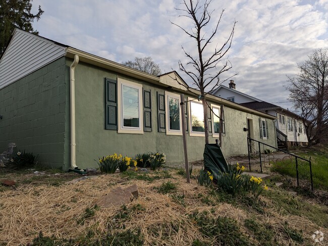
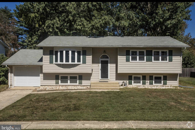
664 W Avondale Rd
West Grove, PA 19390
2 Weeks Ago
Favorites
664 W Avondale Rd

Favorites
Check Back Soon for Upcoming Availability
| Beds | Baths | Average SF |
|---|---|---|
| 2 Bedrooms 2 Bedrooms 2 Br | 1 Bath 1 Bath 1 Ba | 800 SF |
About This Property
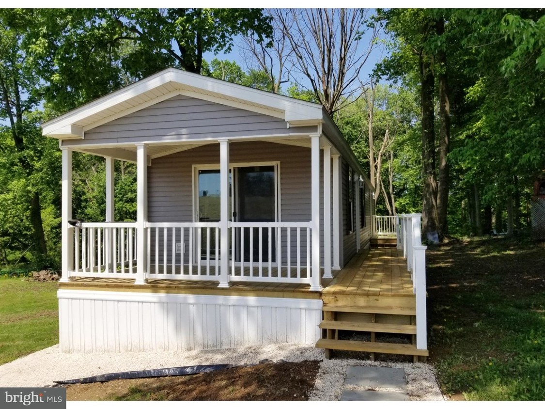
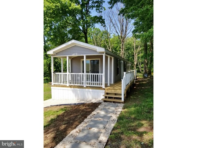
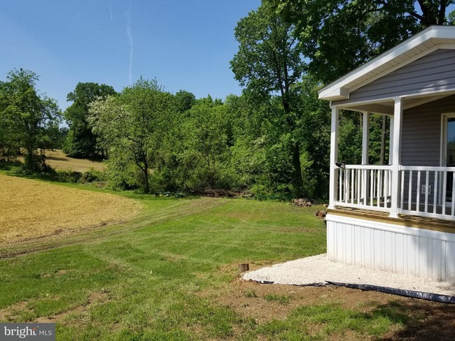
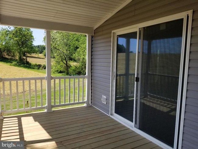
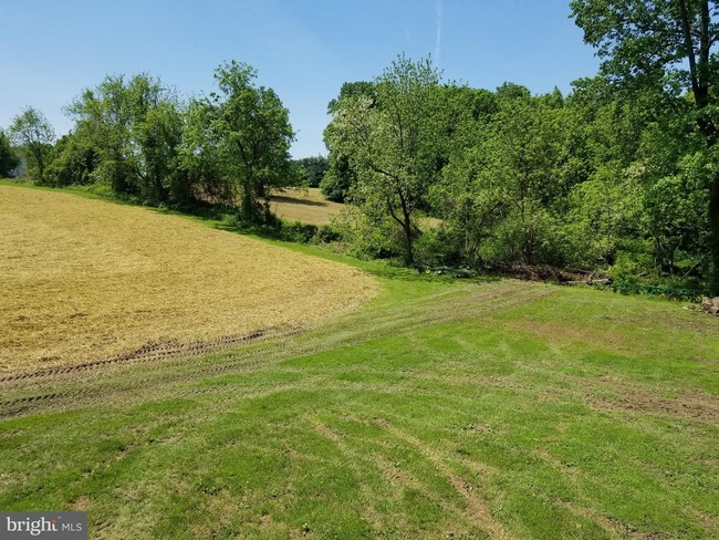
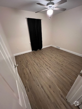
One year old 2 Bedroom, 1 Bath single Mobile Home available for rent. Kitchen has lots of cabinet space & there are built in cabinets in the Family Room. Covered Front Porch overlooks farm land/corn field. Water, Sewer, Trash, Lawn and Snow Removal Included. This is located at the back of the Duvall Bus Co. lot. Showings are by Appointment Only- Please do not enter Business without an appointment. No pets, No exceptions. Application fee for credit /background check is 37.00 per adult. Apply at RE/MAX Excellence.
664 W Avondale Rd is a house located in Chester County and the 19390 ZIP Code. This area is served by the Avon Grove attendance zone.
Location
Get Directions
Education
| Colleges & Universities | Distance | ||
|---|---|---|---|
| Colleges & Universities | Distance | ||
| Drive: | 11 min | 5.2 mi | |
| Drive: | 24 min | 12.1 mi | |
| Drive: | 27 min | 13.1 mi | |
| Drive: | 39 min | 21.8 mi |
664 W Avondale Rd is within 11 minutes or 5.2 miles from Lincoln University. It is also near University of Delaware and Goldey-Beacom College.
Schools


Public Elementary School
Grades PK-5
286 Students
Nearby
Public Elementary School
Grades K-2
1,010 Students
Attendance Zone
Public Elementary School
Grades 3-6
1,457 Students
Attendance Zone
Public Middle School
Grades 7-8
819 Students
Attendance Zone
Public High School
Grades 9-12
1,747 Students
Attendance Zone
Private Elementary & Middle School
Grades PK-8
174 Students
Nearby
Private Elementary & Middle School
Grades 1-7
Nearby
Private Middle & High School
Grades 6-12
19 Students
Nearby
School data provided by
 The GreatSchools Rating helps parents compare schools within a state based on a variety of school quality indicators and provides a helpful picture of how effectively each school serves all of its students. Ratings are on a scale of 1 (below average) to 10 (above average) and can include test scores, college readiness, academic progress, advanced courses, equity, discipline and attendance data. We also advise parents to visit schools, consider other information on school performance and programs, and consider family needs as part of the school selection process.
View GreatSchools Rating Methodology
View GreatSchools Rating Methodology
Transportation options available in West Grove include Orange Street, located 29.2 miles from 664 W Avondale Rd. 664 W Avondale Rd is near Philadelphia International, located 38.2 miles or 64 minutes away.
| Transit / Subway | Distance | ||
|---|---|---|---|
| Transit / Subway | Distance | ||
|
|
Drive: | 53 min | 29.2 mi |
|
|
Drive: | 54 min | 29.4 mi |
|
|
Drive: | 54 min | 29.4 mi |
|
|
Drive: | 54 min | 29.5 mi |
|
|
Drive: | 55 min | 29.8 mi |
| Commuter Rail | Distance | ||
|---|---|---|---|
| Commuter Rail | Distance | ||
|
|
Drive: | 23 min | 12.1 mi |
|
|
Drive: | 27 min | 15.8 mi |
|
|
Drive: | 32 min | 16.8 mi |
|
|
Drive: | 33 min | 19.9 mi |
|
|
Drive: | 38 min | 23.0 mi |
| Airports | Distance | ||
|---|---|---|---|
| Airports | Distance | ||
|
Philadelphia International
|
Drive: | 64 min | 38.2 mi |
Time and distance from 664 W Avondale Rd.
| Shopping Centers | Distance | ||
|---|---|---|---|
| Shopping Centers | Distance | ||
| Drive: | 8 min | 4.1 mi | |
| Drive: | 9 min | 4.2 mi | |
| Drive: | 11 min | 4.5 mi |
664 W Avondale Rd has 3 shopping centers within 4.5 miles, which is about a 11-minute drive. The miles and minutes will be for the farthest away property.
| Parks and Recreation | Distance | ||
|---|---|---|---|
| Parks and Recreation | Distance | ||
|
Peacedale Preserve
|
Drive: | 12 min | 5.3 mi |
|
Fair Hill Nature Center
|
Drive: | 14 min | 6.8 mi |
|
White Clay Creek Preserve
|
Drive: | 16 min | 7.1 mi |
|
Fair Hill NRMA
|
Drive: | 21 min | 8.1 mi |
|
White Clay Creek State Park
|
Drive: | 16 min | 8.9 mi |
664 W Avondale Rd has 5 parks within 8.9 miles, including Peacedale Preserve, White Clay Creek Preserve, and Fair Hill Nature Center.
| Hospitals | Distance | ||
|---|---|---|---|
| Hospitals | Distance | ||
| Drive: | 9 min | 5.0 mi |
664 W Avondale Rd is 5.0 miles and a 9 minute drive from Jennersville Hospital.
| Military Bases | Distance | ||
|---|---|---|---|
| Military Bases | Distance | ||
| Drive: | 40 min | 22.9 mi |
664 W Avondale Rd is 22.9 miles and a 40 minute drive from Ommelanden Range.
You May Also Like
Similar Rentals Nearby


What Are Walk Score®, Transit Score®, and Bike Score® Ratings?
Walk Score® measures the walkability of any address. Transit Score® measures access to public transit. Bike Score® measures the bikeability of any address.
What is a Sound Score Rating?
A Sound Score Rating aggregates noise caused by vehicle traffic, airplane traffic and local sources

664 W Avondale Rd
West Grove, PA 19390