$2,000 / Month
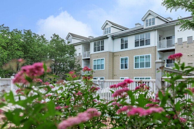
67 Fulton St Unit Brentwood apartment
Brentwood, NY 11717
2 Weeks Ago
Favorites
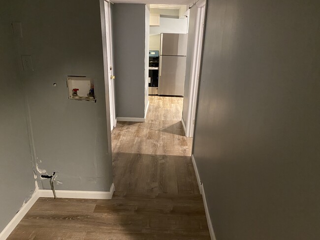
67 Fulton St Unit Brentwood apartment

Favorites
Check Back Soon for Upcoming Availability
| Beds | Baths | Average SF |
|---|---|---|
| 3 Bedrooms 3 Bedrooms 3 Br | 2 Baths 2 Baths 2 Ba | 800 SF |
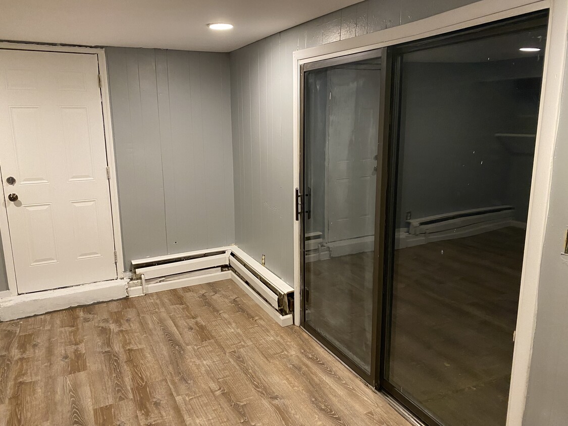
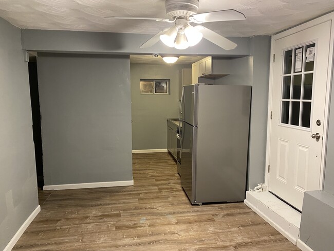
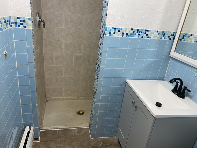
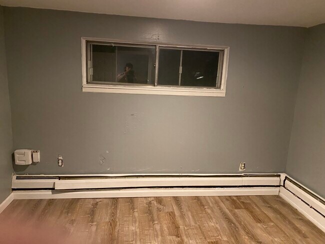
About This Property
It's a high ranch, with a tenant upstairs and you will be sharing the driveway(they already have the left side of the driveway, which accommodates up to 3 cars, and the new tenant will have the right side without impacting anyone!). Also the utilities consisting of oil and electricity will also be shared between both tenants! There is a really big yard, will also be shared ! the property, is close to Long Island expressway(495), with easy and quick access, minimizing travel time to and from work! as well as shopping malls? its exit 55 on the Long Island expressway!
67 Fulton St is an apartment community located in Suffolk County and the 11717 ZIP Code.
Apartment Features
- Yard
Fees and Policies
The fees below are based on community-supplied data and may exclude additional fees and utilities.
- Parking
-
Other--
Details
Utilities Included
-
Water
Property Information
-
2 units
Location
Get Directions
Situated in the middle of Long Island, Brentwood is a relatively dense suburb with a tight-knit community atmosphere set into its neatly organized streets. Suffolk Ave. is the main street in this New York locale, lined with markets and local restaurants as well as a number of schools that serve the area. The charming houses of Brentwood spread outwards from Suffolk Ave, bounded by NY-111 to the east, Otsego Park to the west, I-495 to the north, and the Southern State Pkwy. to the south.
Brentwood is home to Suffolk County Community College, giving the area a lively energy. Brentwood’s location on the island means the beaches to the east are just as accessible as New York City to the west, making this suburb a happy medium of scenic and city living.
Learn more about living in BrentwoodBelow are rent ranges for similar nearby apartments
| Beds | Average Size | Lowest | Typical | Premium |
|---|---|---|---|---|
| Studio Studio Studio | 603 Sq Ft | $1,317 | $1,625 | $2,276 |
| 1 Bed 1 Bed 1 Bed | 824-834 Sq Ft | $1,163 | $1,757 | $2,700 |
| 2 Beds 2 Beds 2 Beds | 1198 Sq Ft | $1,225 | $2,299 | $3,500 |
| 3 Beds 3 Beds 3 Beds | 1542 Sq Ft | $1,500 | $2,644 | $4,100 |
| 4 Beds 4 Beds 4 Beds | 2473 Sq Ft | $2,000 | $3,011 | $4,100 |
Amenities
- Yard
Expenses
Utilities Included
Water
Included
Education
| Colleges & Universities | Distance | ||
|---|---|---|---|
| Colleges & Universities | Distance | ||
| Drive: | 9 min | 3.4 mi | |
| Drive: | 9 min | 5.0 mi | |
| Drive: | 20 min | 12.9 mi | |
| Drive: | 20 min | 13.0 mi |
67 Fulton St Unit Brentwood apartment is within 9 minutes or 3.4 miles from SUNY Suffolk Co., Grant Campus. It is also near Touro University and Stony Brook University.
Transportation options available in Brentwood include Jamaica-179 Street, located 32.9 miles from 67 Fulton St Unit Brentwood apartment. 67 Fulton St Unit Brentwood apartment is near Long Island MacArthur, located 8.8 miles or 16 minutes away, and John F Kennedy International, located 37.5 miles or 52 minutes away.
| Transit / Subway | Distance | ||
|---|---|---|---|
| Transit / Subway | Distance | ||
|
|
Drive: | 47 min | 32.9 mi |
|
|
Drive: | 48 min | 33.4 mi |
|
|
Drive: | 49 min | 34.0 mi |
|
|
Drive: | 50 min | 34.4 mi |
|
|
Drive: | 51 min | 36.2 mi |
| Commuter Rail | Distance | ||
|---|---|---|---|
| Commuter Rail | Distance | ||
|
|
Drive: | 6 min | 2.3 mi |
|
|
Drive: | 7 min | 3.2 mi |
|
|
Drive: | 10 min | 4.6 mi |
|
|
Drive: | 9 min | 5.1 mi |
|
|
Drive: | 11 min | 6.2 mi |
| Airports | Distance | ||
|---|---|---|---|
| Airports | Distance | ||
|
Long Island MacArthur
|
Drive: | 16 min | 8.8 mi |
|
John F Kennedy International
|
Drive: | 52 min | 37.5 mi |
Time and distance from 67 Fulton St Unit Brentwood apartment.
| Shopping Centers | Distance | ||
|---|---|---|---|
| Shopping Centers | Distance | ||
| Walk: | 19 min | 1.0 mi | |
| Drive: | 3 min | 1.1 mi | |
| Drive: | 4 min | 1.7 mi |
67 Fulton St Unit Brentwood apartment has 3 shopping centers within 1.7 miles, which is about a 4-minute walk. The miles and minutes will be for the farthest away property.
| Parks and Recreation | Distance | ||
|---|---|---|---|
| Parks and Recreation | Distance | ||
|
Blydenburgh County Park
|
Drive: | 11 min | 3.5 mi |
|
Caleb Smith State Park Preserve
|
Drive: | 8 min | 4.4 mi |
|
Lakeland County Park
|
Drive: | 10 min | 5.4 mi |
|
Sweetbriar Nature Center
|
Drive: | 12 min | 7.0 mi |
|
Connetquot River State Park Preserve
|
Drive: | 26 min | 12.0 mi |
67 Fulton St Unit Brentwood apartment has 5 parks within 12.0 miles, including Blydenburgh County Park, Caleb Smith State Park Preserve, and Lakeland County Park.
| Hospitals | Distance | ||
|---|---|---|---|
| Hospitals | Distance | ||
| Drive: | 7 min | 4.4 mi | |
| Drive: | 11 min | 6.0 mi | |
| Drive: | 12 min | 7.2 mi |
67 Fulton St Unit Brentwood apartment has 3 hospitals within 7.2 miles, the nearest is Pilgrim Psychiatric Center which is 4.4 miles away and a 7 minute drive.
| Military Bases | Distance | ||
|---|---|---|---|
| Military Bases | Distance | ||
| Drive: | 38 min | 21.0 mi | |
| Drive: | 47 min | 32.9 mi |
67 Fulton St Unit Brentwood apartment is 21.0 miles from Eatons Neck CG Station North, and is convenient to other military bases, including Fort Totten US Govt Reservation.
You May Also Like
Similar Rentals Nearby


What Are Walk Score®, Transit Score®, and Bike Score® Ratings?
Walk Score® measures the walkability of any address. Transit Score® measures access to public transit. Bike Score® measures the bikeability of any address.
What is a Sound Score Rating?
A Sound Score Rating aggregates noise caused by vehicle traffic, airplane traffic and local sources

67 Fulton St
Brentwood, NY 11717