
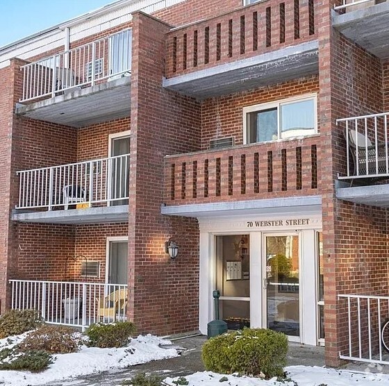
67 Payne St Unit 1
67 Payne St Unit 1
Quincy, MA 02169
2 Weeks Ago
Favorites
67 Payne St Unit 1

Favorites
Check Back Soon for Upcoming Availability
| Beds | Baths | Average SF |
|---|---|---|
| 2 Bedrooms 2 Bedrooms 2 Br | 1 Bath 1 Bath 1 Ba | — |
About This Property
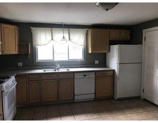
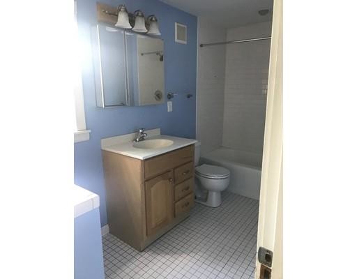
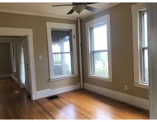
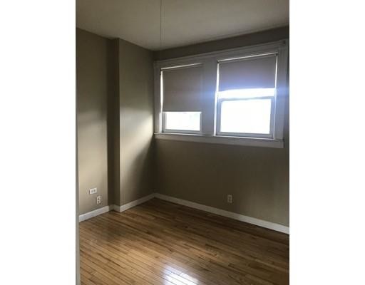
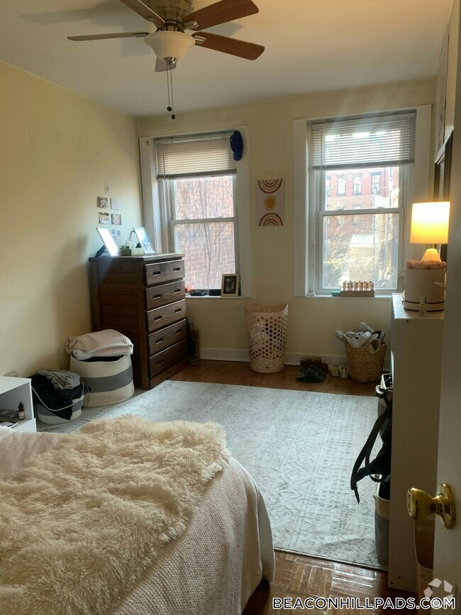
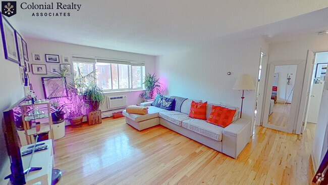
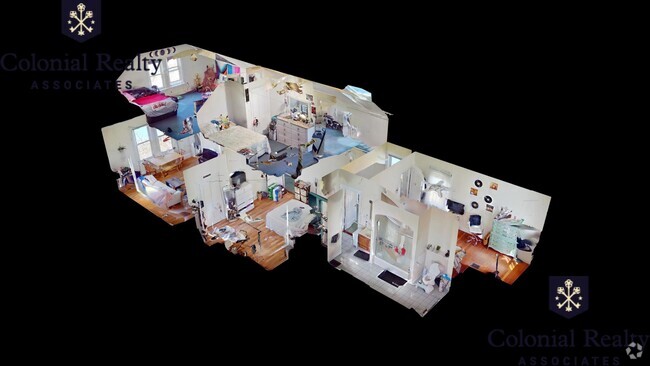
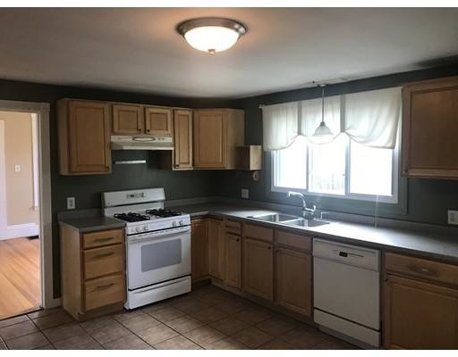
Huge 2 bedroom, one bath. Close to everything. off street parking Laundry in the building. Shared two family, with a nice yard, and driveway. Hardwood floors, updated kitchen and bathroom. Plenty of storage in the basement, close to Quincy Center Train Station. Close to Dunkin Donuts.
67 Payne St is a condo located in Norfolk County and the 02169 ZIP Code. This area is served by the Quincy attendance zone.
Condo Features
- Range
- Tennis Court
Fees and Policies
The fees below are based on community-supplied data and may exclude additional fees and utilities.
Details
Utilities Included
-
Water
Location
Get Directions
Situated in the south central portion of Quincy, South Quincy is a predominantly residential neighborhood teeming with historic homes and luxury apartments available for rent. South Quincy residents enjoy a peaceful atmosphere along with convenience to abundant shopping and dining options at Quincy Center, South Shore Plaza, and Marketplace at Braintree.
South Quincy is popular among commuters for its quick access to I-93, Route 3, MBTA buses, and the Red T Line. Downtown Boston sits just 12 miles north of South Quincy, brimming with metropolitan amenities and attractions. Several beaches are also proximate to South Quincy, including Mound Street Beach and Wollaston Beach.
Learn more about living in South QuincyBelow are rent ranges for similar nearby apartments
Amenities
- Range
- Tennis Court
Expenses
Utilities Included
Water
Included
Education
| Colleges & Universities | Distance | ||
|---|---|---|---|
| Colleges & Universities | Distance | ||
| Drive: | 17 min | 7.6 mi | |
| Drive: | 14 min | 7.7 mi | |
| Drive: | 17 min | 8.5 mi | |
| Drive: | 17 min | 10.2 mi |
67 Payne St Unit 1 is within 17 minutes or 7.6 miles from Curry College. It is also near Massasoit C.C., Canton Campus and UMass Boston.
Schools


Public Elementary School
Grades PK-5
400 Students
Nearby
Public Elementary & Middle School
Grades 5-8
437 Students
Attendance Zone
Public Elementary School
Grades K-4
542 Students
Attendance Zone
Public High School
Grades 9-12
1,495 Students
Attendance Zone
Private Elementary School
Grades PK-6
102 Students
Nearby
Private Elementary & Middle School
Grades 2-7
6 Students
Nearby
Private Middle & High School
Grades 6-12
59 Students
Nearby
Private Middle & High School
Grades 7-12
594 Students
Nearby
School data provided by
 The GreatSchools Rating helps parents compare schools within a state based on a variety of school quality indicators and provides a helpful picture of how effectively each school serves all of its students. Ratings are on a scale of 1 (below average) to 10 (above average) and can include test scores, college readiness, academic progress, advanced courses, equity, discipline and attendance data. We also advise parents to visit schools, consider other information on school performance and programs, and consider family needs as part of the school selection process.
View GreatSchools Rating Methodology
View GreatSchools Rating Methodology
Transportation options available in Quincy include Quincy Adams Station, located 1.3 miles from 67 Payne St Unit 1. 67 Payne St Unit 1 is near General Edward Lawrence Logan International, located 13.1 miles or 22 minutes away.
| Transit / Subway | Distance | ||
|---|---|---|---|
| Transit / Subway | Distance | ||
|
|
Drive: | 4 min | 1.3 mi |
|
|
Drive: | 4 min | 2.2 mi |
|
|
Drive: | 7 min | 3.0 mi |
|
|
Drive: | 7 min | 3.3 mi |
|
|
Drive: | 10 min | 5.0 mi |
| Commuter Rail | Distance | ||
|---|---|---|---|
| Commuter Rail | Distance | ||
|
|
Drive: | 3 min | 1.2 mi |
| Drive: | 5 min | 2.6 mi | |
|
|
Drive: | 5 min | 2.7 mi |
|
|
Drive: | 10 min | 5.4 mi |
|
|
Drive: | 13 min | 7.0 mi |
| Airports | Distance | ||
|---|---|---|---|
| Airports | Distance | ||
|
General Edward Lawrence Logan International
|
Drive: | 22 min | 13.1 mi |
Time and distance from 67 Payne St Unit 1.
| Shopping Centers | Distance | ||
|---|---|---|---|
| Shopping Centers | Distance | ||
| Walk: | 10 min | 0.6 mi | |
| Walk: | 11 min | 0.6 mi | |
| Walk: | 11 min | 0.6 mi |
67 Payne St Unit 1 has 3 shopping centers within 0.6 mile, which is about a 11-minute walk. The miles and minutes will be for the farthest away property.
| Parks and Recreation | Distance | ||
|---|---|---|---|
| Parks and Recreation | Distance | ||
|
Adams National Historical Park
|
Drive: | 3 min | 1.5 mi |
|
Squantum Point Park
|
Drive: | 13 min | 5.0 mi |
|
Webb Memorial State Park
|
Drive: | 12 min | 5.5 mi |
|
Blue Hills Reservation
|
Drive: | 12 min | 7.3 mi |
|
Houghton's Pond Recreation Area
|
Drive: | 12 min | 7.3 mi |
67 Payne St Unit 1 has 5 parks within 7.3 miles, including Adams National Historical Park, Squantum Point Park, and Webb Memorial State Park.
| Hospitals | Distance | ||
|---|---|---|---|
| Hospitals | Distance | ||
| Drive: | 10 min | 5.0 mi | |
| Drive: | 10 min | 5.1 mi | |
| Drive: | 10 min | 6.0 mi |
67 Payne St Unit 1 has 3 hospitals within 6.0 miles, the nearest is Beth Israel Deaconess Hospital - Milton which is 5.0 miles away and a 10 minute drive.
You May Also Like
Similar Rentals Nearby


What Are Walk Score®, Transit Score®, and Bike Score® Ratings?
Walk Score® measures the walkability of any address. Transit Score® measures access to public transit. Bike Score® measures the bikeability of any address.
What is a Sound Score Rating?
A Sound Score Rating aggregates noise caused by vehicle traffic, airplane traffic and local sources
67 Payne St
Quincy, MA 02169