
$2,795 / Month
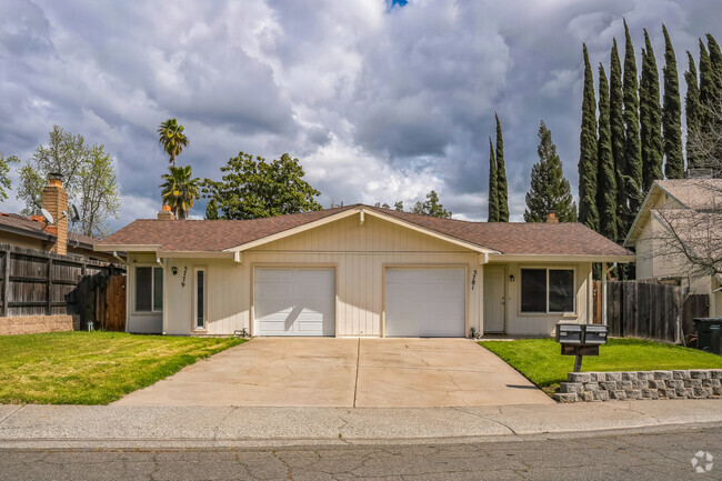
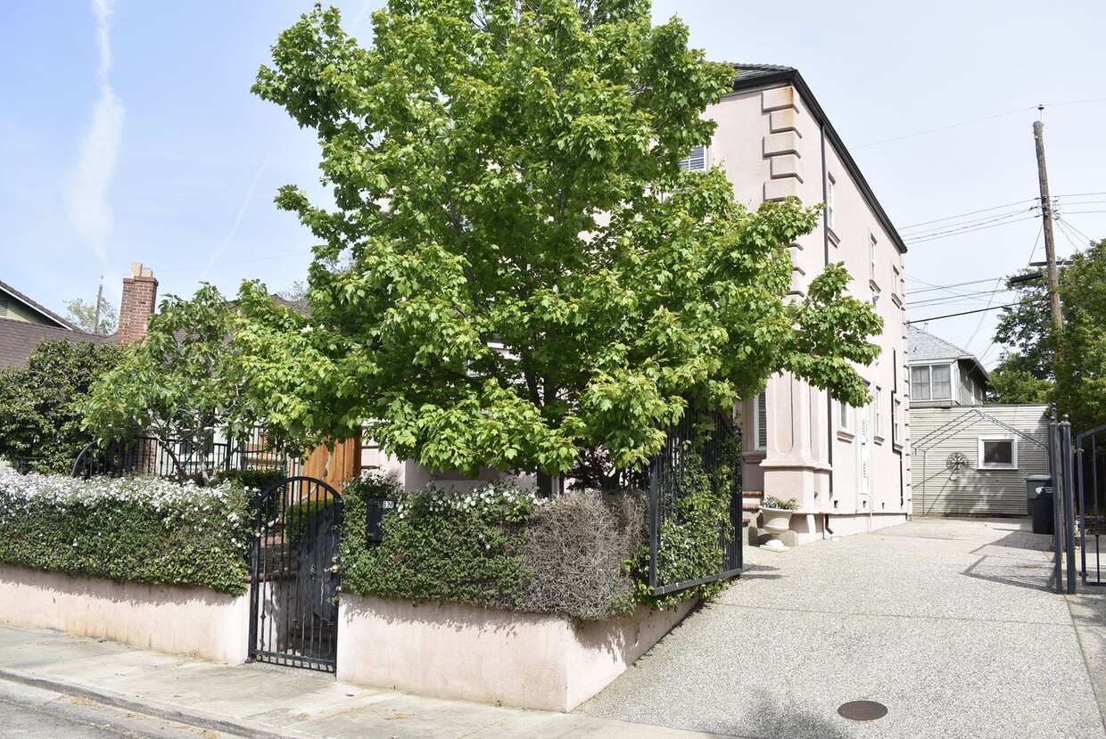
671 San Antonio Way
Sacramento, CA 95819
Today
Favorites
-
Bedrooms
2
-
Bathrooms
2.5
-
Square Feet
1,603 sq ft
671 San Antonio Way

Favorites
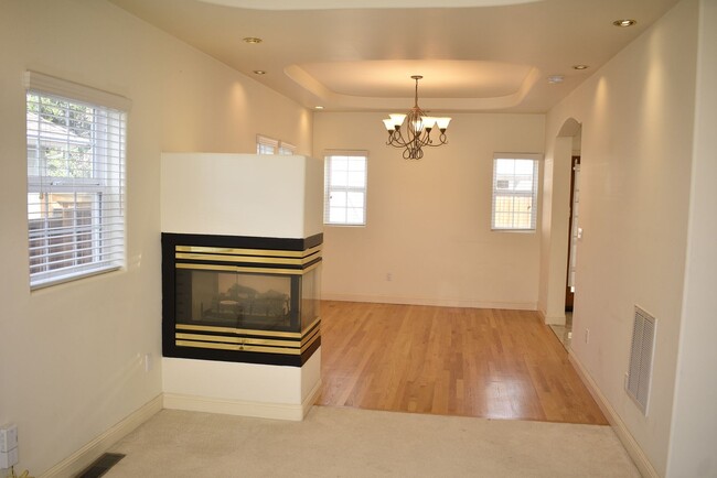
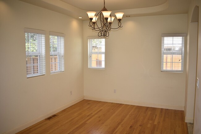
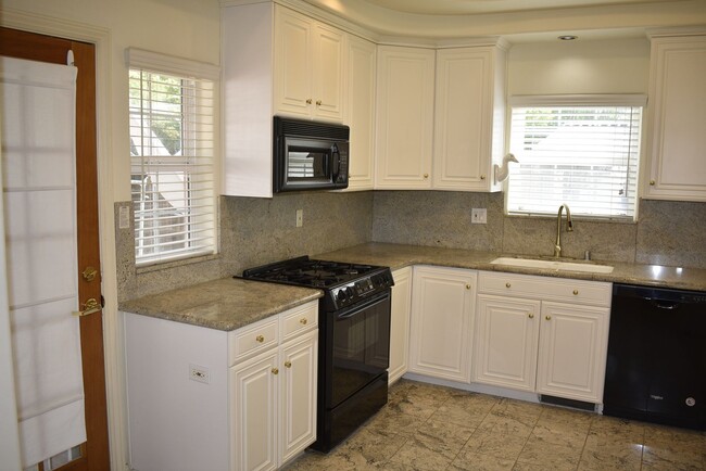
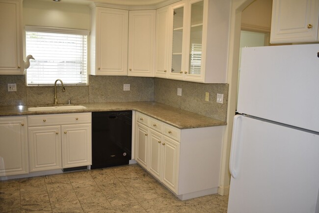
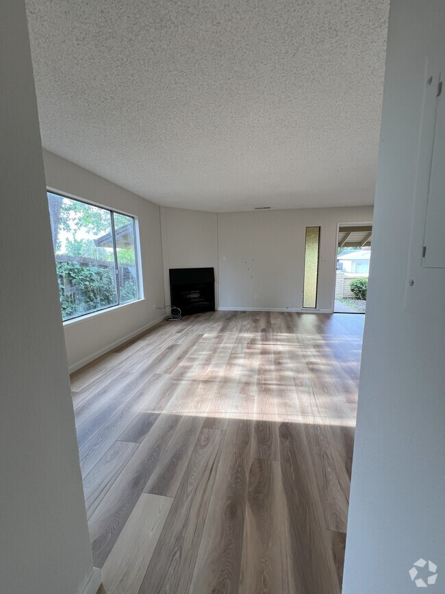
About This Home
$2,795 deposit
Resident Benefits Package (RBP) - $50/month All RNB residents for this property are enrolled in the Resident Benefits Package which includes a variety of services designed to enhance your living experience and help manage your home efficiently. More details will be provided upon request.
671 San Antonio Way is a house located in Sacramento County and the 95819 ZIP Code. This area is served by the Sacramento City Unified attendance zone.
* Price shown is base rent and may not include non-optional fees and utilities.
Price, availability, fees, and any applicable rent special are subject to change without notice.
* Square footage definitions vary. Displayed square footage is approximate.
Location
Get Directions
East Sacramento offers renters a breath of fresh air in the city. Known for tree-lined streets and great parks, East Sacramento is one of the city’s best neighborhoods. The community features lavish apartments, condos, townhomes, and houses. Join your new friends and neighbors at popular McKinley Park, known for its elegant rose garden, food trucks, festivals, concerts, and outdoor movie nights. The neighborhood is also known for its stellar dining and nightlife scene. While living in East Sacramento, you’ll have easy access to craft breweries, trendy coffee shops, quaint boutiques, sports bars, and diverse eateries. Great for students as well, the community borders California State University, Sacramento. This vibrant neighborhood also offers close proximity to Midtown and Downtown Sacramento, which are both about four miles away.
Learn more about living in East Sacramento
Education
| Colleges & Universities | Distance | ||
|---|---|---|---|
| Colleges & Universities | Distance | ||
| Drive: | 5 min | 2.2 mi | |
| Drive: | 7 min | 4.2 mi | |
| Drive: | 16 min | 10.3 mi | |
| Drive: | 16 min | 11.0 mi |
671 San Antonio Way is within 5 minutes or 2.2 miles from Sacramento State. It is also near Sacramento City College and Cosumnes River College.
Schools


Public Elementary School
Grades K-6
432 Students
Attendance Zone
Public Elementary School
Grades K-3
372 Students
Nearby
Public Middle School
Grades 7-8
1,075 Students
Attendance Zone
Public High School
Grades 9-12
1,733 Students
Attendance Zone
Private Elementary & Middle School
Grades PK-8
304 Students
Nearby
Private Elementary & Middle School
Grades PK-8
46 Students
Nearby
Private High School
Grades 9-12
1,091 Students
Nearby
School data provided by
 The GreatSchools Rating helps parents compare schools within a state based on a variety of school quality indicators and provides a helpful picture of how effectively each school serves all of its students. Ratings are on a scale of 1 (below average) to 10 (above average) and can include test scores, college readiness, academic progress, advanced courses, equity, discipline and attendance data. We also advise parents to visit schools, consider other information on school performance and programs, and consider family needs as part of the school selection process.
View GreatSchools Rating Methodology
View GreatSchools Rating Methodology
Transportation options available in Sacramento include 39Th Street, located 1.0 mile from 671 San Antonio Way. 671 San Antonio Way is near Sacramento International, located 14.1 miles or 22 minutes away.
| Transit / Subway | Distance | ||
|---|---|---|---|
| Transit / Subway | Distance | ||
|
|
Walk: | 19 min | 1.0 mi |
|
|
Drive: | 4 min | 1.3 mi |
|
|
Drive: | 3 min | 1.7 mi |
|
|
Drive: | 5 min | 2.0 mi |
|
|
Drive: | 4 min | 2.2 mi |
| Commuter Rail | Distance | ||
|---|---|---|---|
| Commuter Rail | Distance | ||
|
|
Drive: | 22 min | 17.4 mi |
|
|
Drive: | 26 min | 18.9 mi |
|
|
Drive: | 26 min | 21.0 mi |
| Drive: | 40 min | 33.2 mi | |
|
|
Drive: | 40 min | 33.3 mi |
| Airports | Distance | ||
|---|---|---|---|
| Airports | Distance | ||
|
Sacramento International
|
Drive: | 22 min | 14.1 mi |
Time and distance from 671 San Antonio Way.
| Shopping Centers | Distance | ||
|---|---|---|---|
| Shopping Centers | Distance | ||
| Walk: | 16 min | 0.8 mi | |
| Walk: | 19 min | 1.0 mi | |
| Walk: | 20 min | 1.1 mi |
671 San Antonio Way has 3 shopping centers within 1.1 miles, which is about a 20-minute walk. The miles and minutes will be for the farthest away property.
| Parks and Recreation | Distance | ||
|---|---|---|---|
| Parks and Recreation | Distance | ||
|
Sutter's Fort State Historical Monument
|
Drive: | 2 min | 1.4 mi |
|
Paradise Beach County Recreation Area
|
Drive: | 3 min | 1.5 mi |
|
Governor's Mansion State Historic Park
|
Drive: | 5 min | 2.6 mi |
|
California State Capitol Museum
|
Drive: | 6 min | 3.0 mi |
|
Leland Stanford Mansion State Historic Park
|
Drive: | 6 min | 3.0 mi |
671 San Antonio Way has 5 parks within 3.0 miles, including Sutter's Fort State Historical Monument, Paradise Beach County Recreation Area, and Governor's Mansion State Historic Park.
| Hospitals | Distance | ||
|---|---|---|---|
| Hospitals | Distance | ||
| Walk: | 6 min | 0.3 mi | |
| Drive: | 2 min | 1.3 mi | |
| Drive: | 5 min | 2.4 mi |
671 San Antonio Way has 3 hospitals within 2.4 miles, the nearest is Mercy General Hospital which is 0.3 mile away and a 6 minute walk.
| Military Bases | Distance | ||
|---|---|---|---|
| Military Bases | Distance | ||
| Drive: | 24 min | 11.2 mi |
671 San Antonio Way is 11.2 miles and a 24 minute drive from McClellan Air Force Base.
You May Also Like
Similar Rentals Nearby


What Are Walk Score®, Transit Score®, and Bike Score® Ratings?
Walk Score® measures the walkability of any address. Transit Score® measures access to public transit. Bike Score® measures the bikeability of any address.
What is a Sound Score Rating?
A Sound Score Rating aggregates noise caused by vehicle traffic, airplane traffic and local sources
671 San Antonio Way
Sacramento, CA 95819