
$3,150 / Month
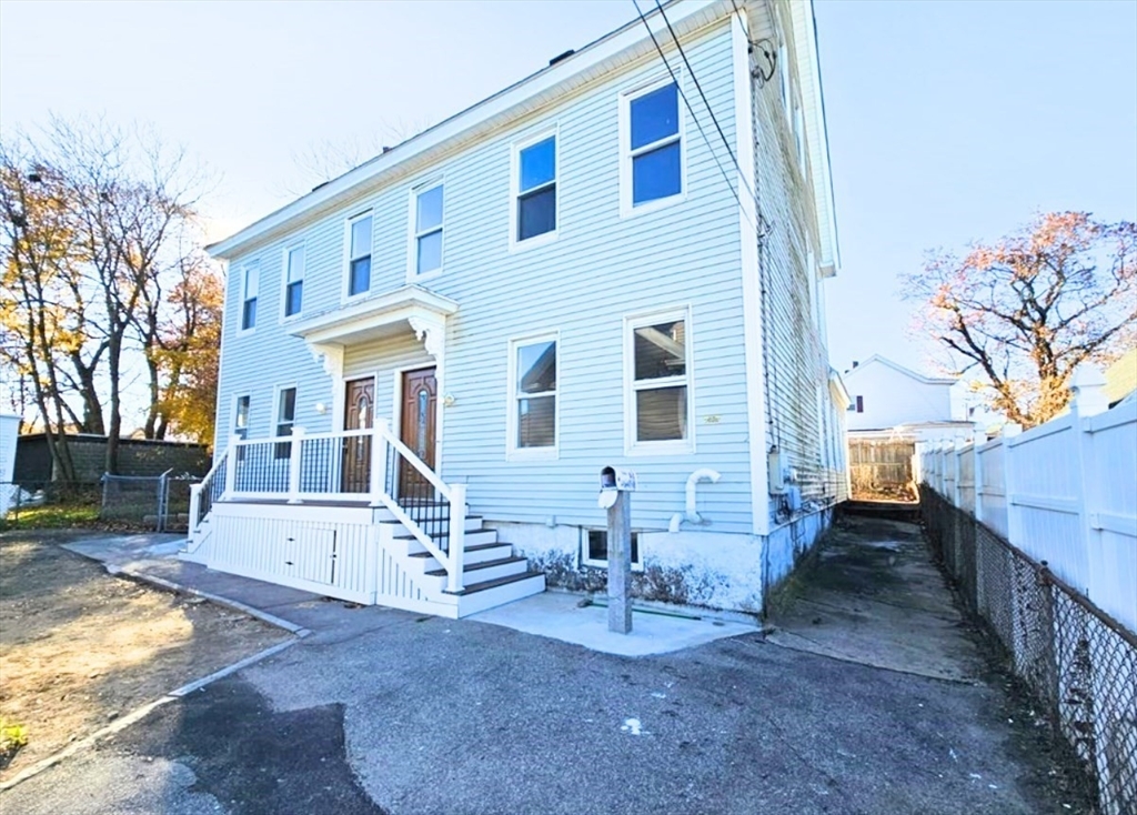
69 Loring St Unit 1
Lowell, MA 01851
Today
Favorites
617-872-6882
-
Bedrooms
4
-
Bathrooms
2
-
Square Feet
2,944 sq ft
-
Available
Available Mar 16
Highlights
- Medical Services
- Property is near public transit
- Jogging Path
- Fenced Yard
- Porch
- No Cooling
69 Loring St Unit 1

Favorites
About This Home
$3,150 deposit,
Available Mar 16
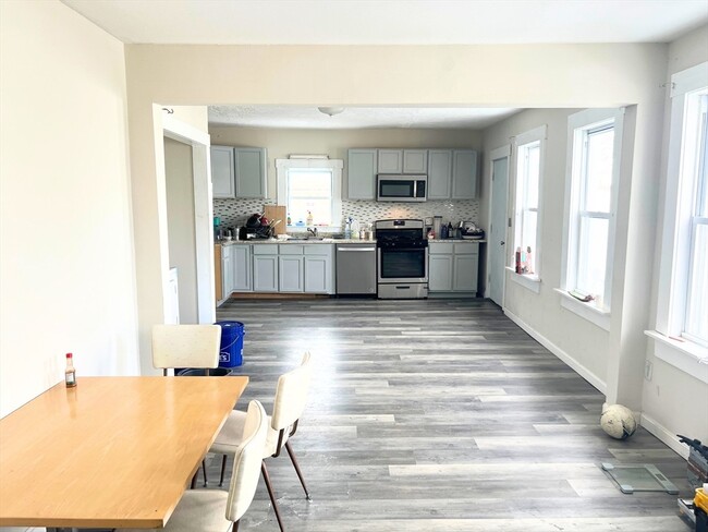
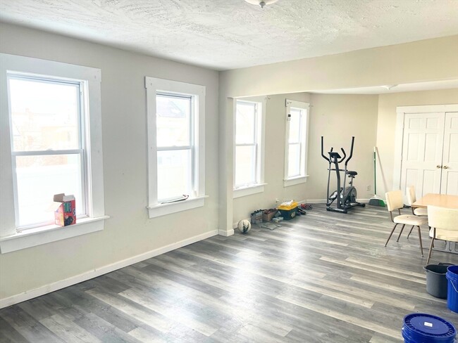
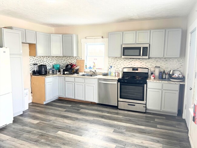
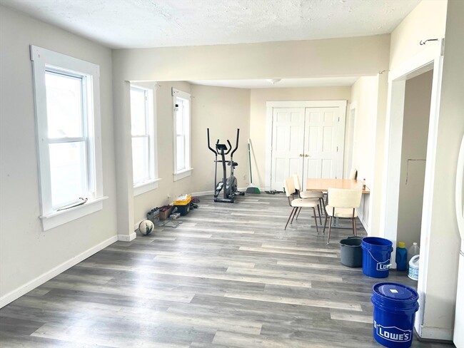
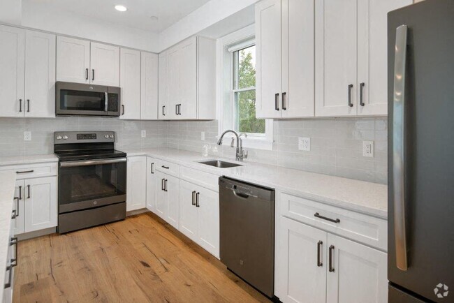
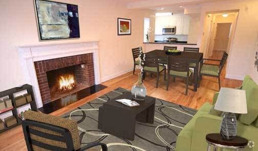
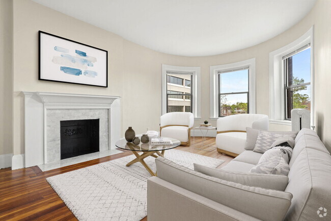
DONT MISS OUT! This spacious townhouse-style unit offers 4 bedrooms and 2 bathrooms,featuring numerous upgrades throughout. The main level boasts an inviting eat-in kitchen,a formal living room,a master bedroom,and a full bathroom. Upstairs,you'll find three generously sized bedrooms with ample closet space and another full bathroom. Washer/dryer hookups for tenant to bring. Conveniently located near shopping centers,schools,and major highways,this home provides easy access to everyday essentials while maintaining a comfortable and stylish living space. Don't miss the opportunity to make this fantastic home yours! Video tour available to send.
69 Loring St is an apartment community located in Middlesex County and the 01851 ZIP Code.
* Price shown is base rent and may not include non-optional fees and utilities.
Price, availability, fees, and any applicable rent special are subject to change without notice.
* Square footage definitions vary. Displayed square footage is approximate.
Home Details
Year Built
Built in 1900
Accessible Home Design
Entry on the 1st floor
Bedrooms and Bathrooms
2 Full Bathrooms
4 Bedrooms
Home Design
Apartment
Interior Spaces
2,944 Sq Ft Home
Kitchen
Range
Microwave
Dishwasher
Laundry
Laundry in unit
Listing and Financial Details
Security Deposit $3,150
Property Available on 3/1/25
Rent includes water, sewer, trash collection, snow removal, gardener, laundry facilities
Location
Property is near public transit
Property is near schools
Lot Details
4,603 Sq Ft Lot
Fenced Yard
Fenced
Outdoor Features
Porch
Parking
1 Parking Space
Schools
Charles Morey Elementary School
Stem Academy Middle School
Lowell High School
Utilities
No Cooling
Heating System Uses Natural Gas
Community Details
Amenities
Medical Services
Shops
Coin Laundry
Common Area
Overview
No Home Owners Association
Pet Policy
Call for details about the types of pets allowed
Recreation
Jogging Path
Park
Contact
- Listed by Stefanos Galouzis | Coldwell Banker Realty - Waltham
- Phone Number (617) 872-6882
-
Source
 MLS Property Information Network
The property listing data and information set forth herein were provided to MLS Property Information Network, Inc. from third party sources, including sellers, lessors and public records, and were compiled by MLS Property Information Network, Inc. The property listing data and information are for the personal, non-commercial use of consumers having a good faith interest in purchasing or leasing listed properties of the type displayed to them and may not be used for any purpose other than to identify prospective properties which such consumers may have a good faith interest in purchasing or leasing. MLS Property Information Network, Inc. and its subscribers disclaim any and all representations and warranties as to the accuracy of the property listing data and information set forth herein. All properties are subject to prior sale, change or withdrawal. Copyright © 2025 MLS Property Information Network, Inc. All rights reserved.
Location
Get Directions
Amenities
- Dishwasher
- Microwave
- Range
- Refrigerator
- Fenced Lot
- Porch
Situated just west of Downtown Lowell, the Highlands neighborhood stands as an urban residential community known for its diverse and close-knit community. Residents bask in the neighborhood's historic beauty with most homes built in the late 1800s and early 1900s, and the affordable housing attracts everyone, from families to professionals. The Highlands neighborhood also has a vibrant student community thanks to its close proximity to UMass Lowell.
Residents live just 25 miles northwest of Boston, but the neighborhood has its own share of attractions and employment hot spots like Mount Pleasant Golf Club and Cross Point Towers, a high-rise office complex housing the city's leading businesses. Choose from diverse housing options ranging from upscale country homes along wooded streets to historic rowhouses and sprawling apartment complexes.
Learn more about living in Highlands Lowell
Education
| Colleges & Universities | Distance | ||
|---|---|---|---|
| Colleges & Universities | Distance | ||
| Drive: | 2 min | 1.4 mi | |
| Drive: | 4 min | 1.6 mi | |
| Drive: | 18 min | 9.5 mi | |
| Drive: | 22 min | 13.9 mi |
69 Loring St Unit 1 is within 2 minutes or 1.4 miles from UMass Lowell. It is also near Middlesex C.C., Lowell Campus and Middlesex C.C., Bedford Campus.
Transportation options available in Lowell include Alewife Station, located 21.3 miles from 69 Loring St Unit 1. 69 Loring St Unit 1 is near Manchester Boston Regional, located 29.5 miles or 43 minutes away, and General Edward Lawrence Logan International, located 31.7 miles or 48 minutes away.
| Transit / Subway | Distance | ||
|---|---|---|---|
| Transit / Subway | Distance | ||
|
|
Drive: | 35 min | 21.3 mi |
|
|
Drive: | 37 min | 21.6 mi |
| Drive: | 36 min | 21.7 mi | |
|
|
Drive: | 37 min | 23.8 mi |
|
|
Drive: | 37 min | 25.2 mi |
| Commuter Rail | Distance | ||
|---|---|---|---|
| Commuter Rail | Distance | ||
|
|
Walk: | 15 min | 0.8 mi |
|
|
Drive: | 10 min | 5.2 mi |
|
|
Drive: | 22 min | 10.3 mi |
|
|
Drive: | 23 min | 13.4 mi |
|
|
Drive: | 20 min | 14.2 mi |
| Airports | Distance | ||
|---|---|---|---|
| Airports | Distance | ||
|
Manchester Boston Regional
|
Drive: | 43 min | 29.5 mi |
|
General Edward Lawrence Logan International
|
Drive: | 48 min | 31.7 mi |
Time and distance from 69 Loring St Unit 1.
| Shopping Centers | Distance | ||
|---|---|---|---|
| Shopping Centers | Distance | ||
| Drive: | 3 min | 1.3 mi | |
| Drive: | 3 min | 1.5 mi | |
| Drive: | 4 min | 1.6 mi |
69 Loring St Unit 1 has 3 shopping centers within 1.6 miles, which is about a 4-minute drive. The miles and minutes will be for the farthest away property.
| Parks and Recreation | Distance | ||
|---|---|---|---|
| Parks and Recreation | Distance | ||
|
Lowell National Historical Park
|
Drive: | 3 min | 1.2 mi |
|
Lowell Heritage State Park
|
Drive: | 4 min | 2.4 mi |
|
Lowell-Dracut-Tyngsboro State Forest
|
Drive: | 8 min | 3.6 mi |
|
Great Brook Farm State Park
|
Drive: | 14 min | 7.0 mi |
|
The Butterfly Place
|
Drive: | 13 min | 8.0 mi |
69 Loring St Unit 1 has 5 parks within 8.0 miles, including Lowell National Historical Park, Lowell Heritage State Park, and Lowell-Dracut-Tyngsboro State Forest.
| Hospitals | Distance | ||
|---|---|---|---|
| Hospitals | Distance | ||
| Drive: | 3 min | 1.9 mi |
69 Loring St Unit 1 is 1.9 miles and a 3 minute drive from Lowell General Hospital.
| Military Bases | Distance | ||
|---|---|---|---|
| Military Bases | Distance | ||
| Drive: | 25 min | 14.9 mi |
69 Loring St Unit 1 is 14.9 miles and a 25 minute drive from Hanscom Air Force Base.
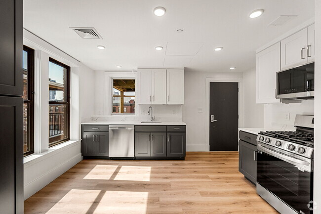
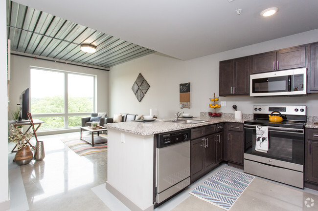
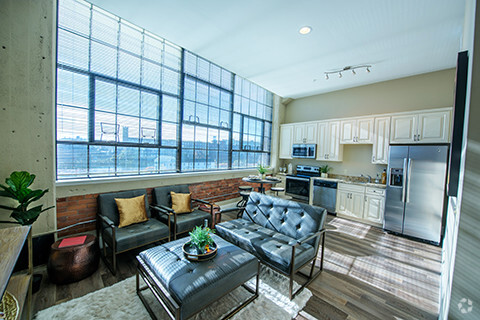
You May Also Like
Similar Rentals Nearby
-
-
-
-
-
-
1 / 20
-
-
1 / 18
-
-

What Are Walk Score®, Transit Score®, and Bike Score® Ratings?
Walk Score® measures the walkability of any address. Transit Score® measures access to public transit. Bike Score® measures the bikeability of any address.
What is a Sound Score Rating?
A Sound Score Rating aggregates noise caused by vehicle traffic, airplane traffic and local sources
69 Loring St
Lowell, MA 01851