$2,600 / Month
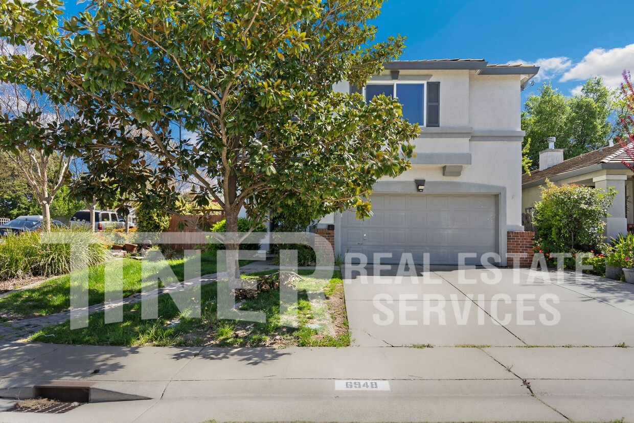
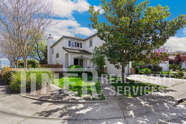
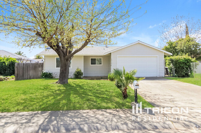
6948 Trailride Way
Citrus Heights, CA 95621
1 Week Ago
Favorites
-
Bedrooms
4
-
Bathrooms
3
-
Square Feet
1,980 sq ft
6948 Trailride Way

Favorites
About This Home
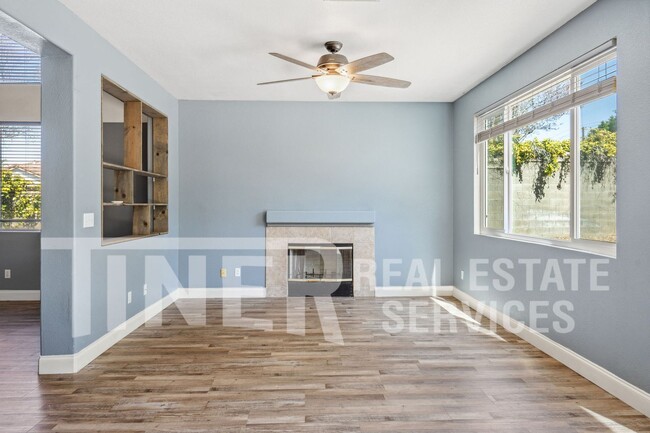
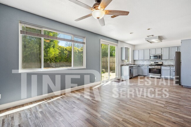
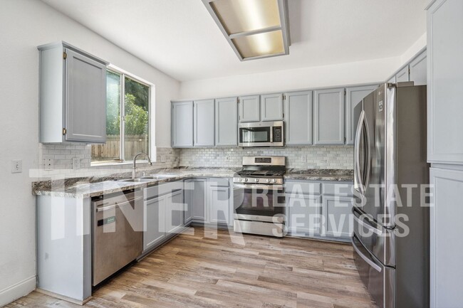
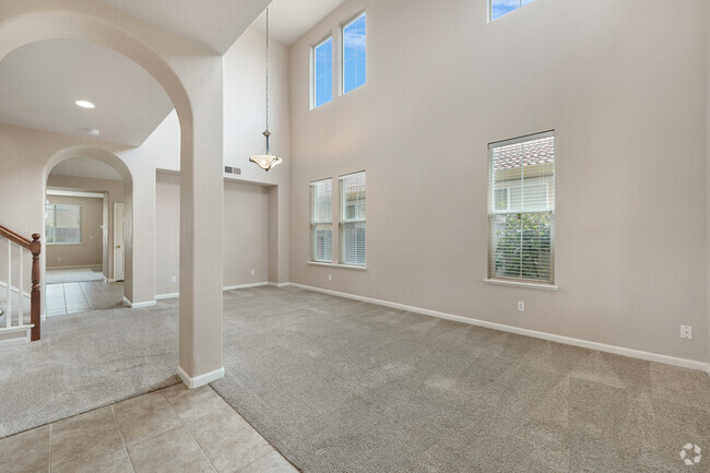
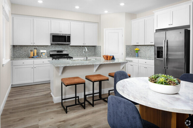
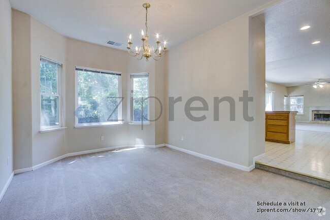
---- SCHEDULE A SHOWING ONLINE AT: ---- INCOME REQUIREMENT CALCULATOR: Welcome to this spacious four-bedroom, three-bath home. It has plenty of common area living space with both formal living and family rooms. The kitchen has stainless steel appliances (refrigerator included) and lots of cabinet and counter space. The primary suite has a walk-in closet and private bath with dual sinks, tub, and shower. Dual-pane windows, central heat and air conditioning, and ceiling fans maximize energy efficiency. There is also an upstairs laundry room. There is an attached two-car garage and two parking spots in the drive. Low-maintenance yards with mature trees. Fabulous location near cripple creek. Great shopping, eateries, and schools nearby. Utilities included: None- Tenant pays: Water, Sewer, Garbage, electricity and gas and a $10 administrative fee that includes, but is not limited to; utility tracking and billing, insurance compliance, 24/7 maintenance call service, tenant portal and online payment option. Restrictions: Non-smoking and Pet Negotiable Home with increased deposit. Applications are reviewed on a first-come, first-served basis for all completed applications. All applications are processed in compliance with Fair Housing Law. How to apply for a property with Tiner Properties: * Start by viewing the property. After reviewing our screening guidelines, we recommend driving by the home and then scheduling an appointment to view it. You may schedule online at
6948 Trailride Way is a house located in Sacramento County and the 95621 ZIP Code.
* Price shown is base rent and may not include non-optional fees and utilities.
Price, availability, fees, and any applicable rent special are subject to change without notice.
* Square footage definitions vary. Displayed square footage is approximate.
House Features
- Washer/Dryer
- Air Conditioning
Fees and Policies
The fees below are based on community-supplied data and may exclude additional fees and utilities.
- Dogs Allowed
-
Fees not specified
- Cats Allowed
-
Fees not specified
Location
Get Directions
Amenities
- Washer/Dryer
- Air Conditioning
Defined by sun-drenched neighborhoods, tree-lined streets, and lacy palm trees against bright blue sky, Citrus Heights is a beautiful suburban city just 14 miles northeast of Downtown Sacramento. Citrus Heights residents enjoy easy access to I-80, for quick trips to Sacramento or northeast to Roseville, home of the Westfield Galleria at Roseville. Folsom Lake, a popular resort area, is minutes east of Citrus Heights.
Apartments in Citrus Heights provide a quieter option to city living while still being well within reach of everything this busy area has to offer -- including California State University, Sacramento, the Sacramento Zoo, and Sacramento International Airport. But as a busy city with plenty of businesses, shops, restaurants, and entertainment of its own, you'll find plenty to do closer to home. Go shopping at the Sunrise Mall, visit Rusch Park, home of the Historic Rusch Home and Gardens, and spend the afternoon golfing at Foothill Golf Center.
Learn more about living in Citrus Heights
Education
| Colleges & Universities | Distance | ||
|---|---|---|---|
| Colleges & Universities | Distance | ||
| Drive: | 10 min | 4.1 mi | |
| Drive: | 15 min | 9.7 mi | |
| Drive: | 25 min | 12.4 mi | |
| Drive: | 22 min | 13.8 mi |
6948 Trailride Way is within 10 minutes or 4.1 miles from American River College. It is also near Sierra College, Rocklin Campus and Folsom Lake College, Folsom.
Transportation options available in Citrus Heights include Watt/I-80, located 6.1 miles from 6948 Trailride Way. 6948 Trailride Way is near Sacramento International, located 21.3 miles or 29 minutes away.
| Transit / Subway | Distance | ||
|---|---|---|---|
| Transit / Subway | Distance | ||
|
|
Drive: | 9 min | 6.1 mi |
|
|
Drive: | 11 min | 7.4 mi |
|
|
Drive: | 10 min | 7.4 mi |
| Drive: | 11 min | 8.0 mi | |
|
|
Drive: | 15 min | 8.4 mi |
| Commuter Rail | Distance | ||
|---|---|---|---|
| Commuter Rail | Distance | ||
|
|
Drive: | 12 min | 6.7 mi |
|
|
Drive: | 13 min | 8.8 mi |
| Drive: | 26 min | 21.0 mi | |
|
|
Drive: | 27 min | 21.1 mi |
|
|
Drive: | 35 min | 28.3 mi |
| Airports | Distance | ||
|---|---|---|---|
| Airports | Distance | ||
|
Sacramento International
|
Drive: | 29 min | 21.3 mi |
Time and distance from 6948 Trailride Way.
| Shopping Centers | Distance | ||
|---|---|---|---|
| Shopping Centers | Distance | ||
| Drive: | 2 min | 1.2 mi | |
| Drive: | 3 min | 1.3 mi | |
| Drive: | 3 min | 1.5 mi |
6948 Trailride Way has 3 shopping centers within 1.5 miles, which is about a 3-minute drive. The miles and minutes will be for the farthest away property.
| Parks and Recreation | Distance | ||
|---|---|---|---|
| Parks and Recreation | Distance | ||
|
Jensen Botanical Gardens
|
Drive: | 9 min | 5.6 mi |
|
The Discovery Museum Science & Space Center
|
Drive: | 11 min | 5.7 mi |
|
Aerospace Museum of California
|
Drive: | 12 min | 6.2 mi |
|
Effie Yeaw Nature Center
|
Drive: | 15 min | 7.3 mi |
|
Lower Sunrise Recreational Area
|
Drive: | 14 min | 7.6 mi |
6948 Trailride Way has 5 parks within 7.6 miles, including Jensen Botanical Gardens, The Discovery Museum Science & Space Center, and Aerospace Museum of California.
| Hospitals | Distance | ||
|---|---|---|---|
| Hospitals | Distance | ||
| Drive: | 4 min | 2.0 mi | |
| Drive: | 9 min | 4.7 mi | |
| Drive: | 10 min | 6.9 mi |
6948 Trailride Way has 3 hospitals within 6.9 miles, the nearest is Mercy San Juan Medical Center which is 2.0 miles away and a 4 minute drive.
| Military Bases | Distance | ||
|---|---|---|---|
| Military Bases | Distance | ||
| Drive: | 19 min | 8.1 mi |
6948 Trailride Way is 8.1 miles and a 19 minute drive from McClellan Air Force Base.
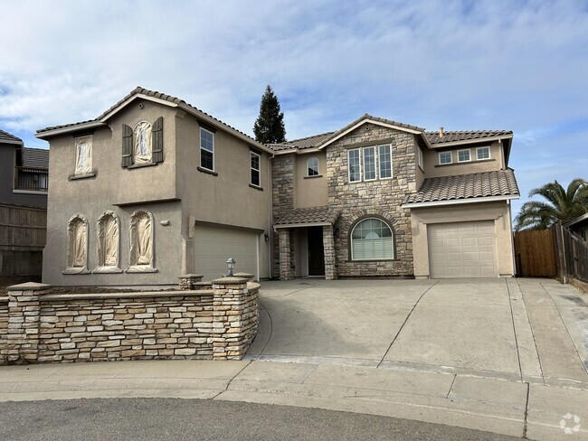
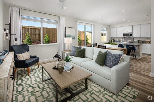
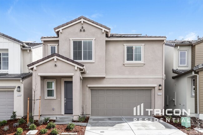
You May Also Like
Similar Rentals Nearby


What Are Walk Score®, Transit Score®, and Bike Score® Ratings?
Walk Score® measures the walkability of any address. Transit Score® measures access to public transit. Bike Score® measures the bikeability of any address.
What is a Sound Score Rating?
A Sound Score Rating aggregates noise caused by vehicle traffic, airplane traffic and local sources

6948 Trailride Way
Citrus Heights, CA 95621